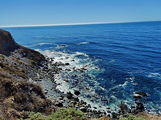
Monterey County, officially the County of Monterey, is a county located on the Pacific coast in the U.S. state of California. As of the 2020 census, its population was 439,035. The county's largest city and county seat is Salinas.

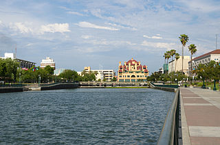
Stockton is a city in and the county seat of San Joaquin County in the Central Valley of the U.S. state of California. Stockton is the most populous city in the county, the 11th-most populous city in California and the 58th-most populous city in the United States. Stockton's population in 2020 was 320,804. It was named an All-America City in 1999, 2004, 2015, and again in 2017 and 2018. The city is located on the San Joaquin River in the northern San Joaquin Valley. It lies at the southeastern corner of a large inland river delta that isolates it from other nearby cities such as Sacramento and those of the San Francisco Bay Area.

Indio is a city in Riverside County, California, United States, in the Coachella Valley of Southern California's Colorado Desert region. It lies 23 miles (37 km) east of Palm Springs, 75 miles (121 km) east of Riverside, 127 miles (204 km) east of Los Angeles, 148 miles (238 km) northeast of San Diego, 250 miles (400 km) west of Phoenix, and 102 miles (164 km) north of Mexicali, Mexico.

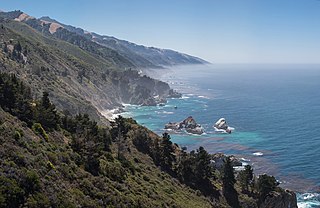
Big Sur is a rugged and mountainous section of the Central Coast of the U.S. state of California, between Carmel Highlands and San Simeon, where the Santa Lucia Mountains rise abruptly from the Pacific Ocean. It is frequently praised for its dramatic scenery. Big Sur has been called the "longest and most scenic stretch of undeveloped coastline in the contiguous United States", a sublime "national treasure that demands extraordinary procedures to protect it from development", and "one of the most beautiful coastlines anywhere in the world, an isolated stretch of road, mythic in reputation". The views, redwood forests, hiking, beaches, and other recreational opportunities have made Big Sur a popular destination for visitors from across the world. With 4.5 to 7 million visitors annually, it is among the top tourist destinations in the United States, comparable to Yosemite National Park, but with considerably fewer services, and less parking, roads, and related infrastructure.

The Central Coast is an area of California, roughly spanning the coastal region between Point Mugu and Monterey Bay. It lies northwest of Los Angeles and south of the San Francisco Bay Area, and includes the rugged, rural, and sparsely populated stretch of coastline known as Big Sur.

Pebble Beach is an unincorporated community on the Monterey Peninsula in Monterey County, California, United States. The small coastal residential community of mostly single-family homes is also notable as a resort destination, and the home of the golf courses of Cypress Point Club, Monterey Peninsula Country Club, and Pebble Beach Golf Links. Nonresidents are charged a toll to use 17-Mile Drive, the main road through Pebble Beach, making it a de-facto gated community.

The Santa Lucia Mountains or Santa Lucia Range is a rugged mountain range in coastal central California, running from Carmel southeast for 140 miles (230 km) to the Cuyama River in San Luis Obispo County. The range is never more than 11 miles (18 km) from the coast. The range forms the steepest coastal slope in the contiguous United States. Cone Peak at 5,158 feet (1,572 m) tall and three miles (5 km) from the coast, is the highest peak in proximity to the ocean in the lower 48 United States. The range was a barrier to exploring the coast of central California for early Spanish explorers.

Carmel High School is a school of 874 students and 50-plus faculty members, situated directly off of Highway 1 within the city of Carmel, California. It is a part of Carmel Unified School District. Carmel High is known for its view of the Santa Lucia Mountains with a peek of Point Lobos and the Pacific Ocean. It is in one of the most affluent school districts in California, due to a state law which allows the school to opt out of ADA funding, choosing instead to receive revenue from local property taxes, which in Carmel's case, are quite high. As a result, Carmel High School salary schedules for teachers, counselors, and administrators are among some of the highest in the state of California.

Berryessa is a district of San Jose, California, located in North San Jose. The district is named after the Berryessa family, a prominent Californio family of the Bay Area which historically owned most of the area.

The Arts Council Silicon Valley (1982–2013) was the official Santa Clara County, United States arts council.
The Big Sur International Marathon is an annual marathon held in California, United States along the Pacific coast. The marathon was established in 1986 and attracts about 4,500 participants annually.
Pulga is an unincorporated community in Butte County, California. It is located along the west slope of the Feather River canyon. A variant name for the community is Big Bar.
Plaskett is an [[unincorporated place in Pacific Valley, alongside the Big Sur Coast Highway in the southern Big Sur region of Monterey County, California. It lies at an elevation of 203 feet. It consists of a USFS campground, and station, two small resorts, a small school, and a few dozen families spread over the general region.

Juan Bautista Rogers Cooper was a 19th-century pioneer of California, who held British, Mexican, and finally American citizenship. Raised in Massachusetts in a maritime family, he came to the Mexican territory of Alta California as master of the ship Rover, and was a pioneer of Monterey, California, when it was the capital of the territory. He converted to Catholicism, became a Mexican citizen, married the daughter of the Mexican territorial governor, and acquired extensive land holdings in the area prior to the Mexican–American War.

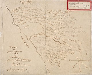
Rancho El Sur was a 8,949.06-acre (36.22 km2) Mexican land grant in present-day Monterey County, California on the Big Sur coast given in 1834 by Governor José Figueroa to Juan Bautista Alvarado. The grant extended from the mouth of Little Sur River inland about 2.5 miles (4.0 km) over the coastal mountains and south along the coast past the mouth of the Big Sur River to Cooper's Point. In about 1892, the rancho land plus an additional 3,000 acres (1,200 ha) of resale homestead land was divided into two major parcels. The southern 4,800 acres (1,900 ha) became the Molera Ranch, later the foundation of Andrew Molera State Park. The northern 7,100 acres (2,900 ha) form the present-day El Sur Ranch.
Big Sur Unified School District is a public school district in the southern Big Sur region of Monterey County, California, United States. It was originally the Pacific Valley School in the 1920s and served residents on the south coast including Manchester, Plaskett, Lucia, and Gorda,

The Eastern Coachella Valley is located in Southern California. It is known to locals as a geographical subdivision of the Coachella Valley. In other words, although the Eastern Coachella Valley is located within the same Coachella Valley geographical parameters, it is considered its own. This subdivision is due primarily to the lack of incorporation of rural communities to the entity of the Coachella Valley as a whole.

The Big Sur Folk Festival, held from 1964 to 1971 in California, was an informal gathering of prominent and emerging folk artists from across the United States. Nancy Jane Carlen (1941-2013) was working at the Esalen Institute when Joan Baez was asked to lead workshops on music. Carlen was a good friend of Baez, and they decided to invite other artists, which turned into the first festival.

Jade Cove is located in the southern area of Big Sur on the California central coast. It contains the only concentrated underwater deposit of quality nephrite jade in the world. Individuals are permitted to collect as much jade as they can personally carry using hand tools up to 90 feet (27 m) deep offshore.

Big Sur Coast Highway is a section of California State Route 1 through the Big Sur region of California that is widely considered to be one of the most scenic driving routes in the United States, if not the world. It is both a National Scenic Highway and a California Scenic Highway, and was described by Australian painter Francis McComas as the "greatest meeting of land and water in the world". Condé Nast Traveler named State Route 1 through Big Sur one of the top ten world-famous streets, comparable to Broadway in New York City and the Champs-Élysées in Paris. The road itself is a destination for visitors.


