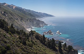
Big Sur ['bɪg ˈsɝ] is a rugged and mountainous section of the Central Coast of California between Carmel and San Simeon, where the Santa Lucia Mountains rise abruptly from the Pacific Ocean. It is frequently praised for its dramatic scenery. Big Sur has been called the "longest and most scenic stretch of undeveloped coastline in the contiguous United States", a sublime "national treasure that demands extraordinary procedures to protect it from development", and "one of the most beautiful coastlines anywhere in the world, an isolated stretch of road, mythic in reputation". The views, redwood forests, hiking, beaches, and other recreational opportunities have made Big Sur a popular destination for about 7 million people who live within a day's drive and visitors from across the world. It is among the top 35 tourist destinations world-wide. The region receives about the same number of visitors as Yosemite National Park, but offers only limited bus service, few restrooms, and a narrow two-lane highway that for most of its length clings to the steep coastal cliffs. North-bound traffic during the peak summer season and holiday weekends is often backed up for about 20 miles (32 km) from Big Sur Village to Carmel Highlands. Due to the large number of visitors, congestion and slow traffic between Carmel and Posts is becoming the norm.

The Santa Lucia Mountains or Santa Lucia Range is a rugged mountain range in coastal central California, running from Carmel southeast for 140 miles (230 km) to the Cuyama River in San Luis Obispo County. The range is never more than 11 miles (18 km) from the coast. The range forms the steepest coastal slope in the contiguous United States. Cone Peak at 5,158 feet (1,572 m) tall and three miles (5 km) from the coast, is the highest peak in proximity to the ocean in the lower 48 United States. The range was a barrier to exploring the coast of central California for early Spanish explorers.
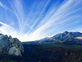
Los Padres National Forest is a United States national forest in southern and central California. Administered by the United States Forest Service, Los Padres includes most of the mountainous land along the California coast from Ventura to Monterey, extending inland. Elevations range from sea level to 8,847 feet (2,697 m).

The Coast Ranges of California span 400 miles (644 km) from Del Norte or Humboldt County, California, south to Santa Barbara County. The other three coastal California mountain ranges are the Transverse Ranges, Peninsular Ranges and the Klamath Mountains.

The Big Sur River is a 15.7-mile-long (25.3 km) river on the Central Coast of California. The river drains a portion of the Big Sur area, a thinly settled region of the Central California coast where the Santa Lucia Mountains rise abruptly from the Pacific Ocean. The upper river and watershed lies within the Ventana Wilderness and encompasses the headwaters downstream to the area known as the Gorge. The lower river flows roughly northwest through Pfeiffer Big Sur State Park, the Big Sur village, several private camp grounds and Andrew Molera State Park where it flows through a lagoon and sandbar into the Pacific Ocean at the Monterey Bay National Marine Sanctuary. Major Tributaries of the river include, in order: Redwood Creek, Lion Creek, Logwood Creek, Terrace Creek, Ventana Creek, Post Creek, Pfeiffer-Redwood Creek, Juan Higuera Creek, and Pheneger Creek.
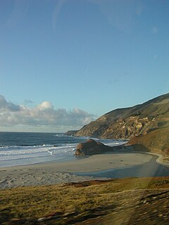
The Little Sur River is a 25.4-mile (40.9 km) long river on the Central Coast of California. The river and its main tributary, the South Fork, drain a watershed of about 40 square miles (100 km2) of the Big Sur area, a thinly settled region of the Central California coast where the Santa Lucia Mountains rise abruptly from the Pacific Ocean. The South Fork and the North Fork both have their headwaters in the Ventana Wilderness, straddling Mount Pico Blanco. Portions west of the national forest and Old Coast Road lie within the El Sur Ranch. Some portions of the North Fork are on land owned by Granite Rock Company of Watsonville, California, which has owned the mineral rights to 2,800 acres (1,100 ha) on Mount Pico Blanco since 1963. The North and South forks converge about 2 miles (3.2 km) from the coast where the river enters the Pacific Ocean.
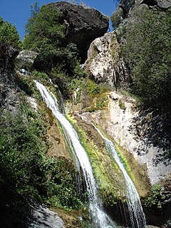
Salmon Creek Falls is a 120-foot waterfall in the southern Big Sur area, Monterey County, California. They are near Gorda, in the Santa Lucia Range and within the Monterey Ranger District of the Los Padres National Forest.

The Chumash Wilderness is a 38,150 acres (15,440 ha) wilderness area within the southern Los Padres National Forest. It is located in the Transverse Ranges, in northern Ventura County and southwestern Kern County in California.

The Ventana Wilderness of Los Padres National Forest is a federally designated wilderness area located in the Santa Lucia Range along the Central Coast of California. This wilderness was established in 1969 when the Ventana Wilderness Act redesignated the 55,800-acre (22,600 ha) Ventana Primitive Area as the Ventana Wilderness and added land, totalling 98,000 acres (40,000 ha). In 1978, the Endangered American Wilderness Act added 61,000 acres (25,000 ha), increasing the total wilderness area to about 159,000 acres (64,000 ha). The California Wilderness Act of 1984 added about 2,750 acres (1,113 ha). The Los Padres Condor Range and River Protection Act of 1992 created the approximately 14,500-acre (5,900 ha) Silver Peak Wilderness and added about 38,800 acres (15,700 ha) to the Ventana Wilderness in addition to designating the Big Sur River as a Wild and Scenic River. The Big Sur Wilderness and Conservation Act of 2002 expanded the wilderness for the fifth time, adding nearly 35,000 acres (14,000 ha), increasing the total acreage of the wilderness to its present size of 240,026 acres (97,135 ha).

The San Rafael Wilderness is a wilderness area in the mountains of north central Santa Barbara County, California, United States. It is north of the city of Santa Barbara and east of Santa Maria within the Los Padres National Forest. Formed in 1968, it was the first wilderness area to be created from a previously designated Primitive Area after the passage of the 1964 Wilderness Act. It also includes the Sisquoc Condor Sanctuary, created in 1937, which is the oldest designated sanctuary for the large endangered birds.
The Pine Ridge Trail is the most popular hiking trail in the Ventana Wilderness of the Los Padres National Forest, California. The 19.5 miles (31.4 km) trail traverses the Ventana Wilderness from the Big Sur Station near sea level to China Camp on Tassajara Road at 5,000 feet (1,500 m). Built in 1916 by the Post family of Big Sur, the Pine Ridge Trail offers hikers and equestrians an array of backcountry camps to enjoy.
The Garcia Wilderness is a 14,100-acre (57 km2) wilderness area within the Los Padres National Forest in San Luis Obispo County, California.
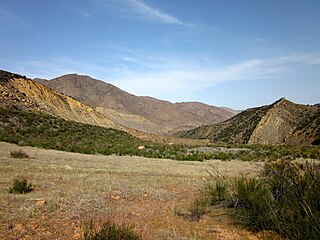
The Sespe Wilderness is a 219,700-acre (88,900 ha) wilderness area in the eastern Topatopa Mountains and southern Sierra Pelona Mountains, within the Los Padres National Forest (LPNF), in Ventura County, Southern California. The wilderness area is primarily located within the Ojai and Mt. Pinos ranger districts of the LPNF.

The policies protecting land used in Big Sur are some of the most restrictive local-use standards in California, and are widely regarded as one of the most restrictive development protections anywhere. The program protects viewsheds from the highway and many vantage points, and severely restricts the density of development. About 60% of the coastal region is owned by governmental or private agencies which do not allow any development. The majority of the interior region is part of the Los Padres National Forest, Ventana Wilderness, Silver Peak Wilderness or Fort Hunter Liggett. The area is protected by the Big Sur Local Coastal Plan, which preserves it as "open space, a small residential community, and agricultural ranching." Its intention is "preserving the environment and visual access to it, the policies of the local coastal plan are to minimize, or limit, all destination activities."

The Los Padres Condor Range and River Protection Act of 1992 is a Federal law that established five new designated Wilderness Areas and three new designated Wild and Scenic Rivers in the Los Padres National Forest and Angeles National Forest in California. The law was sponsored by California Republican and Ventura County native Robert J. Lagomarsino while he represented California's 19th District in the United States House of Representatives. The legislation was cosponsored by Democratic and Republican representatives from districts representing the entirety of the Los Padres National Forest.

The Matilija Wilderness is a 29,207-acre (11,820 ha) wilderness area in Ventura and Santa Barbara Counties, Southern California. It is managed by the U.S. Forest Service, being situated within the Ojai Ranger District of the Los Padres National Forest. It is located adjacent to the Dick Smith Wilderness to the northwest and the Sespe Wilderness to the northeast, although it is much smaller than either one. The Matilija Wilderness was established in 1992 in part to protect California condor habitat.
The Southern Redwood Botanical Area is a 17 acres (6.9 ha) ecological preserve in the southern region of Big Sur in Monterey County, California, just north of the national forest's Salmon Creek trailhead. Established by the Los Padres National Forest of the United States Forest Service, it contains the southernmost naturally occurring Redwood. The trees are located in the Little Redwood Gulch watershed adjacent to the Silver Peak Wilderness. The area is just north of the Salmon Creek trailhead.
The Ventana Wilderness Alliance, founded in 1998, is a group dedicated to preserving and protecting public lands along California's Big Sur coast. Its mission is to protect, preserve and restore the wilderness qualities and biodiversity of the public lands within California's Northern Santa Lucia Mountains and Big Sur region.

Pico Blanco is a peak on the coast of Big Sur in the Santa Lucia Range of the Los Padres National Forest. The Little Sur River and its tributaries almost surround the mountain. The North Fork wraps around the northern flank and eastern edge of the mountain, and the South Fork crosses the mountain to the west and south-west. The mountain is known for an extremely high-grade limestone deposit. The peak and surrounding 2,800 acres (1,100 ha), are owned by the Granite Rock Company of Watsonville, California. The lower western slopes of the mountain are the property of the El Sur Ranch. The Old Coast Road built in the early 1900s cuts across its western flank. The view from its summit allows hikers to see Ventana Double Cone and Kandlbinder Peak to the southeast, as well as a host of other Big Sur peaks: Mt. Manuel, Post Summit, Uncle Sam Mtn., and Cone Peak far to the south.

Bottchers Gap is a day use area, campground, and trail head. It is located 7.6 miles (12.2 km) from the Big Sur Coast Highway at the end of Palo Colorado Road on the northern border of the Los Padres National Forest and Ventana Wilderness. It is located between Mescal Ridge and Skinner Ridge. From Bottchers Gap, there is an 3.3 miles (5.3 km) long private access road that leads to Camp Pico Blanco. Beginning at Bottchers Gap, it is a difficult 14.7 miles (23.7 km) hike via the Skinner Ridge and Ventana Double Cone trails to the Ventana Double Cone, making it one of the more distant locations in the wilderness.


