Santa Cruz is the largest city and the county seat of Santa Cruz County, in Northern California. As of the 2020 census, the city population was 62,956. Situated on the northern edge of Monterey Bay, Santa Cruz is a popular tourist destination, owing to its beaches, surf culture, and historic landmarks.
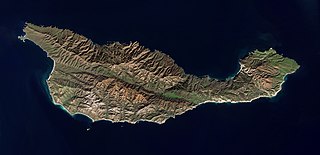
Santa Cruz Island is located off the southwestern coast of Ventura, California, United States. It is the largest island in California and largest of the eight islands in the Channel Islands archipelago and Channel Islands National Park. Forming part of the northern group of the Channel Islands, Santa Cruz is 22 miles (35 km) long and 2 to 6 miles wide with an area of 61,764.6 acres (249.952 km2).
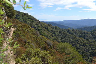
Castle Rock State Park is a 5,242-acre (2,121 ha) state park of California, United States, located along the crest of the Santa Cruz Mountains and almost entirely in Santa Cruz County, with parts extending into Santa Clara County and San Mateo County. It embraces coast redwood, Douglas fir, and madrone forest, most of which has been left in its wild, natural state. Steep canyons are sprinkled with unusual rock formations that are a popular rock climbing area. The park is named after a sandstone formation called Castle Rock. The forest here is lush and mossy, crisscrossed by 32 miles (51 km) of hiking trails. These trails are part of an even more extensive trail system that links the Santa Clara and San Lorenzo valleys with Castle Rock State Park, Big Basin Redwoods State Park, and the Pacific Coast. Due to its overnight parking lot, Castle Rock is a popular starting point for the Skyline-to-the-Sea Trail, a 30-mile (48 km) trail that begins near by at Saratoga Gap and leads to Waddell Beach north of Santa Cruz. There are two walk-in campgrounds within the park for overnight backpacking.

Seacliff State Beach is a state beach park on Monterey Bay, in the town of Aptos, Santa Cruz County, California. It is located off Highway 1 on State Park Drive, about 5 miles (8 km) south of Santa Cruz,. The beach is most known for the concrete ship SS Palo Alto lying in the water. North of Seacliff State Beach is New Brighton State Beach.

The Santa Cruz Beach Boardwalk is an oceanfront amusement park in Santa Cruz, California. Founded in 1907, it is California's oldest surviving amusement park and one of the few seaside parks on the West Coast of the United States.
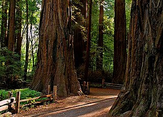
Henry Cowell Redwoods State Park is a state park of California, United States, preserving mainly forest and riparian areas in the watershed of the San Lorenzo River, including a grove of old-growth coast redwood. It is located in Santa Cruz County, primarily in the area between the cities of Santa Cruz and Scotts Valley, near the community of Felton and the University of California at Santa Cruz. The park includes a non-contiguous extension in the Fall Creek area north of Felton. The 4,623-acre (1,871 ha) park was established in 1953.

The Monterey Bay National Marine Sanctuary (MBNMS) is a federally protected marine area offshore of California's Big Sur and central coast in the United States. It is the largest US national marine sanctuary and has a shoreline length of 276 miles (444 km) stretching from just north of the Golden Gate Bridge at San Francisco to Cambria in San Luis Obispo County. Supporting one of the world's most diverse marine ecosystems, it is home to numerous mammals, seabirds, fishes, invertebrates and plants in a remarkably productive coastal environment. The MBNMS was established in 1992 for the purpose of resource protection, research, education, and public use.

Sunset State Beach is a park and beach on Monterey Bay, in Santa Cruz County, California.

Natural Bridges State Beach is a 65-acre (26 ha) California state park in Santa Cruz, California, in the United States. The park features a natural bridge across a section of the beach. It is also well known as a hotspot to see monarch butterfly migrations. The Monarch Butterfly Natural Preserve is home to up to 150,000 monarch butterflies from October through early February.

Huntington State Beach is a protected beach in Southern California, located in the City of Huntington Beach in Orange County. It extends 2 miles (3.2 km) from Newport Beach north to Beach Boulevard, where the Huntington City Beach begins. The 121-acre (49 ha) park was established in 1942.

Lighthouse Field State Beach is a protected beach in the state park system of California, United States. It is located in the city of Santa Cruz at the north end of Monterey Bay. The beach overlooks the Steamer Lane surfing hotspot. It also contains the Santa Cruz Surfing Museum, housed in a 1967 lighthouse. The 38-acre (15 ha) site was established in 1978.

Carpinteria State Beach is a protected beach in the state park system of California, in Santa Barbara County, Southern California.
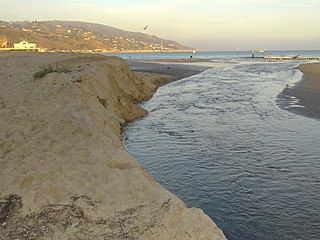
Malibu Lagoon State Beach in Malibu, California, United States, is also known as Surfrider Beach. It was dedicated as the first World Surfing Reserve on October 9, 2010. The 110-acre (45 ha) site was established as a California state park in 1951. It lies within the Santa Monica Mountains National Recreation Area.

Monterey Bay Academy (MBA) is a private school in Santa Cruz County, California. It is a part of the Seventh-day Adventist education system, the world's second largest Christian school system.
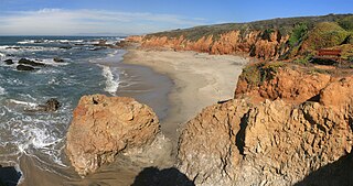
Pescadero State Beach is alongside State Route 1, located 14.5 miles south of Half Moon Bay and 1.5 miles west of the city of Pescadero in San Mateo County, California. The beach has a mile-long shoreline with sandy coves, rocky cliffs, tide pools, fishing spots and picnic facilities.

Santa Cruz Looff Carousel and Roller Coaster On The Beach Boardwalk is a National Historic Landmark composed of two parts, a Looff carousel and the Giant Dipper wooden roller coaster, at the Santa Cruz Beach Boardwalk in Santa Cruz, California, United States. They are among the oldest surviving beachfront amusement park attractions on the west coast of the United States. They were listed as a pair as a National Historic Landmark in 1987.

Wilder Ranch State Park is a California State Park on the Pacific Ocean coast north of Santa Cruz, California. The park was formerly a dairy ranch, and many of the ranch buildings have been restored for use as a museum. There are no campgrounds; a day-use parking lot provides access to the museum. Dogs are prohibited on the trails, but many trails allow bikes and/or horses. The long trails and ocean views make the area a favorite of hikers, equestrians and mountain bikers. Public beaches continue to the north in Coast Dairies State Park.
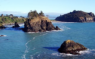
Trinidad State Beach is a state beach 20 miles (30 km) north of Eureka in Humboldt County, California. The offshore rocks are part of the California Coastal National Monument. Colorful tide pools provide specimens to Humboldt State University's Fred Telonicher Marine Laboratory located in Trinidad.

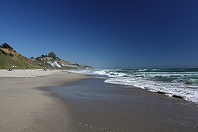
Twin Lakes State Beach is a beach located on Monterey Bay directly south of the Santa Cruz Yacht Harbor Santa Cruz, in coastal Santa Cruz County, northern California.