| Birtsmorton | |
|---|---|
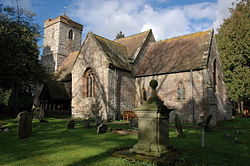 Birtsmorton Church | |
 Birtsmorton Location within Worcestershire | |
| Population | 257 |
| OS grid reference | SO799355 |
| • London | 100 miles (160 km) |
| Civil parish |
|
| District | |
| Shire county | |
| Region | |
| Country | England |
| Sovereign state | United Kingdom |
| Post town | MALVERN |
| Postcode district | WR13 |
| Dialling code | 01684 |
| Police | West Mercia |
| Fire | Hereford and Worcester |
| Ambulance | West Midlands |
| UK Parliament |
|
Birtsmorton is a village and civil parish in the Malvern Hills of Worcestershire, England, which at the 2021 census had a population of 257. [1] It is in the south-west of the county, not far from the borders with Herefordshire and Gloucestershire.