Kerswell Green

Last updated

Kerswell Green
Kerswell Green - row of houses - geograph.org.uk - 938757.jpg
Row of houses
Worcestershire UK location map.svg
Red pog.svg
Kerswell Green
Location within Worcestershire
OS grid reference SO861466
District
Shire county
Region
Country England
Sovereign state United Kingdom
Post town WORCESTER
Postcode district WR5
Police West Mercia
Fire Hereford and Worcester
Ambulance West Midlands
List of places
UK
England
Worcestershire
52°07′05″N2°12′14″W / 52.118101°N 2.203875°W / 52.118101; -2.203875

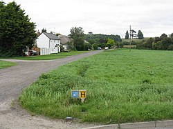
Kerswell Green is a village in the Malvern Hills District of Worcestershire, England. [1] It is within the civil parish of Kempsey. [2]

Kerswell Green Farmhouse is a Grade II listed timber-framed, painted brick building dating from late medieval times and extended in the 17th century. The listing details show it as gable ended and with a thatched roof. [3]

St John the Baptist, Church of England was built circa 1884 as a chapel of ease or mission church to Kempsey parish church. [4] It is closed for worship. [5]

On 23 July 1933 there was a dispute over the erection of a fence barring a footpath. Some parishioners wanted to enforce a claimed right of way but were met with determined opposition. The report in the Evesham Standard said two palings were wrenched off the fence but the attackers were forced to retreat. Two policemen observed the proceedings and one tried to act as peacemaker. A degree of calm ensued while one policeman rescued a cat trapped up a tree. After the respite the fence was breached, but soon re-erected. [6] An inquiry had been held earlier in the year by Upton District Council but the matter rested owing to insufficient proof of the existence of a right of way. [7]

In 2009 approval was given to replace a septic tank serving seven houses with a sewage pumping station. [8]

Kerswell Green Church Kerswell Green Church - geograph.org.uk - 1301909.jpg
Kerswell Green Church

Related Research Articles

<span class="mw-page-title-main">Worcestershire</span> County of England

Worcestershire is a ceremonial county in the West Midlands of England. It is bordered by Shropshire, Staffordshire, and the West Midlands county to the north, Warwickshire to the east, Gloucestershire to the south, and Herefordshire to the west. The city of Worcester is the largest settlement and the county town.

<span class="mw-page-title-main">Evesham</span> Human settlement in England

Evesham is a market town and parish in the Wychavon district of Worcestershire, in the West Midlands region of England. It is located roughly equidistant between Worcester, Cheltenham and Stratford-upon-Avon. It lies within the Vale of Evesham, an area comprising the flood plain of the River Avon, which has been renowned for market gardening. The town centre, situated within a meander of the river, is subjected regularly to flooding. The 2007 floods were the most severe in recorded history.

<span class="mw-page-title-main">Redditch</span> Town and Borough in England

Redditch is a town and borough in Worcestershire, England. It is located south of Birmingham, east of Bromsgrove, northwest of Alcester and northeast of Worcester. The borough had a population of 87,037 in 2021. In the 19th century, it became a centre for the needle and fishing tackle industry.

<span class="mw-page-title-main">Malvern Hills District</span> Non-metropolitan district in England

Malvern Hills is a local government district in Worcestershire, England. Its council is based in Malvern, the district's largest town. The district also includes the towns of Tenbury Wells and Upton-upon-Severn and a large rural area covering much of the western side of the county, including numerous villages. The district is named after the Malvern Hills, which are a designated Area of Outstanding Natural Beauty.

<span class="mw-page-title-main">Wychavon</span> Non-metropolitan district in England

Wychavon is a local government district in Worcestershire, England. The largest towns are Evesham and Droitwich Spa; the council is based in the town of Pershore. The district also includes numerous villages and surrounding rural areas, and includes part of the Cotswolds, a designated Area of Outstanding Natural Beauty. The district's name references the Saxon Kingdom of Hwicce and the River Avon. The population in 2021 was 133,100.

<span class="mw-page-title-main">History of Worcestershire</span>

The area now known as Worcestershire has had human presence for over half a million years. Interrupted by two ice ages, Worcestershire has had continuous settlement since roughly 10,000 years ago. In the Iron Age, the area was dominated by a series of hill forts, and the beginnings of industrial activity including pottery and salt mining can be found. It seems to have been relatively unimportant during the Roman era, with the exception of the salt workings.

<span class="mw-page-title-main">Cotswold Line</span> Railway line between Oxford and Hereford

The Cotswold Line is an 86+12-mile (139.2 km) railway line between Oxford and Hereford in England.

<span class="mw-page-title-main">Bidford-on-Avon</span> Village in Warwickshire, England

Bidford-on-Avon is a large village and civil parish in the English county of Warwickshire, very close to the border with Worcestershire. In the 2001 census it had a population of 4,830, increasing to 5,350 at the 2011 census, increasing again to 6,818 in the 2021 census.

<span class="mw-page-title-main">Kempsey, Worcestershire</span> Human settlement in England

Kempsey is a village and civil parish in the Malvern Hills District in the county of Worcestershire, England. It is bounded by the River Severn on the west, and the A38 main road runs through it and is about 3 miles (5 km) south of Worcester. The village has a long history. Its name is derived from the Saxon "Kemys' Eye", or the island of Kemys. Kemys was a Saxon chief, whose island lay between marshes and the River Severn. One of the roads in Kempsey, Lyf's Lane, is named after another Saxon chief. The village was recorded in the 11th century Domesday Book as having a value of £7.

<span class="mw-page-title-main">Ashchurch</span> Village in Gloucestershire, England

Ashchurch is a village and former civil parish, now in the parish of Ashchurch Rural, in the Tewkesbury district, in the county of Gloucestershire, England, 2 miles (3.2 km) east of the town of Tewkesbury, 11 mi (18 km) southwest of Evesham, 10 mi (16 km) north of Cheltenham, 13 mi (21 km) north-north-east of Gloucester and 10 mi (16 km) south of Pershore.

<span class="mw-page-title-main">Evesham railway station</span> Railway station in Worcestershire, England

Evesham railway station is in the market town of Evesham in Worcestershire, England. It is between Honeybourne and Pershore stations on the Cotswold Line between Oxford and Hereford via Worcester and Great Malvern. It is operated by Great Western Railway. Trains to London Paddington take about 1 hour 45 minutes.

<span class="mw-page-title-main">Pershore railway station</span> Railway station in Worcestershire, England

Pershore railway station is a railway station serving both the town of Pershore and village of Pinvin in Worcestershire, England. The station is on a single-track section of the Cotswold Line. The station and all trains serving it are operated by Great Western Railway.

<span class="mw-page-title-main">Severn Stoke</span> Human settlement in England

Severn Stoke is an English village and civil parish in the Malvern Hills District, in the south of the county of Worcestershire, alongside the A38 trunk road. It had a population of 611 in 2011.

<span class="mw-page-title-main">Harvington</span> Human settlement in England

Harvington is a village near Evesham in Worcestershire, England. Bounded by the River Avon to the south and the Lench Hills to the north, three miles northeast of Evesham and now on the Worcestershire/Warwickshire border. The village today is an amalgamation of two smaller villages, Harvington and Harvington Cross, and has a population of around 1,750.

<span class="mw-page-title-main">Hinton on the Green</span> Human settlement in England

Hinton on the Green is a village and civil parish in the Wychavon district of Worcestershire in England. It is situated at the foot of Bredon Hill, about two miles south of Evesham.

<span class="mw-page-title-main">Prince Henry's High School</span> Academy in Evesham, Worcestershire, England

Prince Henry's High School, formerly Prince Henry's Grammar School, is an upper school with academy status in Evesham, Worcestershire, England. It is a co-educational high school, in which there are about 1,280 students enrolled, aged between 13 and 18. It is situated in the north of Evesham off the A4184, near the junction with the B4624, adjacent to the north of the railway, and serves the town of Evesham and surrounding villages.

Among the places of worship in the town and area of Malvern, Worcestershire are centres of dedication to many faiths and denominations. The town has 31 Christian churches with 11 belonging to the Church of England, ranging from low church to high Anglo-Catholic, two Roman Catholic, one Evangelical, and the others being Non-Conformist and other faiths. Its oldest place of worship is the almost cathedral sized parish church of Great Malvern Priory which is all that remains of the former 10th century abbey in central Malvern, which according to the Worcester Monastic Annals, work began in 1085. The chain of Malvern Hills lies in a north-south direction, thus posing a challenge for the architects of Christian churches located on the steep slopes, chancels being traditionally sited at the east end of the building. Many churches were built in the 19th century concomitant with the rapid expansion of the town due to its popularity as a spa. A few modern buildings such as St Mary's Church (1960) in Sherrard's Green, have been constructed in the second half of the 20th century, and some churches, notably St Andrews in Poolbrook, have had important modern extensions added during the first decade of the 21st century.

References

  1. "Kerswell Green, Malvern Hills - area information, map". OS GetOutside. Retrieved 11 March 2024.
  2. "Home - Kempsey Parish Council". www.kempseyhub.co.uk. Retrieved 11 March 2024.
  3. Historic England. "Kerswell Green Farmhouse (1323684)". National Heritage List for England . Retrieved 11 March 2024.
  4. "Kempsey" . Weekly Supplement to the Worcestershire Chronicle. 21 January 1888. p. 2. Retrieved 11 March 2024 via British Newspaper Archive.
  5. "Kerswell Green: St John the Baptist - CHR Church". facultyonline.churchofengland.org. Retrieved 11 March 2024.
  6. "Right of way dispute at Kempsey" . Evesham Standard & West Midland Observer. No. 1966. 29 July 1933. p. 3. Retrieved 11 March 2024 via British Newspaper Archive.
  7. "Kempsey footpath" . Evesham Standard & West Midland Observer. No. 1969. 19 August 1933. p. 3. Retrieved 11 March 2024 via British Newspaper Archive.
  8. Rogers, Lauren (15 July 2009). "Sewage pumping station gets go ahead". Worcester News. Retrieved 11 March 2024.