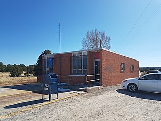
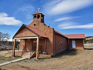
Watrous is a census-designated place in Mora County, New Mexico, United States. Its population was 135 as of the 2010 census. Watrous has a post office with ZIP code 87753, which opened on April 14, 1868. The community is located along Interstate 25. It was named after merchant and landowner Samuel Watrous, who moved to New Mexico from Vermont in 1835.
Bent is a census-designated place in Otero County, New Mexico, United States. Its population was 119 as of the 2010 census. Bent has a post office with ZIP code 88314. U.S. Route 70 passes through the community.

Continental Divide is an unincorporated community in McKinley County, New Mexico, United States.
Veguita is a census-designated place in Socorro County, New Mexico, United States. Its population was 232 as of the 2010 census. Veguita has a post office with ZIP code 87062. New Mexico State Road 304 passes through the community. Veguita has two independent Christian churches, Chihuahua Bible Chapel, and Iglesia Evangelica "Camino De Fe", which share facilities on Carlos Martinez Road. One community fixture is "Veguita Trading Post" which has a fueling station, and provides commodities. There also is the Mission Church of the Catholic Diocese. In 2015, the Veguita community welcomed KVNM-LP 101.1 FM, one of two low power FM Radio Stations in Socorro County. Veguita is the home of iDea Ministries, which is the owner-operator of KVNM-LP 101.1 FM, and produces "Jazz, Power, & The Glory!".
Sandia Park is a census-designated place in Bernalillo County, New Mexico, United States. Its population was 237 as of the 2010 census and 265 as of the 2020 census. Sandia Park has a post office with ZIP code 87047.
McIntosh is a census-designated place in Torrance County, New Mexico, United States. Its population was 1,484 as of the 2010 census. McIntosh has a post office with ZIP code 87032, which opened on August 28, 1906. New Mexico State Road 41 passes through the community.

Cañones is a census-designated place in Rio Arriba County, New Mexico, United States. Its population was 118 as of the 2010 census. Cañones had a post office until it closed on January 3, 2002.
Canjilon is a census-designated place in Rio Arriba County, New Mexico, United States. Its population was 256 as of the 2010 census. Canjilon has a post office with ZIP code 87515. The community is located along New Mexico State Road 115. Canjilon was first settled in 1870, and by 1880, 35 families lived here.
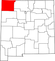
La Plata is a census-designated place in San Juan County, New Mexico, United States. Its population was 612 as of the 2010 census. La Plata has a post office with ZIP code 87418. The community is located at the junction of state roads 170 and 574.
Navajo Dam is a census-designated place in San Juan County, New Mexico, United States. Its population was 253 as of the 2020 census. Navajo Dam has a post office with ZIP code 87419. The community is located in the vicinity of Navajo Dam.
Loco Hills is a census-designated place and unincorporated community in Eddy County, New Mexico, United States. Its population was 126 as of the 2010 census. Loco Hills has a post office with ZIP code 88255. U.S. Route 82 passes through the community.
Nogal is a census-designated place and unincorporated community in Lincoln County, New Mexico, United States. Its population was 96 as of the 2010 census. Nogal has a post office with ZIP code 88341, which opened on November 9, 1880.

Costilla is a census-designated place in Taos County, New Mexico, United States. Its population was 205 as of the 2010 census. Costilla has a post office with ZIP code 87524. State roads 196 and 522 intersect in the community.

San Cristobal is a census-designated place in Taos County, New Mexico. Its population was 273 as of the 2010 census. San Cristobal has a post office with ZIP code 87564, which opened on February 16, 1932.
Lemitar is a census-designated place in Socorro County, New Mexico, United States. Its population was 330 as of the 2010 census. Lemitar has a post office with ZIP code 87823. Exit 156 on Interstate 25 serves the community.
Garfield is a census-designated place in Doña Ana County, New Mexico, United States. Its population was 137 at the time of the 2010 census. Garfield has a post office with ZIP code 87936, which opened on September 19, 1896. The community is located on New Mexico State Road 187 south of Exit 51 of Interstate 25.

Winston is a census-designated place in Sierra County, New Mexico, United States. Its population was 61 as of the 2010 census. Winston has a post office with ZIP code 87943, which opened on August 15, 1881. The community was named for Frank Winston, a pioneer miner. New Mexico State Road 52 passes through the community.
Medanales is an unincorporated community located in Rio Arriba County, New Mexico, United States. The community is located on the Chama River near U.S. Route 84, 14 miles (23 km) north-northwest of Española. Medanales has a post office with ZIP code 87548, which opened on March 10, 1945.
Angustura is an unincorporated community and census-designated place (CDP) in San Juan County, New Mexico, United States. It was first listed as a CDP prior to the 2020 census.
Turley is an unincorporated community and census-designated place (CDP) in San Juan County, New Mexico, United States. It was first listed as a CDP prior to the 2020 census.


