Boaz, Alabama

Last updated

Boaz, Alabama
City
BOAZ, ALABAMA.JPG
Boaz in 2012
Flag of Boaz, Alabama.png
BoazSeal-11.jpg
Nickname: 
City of Possibilities
Etowah County and Marshall County Alabama Incorporated and Unincorporated areas Boaz Highlighted 0107912.svg
Location in Etowah and Marshall counties, Alabama
Coordinates: 34°12′1″N86°7′0″W / 34.20028°N 86.11667°W / 34.20028; -86.11667
CountryFlag of the United States (23px).png  United States
StateFlag of Alabama.svg  Alabama
Counties Marshall, Etowah
Government
  TypeMayor and Council
  MayorDavid Dyar
Area
[1]
  Total14.61 sq mi (37.85 km2)
  Land14.55 sq mi (37.68 km2)
  Water0.06 sq mi (0.16 km2)
Elevation
[2]
1,073 ft (327 m)
Population
 (2020) [3]
  Total10,107
  Density694.64/sq mi (268.2/km2)
Time zone UTC-6 (Central (CST))
  Summer (DST) UTC-5 (CDT)
ZIP codes
35957, 35956
Area code 256
FIPS code 01-07912
GNIS feature ID2403886 [2]
Website www.cityofboaz.org

Boaz is a city in Marshall and Etowah counties in the U.S. state of Alabama. The Marshall County portion of the city is part of the Albertville Micropolitan Statistical Area. As of the 2020 census, the city's population was 10,107. [3] Boaz was known for its outlet shops. [4]

Contents

History

First settled in the 1850s, the town of Boaz was officially founded November 11, 1878, by the Sparks family of Georgia. [5] A post office has been in operation since 1887. [6] The city was named after Boaz, from the Bible. [7] It was incorporated in 1897.

Prior to World War II, Boaz hosted a primarily cotton-based economy, only diversifying to livestock and poultry with the pressures of boll weevil infestations and the Great Depression. After the war, Boaz developed a thriving automotive sales industry, which in many instances survives to this day. [8]

In the early 1980s, the VF Corporation opened an outlet store in an abandoned factory, whose success prompted other retailers to open stores. In the late 1980s, Boaz was a tourist attraction with 130 outlet stores, attracting five million people per year. Retailers moved away from Boaz due to a dwindling customer base, dropping to 80 stores in the early 1990s, with the Great Recession of the 2000s driving away even more. In 2016, three buildings of the outlet center were demolished. [4]

The Julia Street Memorial United Methodist Church, Snead Junior College Historic District, the Thomas A. Snellgrove Homestead and the Edward Fenns Whitman House are listed on the National Register of Historic Places. The Alabama Register of Landmarks and Heritage lists the Boaz Elementary School, the First Baptist Church and Cemetery, and the Methodist Episcopal Church, South. [5]
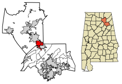
Geography

Boaz is located in southeastern Marshall County at 34°12′10″N86°9′38″W / 34.20278°N 86.16056°W / 34.20278; -86.16056 (34.202793, −86.160457) [9] and extends south into Etowah County. The city sits atop Sand Mountain (a plateau) at 1,080 feet (330 m) above sea level. It is bordered to the north by Albertville and to the southeast by Sardis City. U.S. Route 431 passes through the east side of the city, leading north 16 miles (26 km) to Guntersville and south 20 miles (32 km) to Gadsden.

According to the U.S. Census Bureau, the city of Boaz has a total area of 14.6 square miles (38 km2), of which 0.06 square miles (0.16 km2), or 0.43%, are water. [1] Most of the city drains west to either Slab Creek or Clear Creek, tributaries of the Locust Fork of the Black Warrior River. The Tennessee Valley Divide crosses the east side of the city, with the eastern portions of the city draining to Short Creek, a north-flowing tributary of the Tennessee River.

Demographics

Historical population
CensusPop.Note
1900 253
1910 1,010299.2%
1920 1,36935.5%
1930 1,69123.5%
1940 1,92714.0%
1950 3,07859.7%
1960 4,65451.2%
1970 5,63521.1%
1980 7,15126.9%
1990 6,928−3.1%
2000 7,4117.0%
2010 9,55128.9%
2020 10,1075.8%
U.S. Decennial Census [10]

2020 census

Boaz racial composition [11]
RaceNum.Perc.
White (non-Hispanic)7,26471.87%
Black or African American (non-Hispanic)1891.87%
Native American 430.43%
Asian 570.56%
Pacific Islander 980.97%
Other/Mixed 4074.03%
Hispanic or Latino 2,04920.27%

As of the 2020 United States census, there were 10,107 people, 3,494 households, and 2,197 families residing in the city.

2010 census

At the 2010 census, there were 9,551 people, 3,712 households, and 2,479 families living in the city. The population density was 782.9 inhabitants per square mile (302.3/km2). There were 4,036 housing units at an average density of 330.8 per square mile (127.7/km2). The racial makeup of the city was 87.3% White, 1.8% Black or African American, 0.4% Native American, 0.7% Asian, 0.3% Pacific Islander, 7.9% from other races, and 1.6% from two or more races. 14.2% of the population were Hispanic or Latino of any race.

Of the 3,712 households 30.7% had children under the age of 18 living with them, 46.7% were married couples living together, 14.3% had a female householder with no husband present, and 33.2% were non-families. 29.6% of households were one person and 14.7% were one person aged 65 or older. The average household size was 2.52 and the average family size was 3.11.

The age distribution was 25.9% under the age of 18, 9.5% from 18 to 24, 26.0% from 25 to 44, 22.2% from 45 to 64, and 16.4% 65 or older. The median age was 36 years. For every 100 females, there were 90.0 males. For every 100 females age 18 and over, there were 95.4 males.

The median household income was $31,172 and the median family income was $42,973. Males had a median income of $32,446 versus $27,924 for females. The per capita income for the city was $17,697. About 11.7% of families and 16.0 of the population were below the poverty line, including 24.1% of those under age 18 and 17.1% of those age 65 or over.

2000 census

At the 2000 census, there were 7,411 people, 3,155 households, and 2,085 families living in the city. The population density was 607.7 inhabitants per square mile (234.6/km2). There were 3,468 housing units at an average density of 284.4 per square mile (109.8/km2). The racial makeup of the city was 93.50% White, 1.31% Black or African American, 0.47% Native American, 0.45% Asian, 0.04% Pacific Islander, 3.01% from other races, and 1.23% from two or more races. 4.98% of the population were Hispanic or Latino of any race.

Of the 3,155 households 28.7% had children under the age of 18 living with them, 50.8% were married couples living together, 12.6% had a female householder with no husband present, and 33.9% were non-families. 30.7% of households were one person and 16.3% were one person aged 65 or older. The average household size was 2.30 and the average family size was 2.86.

The age distribution was 23.0% under the age of 18, 8.3% from 18 to 24, 26.2% from 25 to 44, 23.3% from 45 to 64, and 19.2% 65 or older. The median age was 39 years. For every 100 females, there were 83.8 males. For every 100 females age 18 and over, there were 78.5 males.

The median household income was $25,699 and the median family income was $34,018. Males had a median income of $29,504 versus $21,750 for females. The per capita income for the city was $15,664. About 13.9% of families and 18.7% of the population were below the poverty line, including 20.7% of those under age 18 and 25.4% of those age 65 or over.

Education

In May 2004, five schools broke away from the Marshall County School system and formed the Boaz City School System. [12]

Boaz is the site of Snead State Community College. [13]

Climate

Climate is characterized by relatively high temperatures and evenly distributed precipitation throughout the year. The Köppen Climate Classification subtype for this climate is "Cfa" (Humid Subtropical Climate).

Notable people

Related Research Articles

<span class="mw-page-title-main">Etowah County, Alabama</span> County in Alabama, United States

Etowah County is a county located in the northeastern part of the U.S. state of Alabama. As of the 2020 census the population was 103,436. Its county seat is Gadsden. Its name is from a Cherokee word meaning "edible tree". In total area, it is the smallest county in Alabama, but one of the most densely populated. Etowah County comprises the Gadsden Metropolitan Statistical Area.

<span class="mw-page-title-main">Winston County, Alabama</span> County in Alabama, United States

Winston County is a county of the U.S. state of Alabama. As of the 2020 census, the population was 23,540. Its county seat is Double Springs. Known as Hancock County before 1858, the county is named in honor of John A. Winston, the fifteenth Governor of Alabama.

<span class="mw-page-title-main">Marshall County, Alabama</span> County in Alabama, United States

Marshall County is a county of the state of Alabama, United States. As of the 2020 census the population was 97,612. Its county seat is Guntersville. A second courthouse is in Albertville. Its name is in honor of John Marshall, famous Chief Justice of the United States. Marshall County is a dry county, with the exception of the five cities of Albertville, Arab, Grant, Guntersville, and Boaz. Marshall County comprises the Albertville, AL Micropolitan Statistical Area, which is also included in the Huntsville-Decatur-Albertville, AL Combined Statistical Area.

<span class="mw-page-title-main">Snead, Alabama</span> Town in Alabama, United States

Snead is a town in Blount County, Alabama, United States. At the 2020 census, the population was 1,032.

<span class="mw-page-title-main">Glencoe, Alabama</span> City in the United States

Glencoe is a city in Calhoun and Etowah counties in the U.S. state of Alabama. It is part of the Gadsden Metropolitan Statistical Area. The city incorporated in 1939. The population was 5,160 at the 2010 census.

<span class="mw-page-title-main">Arab, Alabama</span> City in Alabama, United States

Arab is a city in Marshall County in the northern part of the U.S. state of Alabama, located 10 miles (16 km) from Guntersville Lake and Guntersville Dam, and is included in the Huntsville-Decatur Combined Statistical Area. The population was 8,461 at the 2020 census.

<span class="mw-page-title-main">Good Hope, Alabama</span> City in Alabama, United States

Good Hope is a city in Cullman County, Alabama, United States. As of the 2010 census, the population of the city was 2,264. It incorporated in April 1962.

<span class="mw-page-title-main">East Brewton, Alabama</span> City in Alabama, United States

East Brewton is a city in Escambia County, Alabama, United States. It was incorporated in October 1918. At the 2020 census, the population was 2,293. The community grew around Fort Crawford, a fort built to protect early settlers of the area.

<span class="mw-page-title-main">Mountainboro, Boaz</span> Neighborhood in Etowah, Alabama, United States

Mountainboro is a neighborhood in the city of Boaz, Alabama.

<span class="mw-page-title-main">Sardis City, Alabama</span> Town in Alabama, United States

Sardis City is a town in Etowah and Marshall counties in the U.S. state of Alabama. It is part of the Gadsden Metropolitan Statistical Area. It originally incorporated in May 1963 under the name of "Sardis". It became Sardis City in the 1980s. At the 2020 census, the population was 1,814.

<span class="mw-page-title-main">Clay, Alabama</span> City in Alabama, United States

Clay is a city in northeastern Jefferson County, Alabama, United States. It is part of the Birmingham–Hoover–Cullman Combined Statistical Area in the north-central part of the state. Local government is run by a mayor and city council.

<span class="mw-page-title-main">Pleasant Grove, Alabama</span> City in Alabama, United States

Pleasant Grove is a city in western Jefferson County, Alabama, United States. It is part of the Birmingham metropolitan area. The population was 9,544 at the 2020 census.

<span class="mw-page-title-main">Tarrant, Alabama</span> City in Alabama, United States

Tarrant is a city in Jefferson County, Alabama, bordering Birmingham to the north. At the 2020 census, the population was 6,124. It is home to the ABC Coke plant owned by the Drummond Company, "the largest single producer of foundry coke in the U.S.".

<span class="mw-page-title-main">Detroit, Alabama</span> Town in Alabama, United States

Detroit is a town in Lamar County, Alabama, United States. It was incorporated in 1955. At the 2010 census the population was 237, down from 247 in 2000. The prior name of the town was Millville due to the many mills built in the late 1800s.

<span class="mw-page-title-main">Albertville, Alabama</span> City in Alabama, United States

Albertville is a city in Marshall County, Alabama, United States, and is included in the Huntsville-Decatur Combined Statistical Area. The population was 22,386 at the 2020 census. It is the largest city in Marshall County.

<span class="mw-page-title-main">Douglas, Alabama</span> Town in Alabama, United States

Douglas is a town in Marshall County, Alabama, United States. Douglas, a part of the Huntsville–Decatur Combined Statistical Area, had a population of 761 as of the 2020 census. The town incorporated in 1978.

<span class="mw-page-title-main">Margaret, Alabama</span> City in Alabama, United States

Margaret is a city in St. Clair County, Alabama, United States. At the 2020 census, the population was 5,106. As of the 2010 census, the population is 4,428, an increase of 278.8%. Margaret incorporated in 1960 and became a city in October 2011.

<span class="mw-page-title-main">Sneads, Florida</span> Town in the state of Florida, United States

Sneads is a town in Jackson County, Florida, United States. The population was 1,849 at the 2020 census.

<span class="mw-page-title-main">Boaz, West Virginia</span> CDP in West Virginia, United States

Boaz is a census-designated place (CDP) in Wood County, West Virginia, United States. It is part of the Parkersburg-Marietta-Vienna, WV-OH Metropolitan Statistical Area. As of the 2020 census, the CDP population was 1,321.

<span class="mw-page-title-main">Boaz, Wisconsin</span> Village in Wisconsin, United States

Boaz is a village in Richland County, Wisconsin, United States. According to the 2010 census, the population of the village was 156.

References

  1. 1 2 "2021 U.S. Gazetteer Files". United States Census Bureau. Retrieved April 14, 2022.
  2. 1 2 U.S. Geological Survey Geographic Names Information System: Boaz, Alabama
  3. 1 2 "Boaz city, Alabama: 2020 DEC Redistricting Data (PL 94-171)". U.S. Census Bureau. Retrieved April 14, 2022.
  4. 1 2 Thorton, William (May 2, 2016). "Last call for Boaz Outlet Center". AL.com . Retrieved March 3, 2017.
  5. 1 2 James P. Kaetz. "Boaz". Encyclopedia of Alabama . Retrieved October 13, 2016.
  6. "Marshall County". Jim Forte Postal History. Retrieved October 30, 2015.
  7. "Tenbroeck in DeKalb County was named for runaway horse". Gadsden Times. June 17, 1984. pp. B1. Retrieved October 30, 2015.
  8. "Boaz". Encyclopedia of Alabama. Retrieved September 26, 2023.
  9. "US Gazetteer files: 2010, 2000, and 1990". United States Census Bureau. February 12, 2011. Retrieved April 23, 2011.
  10. "U.S. Decennial Census". Census.gov. Retrieved June 6, 2013.
  11. "Explore Census Data". data.census.gov. Retrieved December 11, 2021.
  12. "Boaz Schools on the Move". WAFF . May 20, 2004. Archived from the original on December 3, 2022. Retrieved December 3, 2022.
  13. Smith, Shelley (November 16, 2022). "Snead State Community College". Encyclopedia of Alabama. Alabama Humanities Foundation. Retrieved December 2, 2022.