
Narrabeen is a beachside suburb in northern Sydney, in the state of New South Wales, Australia. Narrabeen is 23 kilometres north-east of the Sydney central business district, in the local government area of Northern Beaches Council and is part of the Northern Beaches region. This area was named Broken Bay by James Cook as he sailed by.

Manly Council was a local government area on the northern beaches region of Sydney, New South Wales, Australia, first incorporated in 1877. On 12 May 2016, the Minister for Local Government announced that Manly Council would be subsumed into the newly formed Northern Beaches Council. The last mayor of Manly Council was Cr. Jean Hay, a member of the Liberal Party.
Concord is a suburb in the inner West of Sydney, in the state of New South Wales, Australia. It is 10 kilometres (6.2 mi) west of the Sydney central business district, in the local government area of the City of Canada Bay.

Croydon Park is a suburb in the Inner West of Sydney, in the state of New South Wales, Australia. Croydon Park is 10 kilometres south-west of the Sydney central business district and is divided between the local government areas of the City of Canterbury-Bankstown, Municipality of Burwood and Inner West Council. Croydon is a separate suburb, to the north.

Hen and Chicken Bay is a bay on the Parramatta River, in the inner-west of Sydney, in the state of New South Wales, Australia. It lies approximately 8 kilometres due west of Sydney's central business district. It is surrounded by the suburbs of Abbotsford, Drummoyne, Wareemba, Five Dock, Canada Bay, Concord and Cabarita.

Breakfast Point is a suburb in the Inner West of Sydney, in the state of New South Wales, Australia. Breakfast Point is located 16 kilometres west of the Sydney central business district. It is in the local government area of the City of Canada Bay.

Cabarita is a bayside suburb in the Inner West of Sydney, in the state of New South Wales, Australia. Cabarita is located 16 kilometres west of the Sydney central business district, in the local government area of the City of Canada Bay.

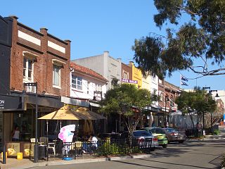
Narooma is a town in the Australian state of New South Wales on the far south coast. The town is on the Princes Highway, which crosses the Wagonga Inlet to North Narooma. The heritage town of Central Tilba is nearby to the south.
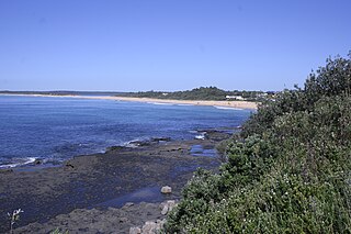
Culburra Beach, commonly referred to as Culburra, is a town located in the South Coast region of New South Wales, Australia. Located within the Shoalhaven local government area, the town is 18 kilometres (11 mi) east-southeast of Nowra on Jerrinja Wandi Wandian Aboriginal Country. At the 2016 census, the town had a population of 2,874 and is the regional centre for the coastal villages of Currarong, Callala Beach, Callala Bay and Orient Point.

Tweed Shire is a local government area located in the Northern Rivers region of New South Wales, Australia. It is adjacent to the border with Queensland, where that meets the Tasman Sea. Administered from the town of Murwillumbah, Tweed Shire covers an area of 1,321 square kilometres (510 sq mi), and has existed as a local government entity since 1947. It was named for the Tweed River.
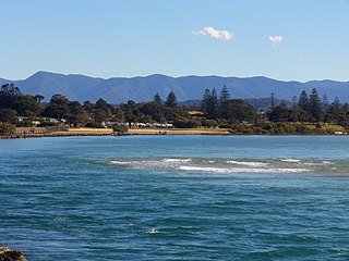
Urunga is a small town located within the Mid North Coast region of New South Wales, Australia, in Bellingen Shire. It is famous for its surf spots. At the 2011 census, Urunga had a population of 3,020. The town is south of Coffs Harbour and Sawtell and north of Nambucca Heads. The place name, Urunga, is derived from the Gumbaynggir word Yurūnga, which is derived from the word for long yurūn in reference to "long white sands".
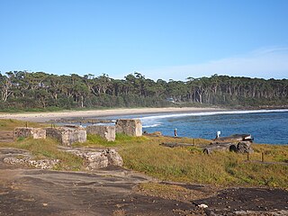
Bawley Point is a small coastal hamlet in New South Wales, Australia, in the Shoalhaven with a population of 698 people at the 2016 census. It is located 30 minutes south of Ulladulla, New South Wales, and 30 minutes north of Batemans Bay on the South Coast of NSW. The town's name is believed to be derived from an Aboriginal word meaning "Brown snake".

Bilinga is a southern coastal suburb in the City of Gold Coast, Queensland, Australia. In the 2016 census, Bilinga had a population of 1,804 people. It is on the border with New South Wales.

Bayview Park ferry wharf is a commuter wharf located in the Sydney suburb of Concord, New South Wales, on Hen and Chicken Bay. It is situated adjacent the namesake Bayview Park reserve, and upon the site of the historical Burwood ferry wharf, where Canadian exiles from the 19th century Lower Canada Rebellion landed in Sydney. Bayview Park was originally serviced by a Matilda Cruises route, before being included on Sydney Ferries' Parramatta River service in 2006, after a brief one-year service by Palm Beach Ferries. Services to the wharf were decommissioned by Sydney Ferries in October 2013, alongside Balmain West after patronage declined to a weekly average of 28 passengers. No operators currently service the wharf, although the structure still remains, with plans to return private ferry services to the wharf as part of a redevelopment project for a factory in eastern Concord.
Cabarita is a small suburb of Mildura, Victoria, Australia, located approximately 10 km from the CBD. At the 2016 census, Cabarita had a population of 488.

Cabarita Beach is a locality in northeastern New South Wales which occupies a thin strip of beach-side land along the Coral Sea coast, east of Tweed Coast Road, in the Tweed Shire town of Bogangar. Locally, the names Cabarita Beach and Bogangar are interchangeable; either may be used when referring to the whole settlement, with more people using the former. Hastings Point lies close to Cabarita Beach to the south and Casuarina to the north. At the 2016 census Cabarita Beach had a population of 103, Bogangar 3060. Cabarita Beach is located within the Tweed Shire Local Government Authority.
Savannah "Sav" Fitzpatrick is an Australian field hockey player.
Cabarita Beach Surf Life Saving Club (SLSC), is a surf lifesaving club in Cabarita Beach, New South Wales, Australia. It is one of 10 such clubs in the Far North Coast.
The Tweed Coast Raiders is an Australian rugby league club. It was formed in 1980 and currently field male and female teams in all junior grades of the Northern Rivers Regional Rugby League and Gold Coast Rugby League. The club is based at Les Burger Fields in Cabarita Beach, New South Wales.

The Federation Pavilion was a temporary structure erected in Centennial Park, Sydney, for use in the celebrations marking the Federation of Australia on 1 January 1901. It was used to swear in the members of the first Federal Executive Council, including Australia's first governor-general and prime minister. The pavilion was originally covered in ornate plasterwork, but the exterior was not preserved and soon fell into disrepair. In 1903, the wooden framework was purchased by the Municipality of Concord and moved to Cabarita Park in the suburb of the Cabarita. The property is now owned by the City of Canada Bay, and was added to the New South Wales State Heritage Register on 22 December 2000. The pavilion has appeared in the clear panel of the Australian five-dollar note since 2016, when the new Next Generation Banknote series went into circulation.
