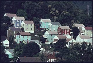
Arbutus is an unincorporated community and a census-designated place in Baltimore County, Maryland, United States. The population was 20,483 at the 2010 census. The census area also contains the communities of Halethorpe and Relay, in which all three names were used during the 1960 census when the area had a population of 22,402.

Coal Fork is an unincorporated census-designated place (CDP) in Kanawha County, West Virginia, United States. It is part of a larger unincorporated community known as Campbells Creek, approximately 10 minutes east of Charleston. The population was 1,233 at the 2010 census.

Alum Creek is a census-designated place (CDP) in Kanawha and Lincoln counties along the Coal River in the U.S. state of West Virginia. It includes the unincorporated communities of Alum Creek, Forks of Coal, and Priestley. The CDP had a population of 1,749 at the 2010 census, down from 1,839 at the 2000 census.

Mallory is a census-designated place (CDP) in Logan County, West Virginia, United States. The population was 1,654 at the 2010 census. The CDP contains the unincorporated communities, from west to east, of Huff Junction, Mallory, Davin, Mineral City, Claypool, Combs Addition, and Gillman Bottom.

Coal City is a census-designated place (CDP) in Raleigh County, West Virginia, United States. The population was 1,815 at the 2010 census. Coal City's population is composed of other surrounding unincorporated communities.
A census-designated place (CDP) is a concentration of population defined by the United States Census Bureau for statistical purposes only.

Tornado, also called Upper Falls, is a census-designated place (CDP) in Kanawha County, West Virginia, United States.
Accoville is an unincorporated community and census-designated place (CDP) in Logan County, West Virginia, United States. The community lies along Buffalo Creek. As of the 2010 United States Census, its population was 574.
Locust Mount is an unincorporated community and census-designated place (CDP) in Accomack County, Virginia, United States. It was first listed as a CDP in the 2020 census with a population of 52. The CDP is in southeastern Accomack County, on the north side of Virginia State Route 180, which leads east 1.1 kilometres (0.7 mi) to Wachapreague and west 3.5 miles (5.6 km) to U.S. Route 13 at Keller.

South Chesconessex is an unincorporated community and census-designated place (CDP) in Accomack County, Virginia, United States. The census uses the name Southside Chesconessex. It was first listed as a CDP in 2010. As of the 2020 census, it had a population of 115.
Beards Fork is a census-designated place (CDP) and coal town in Fayette County, West Virginia, United States that was founded as a coal town. As of the 2010 census, its population was 199.
Monaville is an unincorporated community and census-designated place (CDP) in Logan County, West Virginia, United States. As of the 2010 census, its population was 309.
Allison Gap is an unincorporated community and census-designated place in Smyth County, Virginia.
Crellin is an unincorporated community and census-designated place (CDP) in Garrett County, Maryland, United States, with a population of 264 as of the 2010 census.
Sarah Ann is a census-designated place (CDP) in Logan County, West Virginia, United States. The CDP includes the unincorporated community of Sarah Ann, plus the neighboring communities of Crystal Block and part of Stirrat. As of the 2010 census, the population of the CDP was 345.

Amonate is an unincorporated community and census-designated place (CDP) in Tazewell County, Virginia, United States. Amonate is 8.5 miles (13.7 km) northwest of Tazewell. Its zip code is 24601. It was first listed as a CDP in the 2020 census with a population of 59.

Boomer is a census-designated place (CDP) in Fayette County, West Virginia, United States. Boomer is located on the north bank of the Kanawha River, 2 miles (3.2 km) southeast of Smithers. Boomer has a post office with ZIP code 25031. As of the 2010 census, its population was 615.

Abanda is a census-designated place and unincorporated community in Chambers County, Alabama, United States. Its population was 133 as of the 2020 census.
Dunbar is an unincorporated community, census-designated place, and coal town located in Wise County, Virginia, United States. It was first listed as a CDP in the 2020 census with a population of 79.


