
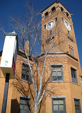
Lee County is a county located in east central Alabama. As of the 2020 census the population was 174,241. The county seat is Opelika, and the largest city is Auburn. The county was established in 1866 and is named for General Robert E. Lee (1807–1870), who served as General in Chief of the Armies of the Confederate States in 1865. Lee County comprises the Auburn-Opelika, AL Metropolitan Statistical Area, which is included in the Columbus-Auburn-Opelika, GA-AL Combined Statistical Area.

Macon County is a county located in the U.S. state of North Carolina. As of the 2020 census, the population was 37,014. Its county seat is Franklin.

Eufaula is the largest city in Barbour County, Alabama, United States. As of the 2010 census the city's population was 13,137.
Tuskegee is a city in Macon County, Alabama, United States. General Thomas Simpson Woodward, a Creek War veteran under Andrew Jackson, laid out the city and founded it in 1833. It became the county seat in the same year and it was incorporated in 1843. It is the largest city in Macon County. At the 2020 census the population was 9,395, down from 9,865 in 2010 and 11,846 in 2000.

Macon, officially Macon–Bibb County, is a consolidated city-county in Georgia, United States. Situated near the fall line of the Ocmulgee River, it is 85 miles (137 km) southeast of Atlanta and near the state's geographic center — hence its nickname "The Heart of Georgia."

The United States District Court for the Middle District of Alabama is a federal court in the Eleventh Circuit.
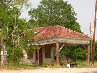
Bee Hive, also spelled Beehive, is an unincorporated community in Lee County, Alabama, United States. It is part of the Columbus, Georgia-Alabama Metropolitan Area. Originally named for an apiary located along Wire Road near the Macon County line, the Bee Hive community today lies near the southwest periphery of the city limits of Auburn.It is the birthplace of James D. Edmondson. A post office operated under the name Beehive from 1896 to 1902.

Knoxville is an unincorporated community and census-designated place in Crawford County, Georgia, United States. It is the Crawford County seat. The community is part of the Macon Metropolitan Statistical Area. As of the 2020 census, Knoxville had a population of 65.
Marvyn, also spelled Marvin, is an unincorporated community located in southern Lee County, Alabama, United States. It sits at the crossroads of Alabama Highway 51 and U.S. Highway 80, and in the Lee County "panhandle" between Russell County and Macon County. It is part of the Columbus, Georgia-Alabama Metropolitan Area.
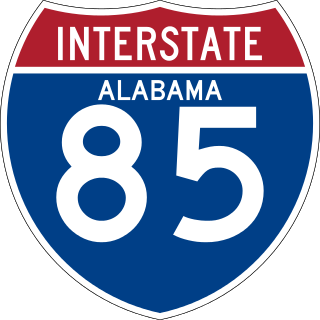
Interstate 85 (I-85) is a part of the Interstate Highway System that runs from Montgomery, Alabama, to Petersburg, Virginia. In Alabama, the Interstate Highway runs 80 miles (130 km) from I-65 in Montgomery northeast to the Georgia state line near Valley. Although it is nominally north–south as it carries an odd number, I-85 travels east–west through the state. It is the primary highway between Montgomery and Atlanta. The Interstate also connects Montgomery with Tuskegee, Auburn, Opelika, and, indirectly, Phenix City and Columbus, Georgia.

U.S. Route 80 (US 80) is a 296-mile-long (476 km) U.S. Highway in the U.S. state of Georgia. It travels west-to-east from the Alabama state line in Columbus across the central portion of the state through cities such as Macon, Dublin, Statesboro, and Savannah to connect to its eastern terminus at an intersection with Tybrisa Street and Inlet Avenue in Tybee Island, near the Atlantic Ocean. Here, the roadway continues as Butler Avenue. US-80 is the main east-west non-Interstate route through Georgia.
Creek Stand is an unincorporated community in Macon County, Alabama, United States.
Macon, also known as Macon Quarters, is an unincorporated community in Calhoun County, Alabama, United States.
Warriorstand is an unincorporated community in Macon County, Alabama, United States.
Snowdoun is an unincorporated community in Montgomery County, Alabama, United States. Snowdoun is located on U.S. Highway 331 9.5 miles (15.3 km) south of Montgomery.
Hillsboro is an unincorporated community in Jasper County, Georgia, United States, established around 1795.

Fort Bainbridge was an earthen fort located along the Federal Road on what is today the county line between Macon and Russell counties in Alabama. Fort Bainbridge was located twenty-five miles west of Fort Mitchell.
Bermuda is an unincorporated community in Conecuh County, Alabama, United States.
Cross Keys is an unincorporated community in Macon County, Alabama, United States.
Society Hill is an unincorporated community in Macon County, Alabama, United States.


