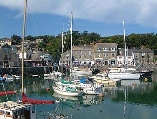
Padstow is a town, civil parish and fishing port on the north coast of Cornwall, England, United Kingdom. The town is situated on the west bank of the River Camel estuary, approximately 5 miles (8.0 km) northwest of Wadebridge, 10 miles (16 km) northwest of Bodmin and 10 miles (16 km) northeast of Newquay. The population of Padstow civil parish was 3,162 in the 2001 census, reducing to 2,993 at the 2011 census. In addition an electoral ward with the same name exists but extends as far as Trevose Head. The population for this ward is 4,434.

The Bodmin and Wenford Railway is a 6 miles 12 chains (9.9 km) heritage railway at Bodmin in Cornwall, England. Its headquarters are at Bodmin General railway station and it connects with the national rail network at Bodmin Parkway.

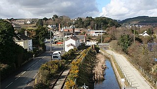
Wadebridge is a town and civil parish in north Cornwall, England, United Kingdom. The town straddles the River Camel five miles upstream from Padstow. The permanent population was 6,222 in the census of 2001, increasing to 7,900 in the 2011 census. There are two electoral wards in the town. Their total population is 8,272.

The Bodmin and Wadebridge Railway was a railway line opened in 1834 in Cornwall, England, United Kingdom. It linked the quays at Wadebridge with the town of Bodmin and also to quarries at Wenfordbridge. Its intended traffic was minerals to the port at Wadebridge and sea sand, used to improve agricultural land, inwards. Passengers were also carried on part of the line.

Bodmin Parkway railway station is on the Cornish Main Line that serves the nearby town of Bodmin and other parts of mid-Cornwall, England. It is situated 3 miles (4.8 km) south-east of the town of Bodmin in the civil parish of St Winnow, 274 miles 3 chains from London Paddington measured via Box and Plymouth Millbay. Network Rail’s National Rail Timetable dated May 2023 records the distance from London Paddington to Bodmin Parkway as 252.50 miles.

Lostwithiel railway station serves the town of Lostwithiel in Cornwall, England. It is 277 miles 36 chains from the zero point at London Paddington measured via Box and Plymouth Millbay. Great Western Railway operates the station along with every other station in Cornwall.

The Camel Trail is a permissive cycleway in Cornwall, England, United Kingdom, that provides a recreational route for walkers, runners, cyclists and horse riders. The trail is flat ; running from Padstow to Wenford Bridge via Wadebridge and Bodmin, it is 17.3 miles (27.8 km) long and used by an estimated 400,000 users each year generating an income of approximately £3 million a year.
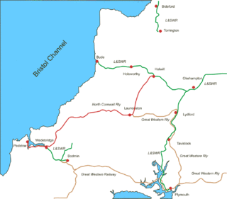
The North Cornwall Railway was a railway line running from Halwill in Devon to Padstow in Cornwall via Launceston, Camelford and Wadebridge, a distance of 49 miles 67 chains. Opened in the last decade of the nineteenth century, it was part of a drive by the London and South Western Railway (LSWR) to develop holiday traffic to Cornwall. The LSWR had opened a line connecting Exeter with Holsworthy in 1879, and by encouraging the North Cornwall Railway it planned to create railway access to previously inaccessible parts of the northern coastal area.
There are seventeen disused railway stations on the Cornish Main Line between Plymouth in Devon and Penzance in Cornwall, England. The remains of nine of these can be seen from passing trains. While a number of these were closed following the so-called "Beeching Axe" in the 1960s, many of them had been closed much earlier, the traffic for which they had been built failing to materialise.

Wadebridge railway station was a railway station that served the town of Wadebridge in Cornwall, England. It was on the Bodmin and Wadebridge Railway.
There are eight disused railway stations between Wadebridge and Bodmin North on the former Bodmin and Wadebridge Railway in Cornwall, in the United Kingdom, with ten other closed sidings on the branches to Ruthern Bridge and Wenfordbridge. The section from Boscarne Junction to Bodmin General is currently part of the Bodmin and Wenford Steam Railway; the line from Wadebridge to Wenfordbridge is now part of the Camel Trail, and the line to Ruthern Bridge can be followed for much of its length as it runs parallel to a public road.

Bodmin General railway station, located in Bodmin, Cornwall, United Kingdom, was the terminus of the Great Western Railway's Bodmin branch line, and is now the principal railway station of the heritage Bodmin & Wenford Railway.
The Truro and Newquay Railway was a Great Western Railway line in Cornwall, England, designed to keep the rival London and South Western Railway (LSWR) out of the west of the county. The line was completed in 1905 and closed in 1963.
The evolution of transport in Cornwall has been shaped by the county's strong maritime, mining and industrial traditions and much of the transport infrastructure reflects this heritage.

Padstow railway station was the western terminus of the North Cornwall Railway. It was opened in 1899 by the London and South Western Railway (LSWR) to serve the port of Padstow. It closed in 1967 having been proposed for closure in the Beeching Report.
Dunmere is a hamlet in Cornwall, England, United Kingdom. It is situated one mile northwest of Bodmin in the valley of the River Camel on the A389 road.

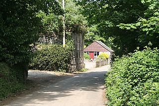
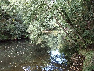
Wenfordbridge, or Wenford Bridge, is a hamlet some 6 miles (9.7 km) north of Bodmin and on the western flank of Bodmin Moor, in Cornwall, England. It takes its name from an old granite bridge over the River Camel, and lies on the border between the parishes of St Breward and St Tudy.

Ruthernbridge is a village in the parish of Withiel in Cornwall, England, UK.
The Cornish China Clay Branches are a number of railway branch lines that serve facilities that produce or process China Clay. The area of Cornwall north of St Austell stretching from Bodmin Moor towards Truro is known for the extraction and processing of commercial volumes of China Clay, and with the expansion of the railways in the 19th century a number of lines were constructed to access various mines and clay-dries. Some branches have closed over the years, but several still operated into the 21st century although much of the China Clay traffic has transferred to road transport. In 2020 rail traffic remained in the shape of regular trains running between Parkandillack and the wharves at Carne Point where the large volumes required to be loaded onto ships for export would make road transport uneconomic.