Bow Bowing, New South Wales

Last updated

Bow Bowing
Sydney,  New South Wales
BowBowingNSWneighbourhoodCentre.jpg
Bow Bowing Neighbourhood Centre
Australia New South Wales location map blank.svg
Red pog.svg
Bow Bowing
Coordinates 34°1′7″S150°50′17″E / 34.01861°S 150.83806°E / -34.01861; 150.83806 Coordinates: 34°1′7″S150°50′17″E / 34.01861°S 150.83806°E / -34.01861; 150.83806
Population1,602 (2016 census) [1]
Established1976
Postcode(s) 2566
Location55 km (34 mi) south-west of Sydney CBD
LGA(s) City of Campbelltown
State electorate(s) Macquarie Fields
Federal Division(s) Werriwa
Suburbs around Bow Bowing:
St Andrews Ingleburn Ingleburn
St Andrews Bow Bowing Minto
St Andrews Minto Minto

Bow Bowing is a suburb of Sydney, in the state of New South Wales, Australia. Bow Bowing is located 55 kilometres south-west of the Sydney central business district, in the local government area of the City of Campbelltown and is part of the Macarthur region.

Suburb Human settlement that is part of or near to a larger city

A suburb is a mixed-use or residential area, existing either as part of a city or urban area or as a separate residential community within commuting distance of a city. In most English-speaking countries, suburban areas are defined in contrast to central or inner-city areas, but in Australian English and South African English, suburb has become largely synonymous with what is called a "neighborhood" in other countries and the term extends to inner-city areas. In some areas, such as Australia, India, China, New Zealand, the United Kingdom, and parts of the United States and Canada, new suburbs are routinely annexed by adjacent cities. In others, such as Saudi Arabia, France, and much of the United States and Canada, many suburbs remain separate municipalities or are governed as part of a larger local government area such as a county. In the United States, beyond the suburbs are exurbs, or "exurban areas", with less density but linked to the metropolitan area economically and by commuters.
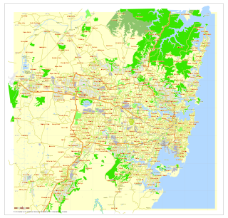
Sydney Metropolis in Australia

Sydney is the state capital of New South Wales and the most populous city in Australia and Oceania. Located on Australia's east coast, the metropolis surrounds Port Jackson and extends about 70 km (43.5 mi) on its periphery towards the Blue Mountains to the west, Hawkesbury to the north, the Royal National Park to the south and Macarthur to the south-west. Sydney is made up of 658 suburbs, 40 local government areas and 15 contiguous regions. Residents of the city are known as "Sydneysiders". As of June 2017, Sydney's estimated metropolitan population was 5,230,330 and is home to approximately 65% of the state's population.

New South Wales State of Australia

New South Wales is a state on the east coast of Australia. It borders Queensland to the north, Victoria to the south, and South Australia to the west. Its coast borders the Tasman Sea to the east. The Australian Capital Territory is an enclave within the state. New South Wales' state capital is Sydney, which is also Australia's most populous city. In December 2018, the population of New South Wales was over 8 million, making it Australia's most populous state. Just under two-thirds of the state's population, 5.1 million, live in the Greater Sydney area. Inhabitants of New South Wales are referred to as New South Welshmen.

Contents

History

The suburb Bow Bowing draws its name from a local creek. The creek's name is probably of aboriginal origin since it was originally spelt Boro Borang and later corrupted. The name Bow Bowing was only chosen for the suburb in 1975 and for more than one hundred years prior to that it was known as Saggart's Field after a local family. A school built in 1866 was named Saggart Field School although it was renamed Minto Public School in 1884. [2]

The land in the area was purchased by the Housing Commission in 1976 with the intention of building over one thousand homes in the relatively small area of the new suburb. Local concerns, particularly over other Housing Commission developments in the area, forced the original plan to be shelved. The land was subsequently sold to private developers who built 350 homes in the area. The development was officially opened in 1990.

Housing NSW is an agency of the Department of Family and Community Services that is responsible for the provision and management of public housing services with the aim to prevent homelessness in the state of New South Wales, Australia.

Population

According to the 2016 census of Population, there were 1,602 people in Bow Bowing. 61.6% of people were born in Australia. 61.4% of people spoke only English at home. Other languages spoken at home included Hindi at 6.4%. The most common responses for religion in Bow Bowing were Catholic 31.4%, No Religion 13.9%, Anglican 13.3%, Islam 8.3% and Hinduism 7.6%. [1]

Related Research Articles

Wyong, New South Wales Suburb of Central Coast, New South Wales, Australia

Wyong is a town of the Central Coast region of New South Wales, located approximately 63 km SSW of Newcastle and 89 km NNE of Sydney. Established in 1888, it is one of the two administrative centres for the Central Coast Council local government area.

Edensor Park, New South Wales Suburb of Sydney, New South Wales, Australia

Edensor Park is a suburb of Sydney, New South Wales, Australia. Edensor Park is located 38 kilometres west of the Sydney central business district in the local government area of the City of Fairfield. It is mainly a residential area, Edensor Park is part of the Greater Western Sydney region.

Coburg, Victoria Suburb of Melbourne, Victoria, Australia

Coburg is a suburb of Melbourne, Victoria, Australia, 9 km north of Melbourne's central business district. Its local government area is the City of Moreland, although a handful of properties on Coburg's eastern boundary are located in the City of Darebin. At the 2016 Census, Coburg had a population of 26,185.

Macquarie Fields, New South Wales Suburb of Sydney, New South Wales, Australia

Macquarie Fields is a suburb of Sydney, in the state of New South Wales, Australia. Macquarie Fields is located 38 kilometres south-west of the Sydney central business district, in the local government area of the City of Campbelltown and is part of the Macarthur region.

Toongabbie Suburb of Sydney, New South Wales, Australia

Toongabbie is a suburb of Sydney, in the state of New South Wales, Australia. One of the oldest suburbs in Sydney, Toongabbie is located 30 kilometres west of the Sydney central business district and is part of the Greater Western Sydney region. Toongabbie is split between the local government areas of the City of Parramatta, the City of Blacktown and Cumberland Council. The suburb is often locally referred to as "Toonie" and "Toonga Bay".

East Ryde, New South Wales Suburb of Sydney, New South Wales, Australia

East Ryde is a suburb in the Northern Suburbs of Sydney, in the state of New South Wales, Australia. East Ryde is located 12 kilometers north-west of the Sydney central business district, in the local government area of the City of Ryde. East Ryde sits on the western bank of the Lane Cove River. East Ryde shares the postcode of 2113 with adjacent suburb of North Ryde though it does not have a Post Office of its own.

Dharruk, New South Wales Suburb of Sydney, New South Wales, Australia

Dharruk is a suburb of Sydney, in the state of New South Wales, Australia. It is located 46 kilometres west of the Sydney central business district, in the local government area of the City of Blacktown and is part of the Greater Western Sydney region.

Schofields, New South Wales Suburb of Sydney, New South Wales, Australia

Schofields is a growing suburb on the fringe of Sydney's urban sprawl, in the state of New South Wales, Australia. Schofields is located 45 kilometres (28 mi) west of the Sydney central business district, in the Blacktown local government area. It is part of Greater Western Sydney's North West Growth Area.

Wattle Grove, New South Wales Suburb of Sydney, New South Wales, Australia

Wattle Grove is a suburb of Sydney, in the state of New South Wales, Australia. Wattle Grove is located 30 kilometres south-west of the Sydney central business district in the local government area of the City of Liverpool.

Rosebery, New South Wales Suburb of Sydney, New South Wales, Australia

Rosebery is a suburb of Sydney, in the state of New South Wales, Australia. It is 6 kilometres south of the Sydney central business district and is part of the local government areas of the City of Sydney and the Bayside Council.

Naremburn, New South Wales Suburb of Sydney, New South Wales, Australia

Naremburn is a suburb on the lower North Shore of Sydney, New South Wales, Australia. Naremburn is located 6 kilometres north of the Sydney central business district, in the local government area of the City of Willoughby.

Minto, New South Wales Suburb of Sydney, New South Wales, Australia

Minto is a suburb of Sydney, in the state of New South Wales, Australia. Minto is located 38 kilometres south-west of the Sydney central business district, in the local government area of the City of Campbelltown and is part of the Macarthur region.

Kellyville, New South Wales Suburb of Greater Western Sydney, New South Wales, Australia

Kellyville is a suburb of Greater Western Sydney, in the state of New South Wales, Australia 36 kilometres north-west of the Sydney central business district in the local government area of The Hills Shire. It is part of the Hills District region.

Oatlands, New South Wales Suburb of Sydney, New South Wales, Australia

Oatlands is a suburb of Sydney, in the state of New South Wales, Australia. It is 23 kilometres north-west of the Sydney CBD in the local government area of the City of Parramatta. Oatlands is considered to be part of the Hills District area.

Bonnyrigg, New South Wales Suburb of Sydney, New South Wales, Australia

Bonnyrigg is a suburb of Sydney, in the state of New South Wales, Australia 36 kilometres west of the Sydney central business district, in the local government area of the City of Fairfield. It is part of the Greater Western Sydney region.

Carramar, New South Wales Suburb of Sydney, New South Wales, Australia

Carramar is a suburb of Sydney, in the state of New South Wales, Australia. Carramar is located 30 kilometres west of the Sydney central business district, in the local government area of the City of Fairfield and is part of the Greater Western Sydney region. Orphan School Creek and Prospect Creek act as the suburb's boundary to the east.

Cartwright, New South Wales Suburb of Sydney, New South Wales, Australia

Cartwright is a suburb in south-western Sydney, in the state of New South Wales, Australia 38 kilometres south-west of the Sydney central business district, in the local government area of the City of Liverpool.

Chifley, New South Wales Suburb of Sydney, New South Wales, Australia

Chifley is a suburb in south-eastern Sydney, in the state of New South Wales, Australia. Chifley is 13 km south-east of the Sydney central business district and is part of the City of Randwick. The postcode is 2036. Chifley is surrounded by the suburbs of Matraville, Malabar, Little Bay and Phillip Bay.

Ermington, New South Wales Suburb of Sydney, New South Wales, Australia

Ermington(formerly "Field of Mars") is a suburb of Sydney, New South Wales, Australia. Ermington is located 19 kilometres north-west of the Sydney central business district, in the local government area of the City of Parramatta. Ermington lies on the northern bank of the Parramatta River.

Eschol Park, New South Wales Suburb of Sydney, New South Wales, Australia

Eschol Park is a suburb of Sydney, in the state of New South Wales, Australia. Eschol Park is located 60 kilometres south-west of the Sydney central business district, in the local government area of the City of Campbelltown and is part of the Macarthur region.

References

  1. 1 2 Australian Bureau of Statistics (27 June 2017). "Bow Bowing (State Suburb)". 2016 Census QuickStats. Retrieved 15 July 2018. OOjs UI icon edit-ltr-progressive.svg
  2. Bow Bowing History Archived 30 July 2008 at the Wayback Machine