Related Research Articles

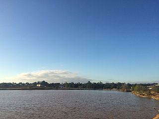
The Georges River, also known as Tucoerah River, is an intermediate tide-dominated drowned valley estuary, located to the south and west of Sydney, New South Wales, Australia.

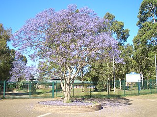
Campbelltown is a town located on the outskirts of the metropolitan area of Sydney, New South Wales, Australia. It is located in Greater Western Sydney 53 kilometres (33 mi) south-west of the Sydney central business district. Campbelltown is the administrative seat of the local government area of the City of Campbelltown. It is also acknowledged on the register of the Geographical Names Board of New South Wales as one of only four cities within the Sydney metropolitan area.
Holsworthy is a suburb in south-western Sydney, in the state of New South Wales, Australia 31 kilometres south-west of the Sydney central business district, in the local government area of the City of Liverpool.

Camden is a historic town and suburb of Sydney, New South Wales, located 65 kilometres from the Sydney central business district. Camden was the administrative centre for the local government area of Camden Council until July/August 2016 and is a part of the Macarthur region.
Glenfield is a suburb of Sydney, in the state of New South Wales, Australia. Glenfield is located 36 kilometres south-west of the Sydney central business district, in the local government areas of the City of Campbelltown and is part of the Macarthur region.

Macquarie Fields is a suburb of Sydney, in the state of New South Wales, Australia. Macquarie Fields is located 38 kilometres south-west of the Sydney central business district, in the local government area of the City of Campbelltown and is part of the Macarthur region.

Varroville is a suburb of Sydney, in the state of New South Wales, Australia. Varroville is located 46 kilometres south-west of the Sydney central business district, in the local government area of the City of Campbelltown and is part of the Macarthur region. Varroville forms part of the scenic hills on the north-west side of the M5 South Western Motorway between Campbelltown and the Camden Valley Way. Of all Sydney suburbs, Varroville has the highest proportion of residents with PhDs.

The City of Campbelltown is a local government area in the Macarthur region of south-western Sydney, in New South Wales, Australia. The area is located about 55 kilometres (34 mi) south west of the Sydney central business district and comprises 312 square kilometres (120 sq mi).

Narellan is a suburb of Sydney, New South Wales. Narellan is located 60 kilometres south-west of the Sydney central business district, in the local government area of Camden Council and is part of the Macarthur region.
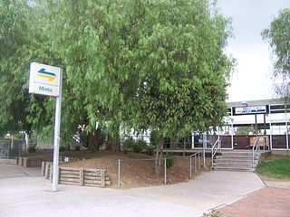
Minto is a suburb of Sydney, in the state of New South Wales, Australia. Minto is located 38 kilometres south-west of the Sydney central business district, in the local government area of the City of Campbelltown and is part of the Macarthur region.
Kentlyn is a suburb of Sydney, in the state of New South Wales, Australia 58 kilometres south-west of the Sydney central business district, in the local government area of the City of Campbelltown. It is part of the Macarthur region.
Leumeah is a suburb of Sydney, in the state of New South Wales, Australia 39 kilometres south-west of the Sydney central business district, in the local government area of the City of Campbelltown. It is north of the suburb of Campbelltown and is part of the Macarthur region.
Spring Farm is a suburb of the Macarthur Region of Sydney in the state of New South Wales, Australia in Camden Council. It is on the east side of the Nepean River. Until recently, it was mainly farmland with a winery, an electricity substation and the Spring Farm Advanced Resource Recovery Facility, but it is currently in the process of suburban redevelopment. spring farm gym with chy
Bradbury is a suburb of Sydney, in the state of New South Wales, Australia. Bradbury is located 54 kilometres south-west of the Sydney central business district, in the local government area of the City of Campbelltown and is part of the Macarthur region.
Bringelly is a suburb of Sydney, in the state of New South Wales, Australia. It is located on the Northern Road between Penrith and Camden. It has a public school. Bringelly is also the name of a local hill.
Elderslie is a suburb of the Macarthur Region of Sydney in the state of New South Wales, Australia in Camden Council. In addition, it is located on the east side of the Nepean River. It has a small local shop, high school, primary school, skateboard park, netball courts, cricket, Australian Football (AFL) oval, Rugby League oval, a BMX track and a historic house, John Oxley Cottage, which was built in the 1890s and converted into the Camden Visitors' centre in 1989. It was named after explorer John Oxley who held an early grant of land in the area.
Gilead is a suburb of Sydney, in the state of New South Wales, Australia. Gilead is located 58 kilometres south-west of the Sydney central business district, in the local government area of the City of Campbelltown and is part of the Macarthur region.
Bickley Vale is a suburb of the Macarthur Region of Sydney in the state of New South Wales, Australia in Camden Council.
Grasmere is a suburb of the Macarthur Region of Sydney in the state of New South Wales, Australia in Camden Council.
Ellis Lane is a suburb of the Macarthur Region of Sydney in the state of New South Wales, Australia in Camden Council.
References
- ↑ Australian Bureau of Statistics (31 October 2012). "Minto Heights (State Suburb)". 2011 Census QuickStats. Retrieved 17 April 2015.

- ↑ Liston, C: Campbelltown: The Bicentennial History, Allen & Unwin, 1988: p.1-2.
- 1 2 "History of Minto Heights". Campbelltown City Council. Archived from the original on 21 July 2005. Retrieved 21 March 2008.
Coordinates: 34°1′52″S150°52′27″E / 34.03111°S 150.87417°E