Bowscale Fell

Last updated

Bowscale Fell
Bowscale Fell.JPG
The Tongue, Bowscale Fell from Mungrisdale
Highest point
Elevation 702 m (2,303 ft)
Prominence c. 90 m
Parent peak Blencathra
Listing Wainwright, Hewitt, Nuttal
Coordinates 54°39′55″N3°02′03″W / 54.66516°N 3.03406°W / 54.66516; -3.03406
Geography
Lake District National Park UK relief location map.png
Red triangle with thick white border.svg
Bowscale Fell
Location in Lake District, UK
Location Cumbria, England
Parent range Lake District, Northern Fells
OS grid NY334305
Topo map OS Landranger 89, 90 OS Explorer OL5
sketch map of Bowscale Fell Bowscale Fell sketch map.JPG
sketch map of Bowscale Fell
Bowscale Tarn seen from Tarn Crags. Bowscale Tarn on Bowscale Fell.jpg
Bowscale Tarn seen from Tarn Crags.

Bowscale Fell is a hill in the English Lake District. It rises above the village of Mungrisdale in the Northern Fells. Bowscale Fell stands at the extreme north east the Blencathra group, connected to this higher fell by the intervening Bannerdale Crags. In common with many fells the western slopes are smooth and convex while the eastern side exhibits crags.

Contents

Topography

A curving ridge surrounds the head of Bannerdale, with Bowscale Fell at the northern end and Bannerdale Crags to the south. The ridgeline is broad and grassy with occasional patches of bog and a couple of small tarns in the north. Bannerdale flows due east from the depression between the two fells to its junction with the River Glenderamackin. A second tributary of the Glenderamackin, Bullfell Beck, runs parallel a little to the north, its source being directly beneath the summit of Bowscale Fell. The heads of the two valleys are divided by a truncated east ridge, The Tongue, which sports a top at 1,814 feet (553 m) at the far end. From below, The Tongue appears as an impressive pyramidal peak with steep slopes on all sides, obscuring the higher ground behind.

A second, longer eastern ridge runs out to the north of Bowscale Fell, forming the northern wall of Bullfell Beck. This has two subsidiary tops at 2,017 feet (615 m) and 1,981 feet (604 m). It ends steeply at Raven Crag above the Mungrisdale to Heskett Newmarket road. Perched in a bowl scooped out on the northern face of this ridge is Bowscale Tarn. This is a classic corrie tarn, held in by a whalebacked moraine and having a depth of around 60 feet (18 m). [1] Bowscale Tarn was a popular tourist attraction in Victorian times, visitors being brought by pony to observe its wild and moody setting. [2] Tastes change and the tarn now finds itself on few itineraries for a grand tour of the District. Legend had it that the tarn was home to two immortal fish, one version of the tale also crediting them with the gift of speech. [1] [2] Above the water is Tarn Crag, the steepest face on the fell.

The western and northern flanks of the fell drain to the River Caldew, which heads north east to Carlisle for a meeting with the River Eden, and thence to the Solway Firth. Northward across the deep cutting of the Caldew is Carrock Fell, while to the west are Great Calva and Knott. Wainwright remarked that the western slopes of Bowscale Fell are drained by the Caldew which ultimately flows to the east, while the eastern slopes feed the Glenderamackin which soon turns west for Keswick and the River Derwent. [2]

Being on the Derwent - Eden watershed, Bowscale Fell has further topographical significance by providing the link between the Northern and Eastern Fells. The eastern ridge continues almost imperceptibly beneath Raven Crag, crossing the road before rising again to form Little Eycott and Eycott Hills. From here the watershed runs south across Great Mell Fell and ultimately climbs onto Great Dodd in the Helvellyn range.

Summit

The summit of the fell bears a rash of stones although all else is grass. There is a windshelter at the highest point and a cairn a little to the north, marking the direction of Bowscale Tarn. [2] [3] The view of Blencathra and Sharp Edge is excellent, together with a surprising vista of the North Western Fells through the Glenderaterra gap. [2]

Ascents

A number of alternatives are available when starting from Mungrisdale. The easiest follows a gently rising track to the depression at the head of Bannerdale, while a variation is to turn off and climb steeply up the terminal slope of The Tongue. Bullfell Beck can also be followed to give the most direct ascent to the summit, but the best route is perhaps to follow the east ridge over its undulating tops. From Bowscale, a little along the road to the north, the Victorian pony route to Bowscale Tarn can still be followed, continuing up a grassy rake that bisects Tarn Crag. [2] [3]

If a much longer walk is required, the ridge between Bowscale Fell and Bannerdale Crags can be reached from the Caldew Valley to the west. This makes Mosedale, or even Skiddaw House and points west into possible starting points.

Ecology

Bowscale Fell is included in the Skiddaw Group Site of Special Scientific Interest. Unusual features include Young Wood which has been claimed to be the highest wood in England. [4]

Related Research Articles

<span class="mw-page-title-main">Skiddaw</span> Mountain in the Lake District, England

Skiddaw is a mountain in the Lake District National Park in England. Its 931-metre (3,054 ft) summit is the sixth-highest in England. It lies just north of the town of Keswick, Cumbria, and dominates the skyline in this part of the northern lakes. It is the simplest of the Lake District mountains of this height to ascend and, as such, many walking guides recommend it to the occasional walker wishing to climb a mountain. This is the first summit of the fell running challenge known as the Bob Graham Round when undertaken in a clockwise direction.

<span class="mw-page-title-main">Blencathra</span> Hill in the Lake District, England

Blencathra, also known as Saddleback, is one of the most northerly hills in the English Lake District. It has six separate fell tops, of which the highest is the Hallsfell Top at 2,848 feet.

<span class="mw-page-title-main">Dale Head</span> Mountain in the Lake District, England

Dale Head is a fell in the north-western sector of the Lake District, in northern England. It is 753 metres or 2,470 foot above sea level and stands immediately north of Honister Pass, the road between Borrowdale and Buttermere.

<span class="mw-page-title-main">Dollywaggon Pike</span> Mountain in the English Lake District, Cumbria, England

Dollywaggon Pike is a fell in the English Lake District. It stands on the main spine of the Helvellyn range in the Eastern Fells, between Thirlmere and the Ullswater catchment.

<span class="mw-page-title-main">Clough Head</span> Mountain in the English Lake District, Cumbria, England

Clough Head is a fell, or hill, in the English Lake District. It marks the northern end of the main ridge of the Helvellyn range and is often walked as part of the ridge walk. The fell stands south of the village of Threlkeld and the A66 road, and it forms the steep eastern side of the tranquil valley of St John's in the Vale.

<span class="mw-page-title-main">Causey Pike</span> Mountain in the English Lake District, Cumbria, England

Causey Pike is a fell in the English Lake District. It is situated in the Newlands Valley, 5 kilometres south-west of the town of Keswick. Even though it has a modest height of 637 metres (2,090 ft) it is one of the most distinctive fells when viewed from the Derwent Water and Keswick area due to its distinguishing summit "knobble" which catches the eye. The fell is one of 214 fells described by Alfred Wainwright in his series of Pictorial Guides to the Lakeland Fells: Causey Pike features in Book Six, The North Western Fells.

<span class="mw-page-title-main">Knott, Caldbeck</span> Mountain in the Lake District, England

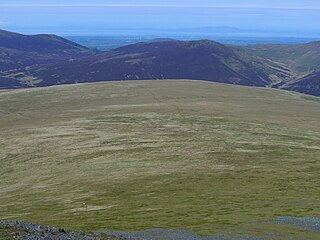
Knott is a mountain in the northern part of the English Lake District. It is the highest point of the Back o'Skiddaw region, an area of wild and unfrequented moorland to the north of Skiddaw and Blencathra. Other tops in this region include High Pike, Carrock Fell and Great Calva. The fell's slopes are mostly smooth, gentle, and covered in grass, with a few deep ravines. It stands a long way from a road and requires a long walk across the moor top get to it; this, as well as the fact that it is hidden from the rest of the Lake District by the two aforementioned giants, make it one of the most unfrequented tops in the Lakes. When it is climbed it is most often from Mungrisdale or from the north via Great Sca Fell. The word Knott is of Cumbric origin, and means simply "hill".

<span class="mw-page-title-main">Carl Side</span> Mountain in the Lake District, England

Carl Side is a fell in the English Lake District, forming a part of the Skiddaw "family" near the town of Keswick and prominently visible from its streets. It is listed in Alfred Wainwright's Pictorial Guides to the Lakeland Fells as one of the Northern Fells.

<span class="mw-page-title-main">Mungrisdale Common</span> Mountain in the Lake District, England

Mungrisdale Common, pronounced mun-grize-dl, with emphasis on grize, is a fell in the English Lake District. Although Alfred Wainwright listed it as one of the 214 featured hills in his influential Pictorial Guide to the Lakeland Fells it was his least favourite. He commented that it "has no more pretension to elegance than a pudding that has been sat on". There is some speculation that Wainwright included the fell in his guide simply as a way to fill space, but that has never been proven. Mungrisdale Common is oddly named, as it is a number of miles from the village of Mungrisdale, which lies in a different river catchment.

<span class="mw-page-title-main">Latrigg</span> Mountain in United Kingdom

Latrigg is one of the lowest fells in the Lake District in North West England, but is a popular climb due to its convenient location overlooking the town of Keswick and the beautiful views down the valley of Borrowdale from the summit. It is the least mountainous of the Skiddaw fells, the summit being almost entirely devoid of rock. The slopes of Latrigg are partially wooded, and logging work is currently being undertaken. One lone tree just south of the summit is prominently viewed in silhouette when approaching Keswick from the west along the A66. It also has petrified trees on top.

<span class="mw-page-title-main">Angletarn Pikes</span> Fell in the Lake District, Cumbria, England

Angletarn Pikes is a fell in the English Lake District near the village of Patterdale. Its most notable feature is Angle Tarn from which it derives its name.

<span class="mw-page-title-main">Wandope</span> Fell in the Lake District, Cumbria, England

Wandope is a fell in the north-western area of the English Lake District. It lies to the east of Crummock Water and south of Crag Hill. From the summit there are excellent panoramas of the Sca Fell and High Stile ranges.

<span class="mw-page-title-main">Green Gable</span> Mountain in the Lake District, England

Green Gable is a fell in the English Lake District often traversed by walkers en route to its more famous neighbour Great Gable. It can be ascended from Honister Pass, Seathwaite in Borrowdale, or Ennerdale. There are good views of Gable Crag, Scafell Pike and the Buttermere valley from the summit.

<span class="mw-page-title-main">Brock Crags</span> Fell in the Lake District, Cumbria, England

Brock Crags is a fell in the English Lake District, standing above Hartsop in the Far Eastern Fells. It forms part of the perimeter of Martindale, lying on the long ridge from Rampsgill Head to Place Fell.

<span class="mw-page-title-main">Great Calva</span> Mountain in the Lake District, England

Great Calva is a fell in the Lake District, England. It is in the Northern Fells, lying roughly at the centre of this region of high ground. As a result, it is distant from roads and quite remote by Lakeland standards. Great Calva stands at the head of a major geological fault running through the centre of the Lake District, and so from the summit it is possible to see all the way south over Thirlmere. The subsidiary summit of Little Calva lies to the west.

<span class="mw-page-title-main">Graystones</span>

Graystones is a fell in the English Lake District. It lies in the North Western Fells region and is one of the peaks on the ridge which encircles the valley of Aiken Beck.

<span class="mw-page-title-main">Bannerdale Crags</span> Mountain in the Lake District, England

Bannerdale Crags is a fell in the English Lake District. It stands between Blencathra and Bowscale Fell in the Northern Fells.

<span class="mw-page-title-main">Lonscale Fell</span> Mountain in the Lake District, England

Lonscale Fell is a hill in the English Lake District. Its pointed second top is instantly recognisable, standing at the eastern end of the Skiddaw massif. The fell is easily climbed from Keswick or from Skiddaw House to the north. Although now primarily a sheep pasture, it once saw considerable mining activity beneath the long eastern wall of crag.

<span class="mw-page-title-main">Souther Fell</span> Mountain in the Lake District, England

Souther Fell is a fell in the English Lake District. It stands to the south of Mungrisdale village in the Northern Fells. It is most famous for the appearance of a "spectral army", said to have been seen marching along its crest on Midsummer's Day, 1745. No such force was in the District at the time.

<span class="mw-page-title-main">Northern Fells</span>

The Northern Fells are a part of the Cumbrian Mountains in the Lake District of England. Including Skiddaw, they occupy a wide area to the north of Keswick. Smooth, sweeping slopes predominate, with a minimum of tarns or crags. Blencathra in the south-east of the group is the principal exception to this trend.

References

  1. 1 2 Blair, Don: Exploring Lakeland Tarns: Lakeland Manor Press (2003): ISBN   0-9543904-1-5
  2. 1 2 3 4 5 6 Wainwright, Alfred: A Pictorial Guide to the Lakeland Fells,Book 5 The Northern Fells: ISBN   0-7112-2458-7
  3. 1 2 Birkett, Bill: Complete Lakeland Fells: Collins Willow (1994): ISBN   0-00-218406-0
  4. Crumley, J (2021). Lakeland Wild