Brandiston

Last updated

Brandiston
Brandiston-g1.jpg
Norfolk UK location map.svg
Red pog.svg
Brandiston
Location within Norfolk
Area3.14 km2 (1.21 sq mi)
Population44 (2001 census [1] )
  Density 14/km2 (36/sq mi)
OS grid reference TG130218
Civil parish
  • Brandiston
District
Shire county
Region
Country England
Sovereign state United Kingdom
Post town NORWICH
Postcode district NR10
Police Norfolk
Fire Norfolk
Ambulance East of England
List of places
UK
England
Norfolk
52°45′04″N1°09′25″E / 52.75114°N 1.15685°E / 52.75114; 1.15685

Brandiston is a small village and civil parish near the centre of the county of Norfolk, England, about two miles south-east of the small market town of Reepham, five miles south-west of the larger town of Aylsham and 10 miles north-west of the city of Norwich. For the purposes of local government, it falls within Broadland district. The hamlet of Guton lies within the parish.

Contents

Geography

The 2001 census recorded a population for Brandiston of just 44. The bulk of the parish is occupied by farmland, mainly arable. At the 2011 Census the population less than 100 and was included in the civil parish of Booton.

History

Brandiston's name is of Anglo-Saxon origin and derives from the Old English for Brant's farmstead or settlement. [2]

In the Domesday Book, Brandiston is described as a settlement of four households, with the village belonging to William the Conqueror. [3]

Brandiston is one of Norfolk's remaining 124 round-tower churches, which date from before the Norman Conquest. St Nicholas' Church was significantly re-modelled in the late Fourteenth Century and, again, in 1844 by Edward Blore at the request of the local Athill family. Today, the church is not in frequent use and is maintained by the Churches Conservation Trust. [4]

In the 1850s, four almshouses were built for the benefit of the parishioners. These were funded by the generous donations of a William Gurney almost three-hundred years earlier. [5]

During the Second World War, Brandiston was home to RAF Swannington. Throughout the war, Brandiston was home to the Hurricanes of No. 85 Squadron RAF and the Mosquitos of No. 157 Squadron RAF. The aircraft fell into disuse after the war and was eventually sold in 1957, mostly returning to agricultural use.

Places of interest

There is a small common in the west of the parish, surrounded by cottages that were originally built to house labourers for Guton Hall and The Grove in Booton.

The remains of a stump cross are on the eastern boundary of the parish, on the Cawston-Norwich road.

War memorial

St. Nicholas' Church holds a marble plaque commemorating the deaths of the two sons of the parish rector during the First World War. They are listed as:

Related Research Articles

<span class="mw-page-title-main">Dilham</span> Human settlement in England

Dilham is a village and civil parish in the English county of Norfolk. The village is located 4.3 miles south-east of North Walsham and 12 miles north-east of Norwich, and is situated on the River Ant.

<span class="mw-page-title-main">Cantley, Norfolk</span> Village in England

Cantley is a village and former civil parish, now in the parish of Cantley, Limpenhoe and Southwood, in the Broadland district, in the English county of Norfolk. Cantley is within the Broads Special Protection Area and lies on the north bank of the River Yare, some 17 km east of Norwich and 15 km south-west of Great Yarmouth. In the 2011 census, Cantley had a population of 733 people living in 279 households.

<span class="mw-page-title-main">East Ruston</span> Human settlement in England

East Ruston is a village and a civil parish in the English county of Norfolk. The village is located 4.1 miles (6.6 km) south-east of North Walsham and 14 miles (23 km) north-east of Norwich.

<span class="mw-page-title-main">Bradwell, Norfolk</span> Human settlement in England

Bradwell is a village and civil parish in the English county of Norfolk. The village is immediately to the west of, and largely indistinguishable from, the built-up urban area of the town of Great Yarmouth.

<span class="mw-page-title-main">Cringleford</span> Human settlement in England

Cringleford is a civil parish and village in the English county of Norfolk. The village sits on the River Yare and forms part of the outskirts of Norwich.

<span class="mw-page-title-main">Brisley</span> Human settlement in England

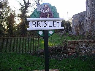
Brisley is a village in the English county of Norfolk located about halfway between Fakenham and East Dereham. It covers an area of 4.90 km2 (1.89 sq mi) and had a population of 276 in 117 households at the 2001 census The Village is located along the B1145 a route which runs between King's Lynn and Mundesley.

<span class="mw-page-title-main">Booton, Norfolk</span> Human settlement in England

Booton is a village and civil parish in the Broadland district of Norfolk, England, just east of Reepham and seven miles west of Aylsham. According to the 2001 census, it had a population of 100, including Brandiston and increasing to 196 at the 2011 Census.

<span class="mw-page-title-main">Brooke, Norfolk</span> Village and civil parish in England

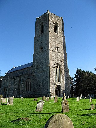
Brooke is a village and civil parish in the South Norfolk district of Norfolk, England, about 7 miles south of Norwich and roughly equidistant from Norwich and Bungay.

<span class="mw-page-title-main">Brundall</span> Human settlement in England

Brundall is a village and civil parish in the English county of Norfolk. It is located on the north bank of the River Yare opposite Surlingham Broad and about 7 miles (11 km) east of the city of Norwich.

<span class="mw-page-title-main">Bracon Ash</span> Human settlement in England

Bracon Ash is a village and civil parish in the South Norfolk district of Norfolk, England.

<span class="mw-page-title-main">Crimplesham</span> Human settlement in England

Crimplesham is a village and civil parish in the English county of Norfolk. It is situated 2.5 miles (4.0 km) east of the small town of Downham Market, 12 miles (19 km) south of the larger town of King's Lynn, and 37 miles (60 km) west of the city of Norwich.

<span class="mw-page-title-main">Flordon</span> Village in south Norfolk, England

Flordon is a village and civil parish in the English county of Norfolk. The village is located 5.4 miles (8.7 km) south-east of Wymondham and 7.6 miles (12.2 km) south-west of Norwich.

<span class="mw-page-title-main">Colney</span> Village in Norfolk, England

Colney is a village in the western outskirts of Norwich in the English county of Norfolk.

<span class="mw-page-title-main">Catfield</span> Village in Norfolk, England

Catfield is a village and civil parish in the English county of Norfolk. The village is 19.7 miles (31.7 km) south-east of Cromer, 17.3 miles (27.8 km) north-east of Norwich and 136 miles (219 km) north-east of London. The village lies 2.7 miles (4.3 km) south-south-east of the nearby town of Stalham.

<span class="mw-page-title-main">Buckenham</span> Human settlement in England

Buckenham is a small village in the civil parish of Strumpshaw, in the Broadland district, in the county of Norfolk, England, situated on the northern bank of the River Yare around 7 miles (11 km) south-east of Norwich. In 1931 the parish had a population of 128.

<span class="mw-page-title-main">Cawston, Norfolk</span> Village and civil parish in England

Cawston is a village and civil parish in the Broadland district of Norfolk, England. The village is approximately 11 miles (18 km) north of Norwich on the B1145 road, a route which runs between King's Lynn and Mundesley. Nearby towns are Reepham and Aylsham.

<span class="mw-page-title-main">Deopham</span> Human settlement in England

Deopham is a village and civil parish in the English county of Norfolk. Deopham is located 3.9 miles west of Wymondham and 12 miles south-west of Norwich.

<span class="mw-page-title-main">Swannington, Norfolk</span> Human settlement in England

Swannington is a village and civil parish in the English county of Norfolk, United Kingdom.

<span class="mw-page-title-main">Carbrooke</span> Human settlement in England

Carbrooke is a village and civil parish in the Breckland district of Norfolk, England. It is 3 miles (4.8 km) from the centre of Watton and 17 miles (27 km) from Thetford. In the 2011 Census, Carbrooke had a population of 2,073 people in 835 households.

Guton was a settlement in the county of Norfolk in England mentioned in the Domesday Book as Guthetuna. It is described as being held by Osbert from Tihel le Breton. It had a mill and 14 beehives. It was considered a small town with 40 households. Lestan, a freeman, was deprived of it on the Norman conquest.

References

  1. Census population and household counts for unparished urban areas and all parishes. Office for National Statistics & Norfolk County Council (2001). Retrieved 20 June 2009.
  2. University of Nottingham. (2022). Retrieved November 9, 2022. http://kepn.nottingham.ac.uk/map/place/Norfolk/Brandiston
  3. Domesday Book. (1086). Retrieved November 9, 2022. https://opendomesday.org/place/TG1421/brandiston/
  4. Knott, S. (2021). Retrieved November 9, 2022. http://www.norfolkchurches.co.uk/brandiston/brandiston.htm
  5. Matthews, D. (2000). Retrieved November 9, 2022. http://www.origins.org.uk/genuki/NFK/places/b/brandiston/white1883.shtml
  6. Imperial War Museum. (2022). Retrieved November 9, 2022. https://www.iwm.org.uk/memorials/item/memorial/19615