
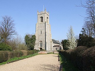
Blakeney is a coastal village and civil parish in the English county of Norfolk. Blakeney lies within the Norfolk Coast AONB and the North Norfolk Heritage Coast. The North Norfolk Coastal Path travels along its quayside. The village is 21.1 mi (34 km) north west of Norwich, 4.6 mi (7.4 km) NNW of the larger settlement of Holt, 11.5 mi (18.5 km) west of Cromer and 112 mi (180 km) NNE of London.

Brumstead is a village and a civil parish in the English county of Norfolk. The village is 15.3 miles (24.6 km) north-east of Norwich, 17.6 miles (28.3 km) south-south-east of Cromer and 134 miles (216 km) north-east of London. The village lies 1.2 miles (1.9 km) north of the town of Stalham.

Denver is a village and civil parish in the English county of Norfolk. The village is situated on the River Great Ouse, approximately 1 mile (1.6 km) south of the small town of Downham Market, 14 miles (23 km) south of the larger town of King's Lynn, and 37 miles (60 km) west of the city of Norwich.

Denton is a village and civil parish in the English county of Norfolk. Denton is located 3.8 miles north-east of Harleston and 13 miles south of Norwich.

Brancaster is a village and civil parish on the north coast of the English county of Norfolk. The civil parish of Brancaster comprises Brancaster itself, together with Brancaster Staithe and Burnham Deepdale. The three villages form a more or less continuous settlement along the A149 at the edge of the Brancaster Manor marshland and the Scolt Head Island National Nature Reserve. The villages are located about 3 miles (4.8 km) west of Burnham Market, 22 miles (35 km) north of the town of King's Lynn and 31 miles (50 km) north-west of the city of Norwich. The civil parish has an area of 8.27 square miles (21.4 km2) and in the 2011 census had a population of 797 in 406 households. For the purposes of local government, the parish falls within the district of King's Lynn and West Norfolk. In 2016, Janet Lake, the clerk to Brancaster Parish Council, reached 50 years of service in the post.

East Harling is a village in the civil parish of Harling, in the Breckland district, in the county of Norfolk, England. It is the principal settlement in the parish of Harling, and is located 13 kilometres (8.1 mi) east of Thetford and 40 kilometres (25 mi) south-west of the city of Norwich on the banks of the River Thet.
Alburgh is a village and civil parish in the English county of Norfolk. It lies about four miles (6 km) north-east of Harleston and 16 miles (26 km) south of Norwich.
Aldeby is a village and civil parish in the English county of Norfolk. It is bounded to the south by the River Waveney, on the other side of which is Suffolk. The village is about five miles (8 km) by road from Beccles.

Alpington is a village and civil parish in the English county of Norfolk. It is situated about six miles (10 km) south-east of Norwich and is closely associated with Yelverton just to the north.

Baconsthorpe is a village and civil parish in the North Norfolk district of the English county of Norfolk. It is 4 miles (6.4 km) south-east of Holt, 5 miles (8.0 km) south of Sheringham and 20 miles (32 km) north of Norwich.

Bergh Apton is a village and civil parish in the South Norfolk district of Norfolk, England, 7 miles (11 km) south-east of Norwich just south of the A146 between Yelverton and Thurton. According to the 2001 census it had a population of 428 in 186 households, the population increasing to 442 at the 2011 Census.

Besthorpe is a village and civil parish in the Breckland district of Norfolk, England, about a mile east of Attleborough, on the A11 road. According to the 2001 census it had a population of 561, increasing to 778 at the 2011 Census.

Brooke is a village and civil parish in the South Norfolk district of Norfolk, England, about 7 miles south of Norwich and roughly equidistant from Norwich and Bungay.
Broome is a village and civil parish in the English county of Norfolk. It is situated on the north bank of the River Waveney, which forms the border with Suffolk, some 2 km north of the town of Bungay and 20 km south-east of the city of Norwich.

Repps with Bastwick is a civil parish in the English county of Norfolk. It comprises the adjacent villages of Bastwick and Repps, which are situated some 16 km (9.9 mi) north-west of the town of Great Yarmouth and 22 km (14 mi) north-east of the city of Norwich. The parish borders the River Thurne and Bastwick is at the south end of the bridge which carries the A149 road over that river to the village of Potter Heigham.

Briston is a village, civil parish and electoral ward in the English county of Norfolk that contains the hamlet of Briston Common. The village is 11 miles (18 km) east north east of the town of Fakenham, 13.3 miles (21.4 km) west south west of Cromer, 20.3 miles (32.7 km) north north west of the city of Norwich, and 125 miles (201 km) north north east of London. The village is situated on the route of the B1354 that runs between the A148 at Thursford and the B1149 at Saxthorpe.
Corpusty is a village and former civil parish, now in the parish of Corpusty and Saxthorpe, in the North Norfolk district, in the county of Norfolk, England, situated on the River Bure. Corpusty is about sixteen miles from Norwich and six miles (10 km) from Holt.

Earsham is a village and civil parish in the English county of Norfolk. Earsham is located 1.7 kilometres (1.1 mi) west of its postal town of Bungay and 21 kilometres (13 mi) south-east of Norwich. The village is located close to the border between Norfolk and Suffolk, and the River Waveney.
Banham is an English village and civil parish in the county of Norfolk, about 7 miles (11 km) north of Diss, 12 miles (19 km) east of Thetford and 20 miles (32 km) south-west of Norwich. It is home to Banham Zoo, a private collection open to the public for more than 40 years, which houses over 2000 animals. The Church of England parish church, dedicated to St Mary the Virgin, is a Grade I listed building. The name of the village derives from "Bean homestead/village", or perhaps "hemmed-in land where beans grow".

Cranworth is a village and civil parish in the Breckland district of the English county of Norfolk.
