The original (1923) route of the A47 was Birmingham to Great Yarmouth, but some changes were made to its route in the early years. At its eastern end, the A47 originally ran through Filby and Caister-on-Sea, with the Acle Straight bearing the number B1140.
A change took place in 1925. The original route of the A47 between Guyhirn and Wisbech in the Isle of Ely was via Wisbech St Mary, with the direct route being part of the A141. That was because there was no road bridge over the River Nene at Guyhirn and hence no junction between the A47 and the A141. In April 1925 a steel road bridge was opened, and the A47 and the A141 swapped routes between Guyhirn and Wisbech.[citation needed]
The A47 was rerouted along the Acle Straight in 1935, with the old route being renumbered as the A1064 (Acle to Caister-on-Sea) and part of the A149 (Caister to Great Yarmouth). Another change also dates from 1935. The A47 originally ran via Downham Market, not King's Lynn. In 1935,[citation needed] it was rerouted via King's Lynn, replacing part of the A141 (Wisbech to King's Lynn) and part of the A17 (King's Lynn to Swaffham). The old route via Downham Market was renumbered as the A1122 (Outwell to Swaffham) and part of the A1101 (Wisbech to Outwell).
Major improvements were made from the late 1970s until early in the 1990s. The seven-mile (11.3km) £5million part-dual-carriageway East Dereham Bypass built on part of the disused railway line was opened in spring 1978 followed by a five-mile (8km) part-dual-carriageway Swaffham Bypass, costing £5million, which was opened in June 1981. Bypasses for Uppingham (£1.4million) and Blofield (£4million) were opened in 1982 and 1983 respectively. The southern section of the Great Yarmouth Western Bypass was opened in May 1985 and the northern section in March 1986 at a cost of £19million, followed by improvements to the one-mile (1.6km) Postwick-Blofield section (£1.2million), which was opened in November 1987. In 1989 Acle Bypass was completed at a cost of £7.1million and the £1.2million East Norton Bypass was opened in December 1990. The three-mile (4.8km) £9million East Dereham-North Tuddenham Improvement opened in August 1992 and the £62million Norwich southern Bypass in September 1992.
Escalating road protests starting with Twyford Down in 1992 and culminating with the Newbury bypass in 1996 (at which more than 1,000 people were arrested)[4] led to more than 300 road schemes being cancelled in November 1995[5] and to the cancellation of further schemes, including the Thorney bypass,[6] by the new Labour government in 1997.[7][8]
In 2002 the government announced a new road-building programme,[9] which included the three-mile (4.8km) dual-carriageway Thorney bypass, which opened on 14 December 2005.
A study on the A47 which concluded in 2001 looked at improving New Road, i.e. the section of the A47 between Acle and Great Yarmouth known as the Acle Straight.[11] The improvement of the Acle Straight has become a point of contention between interested parties due to its passage through the Norfolk Broads, an area of important ecological and conservation significance that limits development. The study which recommended widening rather than dualling of the Acle Straight was opposed by the Broadland District Council, Great Yarmouth Borough Council, Norfolk Police Authority and the majority of local respondents who believed that dualling of the road is necessary to improve road safety, decrease journey time and support the economic development of Great Yarmouth. Dualling was however strongly opposed by the Environment Agency, the Council for National Parks (CNP) and the Broads Authority due to its impact on biodiversity and internationally important wildlife sites. These parties did cautiously support further investigation into the option for widening following further investigation of its environmental impact.[12]
Acle Straight safety improvement scheme
In 2006 a programme of safety improvement for the Acle Straight were announced. This would include road resurfacing, better road markings, improved visibility and the installation of safety cameras at an estimated total cost of £1.6million. The result would then be monitored while long-term improvements, such as widening, are considered.[13]
A £117million road scheme to the north of Norwich, linking the A1067 and Norwich International Airport to the A47, sponsored and managed by Norfolk County Council. It was priority scheme for Norfolk County Council and it attracted strong opposition both locally and from environmental groups.[14] On 2 June 2015 the scheme was given the go ahead, in 2017 parts of the road were opened with the complete road opened in early 2018.
Norwich Western Link
A scheme to connect the A47 at Easton with the A1067 at Attlebridge at the end of the Norwich Northern Distributor Road.[15]
Improvements around Norwich
The two stretches of dual carriageway west and east of Norwich are planned to be dualled by 2027.[16] Although a Development Consent Order (DCO) was granted in 2022,[17][18] both schemes were subject to legal challenge which have since been dismissed.[19] This caused the overall scheme to be delayed by 20 months.[20] Work began on the North Tuddenham to Easton leg in 19 August 2024 and is due to be finished in 2027.[21] Work is also underway to dual the A47 between Blofield and North Burlingham which is scheduled to open in March 2026.[22]
In addition to the two dualling schemes, National Highways also proposed to improve the Thickthorn Junction, where the A47 meets the A11. This will involve the construction of two new free-flow link roads between the A47 and the A11. this project was also the subject of a legal dispute which was since dismissed. In July 2024, the £153million contract was awarded to Skanska.[23] The scheme is scheduled for completion in 2028.[24]
Other proposed improvements
In 2012 Norfolk County Council launched the strategic route prospectus which detailed improvement schemes along the A47 between Peterborough and King's Lynn.[25] The list of improvements, costing a total £526million, included dualling sections of the road and other junction improvements. The sections of the road to be dualled were the Acle straight, Blofield to Burlingham, North Tuddenham to Easton and the East Winch/Middleton bypass. Other improvements detailed were four schemes at Great Yarmouth, including a £112million third river crossing, four junction improvements along the Norwich Southern Bypass and improvements to the three junctions at King's Lynn.
On 8 October 2012 it was the announced that improvements to the A1/A47 junction at Wansford and the roundabout at Honingham would be approved for pinch point funding.[26] On 1 December 2014 it was announced that a package of improvements to the A47 worth a total of £300million would be funded during the 2015–20 parliament.[27]
Plans to dual the A47 west of Peterborough between Wansford and Sutton were cancelled by the government in August 2025.[28]
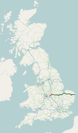
Route
Route of A47, OpenStreetMap
Birmingham
The Birmingham end of the A47 starts one mile from the centre of Birmingham at the junction with the A4540 Middleway. The traffic light controlled junction was laid out in 2018–19 following the infilling of the Ashted Circus roundabout.[29][30] The road runs north-east through Vauxhall as Nechells Parkway and then Saltley Road. (Historically it started in the City Centre on High Street.) The road continues north east following the Cross Country Route and River Rea as first Heartlands Parkway and then Fort Parkway. The Birmingham section of the road terminates at Spitfire Island, a roundabout on the A452 halfway between the M6 Junction 5 and A38 Tyburn Island.
The route between Birmingham and Nuneaton was known as the A47 until 1986, when it was renumbered, mainly as the B4114, following the completion of the M42.[citation needed]
Nuneaton – Leicester
The A47 in Normandy Way, Hinckley
At Nuneaton the road re-emerges as Hinckley Road from a junction with the A444, near the railway station. Leaving Nuneaton, it passes the North Warwickshire and South Leicestershire College, meets the A4254 at a roundabout and the A5Watling Street near the Longshoot Hotel. It follows the A5 for a half-mile entering Leicestershire and the district of Hinckley and Bosworth, then leaves at a roundabout to bypass Hinckley to the north as Dodwells Road then Normandy Way which was completed in the summer of 1994.[citation needed] This section passes through a large industrial estate and close to a Tesco distribution centre, crossing the Ashby-de-la-Zouch Canal. It meets a roundabout near the Triumph motorbike factory. It bypasses Earl Shilton on its southern side as a single carriageway road. It then runs through Leicester Forest on a line parallel with the M69. It enters Leicester Forest East crossing the M1 near the service station and continues on into the City of Leicester at the B5380 junction. The road continues into the city centre crossing the A563 outer ring-road before becoming part of the inner ring road.
Humberstone Gate in Leicester (ex-A47)
Leicester – A1
Uppingham Road shops
Leaving Leicester the road becomes Humberstone Road, then Uppingham Road. It passes under the Midland Main Line and meets the B6146 St Barnabas Road to the south, then passes over the former Leicester Belgrave Road to Peterborough North section of the Great Northern Railway which follows the road as far as Houghton on the Hill. At the A6030 crossroads, it becomes part of the Leicester outer ring road in North Evington. At Humberstone, beyond the A563 (outer ring road) and Goodwood Road (projected extension of the outer ring road) crossroads, the road meets the B667 Spencefield Lane to the south, for Evington. Between the Downing Drive junction and Thurnby Hill it enters Leicestershire and the district of Harborough. At Thurnby it meets Station Road to the north, for Scraptoft. Leaving Bushby it climbs Winkadale Hill into the countryside.
The road travels through Houghton on the Hill, with crossroads for Leicester Airport (to the south) and Old Ingarsby (to the north) next to the Rose and Crown and JETHoughton Garage, and heads down Palace Hill with a right turn for Gaulby, a left turn for Tilton on the Hill, then crosses the River Sence. The two-mile £2.5million three-lane Billesdon Bypass opened in October 1986, passing north of the village, with staggered crossroads. It meets the B6047 north-south Market Harborough to Melton Mowbray road (for Tilton on the Hill) at staggered crossroads at the highest point of the A47, at around 670 feet. It passes through Skeffington with a right turn for Rolleston then heads through Tugby, which is traversed by the Midshires Way and National Cycle Route 63. It winds its way towards the one-kilometre £1.2million East Norton Bypass, which opened in December 1990, passing south of the village, with a left turn for Loddington and right turn for Hallaton. Leaving the village, after rejoining the former route, it passes the former railway station. It heads down a hill as three lanes and crosses the Eye Brook and from here the next ten miles are in Rutland, and three lanes become two.
There is a left turn for Belton-in-Rutland and a right turn for Allexton (in Leicestershire) where the road is crossed by the Leicestershire Round and Macmillan Way. The two-mile £1.9million Wardley Hill Improvement opened in October 1987, and there is a right turn (only) for Wardley, where the road is crossed by the Rutland Round. The road improvement took a less-crooked route closer to the village, with a less steep incline avoiding the top of Wardley Hill. The one-and-a-half-mile £1.4million Uppingham Bypass opened in June 1982, taking a shorter route north of the town, which is the home of Uppingham School. It meets the A6003 (for Oakham) at a roundabout, and meets the former Glaston Road route and crossroads for Bisbrooke, to the south. It passes through Glaston, with crossroads for Wing (to the north) and Seaton (to the south) near the Old Pheasant. It passes over the tunnel of the Oakham to Kettering Line. Entering Morcott it passes Redwings Lodge, a former Travelodge, and a new cafe restaurant, the Country Lounge originally a Little Chef, on the left and there is a left turn for Morcott, where the road is crossed by the Rutland Round. It meets the A6121 (for Stamford) and B672 (for Caldecott) where it crosses a tunnel of a former railway. At a right turn for Barrowden there is Morcott Windmill, and the road is again crossed by the Rutland Round. There is a crossroads for South Luffenham and Barrowden.
Collyweston quarry
From Shire Oaks (Coppice Leys) through Tixover, the road has been straightened, and to the right is the Welland Valley (Rutland – Northamptonshire boundary). At Tixover there is a crossroads, where the Rutland Round follows the road to the east. The road crosses the River Welland, where the Jurassic Way crosses the road. The Duddington Bypass, where the road enters the district of North Northamptonshire, opened in 1975. This section has a busy roundabout where it meets the south-west/north-east corridor A43. On the northern edge of Collyweston Great Wood, it meets Kingscliffe Road for Collyweston, at the west gate of RAF Wittering. It follows the perimeter fence of the airfield to Collyweston Cross Roads (now no longer crossroads due to the airfield), where there is a right turn for Kings Cliffe. The woodland here is the northern edge of the historic Rockingham Forest. The road towards Wittering Lodge has been straightened, and crosses the City of Peterborough boundary (former Northamptonshire, then Cambridgeshire). At Toll Bar Cottage, there is a left turn for Wittering, opposite Bedford Purlieus National Nature Reserve. The road meets the A1.
A1 – Kings Lynn
The road formerly went through Wansford, further to the south. The £250,000 dual-carriageway Wansford North Bypass opened in January 1965. There is a right-turn for Sutton. It is crossed by the Roman roadErmine Street. The dual-carriageway £9million Ailsworth-Castor Bypass opened in September 1991. Around Peterborough, the Peterborough Longthorpe Grade separated junction (GSJ) opened in December 1987 where it meets the A1260. There is a GSJ for Bretton and a Sainsbury's, and it passes the Peterborough City Hospital. The £1.2million Peterborough Westwood GSJ opened in January 1987 near Ravensthorpe. This section of road is called the Soke Parkway (named after the Soke of Peterborough). When this was first built, in the mid-1970s, the A47 followed what is now the A15 Paston Parkway.
It crosses the East Coast Main Line and meets the A15 at New England near to a Morrisons (former Safeway), and Boulevard and Brotherhood retail parks at Walton to the north and New England to the south. There is another GSJ near Paston to the north and it meets the other strand of the A15 at a GSJ near Gunthorpe. It meets the southern terminus of the new A16 alignment before meeting the A1139 at a roundabout and crossing the Car Dyke. The 3-mile (4.8km) £7.2million Eye Bypass opened as Eye Road in October 1991, diverting traffic from the Paston Parkway, and partly built on the former Peterborough to Wisbech railway. There is a local access roundabout at Eye Green near the EssoEye Green Service Station, a Travelodge and the Peterborough Eye former Little Chef on the right, where it becomes Thorney Road, The Causeway. The landscape becomes very flat known as The Fens. A 3-mile (4.8km) dual-carriageway bypass of Thorney opened on 14 December 2005. The road meets the B1040 and B1167 at roundabouts. Near Thorney Toll, the road enters Cambridgeshire and the district of Fenland near the New Toll Service Station. The straight road finishes at Guyhirn, meeting the B1187 and crossing on the Tiddy Mun bridge and following the River Nene and the Nene Way. The 1⁄2-mile (0.80km) £3.7million Guyhirn Diversion opened in October 1990. The road heads north-east, following the east bank of the River Nene. The 5-mile (8.0km) £6million Wisbech/West Walton Bypass opened in autumn 1984. The former route leaves as the B198 at a roundabout. It meets a level crossing, and it enters Norfolk and the district of King's Lynn and West Norfolk just before a roundabout with the A1101 for Elm and Emneth at the Elme Hall Hotel. It passes the TotalWisbech Services and then meets the old route (B198) at a roundabout and becomes the 6-mile (9.7km) £23million dual-carriageway Walpole Highway/Tilney High End Bypass which opened in summer 1996. There is an exit for Walpole Highway, and another for Terrington St John. It passes near Tilney High End. Near Tilney All Saints, it meets the old route at a roundabout, becoming the single carriageway Main Road, then Pullover Road. It meets the end of the A17 at the "Pullover Roundabout" where the West Lynn Little Chef is located.
King's Lynn – Great Yarmouth
This section needs to be updated. Please help update this article to reflect recent events or newly available information.(February 2017)
Nearing King's Lynn, the dual carriageway crosses over the River Great Ouse and Fen Rivers Way footpath. Construction of the King's Lynn southern bypass, built by W. & C. French[31] at a cost of £3,733,000, began on 5 April 1972[32] and was completed in 1975.[33] It meets the A148 road at a grade-separated junction known as the Saddlebow interchange.[34] The A10 and the A149 terminate at the Hardwick Flyover (opened on 30 October 2003[35]) near the Hardwick Industrial Estate (formerly home of Campbell's Soup). After this junction it becomes Constitution Hill until the turn off for North Runcton; then Lynn Road, where in Middleton it passes the Grade II listed former lodge to Middleton Hall, 'The Old Lodge',[36] the former Crown public house and St Mary's church.
Next is East Winch, where it passes All Saints's church, then West Bilney where it passes St Cecilia's church. Soon after, the former Lynn and Dereham Railway line is crossed, followed by a right-turn for Pentney, and the B1153 for East Walton. The half-mile Narborough Bypass, opened in November 1992, where the road crosses the River Nar and enters the district of Breckland. There is a straight section to where it meets the A1122 (for RAF Marham) at a roundabout at the start of the five-mile part-dual-carriageway Swaffham Bypass, which opened in June 1981. There is an exit for Swaffham, and a grade-separated junction with the A1065 (for Fakenham).
It passes some wind turbines and there is a roundabout where it joins the former route just before it is crossed by the Peddars Way. There is a left turn for Sporle and it passes Necton then heads north-west through Little Fransham, passing the Canary and Linnet, with a left turn for Crane's Corner. The seven-mile £5million part-dual-carriageway East Dereham Bypass opened in spring 1978, which was built on part of the disused railway line. It passes near Wendling and St Peter and St Paul church then meets the B1146 (for Dereham) and A1075 (for Shipdham) near a Tesco supermarket and B1135. The B1147 leaves for Swanton Morley. The three-mile £9million East Dereham-North Tuddenham Improvement opened in August 1992, which passes North Tuddenham. It bypasses Hockering. It enters the district of Broadland at the start of the bypass of Honingham, where it crosses the River Tud. Just before the roundabout at Easton, it enters the district of South Norfolk.
Norwich Southern Bypass
The dual-carriageway £62million Norwich Bypass opened in September 1992. At the Longwater Intersection, the A1074 follows the former route through Norwich near the Longwater Retail Park and Sainsbury's. Near Bawburgh, it crosses the River Yare. There is a GSJ with the B1108, for Little Melton and Colney. At Cringleford, it meets the A11 at the Thickthorn Interchange and Thickthorn Services and crosses the Breckland Line. Near Keswick Hall, it meets the A140 at a GSJ at Harford Bridge, south of Norwich, near a Tesco, then crosses the Great Eastern Main Line. It is crossed by Boudica's Way, then meets the A146 at a GSJ. It crosses the River Yare again at the Postwick Viaduct and enters the district of Broadland.
Postwick Viaduct to Great Yarmouth
It crosses the Wherry Line and meets the A1042 at a GSJ. The section from the end of this bypass to Blofield, the one-mile £1.2million Postwick-Blofield Dualling, was opened in November 1987. There is a left turn to Great Plumstead. The one-mile £4million dual-carriageway Blofield Bypass opened in February 1983, which starts at a roundabout for Brundall. It becomes single carriageway and passes North Burlingham near the staggered White House crossroads with the B1140. The three-mile £7.1million dual-carriageway Acle Bypass opened in March 1989, which ends at a roundabout with the A1048 near a Travelodge, becoming the single carriageway New Road. From Acle, the road enters the Acle Straight which is nearly seven miles of straight and level single carriageway to Great Yarmouth, with just one curve at Road House Diner. The road is notorious for congestion, especially during the holiday season, and also for the number of accidents, which due to the drainage ditches on either side of the road are often fatal, and demands for dualling have been heard for many years, although there are no current plans to go ahead with this. It enters the district of Great Yarmouth, then passes close to Breydon Water. The northern section of the two-mile £19million Great Yarmouth Western Bypass (A47) opened in March 1986, and the southern section opened in May 1995.
Great Yarmouth – Lowestoft
The Breydon Bridge to the west of Great Yarmouth now carries the A47.The Gorleston Relief Bypass, which used to be the A12
From the Acle Straight, the A47 meets the Vauxhall Roundabout in Great Yarmouth where it intersects with the A149. The A47 follows a route south across Breydon Bridge which spans the estuary where the Rivers Yare and Bure meet Breydon Water. It meets at the Gapton Hall Roundabout, which intersects with the A1243. The route continues South, meeting with the Harfrey's Roundabout, which connects the A47 to Great Yarmouth's Herring Bridge. From there the A47 is formed of the Gorleston Bypass, a 2.6KM stretch of dual carriageway with a single slip-road connecting it to Gorleston via the A143. After this, a small section of the A47 runs south past the regions main A&E, the James Paget University Hospital. Approx 5.5 KM of dual carriageway then takes the A47 to North Lowestoft, which connects the A47 to the coastal villages of Hopton and Corton via 3 roundabouts. The A47 enters Suffolk as its route heads south into Lowestoft, along restricted 30MPH roads. As the A47 intersects with the A1144 in the centre of Lowestoft, it branches off into two routes. The main A47 branches past the towns docks, where it enters a section of 3 lanes controlled by lane tidal flow lights, which predetermine which of the three lanes is open for north or southbound travel over the bascule bridge. The secondary A47 branches through the centre of the town, passing Lowestoft Railway Station and meeting the main A47 by the docks just before the bridge. The A47 then terminates at the Bascule Bridge, where the A12 begins.[37][38]
Bus service
First Eastern Counties run an 'Excel' service, with four branded routes – A, B, C and D, which primarily serve population centres along the A47, with some routes going as far as Peterborough. [39]
This page is based on this Wikipedia article Text is available under the CC BY-SA 4.0 license; additional terms may apply. Images, videos and audio are available under their respective licenses.