A4074 road

Last updated

UK road A4074.svg
A4074
The A4074 leaving Chazey Heath (geograph 4260534).jpg
The A4074 at Chazey Heath
Route information
Length22 mi (35 km)
Major junctions
South end Caversham, Reading ( 51°28′02″N0°58′36″W / 51.4673°N 0.9767°W / 51.4673; -0.9767 (A4074 road (southern end)) )
North endHeyford Hill, Iffley, Oxford ( 51°43′17″N1°14′03″W / 51.7214°N 1.2343°W / 51.7214; -1.2343 (A4074 road (northern end)) )
Location
Country United Kingdom
Road network
UK road A4071.svg A4071 UK road A4075.svg A4075

The A4074 is a British A road from the Reading suburb of Caversham to the Heyford Hill roundabout on the Oxford Ring Road. [1]

The road starts from a junction with the A4155 close to the northern side of Caversham Bridge (over the River Thames) before climbing through the up-market residential area of Caversham Heights. Crossing the Reading Borough boundary, the road proceeds through the small community of Chazey Heath, where it enters thick woodland for several miles before emerging near the village of Woodcote. From here it crosses the more exposed ground of the Chiltern Hills before bypassing both Wallingford and Crowmarsh Gifford on the Wallingford bypass. It then passes by Benson, passes through Shillingford, bypasses Dorchester and passes through Nuneham Courtenay. The road becomes dual-carriageway as it passes Sandford-on-Thames and remains so to its terminus on the Oxford Ring Road at the Heyford Hill roundabout. [1]

The road was designated in the 1980s [ citation needed ], when the B479 between Caversham and Crowmarsh Gifford was renumbered. In 1990 [ citation needed ] the A423 from Crowmarsh to Heyford Hill was renumbered the A4074, and the road became the primary route between Reading and Oxford in place of the A329 along the River Thames. The short stretch of the Oxford Ring Road between Heyford Hill and the Hinksey Hill interchange was not renumbered A4074, and remains an isolated fragment of the A423.

The poor safety record of a particular stretch of this road, roughly between Chazey Heath and Woodcote, is highlighted in its local nickname, The 13 Bends of Death. Its accident rate of 53 per 100 million vehicle kilometres is nearly 70% higher than average for roads of its type. [2]

A half-hourly bus service, branded as river rapids and operated by Thames Travel, owned by Go-Ahead like its sister company the Oxford Bus Company, runs between Reading and Oxford along the A4074, albeit passing through the centre of Wallingford rather than using the by-pass. Alternate buses are numbered X39 and X40, with the X40 also diverting from the main road to serve Woodcote. [3]

Related Research Articles

<span class="mw-page-title-main">A44 road</span> Major road in the United Kingdom

The A44 is a major road in the United Kingdom that runs from Oxford in southern England to Aberystwyth in west Wales.

<span class="mw-page-title-main">A49 road</span> Road in England

The A49 is an A road in western England, which traverses the Welsh Marches region. It runs north from Ross-on-Wye in Herefordshire via Hereford, Leominster, Ludlow, Shrewsbury and Whitchurch, then continues through central Cheshire to Warrington and Wigan before terminating at its junction with the A6 road just south of Bamber Bridge, near the junction of the M6, M65 and M61 motorways.

<span class="mw-page-title-main">Henley (UK Parliament constituency)</span> Parliamentary constituency in the United Kingdom, 1885 onwards

Henley is a constituency in Oxfordshire represented in the House of Commons of the UK Parliament since 2008 by John Howell, a Member of Parliament from the Conservative Party. He was elected in a by-election following the resignation of future Prime Minister Boris Johnson, who had taken office as Mayor of London. The constituency was established for the 1885 general election.

<span class="mw-page-title-main">Crowmarsh Gifford</span> Human settlement in England

Crowmarsh Gifford, commonly known as Crowmarsh, is a village in the civil parish of Crowmarsh in South Oxfordshire. It is beside the River Thames opposite the market town of Wallingford, the two linked by Wallingford Bridge. Crowmarsh parish also includes the hamlet of Newnham Murren, which is now merged with the village; the hamlet of Mongewell, and the village of North Stoke 2 miles (3.2 km) to the south.

<span class="mw-page-title-main">A43 road</span> Road in England

The A43 is a primary route in the English Midlands and northern South East England, that runs from the M40 motorway near Ardley in Oxfordshire to Stamford in Lincolnshire. Through Northamptonshire it bypasses the towns of Northampton, Kettering and Corby which are the three principal destinations on the A43 route. The A43 also links to the M1 motorway.

<span class="mw-page-title-main">A420 road</span> Road in England

The A420 is a road between Bristol and Oxford in England. Between Swindon and Oxford it is a primary route.

<span class="mw-page-title-main">Mapledurham</span> Human settlement in England

Mapledurham is a small village, civil parish and country estate beside the River Thames in southern Oxfordshire. The large parish borders Caversham, the most affluent major district of Reading, Berkshire. Historic buildings in the area include the Church of England parish church of St. Margaret, Mapledurham Watermill and Mapledurham House.

<span class="mw-page-title-main">Caversham Heights</span> Human settlement in England

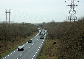
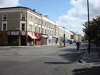
Caversham Heights is a residential area within Caversham in the English Royal County of Berkshire. Today Caversham is a northern suburb of the larger town of Reading. The name Caversham Heights traditionally refers to that part of Caversham situated on higher ground to the west of central Caversham, straddling the Woodcote Road (A4074). Since 2022, Caversham Heights is also the name of a local government ward that extends to the Thames in the south, and across Hemdean Bottom to St. Barnabas Road in the east.

The Oxford Ring Road circles the city of Oxford, England. It is a dual carriageway ring road for most of its length apart from a short section between Woodstock Road and Banbury Road in the north of the city. The severe restrictions on traffic in Oxford city centre mean that it is the only practical way for long-distance traffic to get past Oxford, especially as there are few road bridges over the rivers Isis and Cherwell. Five Park and Rides are close to the ring road.

<span class="mw-page-title-main">A240 road</span> Road in Surrey and Greater London

The A240 is a partially primary status A road in Surrey and Greater London that connects the A217 with the A3 and continues beyond through Surbiton to Kingston upon Thames. The road is 8.5 miles (13.7 km) long and is dualled as the Ewell bypass and thereafter to Tolworth Broadway. In conjunction with the A3 it provides an alternative to the congested A24 corridor through Morden and Merton.

<span class="mw-page-title-main">A423 road</span> Road in England

The A423 road is a primary A road in England in two sections. The main section leads from central Banbury to the A45 near Coventry.

<span class="mw-page-title-main">A4130 road</span> Road in England

The A4130 is a British A road which runs from a junction with the A404 at Burchetts Green (Maidenhead), Berkshire to the A417 at Rowstock in Oxfordshire. It passes through Henley-on-Thames, and Nettlebed, and bypasses Wallingford and Didcot.

<span class="mw-page-title-main">Shillingford</span> Human settlement in England

Shillingford a hamlet on the north bank of the River Thames in Warborough civil parish in South Oxfordshire, England. Its homes are not quite with Warborough by way of one residential road. It lies mostly on the A4074 between Oxford and Reading, at the junction with the A329.

<span class="mw-page-title-main">North Stoke, Oxfordshire</span> Human settlement in England

North Stoke is a small village beside the River Thames in the Crowmarsh civil parish in South Oxfordshire, 2 miles (3.2 km) south of the market town of Wallingford. Its 'Church of St Mary' is a Grade I listed building.

<span class="mw-page-title-main">Chazey Heath</span> Human settlement in England

Chazey Heath is a hamlet in Oxfordshire, England, about 3 miles (4.8 km) north of Reading, Berkshire. It is situated on the A4074 road, between Caversham and Oxford, at its junction with the rural road to Goring Heath and Goring-on-Thames. For local government purposes Chazey Heath is in Mapledurham civil parish, which forms part of the district of South Oxfordshire within the county of Oxfordshire. It is within the Henley constituency of the United Kingdom Parliament. Prior to Brexit in 2020, it was represented by the South East England constituency for the European Parliament.

<span class="mw-page-title-main">Thames Travel</span> Oxfordshire bus operator

Thames Travel is a bus operator serving the southern part of the English county of Oxfordshire. It is based in Didcot and is a subsidiary of the Go-Ahead Group.

<span class="mw-page-title-main">Transport in Reading, Berkshire</span> Transport system overview

Reading's location in the Thames Valley at the confluence of the River Thames and River Kennet, and on both the Great Western Main Line and the M4 motorway, some 40 miles (64 km) west of London has made the town an important location in the nation's transport system.

<span class="mw-page-title-main">A42 road (England)</span> Road in England

The A42 is a major trunk road in the East Midlands region of the United Kingdom. It links junction 23A of the M1 motorway to junction 11 of the M42 motorway. The A42 is in effect a continuation of the M42, and its junctions are numbered accordingly.

References

  1. 1 2 "A4074". sabre-roads.org.uk. Archived from the original on 23 October 2015. Retrieved 23 October 2015.
  2. Times Online. Britain's deadliest road: the 13 bends of death.
  3. "Route X39/X40/NX40" (PDF). Oxford Bus Company. Archived (PDF) from the original on 21 January 2022. Retrieved 21 January 2022.
Map all coordinates using: OpenStreetMap  
Download coordinates as: KML

Coordinates: 51°36′21″N1°06′22″W / 51.6057°N 1.1061°W / 51.6057; -1.1061