A4 road (England)

Last updated

UK road A4.svg
A4
Bath Road
A4 road map.png
Route information
Length126.64 mi (203.81 km)
Major junctions
East endUK road A40.svg A40 in the City of London
Major intersections
West endUK road A403.svg A403 in Avonmouth [1]
Location
Country United Kingdom
Constituent country England
Primary
destinations
Westminster, Hammersmith, Hounslow, Heathrow Airport, Slough, Maidenhead, Reading, Newbury, Marlborough, Calne, Chippenham, Bath, Bristol
Road network
UK road A3.svg A3 UK road A5.svg A5

The A4 is a major road in England from Central London to Avonmouth via Heathrow Airport, Reading, Bath and Bristol. It is historically known as the Bath Road with newer sections including the Great West Road and Portway. The road was once the main route from London to Bath, Bristol and the west of England and formed, after the A40, the second main western artery from London.

Contents

Although most traffic is carried by the M4 motorway today, the A4 still acts as the main route from Bristol to London for non-motorway traffic.

History

Turnpikes

The A4 has gone through many transformations through the ages from pre-Roman routes, Roman roads (such as the one passing Silbury Hill), [2] and basic wagon tracks. During the Middle Ages, most byways and tracks served to connect villages with their nearest market town. A survey of Savernake Forest near Hungerford in 1228 mentions "The King's Street" running between the town and Marlborough. This street corresponded roughly with the route of the modern A4. In 1632, Thomas Witherings was appointed Postmaster of Foreign Mails by Charles I. Three years later, the king charged him with building six "Great Roads" to aid in the delivery of the post, of which the Great West Road was one. [3]

It was not until the 17th century that a distinct route between London and Bristol started to resemble today's road. During the 17th century, the A4 was known as the Great Road to Bristol. When Queen Anne started patronising the spa city of Bath, the road became more commonly known as Bath Road. Over the years, the direction of the road has taken many detours depending on such factors as changes in tolls or turnpike patronage. For example, in 1750 the toll road from London was altered to go through Melksham; [4] and in 1695 the map maker, John Ogilby, produced a map of the Hungerford area of the Great West Road showing two possible routes. [3]

As Bath became more popular with the wealthy and famous, it was inevitable that turnpike trusts would be set up under the terms of the Turnpike Acts to pay for maintenance and improvements to the road. The first turnpike on this road was between Reading and Theale in 1714. [5] Due to increasing traffic, sections of the road between Kensington, over Hounslow Hill, to Twyford were turnpike by 1717 with the remaining sections placed under turnpike trusts.

Strip Map of Bath Road 1786. 1768 genmag lon-malbro.jpg
Strip Map of Bath Road 1786.

As turnpike trusts were individually run, there was the possibility for greatly differing road conditions, especially over the London Clay basin of Kensington, Brentford, Hounslow and Slough, where winter conditions left the way muddy and uneven. This was not always the case with the Bath Road, as many of the wealthy landowners along the route co-operated informally and exercised a large amount of control over feeder roads. As a result, control of the Bath Road was easy to maintain and many inns and towns became prosperous.

Tollhouses were established at Colnbrook, Maidenhead, Twyford, Castle Street Reading, Thatcham and Benham. [6] During the 1820s, the employment of good surveyors improved the condition of the road and aided an increased flow of wealthy travellers. The tolls raised from such clientele ensured that when the turnpike trusts handed over the route to local highway boards, they had no financial liabilities. [7] Justices of the peace were empowered by the Highway Act 1862 to combine turnpike trusts into highways districts. This meant that by the late 1860s trusts were either not renewing their powers or were being terminated by general Acts of Parliament. For example, most turnpikes in Berkshire, including the Bath Road, were officially wound up by 1878 when legislation transferred responsibility for dis-enturnpiked roads to the new county councils.[ dubious ] The tollgate on the Bath Road west of Reading was removed in 1864 as the outward pressure of urban development made rates a more acceptable way of financing the maintenance of what was now a suburban road.

Postal service and coaching

With the improvement being made to the road systems, the business of moving mail became easier and thus more profitable as volumes were able to increase. In Bristol, a postal office had been well established by the 1670s. [8] The journey time to London at this period was about 16 and three quarter hours. [9] A letter from Bath in 1684 took about 3 days going via a postal office in Marshfield on the Bristol Road. (The route to Bristol did not yet go through Bath at this time). Journey times during the Turnpike era fell with the improvements from 2 days in 1752 to 38 hours in 1782 and 18 hours by 1836. Royal Mail coaches in 1836 were able to do the trip in 12 to 13 hours. [3]

Further improvements to regional post services were made between 1719 and 1763 due to contracts with the London Inland Letter Office negotiated by Ralph Allen, the postmaster of Bath. [10]

In the early part of the 19th century, coaching was at its height with six stagecoaches each day carrying passengers to and from London along the Bath Road in 1830, [11] rising to ten by 1836. [3] Hungerford is at about the midway point of the journey between London and Bristol and was ideally positioned to take advantage of the increase in coaching. In 1836, five companies operated a coaching service through Hungerford. [3] This peak was to be short-lived following the construction of the Great Western Railway. The decline in coaching traffic in Hungerford coincided with the building of the Great Western Railway from London to Bath and Bristol, and the subsequent Berks and Hants Railway line from Newbury to Hungerford itself in 1847. [3] By 1843, it was reported that the stage coaches had ceased running between Bristol and London. [12]

Route

Holborn Circus to Westminster (0.4 miles)

View down New Fetter Lane from Holborn Circus, with Sainsbury's head office on the right Holborn Circus - geograph.org.uk - 650950.jpg
View down New Fetter Lane from Holborn Circus, with Sainsbury's head office on the right

The A4 begins as New Fetter Lane in the City of London at Holborn Circus on the A40. It goes in a southerly direction to join Fleet Street where many British national newspapers at one time had their head offices.

Westminster to Hammersmith via Kensington (4.6 miles)

The road heads west through the City of Westminster via Aldwych and the Strand, passing notable landmarks such as the Royal Courts of Justice, the Savoy and Adelphi theatres, and Charing Cross railway station.

From Charing Cross station to Green Park, the westbound and eastbound routes of the A4 are considerably different, due to one-way systems. Westbound, the A4 continues along the Strand up to Charing Cross itself, then along Cockspur Street and into Pall Mall, the location of many exclusive gentlemen's clubs as well as the Institute of Directors, before turning right along St James's Street to reach Piccadilly.

Eastbound from Green Park, the A4 runs along the full length of Piccadilly to Piccadilly Circus, before turning right along Haymarket. It bears left along Pall Mall East, then right along the west side of Trafalgar Square, past the National Gallery and Canada House, to Charing Cross. Finally, it bears left along the east side of the Square, past South Africa House, then right along Duncannon Street to reach Charing Cross station.

The first part of Regent Street, from Waterloo Place to Piccadilly Circus, is also signed as the A4; all traffic here runs in a northbound direction.

Piccadilly Circus PiccadillyCircusLookingDown2005.JPG
Piccadilly Circus

From Green Park, the A4 enters a short tunnel under Hyde Park Corner, where Wellington Arch is located. Afterwards, the road continues along the first part of Knightsbridge, before bearing left onto Brompton Road. This is an affluent area of London, in which the Harrods and Harvey Nichols department stores are located as well as numerous embassies. At this point, the road enters the Royal Borough of Kensington and Chelsea.

At the Brompton Oratory, the road bears right along Thurloe Place and Cromwell Gardens, past the Victoria and Albert Museum and the Ismaili Centre, and onto Cromwell Road, past the Natural History Museum. At Earls Court, the A4 becomes dual carriageway, and continues along West Cromwell Road, over the West London Line into West Kensington and the Borough of Hammersmith and Fulham.

A 5-mile (8.0 km) section of the road from Knightsbridge to the Chiswick Flyover was the first section of Clearway designated in London. It introduced no stopping on the road during rush hours on 21 August 1961. [13]

Hammersmith to Heathrow Airport (10.7 miles)

Hammersmith Flyover Hammersmith flyover 6523r.jpg
Hammersmith Flyover

The A4 continues along Talgarth Road past the London Academy of Music and Dramatic Art. The road becomes elevated at the Hammersmith Flyover and heads towards Heathrow Airport as the Great West Road, passing Hammersmith's two churches of St Paul and St Peter. At this point the road is close to the River Thames.

The road enters Chiswick and the Borough of Hounslow, passing Fuller's Brewery. After Hogarth Roundabout, the road passes Hogarth's House and is called Hogarth Lane, then Ellesmere Road and Cedars Road. It becomes the Great West Road again just a few yards short of the start of Chiswick Flyover, which is junction 1 of the M4. Gunnersbury's Russian Orthodox Cathedral is clearly visible on the right.

The next major intersection is Chiswick Roundabout, which is the junction for both the North and South Circular Roads. The road then passes the Glaxo-Smith Kline premises in Brentford where it follows underneath its successor the M4 as far as the bridge over the River Brent. The stretch between Chiswick's western border to Syon Lane (Gillette Corner) is known as the Golden Mile with some notable Art Deco factories. The road remains as the Great West Road through Osterley and Hounslow where it splits with the A30, which is known as the Great South West Road. Between the two world wars, the Great West Road was built as a bypass to relieve traffic congestion in Brentford and Hounslow.

After the A30, the A4 changes its name to Bath Road, enters Cranford, and crosses the River Crane into the Borough of Hillingdon. It then passes along the northern boundary of Heathrow Airport, before leaving the London suburbs over the M25 towards the west.

Heathrow Airport to Slough (6.7 miles)

The A4 near Heathrow Airport A4 - geograph.org.uk - 726146.jpg
The A4 near Heathrow Airport

After leaving Heathrow Airport, still the A4, it becomes the Colnbrook Bypass and climbs over the M25 motorway. This bypass for the narrow main road of Colnbrook was built after the Second World War across farmland between Harmondsworth and the outskirts of Langley.

The next major intersection is junction 5 of the M4 (Slough-East) known as the Langley junction. At this point the A4 loses its trunk road classification.

Continuing towards Slough town centre, the road, now named London Road, passes Kedermister Park on the right. Changing into Sussex Place, the architecturally impressive St Bernard's former convent is on the right. Becoming the dual carriageway Wellington Street (a late 1960s bypass for the High Street), Tesco's massive "aircraft hangar" supermarket is on the right and the Queensmere and Observatory Shopping Centres on the left.

The end of this section of the Great Western Road is in the centre of Slough at the junction of William Street and Wellington Street. This spot was formerly the site of Slough's largest roundabout on the south-east corner of Thames Valley University. Nearby is Slough railway station, served by Great Western Railway.

The roundabout was removed in 2011 and the university's Slough campus closed in 2011 after planning permission was granted for 1,598 flats.

Slough to Maidenhead (6.0 miles)

The A4 in Slough Bath Road Slough.jpg
The A4 in Slough

Continuing from the William Street / Wellington Street junction, in the centre of Slough, the road heads westwards towards Maidenhead. The short stretch of dual carriageway is Wellington Street, then briefly on the most western end of the High Street, over the railway bridge for the line between Slough and Windsor Central Station.

The Bath Road begins on the west side of the bridge. On the left is Slough's 1936 Town Hall, now abandoned by the local council, and on the right Salt Hill Park.

The next major road intersection is by the Three Tuns Pub where the A4 crosses the A355. This road goes north towards Farnham Royal, Farnham Common, Beaconsfield and the M40 at junction 2. To the south, it goes towards the M4 (junction 6, Slough Centre) and Windsor.

The route at this point runs parallel to both the Great Western Main Line and the M4. The road continues past the southern fringe of Slough Trading Estate.

Maidenhead Bridge crossing the River Thames Maidenhead Bridge (1).jpg
Maidenhead Bridge crossing the River Thames

On Slough's western boundary is the Huntercombe Spur roundabout linking the A4 to junction 7 of the M4 motorway. Here the dual carriageway ends. The road bends right at Taplow and passes under a high railway bridge, then over the River Thames flood prevention channel.

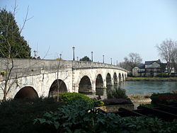
The road then goes over Maidenhead's old bridge Maidenhead Bridge, spanning the River Thames, and into the eastern outskirts of Maidenhead.

Along Bridge Road, St Cloud Way and Bad Godesberg Way respectively. The centre of Maidenhead is reached at the roundabout that forms the junction with the A308. Turning northwards on the A308 would lead to the A404 towards Marlow and High Wycombe. Southwards, the A308 heads towards Windsor and provides an opportunity to branch off for junction 8/9 of the M4.

Maidenhead to Reading (12.3 miles)

Heading out of Maidenhead town centre, the road follows Castle Hill and then Bath Road. At the outskirts, the road forms part of junction 9b of the A404(M)/A404, which links junction 8/9 of the M4 with junction 4 of the M40 at Handy Cross. The A4 crosses open countryside before following New Bath Road on the outskirts of Twyford. This is a bypass, built in 1929, that deviates from the old route of the A4, and crosses the River Loddon on its way into the suburbs of Reading via the village of Charvil.

The A4 passes the King George's Field in Sonning, which are used as playing fields, and the Reading Cricket and Hockey Club. As it enters Reading, along the London Road again, it crosses the junction of the A3290 next to Palmer Park, which leads to Junction 10 of the M4.

Cemetery Junction, Reading in 1976 East Reading, 1976 (4).jpg
Cemetery Junction, Reading in 1976

The A4 goes over the intersection with the A329 Cemetery Junction which links Wokingham with Pangbourne, passing the Royal Berkshire Hospital and the London Road Campus of the University of Reading. At London Street and again at Southampton Street, the A4 meets the A327 twice, since the latter loops round on two branches which meet at Whitley Street. Between the two junctions, the A4 becomes Crown Street for approximately 150 metres.

Reading to Newbury (16.7 miles)

On the other side of the intersection the A4 follows Pell Street and continues westward. Here it crosses the River Kennet, the Holy Brook and the A33 relief road, which goes towards Basingstoke. In West Reading, the A4 becomes Berkeley Avenue, and then the Bath Road. It passes Prospect Park, and the suburbs of Southcote, Horncastle and Calcot, before reaching Junction 12 of the M4. The A4 heads south westerly through Theale and over the roundabout connecting it to the A340 which heads towards Pangbourne.

Heading towards Thatcham, the road passes Aldermaston Wharf next to the Kennet and Avon Canal and through the villages of Woolhampton and Midgham. A large industrial estate is on the left as the road enters Thatcham. At the roundabout after the industrial Estate the route follows London Road and passes Thatcham towards Benham Hill and Newbury. At the Benham Hill roundabout it goes along Bath Road where it deviates from Turnpike Road. Bath Road is the original turnpiked road and the road now confusingly called Turnpike Road was originally called The Shaw Road. [14] The turnpike then continues along London Road as it enters the outskirts of Newbury.

Heading towards the centre of Newbury, the route passes the West Berkshire Community Hospital on the right. To the North of the town centre the road becomes part of an unusual junction with the A339 that links the new A34 by-pass to the north with Basingstoke to the south. The junction is a combination of a figure of eight roundabout with an elevated section that used to be the old route of the A34.

Newbury to Marlborough (18.8 miles)

Aerial view of High Street, Marlborough High Street, Marlborough from St Peter's church roof - geograph.org.uk - 460662.jpg
Aerial view of High Street, Marlborough

After the junction, the road heads out of town through Speenhamland along Western Avenue and Bath Road to the junction with the A34 Newbury bypass, which was opened, after some controversy, on 17 November 1998, at a cost of £104 million. [15] The route heads over undulating countryside in a fairly straight westward direction towards Hungerford, parallel to the Kennet and Avon Canal and crossing the River Kennet on the outskirts of the town at the same time as intersecting with the A338. The route does not enter the town centre, but continues through the northern part of town on its way to Marlborough, via the village of Froxfield and the northern edge of Savernake Forest.

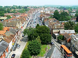
On entering the outskirts of Marlborough the road follows London Road. Crossing the River Kennet again it briefly shares the highway with the A346 which connects northwards to Swindon. It splits again at a roundabout along New Road and Oxford Street into the town centre on the High Street. The High Street is a traditional main thoroughfare for an English market town, in that it is wide, with space for market stalls on either side and in the middle, though these spaces are usually marked for car parking. [16]

Until the late 1980s most of this section, and some of the following Wiltshire section, was configured as three lanes, with the central lane available for overtaking traffic in either direction. This is no longer considered safe so the road now has one wider-than-normal lane in each direction, with ghost islands at junctions to discourage overtaking at these points.

Marlborough to Chippenham (18.9 miles)

Aerial view of Silbury Hill Silbury Hill, Wiltshire. - geograph.org.uk - 364299.jpg
Aerial view of Silbury Hill

The A4 continues along the High Street on its way out of Marlborough via Bridewell Street and Bath Road. The road passes underneath a covered bridge that links Morris House of Marlborough College to the North Block of the same establishment. [17] The college is an independent boarding school established in 1843 using some of the buildings that remained after the demise of the coaching trade, which saw the original Castle Inn Coaching House close.

The route continues westward through the village of Fyfield, across Overton Hill where there is a parking area at the start of the Ridgeway National Trail and through the village of West Kennett. On leaving West Kennett there are some lay-bys where visitors can walk a short distance from the road to the Neolithic West Kennet Long Barrow, which forms part of the Avebury World Heritage Site. [18] One mile further along the A4 is Silbury Hill, which is also part of the Avebury World Heritage Site. A purpose built car park is located beyond the hill on the right travelling westward. [19] As the route approaches the Beckhampton roundabout, which forms the intersection with the A361, it passes by the Waggon & Horses Inn, built in 1669 to profit from the increasing trade along the old Bath Road. It is mentioned in The Pickwick Papers by Charles Dickens. [20]

Cherhill White Horse as seen from the A4 Cherhillwhitehorse.jpg
Cherhill White Horse as seen from the A4

The route continues past Cherhill. The Cherhill White Horse [21] can be seen to the left, and nearby the Lansdowne Monument. The route then descends the Labour in Vain Hill through the village of Quemerford and into the market town of Calne. Heading towards the town centre, the road crosses a double mini roundabout, one exit forming the junction with the A3102 to Melksham. It follows New Road and passes by the old coaching inn of the Lansdowne Strand. [22] On the way out of Calne, the road goes along Curzon Street, and then to Chilvester Hill at the roundabout where the northern part of the A3102 splits off towards Lyneham.

The A4 descends steeply before climbing again up Black Dog Hill past the Bowood House Estate. The old road used to pass through Derry Hill, but the New Road, as it is called at this point, indicates that the village was bypassed. There follows a steep descent to the junction with the A342 Devizes road and a right turn past the Lysley Arms towards Chippenham.

On the outskirts of Chippenham is a large roundabout, where the A4 used to carry straight on down London Road and The Causeway into the town centre, which has since been pedestrianised. Most traffic turns left to go round the Pewsham Estate relief road called Pewsham Way, which is now the classified A4 route. After four roundabouts, the A4 turns left in a southerly direction at another roundabout. The route heads downhill over the River Avon on the Avenue La Fleche, named after one of Chippenham's twin towns, to the Bridge Centre roundabout.

Chippenham to Bath (12.7 miles)

The Paragon, Bath The Paragon Bath.jpg
The Paragon, Bath

The Bridge Centre roundabout forms a junction of the A4 with the A420 Bristol Road. The route heads over Rowden Hill past the Chippenham Community Hospital and down to the spot where musician Eddie Cochran was killed in a car crash on 17 April 1960. A plaque has been placed there in remembrance. [23]

From there it passes under the railway arch built by Isambard Kingdom Brunel in the 1830s and on to its junction with the A350. From this point onwards it regains its trunk road status and heads up Chequers Hill towards Corsham. The road passes through Pickwick, which used to be a village in its own right. Charles Dickens stayed at the Hare & Hounds Inn and used the village name for the title of his novel The Pickwick Papers. [24]

After a series of roundabouts the A4 continues uphill, past what used to be the Ministry of Defence Naval Operations site at Copenacre (now a housing development) before descending steeply to the village of Box. From the road the Box Tunnel, built as part of the Great Western Railway, can be seen clearly. The road bears to the right at the junction with the A365 to Melksham, and criss-crosses with the main railway line as far as the roundabout at Bathford which forms a junction with the A363 towards Bradford-on-Avon. The road after this roundabout becomes a dual carriageway until the A4 diverts to the left down a slip road, and the remainder becomes the A46; this section, the 3-mile (4.8 km) £45 million dual-carriageway Batheaston/Swainswick Bypass, opened in summer 1996, was highly controversial both at planning and at construction stages.

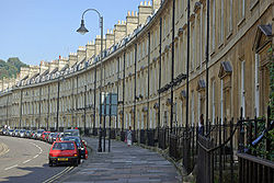
The route enters the outskirts of Bath passing by the training grounds of Bath RFC. After a series of traffic light controlled junctions, the A4 continues straight ahead where it meets the A36. It passes Hedgemead Park and down The Paragon before crossing into George Street and to Queen Square.

Bath to Bristol/Avonmouth (19.6 miles)

A4 passing under the Clifton Suspension Bridge Avon gorge and cave arp.jpg
A4 passing under the Clifton Suspension Bridge

In the original 1922 road numbering list, the A4 ended at the junction between George Street and Milsom Street in Bath. On 1 April 1935, it was extended over the A431 and B4044 to Newbridge, and the A36 to Avonmouth. [25] [26]

From Queen Square, Bath, the A4 carries on to Queen Square Place and Charlotte Street, before heading along the Upper Bristol Road by Royal Victoria Park to Newbridge Road. The road crosses the River Avon on its way to join the A36 and becomes a dual carriageway again until the roundabout that forms the junction with the A39 Wells Road at the Globe Inn and exit for the nearby Bath Spa University. It continues on through the village of Saltford towards Keynsham where a roundabout splits the road and the A4 continues as a dual carriageway by-passing the town, crossing over the River Chew in the process.

The end of the by-pass coincides with the junction of the Avon Ring Road, the A4174. The route goes through the suburb of Brislington, going past Arnos Court Park and Arnos Vale Cemetery. The road runs over a bridge over the New Cut and into Temple Gate where Bristol Temple Meads railway station is located. The A4 no longer has a defined route from this point to the start of Anchor Road at The Centre; originally it went along Victoria Street and Baldwin Street before turning left onto St Augustine's Parade or, later, Broad Quay, but in more recent times it followed Redcliffe Way, via Redcliffe Roundabout (junction with the A38) across Queen Square to The Centre. From there it turns back towards Bristol Harbour via Anchor Road past the We The Curious science museum. After another roundabout the A4 follows along Hotwell Road and around a one-way system that merges the A4 with the A3029.

At this point the A4 regains trunk road classification and passes under the Clifton Suspension Bridge along the Portway. It heads out of the city into the suburbs of Sea Mills and Shirehampton before going under the M5 to end at the roundabout that feeds the motorway, the M49 and A403 in Avonmouth.

Junction list

CountyLocationmi [27] [28] [29] [30] [31] kmDestinationsNotes
Greater London City of London 0.00.0UK road A40.svg A40  / B500 north (Charterhouse Street) to B501 West End, Holborn, Stratford, Barbican, King's Cross, Smithfield Eastern terminus; continues as B500 beyond A40
Westminster 0.71.1Kingsway (A4200 north)Southern terminus of A4200
0.81.3 Waterloo Bridge (A301 south)No access from A4 east to A301 south or from A301 north to A4 west; northern terminus of A301
1.72.7Regent Street (A4201 north)Eastbound access only; southern terminus of A4201
2.4–
2.8
3.9–
4.5
Ring Road (A302 east / A4202 north) ― Westminster, Kilburn Grade-separated junction; Kilburn signed westbound only
Westminster
Kensington &Chelsea
borough boundary
3.04.8UK road A3216.svg A3216 south (Sloane Street) Chelsea, Sloane Square Northern terminus of A3216
3.04.8UK road A315.svg A315 west (Knightsbridge) Kensington Eastern terminus of A315
Kensington & Chelsea 3.55.6Brompton Road (A308 south-west) ― Fulham, Chelsea No access from A3 east to A308; north-eastern terminus of A308
4.77.6UK road A3220.svgUK road A3212.svg A3220 south (Earls Court Road) to A3212  Battersea, Chelsea, Earl's Court, Westminster Routes and Westminster signed eastbound only
4.97.9UK road A3220.svgUK road A40.svg A3220 north to A40  Shepherd's Bush, Olympia
Hammersmith & Fulham 5.7–
6.3
9.2–
10.1
UK road A219.svgUK road A306.svgUK road A315.svg To A219  / A306  / A315  Hammersmith Hammersmith flyover; grade-separated junction
Hounslow 7.1–
7.3
11.4–
11.7
UK road A316.svgUK-Motorway-M3.svg A316 to M3  Richmond, Chiswick
8.413.5UK-Motorway-M4.svg M4 west (Chiswick flyover) Heathrow, Staines, Hounslow Eastern terminus of M4; westbound exit and eastbound entrance
8.613.8UK road A205.svgUK road A406.svgUK road A315.svgUK-Motorway-M1.svgUK road A40.svg A205 east (South Circular) / A406 east (North Circular) to A315  / M1  / A40  Richmond, Wembley, Ealing, Kew Richmond, Wembley, and Ealing signed westbound only, Kew eastbound only; western terminus of A205 / A406
9.2–
9.4
14.8–
15.1
UK-Motorway-M4.svg M4 west Heathrow, Slough Westbound exit and entrance
UK-Motorway-M4.svg M4 east Central London, Hammersmith Eastbound exit and entrance
9.915.9UK road A3002.svg A3002 (Boston Manor Road) Brentford, Hanwell
12.420.0UK road A3005.svg A3005 (Lampton Road / Heston Road) Hounslow, Southall, Heston Southall and Heston signed westbound only; most access via Jersey Road
12.820.6UK road A3063.svg A3063 (Sutton Lane / Upper Sutton Lane) Hounslow, Southall, Heston No access from A4 west to A3063 north or from A4 east to A3063 south; Southall and Heston signed eastbound only
13.722.0UK road A3006.svg A3006 east (Bath Road) Hounslow No access from A3006 to A4 east; western terminus of A3006
13.822.2UK road A30.svg A30 west (Great South-West Road) Heathrow, Staines Eastern terminus of A30
14.222.9UK road A312.svgUK-Motorway-M4.svgUK-Motorway-M25.svgUK road A30.svg A312 to M4  / M25  / A30  Feltham, Harrow, Hayes, Cranford, Heathrow To A30 and Heathrow signed eastbound only
Hillingdon 15.625.1UK road A437.svg A437 north (High Street) / Hatton Road North Harlington, Heathrow Airport (Terminals 4 & Cargo)Southern terminus of A437
16.226.1UK road A408.svg A408 (Sipson Road) / Nene Road Sipson, Heathrow Airport (Terminals 1, 2 & 3)Southern terminus of A408
17.428.0UK road A3044.svg A3044 north (Hatch Lane) West Drayton, Harmondsworth A3044 and destinations signed eastbound only; eastern terminus of A3044 concurrency
18.129.1UK road A3044.svgUK-Motorway-M25.svg A3044 south (Stanwell Moor Road) to M25  / Saxon Way Heathrow Airport, Staines, Colnbrook, Poyle, Longford, Harmondsworth To M25, Heathrow, Staines, and Harmondsworth signed westbound only; western terminus of A3044 concurrency
Berkshire Slough 20.533.0UK-Motorway-M4.svgUK-Motorway-M25.svgAircraft Airport ecomo.svg M4 to M25  London, Reading, Windsor, Maidenhead, Heathrow Airport M4 junction 5
22.536.2UK road A412.svgUK road A332.svg A412 (Uxbridge Road) to A332  / B376 Uxbridge, Datchet, Windsor, Watford Watford signed eastbound only
23.938.5UK road A355.svgUK-Motorway-M4.svgUK-Motorway-M40.svg A355 (Tuns Lane / Farnham Road) / M4  / M40  Windsor, Beaconsfield
25.841.5UK-Motorway-M4.svg M4  London, Reading M4 junction 7
Buckinghamshire
Berkshire county
boundary
Taplow
Maidenhead boundary
27.9–
28.0
44.9–
45.1
Maidenhead Bridge over River Thames
Berkshire Maidenhead 28.045.1UK road A4094.svg A4094 north (Ray Mead Road) Cookham Southern terminus of A4094
29.046.7UK road A308.svgUK-Motorway-M4.svgUK road A330.svg A308 (Frascati Way / Marlow Road) to M4  / A330  Winsor, Bracknell, Marlow
30.849.6UK-Motorway-A404 (M).svgUK road A404.svgUK-Motorway-M4.svgUK-Motorway-M40.svgUK road A4130.svg A404(M) south / A404 east to M4  / M40  / A4130  Reading, Slough, Windsor, Wycombe, Marlow, Oxford, Henley Reading signed westbound only; northern terminus of A404(M); western terminus of A404; A404(M) junction 9B
Hare Hatch 35.156.5UK road A3032.svg A3032 south-west (London Road) Ruscombe, Twyford Twyford signed eastbound only; north-eastern terminus of A3032
Twyford 36.258.3UK road A321.svg A321 (Wargrave Road) Twyford, Wokingham, Wargrave, Henley
Charvil 37.560.4UK road A3032.svg A3032 north-east (Old Bath Road) / B478 (Charvil Lane) Twyford, Charvil, Sonning South-western terminus of A3032
Earley 40.064.4UK road A3290.svgUK-Motorway-A329 (M).svgUK-Motorway-M4.svg A3290 to A329(M)  / M4  / Thomas Valley Park Wokingham, Bracknell
Reading 40.565.2UK road A329.svg A329  Wokingham, Earley
Begin one-way
41.366.5UK road A327.svg A327 south (Silver Street)Westbound junction
41.767.1 A329 north to UK road A33.svgUK-Motorway-M4.svg A33  / M4  Caversham
UK road A327.svg A327 (Mill Lane) Aldershot
Eastbound junction
41.466.6Southampton Street (A327 north / M4 east) to UK road A33.svgUK-Motorway-M4.svgUK road A329.svg A33  / M4  / A329  Caversham Westbound junction
End one-way
42.568.4Bath Road (A4155 north-east) ― Town centre Southeastern terminus of A4155
Theale 45.973.9UK-Motorway-M4.svg M4  London, South Wales, Newbury, Oxford M4 junction 12
47.276.0UK road A340.svg A340 north / The Grn Pangbourne, Theale Eastern terminus of A340 concurrency
49.980.3UK road A340.svg A340 south (Basingstroke Road) Basingstoke, Aldermaston, Tadley Western terminus of A340 concurrency
Newbury 58.293.7UK road A339.svgUK road A34.svgUK-Motorway-M4.svg A339  / B4009 north-east (Shaw Road) to A34  / M4  Basingstoke, Winchester, Oxford, Hermitage South-western terminus of B4009
59.8–
60.1
96.2–
96.7
UK road A34.svgUK road A303.svgUK-Motorway-M3.svgUK-Motorway-M4.svg A34 to A303  / M3  / M4  Winchester, Basingstoke, Southampton, The Midlands, Oxford Grade-separated junction on M34
Eddington 66.7107.3UK road A338.svgUK-Motorway-M4.svg A338 north to M4  Wantage, RAF Welford Eastern terminus of A338 concurrency
Hungerford 67.0107.8UK road A338.svg A338 south (Bridge Street) Town centre, Salisbury Western terminus of A338 concurrency
Wiltshire Marlborough 76.6123.3UK road A346.svgUK road A338.svg A346 south (Salisbury Street) to A338  Salisbury Eastern terminus of A346 concurrency
76.8123.6UK road A346.svgUK-Motorway-M4.svg A346 north (Barn Street) to M4  Swindon, Ramsbury, Ogbourne Western terminus of A346 concurrency
77.2124.2UK road A345.svg A345 south (Pewsey Road) Amesbury Northern terminus of A345
Avebury 83.6134.5UK road A4361.svgUK road A361.svg A4361 north (Beckhampton Road) / A361 west Swindon, Wroughton, Devizes, Bishops Cannings Southern terminus of A4361; eastern terminus of A361
Calne 89.7144.4UK road A3102.svg A3102 south-west (Silver Street) Melksham Eastern terminus of A3102 concurrency
90.5145.6UK road A3102.svg A3102 north-east (Greenacres Way) Wootton Bassett, Lyneham Western terminus of A3102 concurrency
93.0149.7UK road A342.svg A342 south-east (Old Derry Hill) Devizes, Sandy Lane, Derry Hill Derry Hill signed eastbound only; north-western terminus of A342
Chippenham 98.0157.7UK road A350.svgUK-Motorway-M4.svgUK road A361.svg A350 (West Cephan Way) to M4  / A361  Cirencester, Warminster, Melksham, Trowbridge, Castle Combe Castle Combe signed eastbound only
Box 103.3166.2UK road A365.svg A365 south-east (Devizes Road) Melksham, MoD Corsham MoD Corsham signed eastbound only; north-western terminus of A365
Somerset Bathford 106.2170.9UK road A363.svg A363 south-east (Bradford Road) / London Road East Bradford-on-Avon, Batheaston, Monkton Farleigh, Bathford, Colerne North-eastern terminus of A363
Bath 107.2–
107.6
172.5–
173.2
UK road A46.svgUK-Motorway-M4.svg A46 north to M4  / London Road East Stroud, Batheaston Southern terminus of A46
108.6174.8Cleveland Place to UK road A36.svg A36  Warminster
108.7174.9London Street (A3039 south)Northern terminus of A3039
109.3175.9Charles Street (A367 south) to A36 To A36 westbound only; northern terminus of A367
110.1177.2Windsor Bridge Road (A3064 south) ― Twerton Twerton signed eastbound only; northern terminus of A3604
110.3177.5UK road A431.svg A431 north-west (Newbridge Hill) Kelston, Bitton, Weston No access from A4 east to A431 or from A431 to A4 west; south-eastern terminus of A431
111.6179.6UK road A36.svg A36 south-east (Lower Bristol Road) Twerton, Bath North-western terminus of A36
112.4180.9UK road A39.svgUK road A368.svg A39 south-west (Wells Road) to A368  / Pennyquick Wells, Weston-super-Mare, Corston, Marksbury, Newton St Loe, Combe Down Weston-super-Mare signed westbound only; north-eastern terminus of A39
Keynsham 117.2188.6UK road A4174.svgUK road A4175.svgUK-Motorway-M4.svgUK-Motorway-M5.svgUK road A431.svgUK road A420.svg A4174 north / A4175 north (Durley Hill) to M4  / M5 north / A431  / A420  Keynsham, Longwell Green, Hanham, Kingswood Eastern terminus of A4174 concurrency; southern terminus of A4175
Bristol 118.5190.7UK road A4174.svgUK road A37.svg A4174 south (West Town Lane) to A37  Bristol Airport, Whitchurch, Knowle, Stockwood To A37 signed eastbound only; western terminus of A4174 concurrency
119.6192.5UK road A4320.svgUK-Motorway-M32.svgUK-Motorway-M4.svgUK-Motorway-M5.svg A4320 north (St. Phillips Causeway) to M32  / M4  / M5 north City centre City centre signed westbound only; southern terminus of A4320
120.4193.8UK road A37.svgUK road A39.svg A37 south (Wells Road) to A39  Yeovil, Wells Northern terminus of A37
120.6194.1UK road A370.svgUK-Motorway-M5.svgUK road A4.svgUK road A38.svg A370 south-west (York Road) to M5 south / A4  / A38  Avonmouth, Weston, Taunton, Bristol Airport Bristol Airport signed eastbound only; North-eastern terminus of A370
120.8194.4Redcliffe Way / Temple Gate (A4044)Western terminus of eastern segment
Gap in route in downtown Bristol
St. Augustine's Parade (A38 north) / College Green (A4018 north) to UK-Motorway-M32.svgUK-Motorway-M4.svgUK-Motorway-M5.svgUK road A4.svgUK road A37.svgUK road A420.svg M32  / M4  / M5  / A4  / A37  / A420  Gloucester, Bath, Shepton Mallet, Chippenham Eastern terminus of western segment; southern terminus of A38 / A4018
121.9–
122.1
196.2–
196.5
Brunel Way (A3029 south) to UK road A370.svgUK road A4.svgUK road A38.svg A370  / A4  / A38  Weston-super-Mare, Bristol Airport, Bath, Taunton Northern terminus of A3029
122.7197.5UK road A4176.svgUK road A4018.svg A4176 north-east (Bridge Valley Road) to A4018  Clifton, Westbury-on-Trym No access from A4176 to A4 west; information signed westbound only; South-western terminus of A4176
125.2201.5Sylvan Way (A4162 east) ― Westbury-on-Trym, Lawrence Weston, Sea Mills Sea Mills signed westbound only; western terminus of A4162
127.4205.0UK-Motorway-M5.svgUK-Motorway-M49.svgUK-Motorway-M4.svg M5  / B4054 south-east (Avonmouth Road) to M49  / M4  Royal Portbury Dock, Shirehampton Royal Portbury Dock signed westbound only; north-western terminus of B4054
127.7205.5UK-Motorway-M5.svgUK-Motorway-M49.svgUK-Motorway-M4.svg M5 to M49  / M4  / Avonmouth Way Royal Portbury Dock
128.0206.0UK road A403.svg A403 north-east (St. Andrew's Road) / McLaren Road / King Road Severn Beach, Aust Western terminus; south-western terminus of A403
1.000 mi = 1.609 km; 1.000 km = 0.621 mi

Related Research Articles

<span class="mw-page-title-main">Newbury, Berkshire</span> Market town in England

Newbury is a market town in the county of Berkshire, England, and is home to the administrative headquarters of West Berkshire Council. The town centres around a large market square retains a rare medieval Cloth Hall, an adjoining half timbered granary, and the 15th-century St Nicolas Church, along with 17th- and 18th-century listed buildings. As well as being home to Newbury Racecourse, it is the headquarters of Vodafone and software company Micro Focus International. In the valley of the River Kennet, 26 mi (42 km) south of Oxford, 25 mi (40 km) north of Winchester, 27 mi (43 km) southeast of Swindon and 20 mi (32 km) west of Reading.

<span class="mw-page-title-main">M4 motorway</span> Major motorway in England and Wales

The M4, originally the London-South Wales Motorway, is a motorway in the United Kingdom running from west London to southwest Wales. The English section to the Severn Bridge was constructed between 1961 and 1971; the Welsh element was largely complete by 1980, though a non-motorway section around Briton Ferry bridge remained until 1993. On the opening of the Second Severn Crossing in 1996, the M4 was rerouted over it.

<span class="mw-page-title-main">A5 road (Great Britain)</span> Major road in England and Wales

The A5, the London-Holyhead trunk road, is a major road in England and Wales. It runs for about 243 miles (391 km) from London to the Irish Sea at the ferry port of Holyhead. In many parts the route follows that of the Roman Iter II route which later took the Anglo-Saxon name Watling Street.

<span class="mw-page-title-main">A38 road</span> Trunk road in England

The A38, parts of which are known as Devon Expressway, Bristol Road and Gloucester Road, is a major A-class trunk road in England.

<span class="mw-page-title-main">A46 road</span> Road in England

The A46 is a major A road in England. It starts east of Bath, Somerset and ends in Cleethorpes, Lincolnshire, but it does not form a continuous route. Large portions of the old road have been lost, bypassed, or replaced by motorway development. Between Leicester and Lincoln the road follows the course of the Roman Fosse Way, but between Bath and Leicester, two cities also linked by the Fosse Way, it follows a more westerly course.

<span class="mw-page-title-main">A36 road</span> Major road in south-west England

The A36 is a trunk road and primary route in southwest England that links the port city of Southampton to the city of Bath. At Bath, the A36 connects with the A4 to Bristol, thus providing a road link between the major ports of Southampton and Bristol. It also provides a link between Bristol and London via the A303.

<span class="mw-page-title-main">A33 road</span> Major road in England

The A33 is a major road in the counties of Berkshire and Hampshire in southern England. The road currently runs in three disjoint sections.

<span class="mw-page-title-main">A350 road</span> Road in England

The A350 is a north–south primary route in southern England, that runs from the M4 motorway in Wiltshire to Poole in Dorset.

<span class="mw-page-title-main">Theale</span> Village and civil parish in England

Theale is a village and civil parish in the West Berkshire unitary area of the county of Berkshire, England. It is 5 miles (8 km) southwest of Reading and 10 miles (16 km) east of Thatcham. The compact parish is bounded to the south and south-east by the Kennet & Avon Canal, to the north by a golf course, to the east by the M4 motorway and to the west by the A340 road.

<span class="mw-page-title-main">A419 road</span> Road in Wiltshire and Gloucestershire

The A419 road is a primary route between Chiseldon near Swindon at junction 15 of the M4 with the A346 road, and Whitminster in Gloucestershire, England near the M5 motorway. The A419 is managed and maintained by a private company, Road Management Group, on behalf of the UK Department for Transport.

<span class="mw-page-title-main">A449 road</span> Major road in England and Wales

The A449 is a major road in the United Kingdom. It runs north from junction 24 of the A48 road at Newport in South Wales to Stafford in Staffordshire.

<span class="mw-page-title-main">A308 road</span> Road in England

The A308 is a road in England in two parts. The first part runs from Central London to Putney Bridge. The second part runs from just beyond Putney Heath to Bisham, Berkshire. It traces four, roughly straight lines, to stay no more than 3 miles (4.8 km) from the Thames. It is a dual carriageway where it is furthest from that river, in Spelthorne, Surrey and forms one of the motorway spurs to the large town of Maidenhead. Other key settlements served are Fulham, Kingston (London), Staines upon Thames, Windsor and a minor approach to Marlow

<span class="mw-page-title-main">A420 road</span> Road in England

The A420 is a road between Bristol and Oxford in England. Between Swindon and Oxford it is a primary route.

<span class="mw-page-title-main">A4174 road</span> Road in Bristol

The A4174 is a major ring road in England which runs around the northern and eastern edge of Bristol, mainly in South Gloucestershire, and through the southern suburbs of the city. When it was first conceived it was planned to circle the whole of Bristol, and is commonly referred to as the "Avon Ring Road", or less accurately the "Bristol Ring Road", on road signs. The road does not circle the whole city, instead covering roughly half of the route. It is broken in part where it is concurrent with the A4.

Bristol is a city in south west England, near the Bristol Channel coast, approximately 106 miles (170 km) west of London. Several factors have influenced the development of its transport network. It is a major centre of employment, retail, culture and higher education, has many historic areas, and has a history of maritime industry. The city has a population of 450,000, with a metropolitan area of 650,000, and lies at the centre of the former County of Avon, which includes many dormitory towns, and has a population of one million.

<span class="mw-page-title-main">A404 road</span> Road in London and Berkshire

The A404 is a road in the United Kingdom that starts at Paddington in London and terminates near Maidenhead in Berkshire. It is 44.6 miles (71.8 km) long.

<span class="mw-page-title-main">A329 road</span>

The A329 is an east–west road in Southern England that runs from Wentworth in Surrey to Thame in Oxfordshire.

<span class="mw-page-title-main">National Cycle Route 4</span> Cycle route in the United Kingdom

National Cycle Route 4 is a route of the National Cycle Network, running from London to Fishguard, Pembrokeshire. Between these, the route runs through Reading, Bath, Bristol, Newport, Swansea and St David's. Within Wales, sections of the route follow branches of the Celtic Trail cycle route.

<span class="mw-page-title-main">20th century road schemes in Bristol</span>

Road building was central to planning policy for much of the 20th century in Bristol, England. The planned road network evolved over time but at its core was a network of concentric ring roads and high-capacity radial roads.

<span class="mw-page-title-main">Hatfield and Reading Turnpike</span> English turnpike road

The Hatfield and Reading Turnpike, nicknamed the Gout Track, was an English turnpike road created in the 1760s to provide a route that connected the Great North Road with the Holyhead Road (A5) and the Bath Road (A4). It had the advantage that it made it possible for travelers to avoid congested London and was shorter in distance. In 1881 it was one of the last of the turnpikes to have its tolls removed.

References

  1. 51°30′07″N2°41′10″W / 51.502°N 2.686°W
  2. Watkins, Jack (22 May 2018). "Silbury Hill mystery soon to be resolved". The Telegraph.
  3. 1 2 3 4 5 6 "Hungerford Museum". Archived from the original on 20 April 2013. Retrieved 20 September 2010.
  4. "History of Melksham". Archived from the original on 14 November 2010. Retrieved 4 April 2010.
  5. "Turnpikes" . Retrieved 4 April 2010.
  6. "Tollhouses" . Retrieved 4 April 2010.
  7. "Highway Boards" . Retrieved 4 April 2010.
  8. "Bristol Post Office History". Archived from the original on 23 March 2010. Retrieved 4 April 2010.
  9. "Bath Postal Museum". Archived from the original on 8 June 2009. Retrieved 4 April 2010.
  10. "Ralph Allen". Archived from the original on 8 June 2009. Retrieved 4 April 2010.
  11. "Stagecoaches". Archived from the original on 14 November 2010. Retrieved 4 April 2010.
  12. "Death of the coach service" . The Independent. London. 11 May 2005. Archived from the original on 7 November 2012. Retrieved 4 April 2010.
  13. "Satisfactory First Day For Clearway". The Times . No. 55166. 22 August 1961. p. 12. Retrieved 1 March 2020.
  14. Thatcham Road Names, 1991, Roy Tubb
  15. "Newbury By-pass Opens" . Retrieved 5 April 2010.
  16. "Marlborough History" . Retrieved 5 April 2010.
  17. "Marlborough College". Archived from the original on 5 April 2010. Retrieved 5 April 2010.
  18. "West Kennet Long Barrow" . Retrieved 5 April 2010.
  19. "Silbury Hill". Archived from the original on 29 March 2010. Retrieved 5 April 2010.
  20. "Waggon & Horses Inn" . Retrieved 5 April 2010.
  21. "Cherhill White Horse" . Retrieved 5 April 2010.
  22. "Lansdowne Strand" . Retrieved 5 April 2010.
  23. "Eddie Cochrane Memorial". Archived from the original on 22 January 2011. Retrieved 5 April 2010.
  24. Flavin, Steve (1991). Corsham Born and Bred. Market Drayton: S.B. Publications. ISBN   1-870708-86-5.
  25. The National Archives file MT39/241 and MT39/246
  26. "1922 Road Lists - Roader's Digest: The SABRE Wiki". www.sabre-roads.org.uk.
  27. "Directions from Charterhouse St, London EC1N 8AA, UK to 51.487462, -0.256987 to Ellesmere Rd, Chiswick, London, UK to Chiswick, London, UK to 564 Great West Rd, Hounslow TW5 0TH, UK to 51.481919, -0.471081 to Wellington St, Slough, UK to 51.519721, -0.633138 to 39 Bath Rd, Maidenhead SL6 4RH, UK". Google Maps . Retrieved 12 November 2022.
  28. "Directions from 39 Bath Rd, Maidenhead SL6 4RH, UK to New Bath Rd, Reading, UK to 108 London Rd, Reading RG1 5AY, UK to Woolhampton, Reading, UK to The Priory, Marlborough SN8 1LW, UK to 29-39 Bath Rd, Corsham, UK". Google Maps . Retrieved 12 November 2022.
  29. "Directions from 29-39 Bath Rd, Corsham, UK to 7-9 Comfortable Pl, Bath BA1 3AJ, UK to 20 Temple Gate, Redcliffe, Bristol BS1 6QH, UK". Google Maps . Retrieved 12 November 2022.
  30. "Directions from 1 Canon's Rd, Bristol BS1 5TX, UK to Avonmouth, Bristol BS11 9ED, UK". Google Maps . Retrieved 12 November 2022.
  31. "86 Pell St, Reading RG1 2NR, UK to Dr Monia Conforti, King's Rd, Reading RG1 3LW, United Kingdom". Google Maps . Retrieved 12 November 2022.
Template:Attached KML/A4 road (England)
KML is from Wikidata