The M4, originally the London-South Wales Motorway, is a motorway in the United Kingdom running from west London to southwest Wales. The English section to the Severn Bridge was constructed between 1961 and 1971; the Welsh element was largely complete by 1980, though a non-motorway section around Briton Ferry bridge remained until 1993. On the opening of the Second Severn Crossing in 1996, the M4 was rerouted over it.
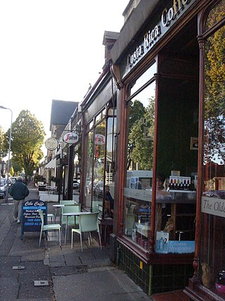
Pontcanna is an inner-city district and community in the west of Cardiff, Wales. It is located adjecent to Canton, Cardiff. It is also located a short distance to the city centre, and its borders are approximately indicated by Western Avenue, the River Taff, Cowbridge Road East and Llandaff Road.

The Taff Trail is a popular walking and cycle path that runs for 55 miles (89 km) between Cardiff Bay and Brecon in Wales. It is so named because it follows the course of the River Taff. Along much of its length, it follows the National Cycle Network Route 8 that continues to Holyhead, and is substantially off-road.

Llansamlet railway station is a minor station in Llansamlet, Swansea, south Wales. The station is located below street level at Frederick Place in Peniel Green, 212 miles 8 chains (341 km) from London Paddington. It is served by local trains operated by Transport for Wales on the South Wales Main Line between Swansea and Cardiff.

The A4232, which is also known either as the Peripheral Distributor Road (PDR) (Welsh: Ffordd Ddosbarthu Ymylol) or the Cardiff Link Road (Welsh: Ffordd Gyswllt Caerdydd), is a distributor road in Cardiff, the capital of Wales.

The A4055 is the main road link between Cardiff Bay and Barry.

The A4050 road connects Barry, Vale of Glamorgan with Culverhouse Cross on the outskirts of Cardiff, Wales. It is approximately 10 miles (16 km) long, and is the key link road between the M4 motorway and Cardiff International Airport.

The A4161 is a main road in Cardiff, Wales, United Kingdom. The main purpose of the road is to link the city centre with the M4 motorway in the west at junction 33, and in the east with the A48(M) motorway at St Mellons.

West Grove is a road in Roath, Cardiff, Wales. It is situated off Newport Road. The Queen's Buildings of Cardiff University, Kings Monkton School and the former West Grove Unitarian Church are all located in West Grove. The Mansion House is officially in Richmond Road, but it is at the extreme end of West Grove and dominates the northern end.

The A4160 is a road between Cardiff and Penarth in Wales. Its role as the main road between Cardiff city centre and Penarth has largely been superseded by the A4055 and A4232 roads via Cardiff Bay.

The A4234, also known as the Central Link Road, is a spur off the A4232 in Cardiff, the capital of Wales. It links the southern part of Cardiff city centre to the motorway network. The length of the A4234 is just 0.9 miles (1.4 km) and is entirely a two lane dual carriageway with clearway restrictions. The road was opened on 16 February 1989.
Lloyd George Avenue, originally known as Bute Avenue, is an avenue in Cardiff, Wales. Roughly one mile long, the road links the Inner Harbour of Cardiff Bay to Cardiff city centre and forms part of the A470 road. It runs parallel to Bute Street and the Butetown Branch Line. Landscaping on the route was completed in 2000, and it was renamed after the Liberal prime minister David Lloyd George. The site of the avenue had been known as Collingdon Road, which was described as a "grimy industrial area of small factories and workshops, employing hundreds of people".

Caerleon railway station is a former station serving Caerleon on the east side of the city of Newport, UK and a proposed future station as part of the South Wales Metro.

South East Wales is a loosely defined region of Wales generally corresponding to the preserved counties of Mid Glamorgan, South Glamorgan and Gwent. Highly urbanised, it includes the cities of Cardiff and Newport as well as large towns in the South Wales Valleys.
Newport West Central railway station is a proposed station on the Ebbw Valley Railway in the city of Newport, Wales.

The B4265 road is a main road in the Vale of Glamorgan, southeastern Wales, running in a northwesterly direction along near the coast. It links Cardiff Airport to Bridgend, lasting for 15.9 miles (25.6 km). The road begins at the roundabout near the airport and the village of Penmark at 51°24′21″N3°20′39″W as a continuation of the A4226 road leading from Barry. Passing the junction turnoff to Gileston and St Athan, at Llantwit Major, the B4270 road branches off to the northwest to Llandow Industrial Estate. The road then moves progressively in northwesterly direction until St Brides Major, where the B4524 road to the south connects it to Southerndown and Ogmore-by-Sea. At St Brides Major, the road shifts to a northerly direction, where it passes Ewenny and Ogmore village leading to Bridgend, where it joins the A48 road and finally A473 road at 51°30′7″N3°34′34″W.

Cardiff Parkway is a planned railway station in the eastern region of Cardiff, and near to the boundary with the neighbouring city of Newport. The station is privately funded as part of the wider Cardiff Hendre Lakes business development.

Plasdwr is the name given to a planned new suburb of approximately 7,000 homes in the north of Cardiff, Wales. Construction by lead developer Redrow Homes started in 2017.
Crwys Road is a proposed railway station on the Rhymney line in Cardiff, Wales, serving the Cathays and Roath districts of the city. It is planned as part of the South Wales Metro.
Gabalfa is a proposed railway station on the Merthyr line in the Gabalfa district of Cardiff, Wales. The station would be on the South Wales Metro and be part of the Wales & Borders franchise. It is planned to open in 2028. It will be located on an old coal yard next to the existing railway. This followed significant local petitioning for a railway station from Gabalfa and Mynachdy.