 | |
|---|---|
| Major junctions | |
| South end | Bridgend |
| North end | Cymer |
| Location | |
| Country | United Kingdom |
| Constituent country | Wales |
| Primary destinations | Bridgend |
| Road network | |
The A4063 links the town of Bridgend with Cymer in Wales.
| | |
|---|---|
| Major junctions | |
| South end | Bridgend |
| North end | Cymer |
| Location | |
| Country | United Kingdom |
| Constituent country | Wales |
| Primary destinations | Bridgend |
| Road network | |
The A4063 links the town of Bridgend with Cymer in Wales.
Settlements served by the route include:
Geohash Coordinates: [1] gcjmmqdnqp2

In geography, latitude is a coordinate that specifies the north–south position of a point on the surface of the Earth or another celestial body. Latitude is given as an angle that ranges from –90° at the south pole to 90° at the north pole, with 0° at the Equator. Lines of constant latitude, or parallels, run east–west as circles parallel to the equator. Latitude and longitude are used together as a coordinate pair to specify a location on the surface of the Earth.

The geographic coordinate system (GCS) is a spherical or geodetic coordinate system for measuring and communicating positions directly on the Earth as latitude and longitude. It is the simplest, oldest and most widely used of the various spatial reference systems that are in use, and forms the basis for most others. Although latitude and longitude form a coordinate tuple like a cartesian coordinate system, the geographic coordinate system is not cartesian because the measurements are angles and are not on a planar surface.

A prime meridian is an arbitrarily-chosen meridian in a geographic coordinate system at which longitude is defined to be 0°. Together, a prime meridian and its anti-meridian form a great circle. This great circle divides a spheroid, like Earth, into two hemispheres: the Eastern Hemisphere and the Western Hemisphere. For Earth's prime meridian, various conventions have been used or advocated in different regions throughout history. Earth's current international standard prime meridian is the IERS Reference Meridian. It is derived, but differs slightly, from the Greenwich Meridian, the previous standard.
A projected coordinate system – also called a projected coordinate reference system, planar coordinate system, or grid reference system – is a type of spatial reference system that represents locations on Earth using Cartesian coordinates (x, y) on a planar surface created by a particular map projection. Each projected coordinate system, such as "Universal Transverse Mercator WGS 84 Zone 26N," is defined by a choice of map projection (with specific parameters), a choice of geodetic datum to bind the coordinate system to real locations on the earth, an origin point, and a choice of unit of measure. Hundreds of projected coordinate systems have been specified for various purposes in various regions.

The historic prime meridian or Greenwich meridian is a geographical reference line that passes through the Royal Observatory, Greenwich, in London, England. The modern IERS Reference Meridian widely used today is based on the Greenwich meridian, but differs slightly from it. This prime meridian was first established by Sir George Airy in 1851, and by 1884, over two-thirds of all ships and tonnage used it as the reference meridian on their charts and maps. In October of that year, at the behest of US President Chester A. Arthur, 41 delegates from 25 nations met in Washington, D.C., United States, for the International Meridian Conference. This conference selected the meridian passing through Greenwich as the world standard prime meridian due to its popularity. However, France abstained from the vote, and French maps continued to use the Paris meridian for several decades. In the 18th century, London lexicographer Malachy Postlethwayt published his African maps showing the "Meridian of London" intersecting the Equator a few degrees west of the later meridian and Accra, Ghana.
ISO 6709, Standard representation of geographic point location by coordinates, is the international standard for representation of latitude, longitude and altitude for geographic point locations.
The Irish grid reference system is a system of geographic grid references used for paper mapping in Ireland. The Irish grid partially overlaps the British grid, and uses a similar co-ordinate system but with a meridian more suited to its westerly location.

A geotagged photograph is a photograph which is associated with a geographic position by geotagging. Usually this is done by assigning at least a latitude and longitude to the image, and optionally elevation, compass bearing and other fields may also be included.
In the Domain Name System, a LOC record is a means for expressing geographic location information for a domain name.
The Universal Transverse Mercator (UTM) is a map projection system for assigning coordinates to locations on the surface of the Earth. Like the traditional method of latitude and longitude, it is a horizontal position representation, which means it ignores altitude and treats the earth surface as a perfect ellipsoid. However, it differs from global latitude/longitude in that it divides earth into 60 zones and projects each to the plane as a basis for its coordinates. Specifying a location means specifying the zone and the x, y coordinate in that plane. The projection from spheroid to a UTM zone is some parameterization of the transverse Mercator projection. The parameters vary by nation or region or mapping system.
Decimal degrees (DD) is a notation for expressing latitude and longitude geographic coordinates as decimal fractions of a degree. DD are used in many geographic information systems (GIS), web mapping applications such as OpenStreetMap, and GPS devices. Decimal degrees are an alternative to using sexagesimal degrees. As with latitude and longitude, the values are bounded by ±90° and ±180° respectively.
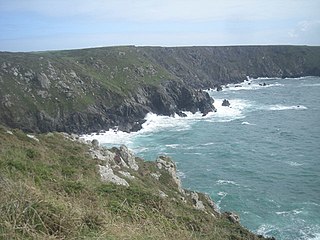
Ogo-dour Cove is a small cove located at grid reference SW 667 157. Its name comes from the Cornish words 'ogo' meaning a 'cave' and 'dour' meaning 'water' its name is literally "Cave-Water Cove" in Cornish. It is at the northern end of Predannack Downs on the west side of the Lizard peninsula in Cornwall.
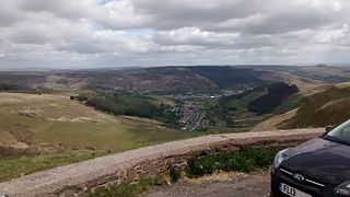
The A4107 road is an A road in Neath Port Talbot County Borough, Wales. It begins in Port Talbot and heads up the Afan Valley in a north easterly direction. It then continues over the moors eastwards until it connects with the A4061 road south west of Treorchy in the Rhondda Valley.

Geohash is a public domain geocode system invented in 2008 by Gustavo Niemeyer which encodes a geographic location into a short string of letters and digits. Similar ideas were introduced by G.M. Morton in 1966. It is a hierarchical spatial data structure which subdivides space into buckets of grid shape, which is one of the many applications of what is known as a Z-order curve, and generally space-filling curves.

Gwynfi is an electoral ward of Neath Port Talbot county borough, Wales.
Kajo Keji is an airstrip serving the town of Kajo Keji, in South Sudan.

This is a list of the National Register of Historic Places listings in Grand County, Colorado.

This is intended to be a complete list of the properties and districts on the National Register of Historic Places in Vigo County, Indiana, United States. Latitude and longitude coordinates are provided for many National Register properties and districts; these locations may be seen together in a map.
A position representation is a set of parameters used to express a position relative to a reference frame. When representing positions relative to the Earth, it is often most convenient to represent vertical position separately, and to use some other parameters to represent horizontal position. There are also several applications where only the horizontal position is of interest, this might e.g. be the case for ships and ground vehicles/cars. It is a type of geographic coordinate system.

The equidistant conic projection is a conic map projection commonly used for maps of small countries as well as for larger regions such as the continental United States that are elongated east-to-west.
A roads in Zone 4 of the Great Britain road numbering scheme | ||
|---|---|---|
| ||
| ||
Transport in Bridgend county borough | ||
|---|---|---|
| Roads |  | |
| Bus | ||
| Cycling | ||
| Railway lines | ||
| Railway stations | ||
Transport in Neath Port Talbot | ||
|---|---|---|
| Road |  | |
| Bus | ||
| Cycling | ||
| Railway lines | ||
| Railway stations | ||
| Sea | ||
| Canals | ||