The Avon Wildlife Trust aims to protect and promote wildlife in the area of the former county of Avon — now Bath and North East Somerset, Bristol, North Somerset and South Gloucestershire, in England. It has its headquarters in Bristol and runs wildlife centres at Folly Farm, Somerset and Grow Wilder, Frenchay, North Bristol.

The Cotswold Water Park is the United Kingdom's largest marl lake system, straddling the Wiltshire–Gloucestershire border, north-west of Cricklade and south of Cirencester. There are 180 lakes, spread over 42 square miles (110 km2).

Bristol North West is a constituency represented in the House of Commons of the UK Parliament since 2017 by Darren Jones of the Labour Party.

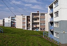
Shirehampton is a district of Bristol in England, near Avonmouth, at the northwestern edge of the city.

Hampshire and Isle of Wight Wildlife Trust is a Wildlife Trust with 27,000 members across the counties of Hampshire and the Isle of Wight, England.

The River Trym is a short river, some 4.5 miles (7.2 km) in length, which rises in Filton, South Gloucestershire, England. The upper reaches are culverted, some underground, through mostly urban landscapes, but once it emerges into the open it flows through a nature reserve and city parks before joining the tidal River Avon at Sea Mills. 18th-century water mills near the mouth gave the area its name.

Gordano is an area of North Somerset, in England. It has been designated as a National Nature Reserve.
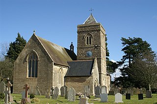
Weston in Gordano is a village and civil parish in Somerset, England. It is situated in the middle of the Gordano valley on the north side, and in the Unitary Authority of North Somerset, on the road between Clevedon and Portishead. The parish has a population of 301.

Leigh Woods is a 2-square-kilometre (0.77 sq mi) area of woodland on the south-west side of the Avon Gorge, close to the Clifton Suspension Bridge, within North Somerset opposite the English city of Bristol and north of the Ashton Court estate, of which it formed a part. Stokeleigh Camp, a hillfort thought to have been occupied from the third century BC to the first century AD and possibly also in the Middle Ages, lies within the reserve on the edge of the Nightingale Valley. On the bank of the Avon, within the reserve, are quarries for limestone and celestine which were worked in the 18th and 19th centuries are now derelict.

Coombe Dingle is a suburb of Bristol, England, centred near where the Hazel Brook tributary of the River Trym emerges from a limestone gorge bisecting the Blaise Castle Estate to join the main course of the Trym. Historically this area formed part of the parish of Westbury on Trym, Gloucestershire, and it is now part of Kingsweston ward of the city of Bristol. South of Coombe Dingle is Sea Mills; to the north is Kings Weston Hill; to the west are Kings Weston House and Shirehampton Park; and to the east, Henbury Golf Club and Westbury on Trym proper.
Weston Big Wood is a 37.48 hectare woodland west of the town of Portishead, North Somerset, England. It is a nature reserve and biological Site of Special Scientific Interest, notified in 1971. The wood takes its name from the nearby village of Weston-in-Gordano.

Puxton is a village and civil parish, 5 miles (8.0 km) north west of Axbridge in the unitary authority of North Somerset within the ceremonial county of Somerset, England.

Stockwood is a residential area and council ward in south Bristol, between Whitchurch and Brislington, and west of the Somerset town of Keynsham.

Kings Weston House is a historic building in Kings Weston Lane, Kingsweston, Bristol, England. Built during the early 18th century, it was remodelled several times, the most recent in the mid-19th century. The building was owned by several generations of the Southwell family. By World War I, the house was used as a hospital and then later used as a school by the Bath University School of Architecture. The building is today used as a conference and wedding venue, as well as a communal residence.
Kingsweston was a ward of the city of Bristol. The three districts in the ward were Coombe Dingle, Lawrence Weston and Sea Mills. The ward takes its name from the old district of Kings Weston, now generally considered part of Lawrence Weston. Following a Local Government Boundary Commission review in 2015 ward boundaries were redrawn and Kingsweston ward is now split between the Stoke Bishop ward and the Avonmouth and Lawrence Weston ward.
There are several nature reserves in the surroundings of Nailsea, North Somerset, England, which is located at 51°25′55″N2°45′49″W.
Dunsdon National Nature Reserve is a nature reserve of the Devon Wildlife Trust, near Dunsdon and about 3.5 miles (5.6 km) north-west of Holsworthy, in Devon, England. The habitat is culm grassland.

Clapton Moor is a 40-hectare (99-acre) Avon Wildlife Trust nature reserve and part of the Gordano Valley, Clapton Moor, Middle Bridge and rhynes Site of Nature Conservation Interest in Somerset, England.