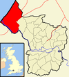
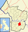
Kingswood is a town and civil parish in the South Gloucestershire district of the ceremonial county of Gloucestershire, England. The town is situated 3 miles (4.8 km) east-northeast of Bristol.
GSS codes are nine-character geocodes maintained by the United Kingdom's Office for National Statistics (ONS) to represent a wide range of geographical areas of the UK, for use in tabulating census and other statistical data. GSS refers to the Government Statistical Service of which ONS is part.

The Nottingham Built-up Area (BUA), Nottingham Urban Area, or Greater Nottingham is an area of land defined by the Office for National Statistics as which is built upon, with nearby areas linked if within 200 metres. It consists of the city of Nottingham and the adjoining urban areas of Nottinghamshire and Derbyshire, in the East Midlands of England. It had a total population of 729,977 at the time of the 2011 census. This was an increase of almost 10% since the 2001 census recorded population of 666,358, due to population increases, reductions and several new sub-divisions.

South Hampshire is a term used mainly to refer to the conurbation formed by the city of Portsmouth, city of Southampton and the non-metropolitan boroughs of Gosport, Fareham, Havant and Eastleigh in southern Hampshire, South East England. The area was estimated to have a population of over 1.5 million in 2013. It is the most populated part of South East England excluding London. The area is sometimes referred to as Solent City particularly in relation to local devolution, but the term is controversial.

The Greater Manchester Built-up Area is an area of land defined by the Office for National Statistics (ONS), consisting of the large conurbation that encompasses the urban element of the city of Manchester and the metropolitan area that forms much of Greater Manchester in North West England. According to the United Kingdom Census 2011, the Greater Manchester Built-up Area has a population of 2,553,379 making it the second most populous conurbation in the United Kingdom after the Greater London Built-up Area. This was an increase of 14% from the population recorded at the United Kingdom Census 2001 of 2,240,230, when it was known as the Greater Manchester Urban Area.
Greater Bristol is a term used for the conurbation which contains and surrounds the city of Bristol in the South West of England. There is no official "Greater Bristol" authority, but the term is sometimes used by local, regional and national authorities, and others as a synonym for either the "Bristol Urban Area" or a wider area of the former County of Avon, and by some, TfGB, to refer to the Province of Bristol as defined by C. B. Fawcett (1919) or Derek Senior (1969).
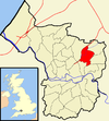
The Leicester Urban Area or Leicester Built Up Area is an urban agglomeration defined by the Office of National Statistics (ONS), centred on the City of Leicester in the East Midlands, England. With a population of 559,017 at the time of the 2021 census, increased from 508,916 at the time of the 2011 census, the Built Up Area is the eleventh largest in England and thirteenth largest in the United Kingdom. It comprises Leicester itself and its suburbs, all of which are contiguous with or situated in close proximity to the city.

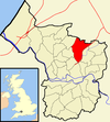
The Sheffield Urban Area is a conurbation in the north of England with a population of 685,368 according to the 2011 census. This was a 7% increase on the 2001 population of 640,720 making it the 8th largest conurbation in the United Kingdom and England's 6th largest. Named the Sheffield Urban Area by the Office for National Statistics, it must not be confused with the Sheffield City Region, a non-government term, although often used, particularly by the business community. In 2001 the population density of the urban area was 3,949.2 people per km2 by 2011 this had increased slightly to 4,092 people per km2.

Bishopsworth is the name of both a council ward of the city of Bristol in the United Kingdom, and a suburb of the city which lies within that ward. Bishopsworth contains many council estates.

The Brighton and Hove Built-up area or Brighton/Worthing/Littlehampton conurbation has a population of 474,485, making it England's 12th largest conurbation. This was an increase of around 3% from the 2001 population of 461,181. Named the Brighton/Worthing/Littlehampton conurbation by the Office for National Statistics for the 2001 census and Brighton and Hove Built-up area for the 2011 census, the area has also been known as Greater Brighton, although the Greater Brighton City Region that was created in 2014 from seven local authorities in Sussex covers a much larger area. The conurbation dominates West and East Sussex, with around one in three of Sussex's population living within its boundaries. It is also the second largest conurbation in the South East region of England and the second largest conurbation on the English Channel coast, in either England or France. In both of these cases the Brighton conurbation trails the Southampton and Portsmouth conurbation. The Brighton/Worthing/Littlehampton conurbation was the largest on the Channel before Portsmouth and Southampton's conurbations were combined for much official data analysis after the 2011 census.

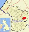
The Milton Keynes urban area or Milton Keynes Built-up Area is a designation established by the United Kingdom's Office for National Statistics. Milton Keynes has no statutory boundary: the 1967 designated area only determined the area assigned to the Milton Keynes Development Corporation for development. The wider urban area outside that designation includes Newport Pagnell and Woburn Sands as well as Aspley Guise (Bedfordshire) and part of Stoke Hammond civil parish.