List of settlements in Berkshire by population

Last updated

This is a list of settlements in Berkshire by population based on the results of the 2011 census. The next United Kingdom census will take place in 2021. In 2011, there were 19 built-up area subdivisions with 5,000 or more inhabitants in Berkshire, shown in the table below.

Contents

Berkshire UK location map.svg
Berkshire's 10 largest settlements, council centres are highlighted.

Population ranking

#SettlementBorough/DistrictPopulation 1
200120112021
1 Reading Reading206,060218,705300,800
2 Slough Slough 133,860155,298200,054
3 Bracknell Bracknell Forest 74,09077,25695,023
4 Maidenhead Windsor and Maidenhead 57,93063,58077,012
5 Wokingham Wokingham 42,19042,72845,923
6 Newbury West Berkshire 34,67038,76242,987
7 Woodley Wokingham34,20035,47037,983
8 Windsor Windsor and Maidenhead28,44331,22535,000
9 Thatcham West Berkshire23,55026,01732,456
10 Sandhurst Bracknell Forest20,67020,49528,913
11 Crowthorne Bracknell Forest14,21014,26315,654
12 Ascot/North Ascot Bracknell Forest9,48010,22713,000
13 Twyford Wokingham7,0357,53312,101
14 Wraysbury/Old Windsor Windsor and Maidenhead7,0087,37710,055
15 Sunninghill/South Ascot ** 2 Windsor and Maidenhead6,5387,04210,000
16 Burghfield Common West Berkshire5,6175,9327,000
17 Sunningdale ** 3 Windsor and Maidenhead4,8755,3477,459
18 Cookham Windsor and Maidenhead4,9175,1087,421
19 Hungerford West Berkshire4,9385,1007,012
20 Datchet Windsor and Maidenhead4,6464,9135,987
21 Earley Wokingham3,6463,9455,646
22 Holyport Windsor and Maidenhead2,0002,0223,041
23 Sonning Wokingam1,9331,9372,011
24 Lambourn West Berkshire1,3001,5672,066
25 Theale West Berkshire1,0021,3571,553

** Ward count

Notes


Historical County Population ranking

#SettlementBorough/DistrictPopulation 1 Notes
20012011
1 Reading Reading206,060218,705
2 Bracknell Bracknell Forest 74,09077,256
3 Maidenhead Windsor and Maidenhead 57,93063,580
4 Wokingham Wokingham 42,19042,728
5 Newbury West Berkshire 34,67038,762
6 Abingdon-on-Thames Vale of White Horse37,931In Berkshire until 1974.
7 Didcot South Oxfordshire32,183200 dwellings in the south-east of the town lie in neighbouring East Hagbourne parish. In Berkshire until 1974.
8 Windsor Windsor and Maidenhead28,44331,225
9 Thatcham West Berkshire23,55026,017
10 Sandhurst Bracknell Forest20,67020,495
11 Crowthorne Bracknell Forest14,21014,263
12 Wantage Vale of White Horse13,106In Berkshire until 1974.
13 Ascot/North Ascot Bracknell Forest9,48010,227
14 Faringdon Vale of White Horse8,627 Great Faringdon civil parish, in Berkshire until 1974.
15 Wallingford South Oxfordshire8,455In Berkshire until 1974.
16 Twyford Wokingham7,0357,533
17 Wraysbury/Old Windsor Windsor and Maidenhead7,0087,377
18 Sunninghill/South Ascot ** 2 Windsor and Maidenhead6,5387,042
19 Burghfield Common West Berkshire5,6175,932
20 Sunningdale ** 3 Windsor and Maidenhead4,8755,347
21 Cookham Windsor and Maidenhead4,9175,108
22 Hungerford West Berkshire4,9385,100
23 Datchet Windsor and Maidenhead4,6464,913
24 Sonning Windsor and Maidenhead1,101

See also

Related Research Articles

<span class="mw-page-title-main">Bracknell Forest</span> District in Berkshire, England

Bracknell Forest is a unitary authority area in Berkshire, southern England. It covers the two towns of Bracknell and Sandhurst and the village of Crowthorne and also includes the areas of North Ascot, Binfield, Warfield, and Winkfield. The borough borders Wokingham and the Royal Borough of Windsor & Maidenhead in Berkshire, and also parts of Surrey and Hampshire.

<span class="mw-page-title-main">Royal Borough of Windsor and Maidenhead</span> Borough and unitary authority in Berkshire, England

The Royal Borough of Windsor and Maidenhead is a royal borough and unitary authority in Berkshire, South East England. While it is named after both the towns of Maidenhead and Windsor, the borough also covers the nearby towns of Ascot and Eton. It is home to Windsor Castle, Eton College, Legoland Windsor and Ascot Racecourse. It is one of four boroughs entitled to be prefixed Royal and is one of six unitary authorities in the county, which has historic and ceremonial status.

<span class="mw-page-title-main">Bracknell (UK Parliament constituency)</span> Parliament constituency in the United Kingdom since 1997

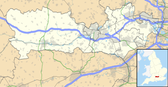
Bracknell is a constituency in Berkshire represented in the House of Commons of the UK Parliament since 2019 by James Sunderland, a Conservative. It was created for the 1997 general election, largely replacing the abolished county constituency of East Berkshire.

<span class="mw-page-title-main">East Berkshire (UK Parliament constituency)</span> Parliamentary constituency in the United Kingdom 1983-1997

East Berkshire was a county constituency in the county of Berkshire. It returned one Member of Parliament (MP) to the House of Commons of the Parliament of the United Kingdom, elected by the first past the post voting system.

<span class="mw-page-title-main">Borough of Slough</span> Borough and unitary authority in England

The Borough of Slough is a unitary authority with borough status in the ceremonial county of Berkshire, Southern England. The borough is centred around the town of Slough and includes Langley. It forms an urban area with parts of Buckinghamshire and extends to the villages of Burnham, Farnham Royal, George Green, and Iver. Part of the district's area was in Buckinghamshire prior to the district's formation and in Middlesex until 1965.

References

  1. "Wokingham (Unitary District, South East England, United Kingdom) - Population Statistics and Location in Maps and Charts". www.citypopulation.de. Retrieved 20 November 2016.
  2. "West Berkshire (Unitary District, South East England, United Kingdom) - Population Statistics and Location in Maps and Charts". www.citypopulation.de. Retrieved 20 November 2016.
  3. "Slough (Unitary District, South East England, United Kingdom) - Population Statistics and Location in Maps and Charts". www.citypopulation.de. Retrieved 20 November 2016.
  4. "Windsor and Maidenhead (Unitary District, South East England, United Kingdom) - Population Statistics and Location in Maps and Charts". www.citypopulation.de. Retrieved 20 November 2016.
  5. "Bracknell Forest (Unitary District, South East England, United Kingdom) - Population Statistics and Location in Maps and Charts". www.citypopulation.de. Retrieved 20 November 2016.
  6. "Reading (Unitary District, South East England, United Kingdom) - Population Statistics and Location in Maps and Charts". www.citypopulation.de. Retrieved 20 November 2016.
  7. "KS101EW (Usual resident population) - Nomis - Official Labour Market Statistics". www.nomisweb.co.uk. Retrieved 20 November 2016.
  8. "ONS Neighbourhood Statistics - Area: Sunninghill and South Ascot (Ward) Key Figures for 2001 Census: Key Statistics". www.neighbourhood.statistics.gov.uk. 14 April 2008. Retrieved 19 January 2017.
  9. "ONS Neighbourhood Statistics - Area: Sunninghill and South Ascot (Ward) Key Figures for 2011 Census: Key Statistics". www.neighbourhood.statistics.gov.uk. 14 April 2008. Retrieved 19 January 2017.
  10. "ONS Neighbourhood Statistics - Area: Sunningdale (Ward) Key Figures for 2001 Census: Census Area Statistics". www.neighbourhood.statistics.gov.uk. 14 April 2008. Retrieved 19 January 2017.
  11. "ONS Neighbourhood Statistics - Area: Sunningdale (Ward) - Key Figures for 2011 Census: Key Statistics". www.neighbourhood.statistics.gov.uk. 14 April 2008. Retrieved 19 January 2017.