West Berkshire

Last updated

West Berkshire
Newbury Town Hall.jpg
High Street in Theale - geograph.org.uk - 3032846.jpg
Donnington Castle 05.jpg
Thatcham, Berkshire, St Mary - geograph.org.uk - 5903203.jpg
Combe Gibbet and long barrow, Gallows Down 04.jpg
West Berkshire UK locator map.svg
Shown within Berkshire
Coordinates: 51°24′03″N1°19′25″W / 51.4009°N 1.3235°W / 51.4009; -1.3235
Sovereign state United Kingdom
Constituent country England
Region South East England
Ceremonial county Berkshire
Status Unitary authority
Incorporated1 April 1974
Admin HQ Newbury
Government
  TypeUnitary authority
  Body West Berkshire Council
  LeadershipLeader & Cabinet (Liberal Democrat)
   MPs
Area
  Total271.88 sq mi (704.17 km2)
  Rank47th (of 296)
Population
 (2021)
  Total161,865
  Rank125th (of 296)
  Density600/sq mi (230/km2)
Ethnicity (2021)
[1]
   Ethnic groups
List
Religion (2021)
[1]
   Religion
List
Time zone UTC0 (GMT)
  Summer (DST) UTC+1 (BST)
ISO 3166 code GB-WBK
ONS code 00MB (ONS) E06000037 (GSS)
OS grid reference SU4705467146
Website www.westberks.gov.uk

West Berkshire is a unitary authority area in the ceremonial county of Berkshire, England. It is administered from Newbury by West Berkshire Council.

Contents

History

The district of Newbury was formed on 1 April 1974, as a merger of the borough of Newbury, Bradfield Rural District, Hungerford Rural District and Newbury Rural District, along with part of Wantage Rural District.

Until 1 April 1998, Newbury District Council and Berkshire County council were responsible for the region at local government level. On 1 April 1998, Berkshire County Council was abolished and Newbury District Council changed its name to West Berkshire Council and took on the former County Council's responsibilities within its area.

Geography

West Berkshire is semi-rural in character, with most of the population living in the wooded Kennet valley. [2] Apart from Newbury, the other main centres in the district include Thatcham, Hungerford, Pangbourne and Lambourn. Larger villages include Burghfield, Mortimer and Hermitage. 30% of the population resides in the East of the district, these towns and villages including Tilehurst, Theale, Purley-on-Thames and Calcot which form part of the Reading/Wokingham Urban Area. West Berkshire borders Hampshire to the south, Wiltshire to the west, Oxfordshire to the north and both the Reading and Wokingham authorities to the east. Around three-quarters of the land is designated North Wessex Downs Area of Outstanding Natural Beauty, ranging from the Berkshire Downs to the Thames Valley.

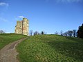
The highest point in southeast/south-central England is located in West Berkshire at Walbury Hill with a summit height of 297 m (974 ft) 2 km to the south of the village of Inkpen, though the hill is not particularly prominent.

West Berkshire has a number of water courses running through the area. In addition to the River Thames, there are the Rivers Lambourn, Kennet, Pang, Bourne and the Kennet and Avon Canal and a number of tributaries that feed these rivers. Properties within flood plains may be at risk of flooding from rising river waters or from water coming up through the ground in some periods of heavy and/or prolonged periods of rain. [3] Purley and Pangbourne are particularly at risk. [4]

Economy

West Berkshire has the 21st largest economy in England, [5] characterised by low unemployment, above average wages, and abundance of jobs in technology and financial sectors. The presence of Vodafone has created a cluster of around 80 mobile phone related businesses in Newbury, [5] while the Lambourn area is the second most important centre for the racehorse industry in Great Britain, employing over 800 people directly, and producing an annual income of £20 million. [6]

West Berkshire is also home to Atomic Weapons Establishment, near Aldermaston, Wolseley plc, Bayer and PepsiCo.

Coat of arms

The coat of arms for West Berkshire was established in 1974 for Newbury District Council. Upon the creation of the unitary authority it was inherited by West Berkshire Council.

The colours of red and gold in the arms represent industry and the richness of the area, whilst the interwoven cross represents the weaving industry which was important to Newbury in past centuries. The corn on the shield represents the agriculture industry which is important to the area, whilst the cogwheels represent manufacturing and manufacturing achievement. The mural crown represents local government and the grassy mount symbolises the downs of the surrounding area. Finally, the horseman represents the two battles of Newbury in the English Civil War.

Politics

West Berkshire Council is the local authority for the area, based at the Council Offices on Market Street in Newbury.

The district is similar in area to the parliamentary constituency of Newbury, except for areas to the east where parts of West Berkshire are incorporated into the constituencies of Wokingham and Reading West.

Education

There are 10 state-funded secondary schools operating in West Berkshire as well as numerous primary schools and a special school provision. There are also a number of private schools.

Further and higher education in the area is provided by Newbury College, however there are no universities, the nearest being the University of Reading and one of the University of West London campuses, both in the neighbouring Reading Borough.

Notable people

Related Research Articles

<span class="mw-page-title-main">Berkshire</span> County of England

The Royal County of Berkshire, commonly known as simply Berkshire, is a ceremonial county in South East England. It is bordered by Oxfordshire to the north, Buckinghamshire to the north-east, Greater London to the east, Surrey to the south-east, Hampshire to the south, and Wiltshire to the west. Reading is the largest settlement and the county town.

<span class="mw-page-title-main">Newbury, Berkshire</span> Market town in England

Newbury is a market town in West Berkshire, England, in the valley of the River Kennet. It is 26 miles (42 km) south of Oxford, 25 miles (40 km) north of Winchester, 27 miles (43 km) southeast of Swindon and 20 miles (32 km) west of Reading. It is also where West Berkshire Council is headquartered.

<span class="mw-page-title-main">River Kennet</span> Tributary of the River Thames in Southern England

The Kennet is a tributary of the River Thames in Southern England. Most of the river is straddled by the North Wessex Downs AONB. The lower reaches have been made navigable as the Kennet Navigation, which – together with the Avon Navigation, the Kennet and Avon Canal and the Thames – links the cities of Bristol and London.

<span class="mw-page-title-main">Hungerford</span> Town in England

Hungerford is a historic market town and civil parish in Berkshire, England, 8 miles (13 km) west of Newbury, 9 miles (14 km) east of Marlborough, 27 miles (43 km) north-east of Salisbury and 60 miles west of London. The Kennet and Avon Canal passes through the town alongside the River Dun, a major tributary of the River Kennet. The confluence with the Kennet is to the north of the centre whence canal and river both continue east. Amenities include schools, shops, cafés, restaurants, and facilities for the main national sports. Hungerford railway station is a minor stop on the Reading to Taunton Line.

<span class="mw-page-title-main">River Lambourn</span> River in Berkshire, United Kingdom

The River Lambourn is a chalk stream in the English county of Berkshire. It rises in the Berkshire Downs near its namesake village of Lambourn and is a tributary of the River Kennet, which is itself a tributary of the River Thames.

<span class="mw-page-title-main">Lambourn</span> Village and civil parish in West Berkshire

Lambourn is a village and civil parish in Berkshire, England. It lies just north of the M4 Motorway between Swindon and Newbury, and borders Wiltshire to the west and Oxfordshire to the north. After Newmarket it is the largest centre of racehorse training in England, and is home to a rehabilitation centre for injured jockeys, an equine hospital, and several leading jockeys and trainers. To the north of the village are the prehistoric Seven Barrows and the nearby long barrow. In 2004 the Crow Down Hoard was found close to the village.

<span class="mw-page-title-main">Berkshire Downs</span> Chalk hills in England

The Berkshire Downs are a range of chalk downland hills in southern England, part of the North Wessex Downs Area of Outstanding Natural Beauty. The Berkshire Downs are wholly within the traditional county of Berkshire, although split between the current ceremonial counties of Berkshire and Oxfordshire. The western parts of the downs are also known as the Lambourn Downs.

<span class="mw-page-title-main">River Pang</span> River in Berkshire, England

The River Pang is a small chalk stream river in the west of the English county of Berkshire, and a tributary of the River Thames. It runs for approximately 23 kilometres (14 mi) from its source near the village of Compton to its confluence with the Thames in the village of Pangbourne.

<span class="mw-page-title-main">North Wessex Downs National Landscape</span> National Landscape in England

The North Wessex Downs National Landscape is located in the English counties of Berkshire, Hampshire, Oxfordshire and Wiltshire. The name North Wessex Downs is not a traditional one, the area covered being better known by various overlapping local names, including the Berkshire Downs, the North Hampshire Downs, the White Horse Hills, the Lambourn Downs, the Marlborough Downs, the Vale of Pewsey and Savernake Forest.

<span class="mw-page-title-main">Reading West (UK Parliament constituency)</span> Parliamentary constituency in the United Kingdom, 1983 onwards

Reading West is a constituency represented in the House of Commons of the UK Parliament since 2010 by Alok Sharma, a Conservative.

<span class="mw-page-title-main">Pangbourne</span> Village in Berkshire, England

Pangbourne is a village and civil parish on the River Thames in the West Berkshire unitary area of the ceremonial county of Berkshire, England. It is home to Pangbourne College.

<span class="mw-page-title-main">Purley on Thames</span> Village and civil parish in England

Purley on Thames is a village and civil parish in Berkshire, England. Purley is centred 3 miles (4.8 km) north-west of Reading, 1 mile (1.6 km) east of Pangbourne, and 22 miles (35 km) south-east of Oxford. Historically, Purley comprised three separate manors and associated settlements. In the centre there is an historic area named variously Lething or Burley (Domesday) which accommodated traders and craftsmen alongside the main Reading to Oxford road.

<span class="mw-page-title-main">Newbury (UK Parliament constituency)</span> Parliamentary constituency in the United Kingdom since 1885

Newbury is a constituency represented in the House of Commons of the UK Parliament from 2019 by Laura Farris, a Conservative. It was created by the Redistribution of Seats Act 1885 and has been in continual existence since then.

<span class="mw-page-title-main">Wokingham (UK Parliament constituency)</span> Parliamentary constituency in the United Kingdom 1885-1918 and from 1950 onwards

Wokingham is a constituency in Berkshire represented in the House of Commons of the Parliament of the United Kingdom since 1987 by John Redwood, a Conservative.

<span class="mw-page-title-main">Woolhampton</span> Village and civil parish in England

Woolhampton is a village and civil parish in West Berkshire, England. The village straddles the Bath Road between the towns of Reading, 8 mi (13 km) to the east, and Newbury, 6 mi (10 km) to the west.

West Berkshire Council is the local authority for West Berkshire, a unitary authority in Berkshire, England. Until 1 April 1998 it was a non-metropolitan district called Newbury.

<span class="mw-page-title-main">West Berkshire Council</span>

West Berkshire Council is the local authority of West Berkshire in Berkshire, England. It is a unitary authority, having the powers of a non-metropolitan county and district council combined. West Berkshire is divided into 24 wards, electing 43 councillors. The council was created in 1974 as the Newbury District Council. On 1 April 1998 it was renamed West Berkshire Council and since then has been a unitary authority, assuming the powers and functions of the abolished Berkshire County Council within the district. In the 2023 election the Liberal Democrats won 29 out of 43 seats.

References

  1. 1 2 UK Census (2021). "2021 Census Area Profile – West Berkshire Local Authority (E06000037)". Nomis. Office for National Statistics . Retrieved 5 January 2024.
  2. "West Berkshire Council". westberks.gov.uk.
  3. "West Berkshire Council". westberks.gov.uk.
  4. "Newbury Today Pangbourne and Purley braced for floods Mon, 23 July 2007".
  5. 1 2 "West Berkshire Council". westberks.gov.uk.
  6. Archived 17 July 2012 at the Wayback Machine