Bratunac

Last updated
Bratunac
Братунац
Kravicka zelena dolina - panoramio.jpg
Bratunac
Bratunac veliki grb.jpg
Bratunac municipality.svg
Location of Bratunac within Bosnia and Herzegovina
Bratunac-naselja.PNG
Coordinates: 44°11′02″N19°19′51″E / 44.18389°N 19.33083°E / 44.18389; 19.33083
Country Flag of Bosnia and Herzegovina.svg  Bosnia and Herzegovina
Entity Flag of the Republika Srpska.svg  Republika Srpska
Geographical region Podrinje
Government
  Municipal mayorLazar Prodanović (SNSD)
  Municipality293.49 km2 (113.32 sq mi)
Population
 (2013 census)
  Town
8,359
  Municipality
20,340
  Municipality density69/km2 (180/sq mi)
Time zone UTC+1 (CET)
  Summer (DST) UTC+2 (CEST)
Area code 56
Website opstinabratunac.com

Bratunac is a town and municipality located in the easternmost part of Bosnia and Herzegovina. As of 2013 census, the municipality has a population of 20,340 inhabitants, while the town of Bratunac has a population of 8,359 inhabitants.

Contents

History

Early history

In 1381, the name Bratunac was mentioned for the first time because of the direct road from Bosnia and Herzegovina to Serbia that passed through Bratunac. At the time, Bratunac was composed of five houses and had a population of roughly 30 people. In 1461, the region was conquered by the Ottomans under Mehmed II. Under Ottoman rule, it was transformed into a kasbah that included mosques, a madrasa, several mekteps, shadirvans, caravanserais, and other types of Islamic architecture. In 1878, as the Ottoman Empire fell into decline, Austro-Hungary annexed Bosnia and Herzegovina and ruled over Bratunac until its dissolution at the end of the WW1. In 1927, Bratunac became a municipality for the first time.

Settlements

Aside from the town of Bratunac, the municipality consists of the following settlements:

Demographics

Serbian Orthodox cemetery in Bratunac. Bratunac-Serbian-Cemetery-Bosnia-War.jpg
Serbian Orthodox cemetery in Bratunac.

According to the Columbia-Lippincott Gazetteer, in 1948 Bratunac had a population of 5,033.

Population

Population of settlements – Bratunac municipality
Settlement1948.1953.1961.1971.1981.1991.2013.
Total5,2349,64723,14926,51330,33333,37520,340
1Biljača655211
2Bjelovac290201
3Bratunac1,4102,7165,5157,6958,359
4Dubravice388269
5Glogova1,913848
6Hranča701317
7Hrnčići1,226646
8Ježeštica503342
9Konjevići998615
10Krasanovići532284
11Kravica363558
12Magašići646486
13Mihaljevići391224
14Opravdići441247
15Pobuđe2,359993
16Polom436206
17Rakovac537423
18Repovac504351
19Slapašnica542286
20Suha988371
21Urkovići1,095460
22Voljavica1,379273
23Zagoni588305
24Žlijebac380240

Ethnic composition

Ethnic composition – Bratunac town
2013.1991.1981.1971.
Total8,359 (100,0%)7,695 (100,0%)5,515 (100,0%)2,716 (100,0%)
Bosniaks4,311 (56,02%)2,715 (49,23%)1,210 (44,55%)
Serbs3 037 (39,47%)2,308 (41,85%)1,406 (51,77%)
Yugoslavs159 (2,066%)312 (5,657%)1 (0,037%)
Others156 (2,027%)26 (0,471%)32 (1,178%)
Croats32 (0,416%)31 (0,562%)32 (1,178%)
Roma87 (1,578%)9 (0,331%)
Albanians18 (0,326%)11 (0,405%)
Montenegrins15 (0,272%)12 (0,442%)
Macedonians3 (0,054%)2 (0,074%)
Hungarians1 (0,037%)
Ethnic composition – Bratunac municipality
2013.1991.1981.1971.
Total20,340 (100,0%)33,619 (100,0%)33,033 (100,0%)26,513 (100,0%)
Serbs12,350 (60,72%)11,475 (34,13%)12,055 (36,49%)12,820 (48,35%)
Bosniaks7,803 (38,36%)21,535 (64,06%)17,349 (52,52%)13,428 (50,65%)
Others154 (0,757%)346 (1,029%)2,766 (8,373%)118 (0,445%)
Croats33 (0,162%)40 (0,119%)41 (0,124%)50 (0,189%)
Yugoslavs223 (0,663%)645 (1,953%)15 (0,057%)
Roma124 (0,375%)26 (0,098%)
Montenegrins31 (0,094%)36 (0,136%)
Albanians18 (0,054%)16 (0,060%)
Macedonians4 (0,012%)3 (0,011%)
Hungarians1 (0,004%)
Data by settlements
Ethnic structure of the population of Bratunac municipality, by settlements, 2013 census
SettlementtotalBosniaksCroatsSerbsothers
Biljača 306301050
Bjelovac 207202050
Bratunac7,827730276,99773
Dubravice 270002700
Glogova 920914060
Hranča 3682590990
Hrnčići 780780000
Ježeštica 345003450
Konjevići 735735000
Krasanovići 28715601301
Kravica 567005670
Magašići 52723622890
Mihaljevići 233231020
Opravdići 2752302520
Pobuđe 1,2861,286000
Polom 217002161
Rakovac 4333603889
Repovac 3521333360
Slapašnica 3043702661
Suha 39620211930
Urkovići 504504000
Voljavica 419417020
Zagoni 3161802980
Žlijebac 272002720

Economy

The landscape of Bratunac Opravdici ( pogled sa Mlakve) - panoramio.jpg
The landscape of Bratunac

The following table gives a preview of total number of registered people employed in professional fields per their core activity (as of 2018): [1]

Professional fieldTotal
Agriculture, forestry and fishing43
Mining and quarrying-
Manufacturing645
Electricity, gas, steam and air conditioning supply57
Water supply; sewerage, waste management and remediation activities50
Construction94
Wholesale and retail trade, repair of motor vehicles and motorcycles337
Transportation and storage58
Accommodation and food services118
Information and communication11
Financial and insurance activities25
Real estate activities1
Professional, scientific and technical activities30
Administrative and support service activities6
Public administration and defense; compulsory social security147
Education266
Human health and social work activities95
Arts, entertainment and recreation11
Other service activities56
Total2,050

See also

Related Research Articles

<span class="mw-page-title-main">Srebrenica</span> Town and municipality in Republika Srpska, Bosnia and Herzegovina

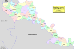
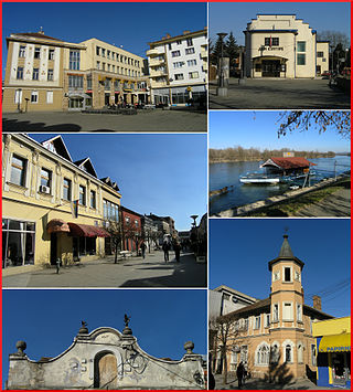
Srebrenica is a town and municipality in Republika Srpska, Bosnia and Herzegovina. It is a small mountain town, with its main industry being salt mining and a nearby spa.

<span class="mw-page-title-main">Republika Srpska</span> Political entity of Bosnia and Herzegovina

Republika Srpska is one of the two entities of Bosnia and Herzegovina, the other being the Federation of Bosnia and Herzegovina. It is located in the north and east of the country. Its largest city and administrative centre is Banja Luka, lying on the Vrbas river, and with a population of about 138,963 people.

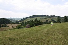
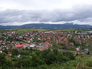
Kravica is a village in Bratunac, Republika Srpska, Bosnia and Herzegovina. As of 2013 census, it has a population of 567 inhabitants.

<span class="mw-page-title-main">Foča</span> Town and municipality in Republika Srpska

Foča is a town and municipality in Republika Srpska, Bosnia and Herzegovina. It is located in south-eastern Bosnia and Herzegovina, on the banks of the Drina river. As of 2013, the town has a population of 12,234 inhabitants, while the municipality has 18,288 inhabitants. Foča houses some faculties from the Istočno Sarajevo University. It is also home to the "Seminary of Saint Peter of Sarajevo and Dabar-Bosna", one of seven seminaries in the Serbian Orthodox Church. Foča was also, until 1992, home to one of Bosnia's most important Islamic high schools, the Madrasa of Mehmed Pasha Kukavica. The Sutjeska National Park, which is the oldest National Park in Bosnia and Herzegovina, is located in the municipality.

<span class="mw-page-title-main">Bijeljina</span> City and municipality in Bosnia and Herzegovina

Bijeljina is a city and municipality in Republika Srpska, Bosnia and Herzegovina. It is the provincial center of Semberija, a geographic region in the country's northeast. As of 2013, it has a population of 107,715 inhabitants.

<span class="mw-page-title-main">Šamac, Bosnia and Herzegovina</span> Town and municipality in Republika Srpska, Bosnia and Herzegovina

Šamac, formerly Bosanski Šamac is a town and municipality in Republika Srpska, Bosnia and Herzegovina. There are also small, uninhabited, parts located in the municipalities of Odžak and Domaljevac-Šamac, Federation of Bosnia and Herzegovina.

<span class="mw-page-title-main">Gradiška, Bosnia and Herzegovina</span> City and municipality in Republika Srpska

Gradiška, formerly Bosanska Gradiška, is a city in Republika Srpska, Bosnia and Herzegovina. As of 2013, it has a population of 51,727 inhabitants, while the city of Gradiška has a population of 14,368 inhabitants.

<span class="mw-page-title-main">Nevesinje</span> Town

Nevesinje is a town and municipality in Republika Srpska, Bosnia and Herzegovina. As of 2013, the town has a population of 5,162 inhabitants, while the municipality has 12,961 inhabitants.

<span class="mw-page-title-main">Novi Grad, Bosnia and Herzegovina</span> Town and municipality in Bosnia and Herzegovina

Novi Grad, formerly Bosanski Novi, is a town and municipality in Republika Srpska, Bosnia and Herzegovina. Situated in the far northwest of the country, it lies across the Una from the Croatian town of Dvor. According to the 2013 census, the town has a population of 11,063 while its municipality comprises a total of 27,115 inhabitants.

<span class="mw-page-title-main">Dubica, Bosnia and Herzegovina</span> Town and municipality

Kozarska Dubica, formerly Bosanska Dubica is a town and municipality in Republika Srpska, Bosnia and Herzegovina. As of 2013, it has a population of 21,542 inhabitants, while the town of Kozarska Dubica has a population of 11,566 inhabitants.

<span class="mw-page-title-main">Demographic history of Bosnia and Herzegovina</span>

This article is about the Demographic history of Bosnia and Herzegovina, and deals with the country's documented demographics over time. For an overview of the various ethnic groups and their historical development, see Ethnic groups in Bosnia and Herzegovina.

<span class="mw-page-title-main">Gacko</span> Town and municipality in Republika Srpska, Bosnia and Herzegovina

Gacko is a town and municipality in Republika Srpska, Bosnia and Herzegovina. It is situated in the region of East Herzegovina. As of 2013, the town has a population of 5,784 inhabitants, while the municipality has 8,990 inhabitants.

<span class="mw-page-title-main">Trnovo, Republika Srpska</span> Municipality

Trnovo is a municipality of the city of Istočno Sarajevo, Republika Srpska, Bosnia and Herzegovina.

<span class="mw-page-title-main">Han Pijesak</span> Town and municipality

Han Pijesak is a town and municipality in Republika Srpska, Bosnia and Herzegovina. As of 2013, it has a population of 3,530 inhabitants, while the town of Han Pijesak has a population of 2,018 inhabitants.

<span class="mw-page-title-main">Kostajnica, Bosnia and Herzegovina</span> Town and municipality in Republika Srpska, Bosnia and Herzegovina

Kostajnica, formerly Bosanska Kostajnica, is a town and municipality located in Republika Srpska, Bosnia and Herzegovina. It is situated in the part of the Кrajina region. As of 2013, it had a population of 5,977 inhabitants, while the town of Kostajnica has a population of 4,047 inhabitants.

<span class="mw-page-title-main">Ljubinje</span> Town and municipality, Bosnia and Herzegovina

Ljubinje is a town and municipality in Republika Srpska, Bosnia and Herzegovina. It is situated in south-eastern part of Herzegovina. As of 2013, the town has a population of 2,744 inhabitants, while the municipality has 3,511 inhabitants.

<span class="mw-page-title-main">Prnjavor, Bosnia and Herzegovina</span> Town and municipality

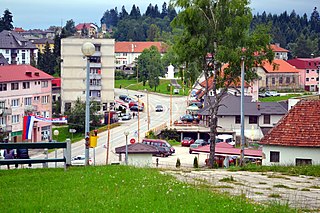
Prnjavor is a town and municipality in Republika Srpska, Bosnia and Herzegovina. According to the 2013 census, the town has a population of 8,120 inhabitants, with 35,956 inhabitants in the municipality.

<span class="mw-page-title-main">Vlasenica</span> Town and municipality in Republika Srpska, Bosnia and Herzegovina

Vlasenica is a town and municipality in Republika Srpska, Bosnia and Herzegovina. As of 2013, it has a population 11,467 inhabitants, while the town of Vlasenica has a population of 7,228 inhabitants.

<span class="mw-page-title-main">Šekovići</span> Town and municipality

Šekovići is a town and municipality in Republika Srpska, Bosnia and Herzegovina. As of 2013, it has a population of 6,761 inhabitants, while the town of Šekovići has a population of 1,519 inhabitants.

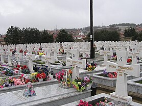
The Kravica attack was an attack on the Bosnian Serb village of Kravica by the Army of the Republic of Bosnia and Herzegovina (ARBiH) from the Srebrenica enclave on Orthodox Christmas Day, 7 January 1993. The attack was organized to coincide with the Serbian Orthodox Christmas, leaving the Serbs unprepared for any attack. 43-46 people died in the attack on the Serb side: 30-35 soldiers and 11-13 civilians.

References

  1. "Cities and Municipalities of Republika Srpska" (PDF). rzs.rs.ba. Republika Srspka Institute of Statistics. 25 December 2019. Retrieved 31 December 2019.