
Towanda Creek is a tributary of the Susquehanna River in Bradford County, Pennsylvania, in the United States. It is approximately 32.9 miles (52.9 km) long and flows through Canton Township, Canton, Leroy Township, Franklin Township, and Monroe Township.

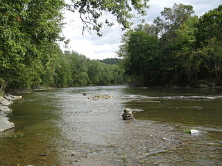
Bowman Creek is a tributary of the Susquehanna River in Luzerne County and Wyoming County, in Pennsylvania, in the United States. It is approximately 26 miles (42 km) long and flows through Ross Township and Lake Township in Luzerne County and Noxen Township, Monroe Township, and Eaton Township in Wyoming County. The watershed of the creek has an area of 120 square miles (310 km2). The creek is not designated as an impaired waterbody and its pH is close to neutral, although it has experienced some problems with acid rain. It has low concentrations of dissolved solids like calcium. The creek is relatively small in its upper reaches, but by Noxen, its width is 40 to 60 feet. It is also relatively shallow in many reaches. Rock formations in the watershed include the Catskill Formation, the Huntley Mountain Formation, Burgoon Sandstone, the Mauch Chunk Formation, the Pottsville Group, and the Pocono Formation. Soil associations in the creek's watershed include the Wellsboro-Morris-Oquaga association, the Oquaga-Lackawanna-Arnot association, the Mardin-Bath-Volusia association, and the Wyoming-Pope association.
Fishing Creek is a 29.98-mile (48.25 km) long tributary of the Susquehanna River in Columbia County, Pennsylvania, in the United States. It joins the Susquehanna River near the census-designated place of Rupert and the town of Bloomsburg. The watershed has an area of 385 square miles (1,000 km2).
Briar Creek is a tributary of the Susquehanna River in Columbia County, Pennsylvania, in the United States. It is 7.77 miles (12.50 km) in length. The stream has a watershed area of 33.0 square miles. It flows through Briar Creek Township and the borough of Briar Creek. The area near the creek was originally inhabited by the Lenni Lenape and the Shawanese. European settlers arrived in the 1770s.
Little Shickshinny Creek is a tributary of Shickshinny Creek in Columbia County and Luzerne County, in Pennsylvania, United States. It is 9.5 miles (15.3 km), nearly as long as Shickshinny Creek itself. The creek flows through Briar Creek Township, Columbia County; Salem Township, Luzerne County; and the borough of Shickshinny, in Luzerne County. It is designated as a high-quality coldwater fishery. Pennsylvania State Game Lands #55 and #260 are in the creek's watershed. The watershed has an area of 9.8 square miles, which includes swamps and forests. Waterfalls known as the Little Shickshinny Creek Falls are located on the creek.

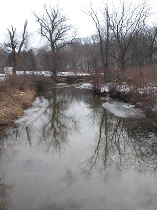
Lake Chillisquaque is a lake and reservoir in Montour County, Pennsylvania, in the United States. It has a surface area of 165 acres. The lake is situated on Middle Branch Chillisquaque Creek, which it is named after. Nearby communities include Danville and Washingtonville. The lake has an elevation of 567 feet (173 m) above sea level and is up to 40 feet (12 m) deep. It has several coves, including Goose Cove, Heron Cove, and Jellyfish Cove. The lake is dammed on its southern side by the Lake Chillisquaque Dam, which is 2,000 feet (610 m) long and 54 feet (16 m) high. The metals with the highest concentrations are calcium and iron. Nonmetals such as nitrogen and phosphorus are also found in the lake. It experiences agricultural runoff as well.

Glen Brook is a tributary of East Branch Briar Creek in Luzerne County and Columbia County, in Pennsylvania, in the United States. It is approximately 4.7 miles (7.6 km) long and flows through Salem Township in Luzerne County and Briar Creek Township and Berwick in Columbia County. Its watershed has an area of 4.96 square miles (12.8 km2). A number of dams and reservoirs have been built on the creek and two major bridges cross it. The stream lies over mudstone, siltstone, limestone, sandstone and shale.
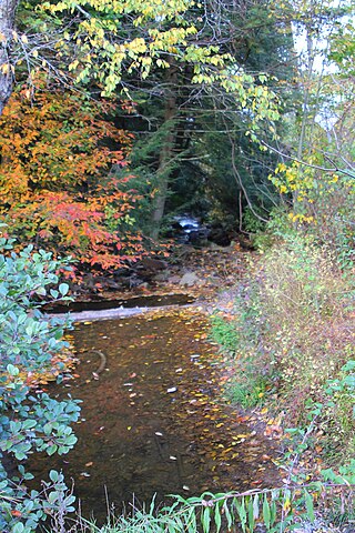
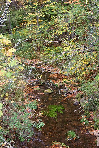
Scotch Run is one of the main tributaries of Catawissa Creek in Columbia County, Pennsylvania, in the United States. It is approximately 7.8 miles (12.6 km) long and flows through Beaver Township and Main Township. The stream's watershed has an area of 9.10 square miles (23.6 km2). The stream is infertile and acidic. It is 7.2 feet (2.2 m) wide in its upper reaches and 17.0 feet (5.2 m) wide in its lower reaches. The main rock formations in the watershed include the Mauch Chunk Formation, the Pocono Formation, the Pottsville Formation, and the Spechty Kopf Formation. The main soils include Leck Kill soil and Hazleton soil. It flows between Nescopeck Mountain and McCauley Mountain.
Klingermans Run is a tributary of Catawissa Creek in Columbia County, Pennsylvania, in the United States. It is approximately 2.4 miles (3.9 km) long and flows through Roaring Creek Township and Beaver Township. The watershed of the stream has an area of 1.78 square miles (4.6 km2). The stream is considered to be a High-Quality Coldwater Fishery and Class A Wild Trout Waters. The main rock formations in the stream's watershed are the Mauch Chunk Formation and the Pocono Formation and the main soils are the Leck Kill soil and the Hazleton soil.

Little Catawissa Creek is a tributary of Catawissa Creek in Columbia County and Schuylkill County, in Pennsylvania, in the United States. It is approximately 10.8 miles (17.4 km) long and flows through Conyngham Township in Columbia County and Union Township and North Union Township in Schuylkill County. The named tributaries of the creek include Stony Run and Trexler Run. The creek has some alkalinity and is slightly acidic. The main rock formations in the watershed of it are the Mauch Chunk Formation, the Pocono Formation, and the Pottsville Formation. A number of other rock formations occur in small areas of the watershed as well. The main soils in the watershed are the Leck Kill soil and the Hazleton soil.

Trexler Run is a tributary of Little Catawissa Creek in Columbia and Schuylkill counties in Pennsylvania, in the United States. It is approximately 3.4 miles (5.5 km) long and flows through Roaring Creek Township in Columbia County and Union Township in Schuylkill County. The watershed of the stream has an area of 3.81 square miles (9.9 km2). The stream is considered to be a High-Quality Coldwater Fishery and Class A Wild Trout Waters. The main rock formations in the stream's watershed are the Mauch Chunk Formation, the Pocono Formation, and the Pottsville Formation and the main soil is the Leck Kill soil. Both brook trout and brown trout inhabit the stream, as do several other species of fish.

Davis Run is a tributary of Catawissa Creek in Schuylkill County, Pennsylvania, in the United States. It is approximately 1.2 miles (1.9 km) long. The watershed of the stream has an area of 2.86 square miles (7.4 km2). The stream is considered to be a High-Quality Coldwater Fishery and Class A Wild Trout Waters. Six species of fish inhabit the stream, including brown trout and brook trout. The main rock formations in the stream's watershed are the Mauch Chunk Formation and the Pottsville Formation and the main soils are the Leck Kill soil and the Hezleton soil. The stream has two unnamed tributaries and a lake known as the Pumping Station Reservoir.

Messers Run is a tributary of Catawissa Creek in Schuylkill County, Pennsylvania, in the United States. It is approximately 5.2 miles (8.4 km) long and flows through Kline Township and East Union Township. The only named tributary of the stream is Negro Hollow, but it has two unnamed tributaries. The creek has some alkalinity, but is slightly acidic. The main rock formations in the watershed of it are the Mauch Chunk Formation and the Pottsville Formation. The main soils in the watershed are the Leck Kill soil and the Hazleton soil.
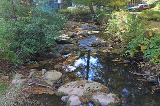
Mill Creek is a tributary of Roaring Creek in Columbia County, Pennsylvania, in the United States. It is approximately 3.1 miles (5.0 km) long and flows through Roaring Creek Township and Locust Township. The watershed of the creek has an area of 4.98 square miles (12.9 km2). The creek is considered to be a High-Quality Coldwater Fishery and Class A Wild Trout Waters. Numerous species of macroinvertebrates inhabit it. The creek was named from the presence of a mill.

Pikes Creek is a tributary of Harveys Creek in Luzerne County, Pennsylvania, in the United States. It is approximately 8.9 miles (14.3 km) long and flows through Lake Township, Lehman Township, Jackson Township, and Plymouth Township. The watershed of the creek has an area of 11.6 square miles (30 km2). It is designated as a High-Quality Coldwater Fishery and a Migratory Fishery, as well as being Class A Wild Trout Waters for part of its length. The creek has a 400-acre reservoir, which is known as the Pikes Creek Reservoir and supplies water to tens of thousands of people. A number of bridges have been constructed over the creek.

Lily Lake is an impoundment and natural lake in Luzerne County, Pennsylvania, in the United States. It has a surface area of approximately 160 acres and is situated on Pond Creek. It is a natural glacial lake in Slocum Township and Conyngham Township. The lake is listed on the Luzerne County Natural Areas Inventory. It is inhabited by eleven species of fish, including alewives and bluegills. The lake has one boat launch.

Spring Brook is a tributary of the Lackawanna River in Lackawanna County and Luzerne County, in Pennsylvania, in the United States. It is approximately 17 miles (27 km) long and flows through Covington Township, Spring Brook Township, and Moosic in Lackawanna County and Pittston Township in Luzerne County. The watershed of the stream has an area of 57.2 square miles (148 km2). It is designated as a High-Quality Coldwater Fishery and a Migratory Fishery above Interstate 476 and as a Coldwater Fishery and a Migratory Fishery below it. A section is also designated as Class A Wild Trout Waters. The stream's tributaries include Panther Creek, Plank Bridge Creek, Rattlesnake Creek, Green Run, Monument Creek, and Covey Swamp Creek. It has a relatively high level of water quality and is very slightly acidic, with a pH of 6.4 to 6.9.
Rattlesnake Creek is a tributary of Spring Brook in Lackawanna County, Pennsylvania, in the United States. It is approximately 5.0 miles (8.0 km) long and flows through Spring Brook Township. The watershed of the creek has an area of 9.18 square miles (23.8 km2). The creek has one named tributary, which is known as Six Springs Creek. Rattlesnake Creek is inhabited by wild trout and part of it is considered to be Class A Wild Trout Waters. A dammed lake known as Maple Lake is located near its headwaters. The surficial geology in the area mainly consists of Wisconsinan Till and bedrock, with some alluvium, Wisconsinan Ice-Contact Stratified Drift, wetlands, and peat bogs.

Leggetts Creek is a tributary of the Lackawanna River in Lackawanna County, Pennsylvania, in the United States. It is approximately 9.0 miles (14.5 km) long and flows through Scott Township, South Abington Township, and Scranton. The watershed of the creek has an area of 18.5 square miles (48 km2). The creek has three named tributaries: Leach Creek, Clover Hill Creek, and Summit Lake Creek. Leggetts Creek is considered to be impaired due to urban development problems, but is not affected by acid mine drainage. The creek is fairly alkaline and is a perennial stream. Its headwaters are in wetlands outside of the Lackawanna Valley and it flows through a water gap known as Leggetts Gap or The Notch. Major lakes in the watershed include the Griffin Reservoir, Summit Lake, and Maple Lake. The creek is a source of flooding in South Abington Township.
Pikes Creek Reservoir is a reservoir in Luzerne County, Pennsylvania, in the United States. It has a surface area of approximately 400 acres (160 ha) and is situated in Lehman Township, Jackson Township, and Plymouth Township. The lake is situated on Pikes Creek. It has a volume of approximately 3 billion gallons and is used as a water supply reservoir. As of 2013, it is inhabited by fifteen fish species. The reservoir is owned by the Pennsylvania-American Water Company, but shoreline fishing is permitted at designated spots.


