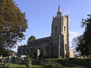
Burwell is a village and civil parish in Cambridgeshire, England, some 10 miles north-east of Cambridge. It lies on the south-east edge of the Fens. Westward drainage is improved by Cambridgeshire lodes (waterways), including Burwell Lode, a growth factor in the village. A population of 6,309 in the 2011 census was put at 6,417 in 2019.
Gamlingay is a village and civil parish in the South Cambridgeshire district of Cambridgeshire, England about 14 miles (23 km) west southwest of Cambridge.

Witcham is a small village near Ely in Cambridgeshire, England.

Fordham is a village in rural Cambridgeshire, England. Fordham is part of the East Cambridgeshire district. It is four miles north of Newmarket, as well as being close to the settlements of Soham, Burwell, Isleham, Mildenhall and Chippenham.

Reach is a small village and civil parish on the edge of the fenland in East Cambridgeshire, England at the north end of Devil's Dyke, about 1.5 miles (2.4 km) west of Burwell.
Caxton is a small rural village and civil parish in the South Cambridgeshire district of Cambridgeshire, England. It is 9 miles west of the county town of Cambridge. In 2001, the population of Caxton parish was 480 people, increasing to 572 at the 2011 Census. Caxton is most famous for the Caxton Gibbet.
Comberton is a village and civil parish in South Cambridgeshire, England, just east of the Prime Meridian.

Swaffham Prior is a small village in East Cambridgeshire, England.
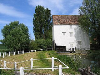
Lode is a small village in East Cambridgeshire on the southern edge of The Fens. It lies just north of the B1102 between Quy and Swaffham Bulbeck, 8 miles (13 km) to the north east of Cambridge.
Houghton is a village and former civil parish, now in the parish of Houghton and Wyton, in Cambridgeshire, England, approximately 3 miles (5 km) east of Huntingdon on the A1123 road, and south of RAF Wyton. It lies on the north bank of the River Great Ouse, by Houghton Mill.
Ashley is a village and civil parish in the East Cambridgeshire district of Cambridgeshire, England, about 4 miles (6.4 km) east of Newmarket. The modern village consists of the two ancient parishes of Ashley and Silverley. Ashley covers 2,250 acres (910 ha) and in the 2011 census had a population of 749. Ashley is in the electoral area of Cheveley ward.

Bainton is a village and civil parish in the Peterborough unitary authority area of Cambridgeshire, England. Bainton is on the southern edge of the Welland valley and lies 7.4 miles (11.9 km) north-west of Peterborough and 4 miles (6.4 km) east of Stamford. Ashton is a neighbouring hamlet and lies approximately 1 mile (1.6 km) south-east of Bainton within the same civil parish. At the time of the 2001 census, the parish's population was 305 people and by the 2011 census the parish's population was 290 people.
Cherry Hinton is a suburban area of the city of Cambridge, in the Cambridge district, in the county of Cambridgeshire, England. It is around 3 miles (4.8 km) southeast of the Cambridge city centre.

Dullingham is a small village and civil parish in East Cambridgeshire, England. It is situated 4 miles (6 km) south of Newmarket and 14 miles (23 km) east of Cambridge.

Stetchworth is a small village and civil parish in East Cambridgeshire, England, 3 miles (5 km) to the south of the horse-racing centre of Newmarket and around 12 miles (19 km) east of Cambridge.

Eltisley is a village and civil parish in South Cambridgeshire, England, on the A428 road about 5.5 miles (8.9 km) east of St Neots and about 11 miles (18 km) west of the city of Cambridge. The population in 2001 was 421 people, falling slightly to 401 at the 2011 Census.
Bourn is a small village and civil parish in South Cambridgeshire, England. Surrounding villages include Caxton, Eltisley and Cambourne. It is 8 miles (12 km) from the county town of Cambridge. The population of the parish was 1,015 at the time of the 2011 census.

Little Thetford is a small village in the civil parish of Thetford, 3 miles (5 km) south of Ely in Cambridgeshire, England, about 76 miles (122 km) by road from London. The village is built on a boulder clay island surrounded by flat fenland countryside, typical of settlements in this part of the East of England.

Hardwick is a village and civil parish in the county of Cambridgeshire, England with a large housing estate located about 6 miles (9.7 km) west of the city of Cambridge, England. The village lies immediately south of the A428 road between Cambridge and St Neots. It is about 4 miles (6.4 km) east of the newly developed town of Cambourne. The village is nearly on the Greenwich Meridian. The northern border of the village is St Neots Road, now largely bypassed by the A428, with no houses or property on the north side of the road. In the 2001 census, the population was 2,630 in 946 households, increasing to 2,670 in 1,017 households at the 2011 Census.

Westley Waterless is a small village and civil parish in East Cambridgeshire, England, 5 miles south west of Newmarket.


