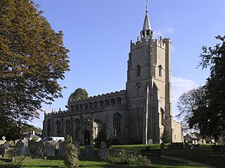
Burwell is a village and civil parish in Cambridgeshire, England, some 10 miles north-east of Cambridge. It lies on the south-east edge of the Fens. Westward drainage is improved by Cambridgeshire lodes (waterways), including Burwell Lode, a growth factor in the village. A population of 6,309 in the 2011 census was put at 6,417 in 2019.

Soham is a town and civil parish in the district of East Cambridgeshire, in Cambridgeshire, England, just off the A142 between Ely and Newmarket. Its population was 12,336 at the 2021 census.

Isleham is a village and civil parish in the English county of Cambridgeshire. It is part of the Fens. It has three pubs.

Fordham is a village in rural Cambridgeshire, England. Fordham is part of the East Cambridgeshire district. It is four miles north of Newmarket, as well as being close to the settlements of Soham, Burwell, Isleham, Mildenhall and Chippenham.
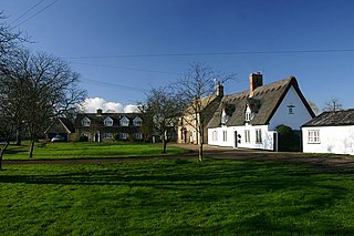
Wicken is a small village on the edge of The Fens near Soham in East Cambridgeshire, ten miles north east of Cambridge and five miles south of Ely. It is the site of Wicken Fen National Nature Reserve.
Swalcliffe is a village and civil parish about 5 miles (8 km) west of Banbury in Oxfordshire. The parish is about 2+1⁄2 miles (4 km) long north–south and about 1 mile (1.6 km) east–west. The 2011 Census recorded the population of the modern Swalcliffe parish as 210. The toponym "Swalcliffe" comes from the Old English swealwe and clif, meaning a slope or cliff frequented by swallows. The ancient parish of Swalcliffe was larger than the present civil parish, and included the townships of East Shutford, Epwell, Sibford Ferris, Sibford Gower and West Shutford.

Abbots Ripton is a village and civil parish in Cambridgeshire, England. Abbots Ripton is situated within Huntingdonshire which is a non-metropolitan district of Cambridgeshire as well as being an historic county of England. Abbots Ripton lies approximately 4 miles (6 km) north of Huntingdon on the B1090.
Benwick is a village and civil parish in the Fenland district of Cambridgeshire, England. It is approximately 15 miles (24 km) from Peterborough and 30 miles (48 km) from Cambridge. The population of Benwick was recorded as 1137 in the United Kingdom Census 2011 with 452 households. The River Nene passes through the village, which is thus accessible by boat from the inland waterways network in England.

Stretham is a village and civil parish 4 miles (6 km) south-south-west of Ely in Cambridgeshire, England, about 74 miles (119 km) by road from London. Its main attraction is Stretham Old Engine, a steam-powered pump used to drain the fens. The pump is still in use today although converted to electric power. It has open days throughout the year.

Croxton is a village and civil parish about 13 miles (21 km) west of Cambridge in South Cambridgeshire, England. In 2001, the resident population was 163 people, falling slightly to 160 at the 2011 Census. Croxton Park is to the south of the current village and contains a large house and parkland.
Manea is a village and civil parish in the District of Fenland, Isle of Ely, Cambridgeshire, England.
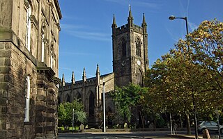
Stoke Minster is the Minster church of St Peter ad Vincula and main church in Stoke-upon-Trent, Staffordshire, England. Which is now the main church of the wider city of Stoke-on-Trent.

Witchford is a village and civil parish about 2.5 miles (4 km) west of Ely, Cambridgeshire, England. The 2011 Census recorded the parish's population as 2,385.

Little Thetford is a small village in the civil parish of Thetford, 3 miles (5 km) south of Ely in Cambridgeshire, England, about 76 miles (122 km) by road from London. The village is built on a boulder clay island surrounded by flat fenland countryside, typical of settlements in this part of the East of England.
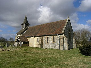
Colemore is a village and former civil parish, now in the parish of Colemore and Priors Dean, in the East Hampshire district, in the county of Hampshire, England. It is in the Hampshire Downs about 5 miles (8 km) northwest of Petersfield. In 1931 the parish had a population of 72. On 1 April 1932 the parish was abolished and merged with Priors Dean to form "Colemore and Priors Dean".

Ratley is a village in the civil parish of Ratley and Upton, Stratford-on-Avon District, Warwickshire, England. The population of the civil parish in 2011 was 327. It is on the northwest side of the Edge Hill escarpment about 200 metres (660 ft) above sea level. The village is close to the county border with north Oxfordshire, some 7 miles northwest of Banbury, the closest town.
Outwell is a village and civil parish in the borough of King's Lynn and West Norfolk, in the English county of Norfolk.
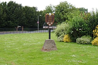
West Walton is a village and civil parish in the King's Lynn and West Norfolk District of Norfolk, England.

South Newington is a village and civil parish on the south bank of the River Swere in the Cotswold Hills in Oxfordshire, England, about 5 miles (8 km) southwest of Banbury. The 2011 Census recorded the parish's population as 285.

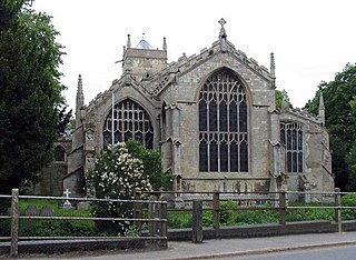
Ely is a cathedral city and civil parish in the East Cambridgeshire district of Cambridgeshire, England, about 14 miles (23 km) north-northeast of Cambridge and 80 miles (130 km) from London.


