Clay County is a county in the east central part of the U.S. state of Alabama. As of the 2020 census the population was 14,236. Its county seat is Ashland. Its name is in honor of Henry Clay, famous American statesman, member of the United States Senate from Kentucky and United States Secretary of State in the 19th century. It was the last dry county in Alabama with no wet cities within its boundaries, until a vote on March 1, 2016, approved the sale of alcohol in Lineville and Ashland.

Autauga County is a county located in the central portion of the U.S. state of Alabama. As of the 2020 census the population was 58,805. Its county seat is Prattville.

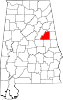
Lineville is a city in Clay County, Alabama, United States. At the 2020 census, the population was 2,489.

Wetumpka is a city in and the county seat of Elmore County, Alabama, United States. At the 2020 census, the population was 7,220. In the early 21st century Elmore County became one of the fastest-growing counties in the state. The city is considered part of the Montgomery Metropolitan Area.

The 16th Street Baptist Church is a Baptist church in Birmingham, Alabama, United States. In 1963, the church was bombed by Ku Klux Klan members. The bombing killed four young girls in the midst of the Civil Rights Movement. The church is still in operation and is a central landmark in the Birmingham Civil Rights District. It was designated as a National Historic Landmark in 2006. Since 2008, it has also been on the UNESCO list of tentative World Heritage Sites.
The Alabama Register of Landmarks and Heritage, commonly referred to as the Alabama Register, is an official listing of buildings, sites, structures, objects, and districts deemed worthy of preservation in the U.S. state of Alabama. These properties, which may be of national, state, and local significance, are designated by the Alabama Historical Commission. The designation is honorary and carries no direct restrictions or incentives. The register includes properties such as cemeteries, churches, moved properties, reconstructed properties, and properties at least 40 years old which may not normally qualify for listing in the National Register of Historic Places. There are approximately 1421 properties and districts listed on the Alabama Register. Of these, approximately 196 are also listed on the National Register of Historic Places and 5 are designated as National Historic Landmarks.

Dunlap's Creek Bridge was the first arch bridge in the United States built of cast iron. It was designed by Richard Delafield and built by the United States Army Corps of Engineers. Constructed from 1836 to 1839 on the National Road in Brownsville, Pennsylvania, it remains in use today. It is listed on the National Register of Historic Places and is a National Historic Civil Engineering Landmark (1978). It is located in the Brownsville Commercial Historic District and supports Market Street, the local main thoroughfare. Due to the steep sides of the Monongahela River valley, there is only room for two short streets parallel to the river's shore and graded mild enough to be comfortable to walk before the terrain rises too steeply for business traffic.

Barton Academy is a historic Greek Revival school building located on Government Street in Mobile, Alabama, United States. It was under construction from 1836 to 1839 and was designed by architects James H. Dakin, Charles B. Dakin, and James Gallier, Sr. Gallier and the Dakin brothers also designed the nearby Government Street Presbyterian Church. Barton Academy was the first public school in the state of Alabama.

Pleasant Hill is an unincorporated community in Dallas County, Alabama.

The Pleasant Hill Presbyterian Church, originally known as Mount Carmel Presbyterian Church, is a historic Greek Revival church in Pleasant Hill, Alabama. The current structure was built between 1851 and 1852. It features a distyle-in-antis type portico with simple box columns, a bell tower topped by a small domed cupola, and a second-floor balcony around three sides of the interior. It was placed on the Alabama Register of Landmarks and Heritage on the November 2, 1990 and on the National Register of Historic Places on April 22, 1999.
Tunnel Springs is an unincorporated community in Monroe County, Alabama, United States. It has one site listed on the Alabama Register of Landmarks and Heritage, the Old Scotland Presbyterian Church.

Mingo Creek Presbyterian Church and Churchyard is a church and historic location in Washington County, Pennsylvania. It is located at the junction of Pennsylvania Route 88 and Mingo Church Road in Union Township, Washington County, Pennsylvania, near Courtney, Pennsylvania. It is a member of the Washington Presbytery.

Valley Creek Presbyterian Church is a historic Presbyterian church in Valley Grande, Alabama, United States. The two-story red brick church building was built in the Greek Revival-style from 1857–1859. The sanctuary and a mezzanine level, formerly a slave gallery, are located on the upper floor. It was added to the National Register of Historic Places on May 28, 1976, due to its architectural significance.
Le Grand, also spelled as Legrand, is an unincorporated community in Montgomery County, Alabama, United States. Le Grand is located on U.S. Route 331, 15.8 miles (25.4 km) south of Montgomery. A post office operated under the name Legrand from 1883 to 1916.
Pintlala, also known as Pint Lala or Colquitt, is an unincorporated community in Montgomery County, Alabama, United States, located on U.S. Route 31, 15.6 miles (25.1 km) south of Montgomery.
Cleveland Crossroads, also known as Elias, is an unincorporated community in Clay County, Alabama, United States.
Edna is an unincorporated community in Choctaw County, Alabama, United States.
Burnsville, also known as Byrnville, is an unincorporated community in Dallas County, Alabama.
Pine Flat, also known as Dogwood Flat, is an unincorporated community in Butler County, Alabama, United States, located on Alabama State Route 10.