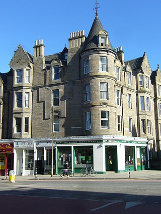
Marchmont is a mainly residential area of Edinburgh, Scotland. It lies roughly one mile to the south of the Old Town, separated from it by The Meadows and Bruntsfield Links. To the west it is bounded by Bruntsfield; to the south-southwest by Greenhill and then Morningside; to the south-southeast by The Grange; and to the east by Sciennes.

Murrayfield is an area to the west of Edinburgh city centre in Scotland. It is to the east of Corstorphine and north of Balgreen, Saughtonhall and Roseburn. The A8 road runs east–west through the south of the area. Murrayfield is often considered to include the smaller neighbouring areas of Ravelston and Roseburn.
Bruntsfield is a largely residential area around Bruntsfield Place in Southern Edinburgh, Scotland. In feudal times, it fell within the barony of Colinton.
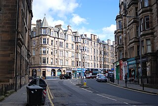
Sciennes is a district of Edinburgh, Scotland, situated approximately 2 kilometres south of the city centre. It is a mainly residential district, although it is also well-known as the site of the former Royal Hospital for Sick Children. Most of its housing stock consists of terraces of four-storey Victorian tenements. The district is popular with students, thanks to its proximity to the University of Edinburgh. Its early history is linked to the presence in the area of the 16th-century Convent of St Catherine of Scienna, from which the district derives its name.
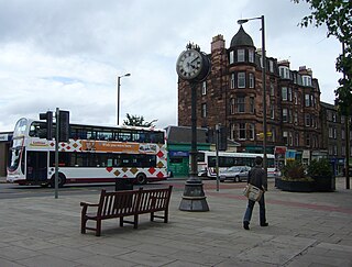
Morningside is a district and former village in the south of Edinburgh, Scotland. It lies alongside the main arterial Morningside Road, part of an ancient route from Edinburgh to the south west of Scotland. The original village served several farms and estates in the area. In the 19th century, it developed as a residential suburb, its growth being stimulated by the arrival of a railway service and other transport improvements.
Merchiston is a residential area around Merchiston Avenue in the south-west of Edinburgh, Scotland.

Holy Corner is a colloquial name for a small area of Edinburgh, Scotland, and is part of the area more properly known as Burghmuirhead, itself part of the lands of Greenhill. Holy Corner lies between the areas of Bruntsfield and Morningside.

South Gyle is an area of Edinburgh, Scotland, lying on the western edge of the city and to the south and west of an area of former marshland once known as the Gogarloch, on the edge of Corstorphine. Most of the buildings in the area are of recent origin, dating from the later 1980s, 1990s, and early 21st century, with the exception of some farm workers' cottages and an early 1970s council estate abutting South Gyle railway station.
Tollcross is a major road junction to the south west of the city centre of Edinburgh, Scotland which takes its name from a local historical land area.

Stanecastle was a medieval barony and estate in North Ayrshire, Scotland, first mentioned in 1363 and now part of the Irvine New Town project. Its nearest neighbours are Bourtreehill and Girdle Toll.
Cammo is a northwestern suburb of Edinburgh, the capital of Scotland. It is south of A90, at the edge of the city, approximately 6 miles from the city centre.

Greenhill is a small area of Edinburgh, the capital of Scotland. Situated south of the city centre, Greenhill is normally taken to be part of Bruntsfield, which skirts it to the north. Greenhill borders Marchmont and The Grange to the east, Morningside to the south, and Merchiston, beyond Holy Corner, to the west. It comprises a mixture of Georgian and Victorian villas and some tenement housing.
Ravelston is an area of Edinburgh, Scotland, to the west of the city centre, the east of Corstorphine and Clermiston, the north of Murrayfield, West End and Roseburn and to the south of Queensferry Road. Ravelston is often considered to be part of the larger neighbouring area of Murrayfield.

Church Hill is a street and small surrounding area in Edinburgh, Scotland.
Hunter's Tryst is the name of a long-established inn in Edinburgh, Scotland; it has lent its name to the surrounding area, near Fairmilehead.
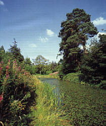
Bruntsfield Links is 35 acres (14 ha) of open parkland in Bruntsfield, Edinburgh, immediately to the south-west of the adjoining Meadows.
The Burgh Muir is the historic term for an extensive area of land lying to the south of Edinburgh city centre, upon which much of the southern part of the city now stands following its gradual spread and more especially its rapid expansion in the late 18th and 19th centuries. The name has been retained today in the partly anglicised form Boroughmuir for a much smaller district within Bruntsfield, vaguely defined by the presence of Boroughmuir High School, and, until 2010, Boroughmuirhead post office in its north-west corner.
Hibernian Park was the home ground of the Scottish football club Hibernian from 1880 until the club's dissolution in 1891. When the club was reformed in 1892, the club took out on a lease on a site which became known as Easter Road. Hibernian Park was also located in the Easter Road area; in fact, it was closer to Easter Road itself than the present stadium because it was on the site of what is now Bothwell Street.
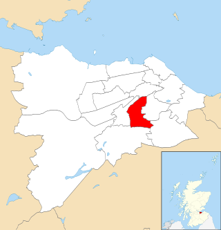
Morningside is one of the seventeen wards used to elect members of the City of Edinburgh Council. Established in 2007 along with the other wards, it elects four Councillors. As its name suggests, the ward's territory is based around the community of Morningside to the south of the city centre, also including Braid Hills, Bruntsfield, Burghmuirhead, Greenbank, Greenhill, Marchmont, Merchiston and Polwarth.

