
This page lists residential areas of Edinburgh situated in the Edinburgh (settlement) urban area. The urban area of Edinburgh, the capital of Scotland, is located in the City of Edinburgh council area and in East Lothian. The City of Edinburgh council area is divided into wards areas that are combined into four operational management areas termed "localities":

Murrayfield is an area to the west of Edinburgh city centre in Scotland. It is to the east of Corstorphine and north of Balgreen, Saughtonhall and Roseburn. The A8 road runs east–west through the south of the area. Murrayfield is often considered to include the smaller neighbouring areas of Ravelston and Roseburn.

Edinburgh West was a constituency of the Scottish Parliament (Holyrood) from 1999 until 2011. It elected one Member of the Scottish Parliament (MSP) by the plurality method of election. It was also one of nine constituencies in the Lothians electoral region, which elected seven additional members, in addition to nine constituency MSPs, to produce a form of proportional representation for the region as a whole.
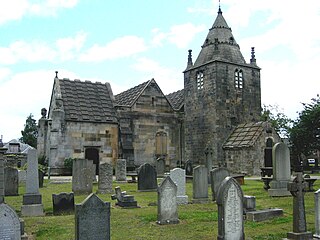
Corstorphine is an area of the Scottish capital city of Edinburgh. Formerly a separate village and parish to the west of Edinburgh, it is now a suburb of the city, having been formally incorporated into it in 1920.
Sighthill is a suburb in the west of Edinburgh, Scotland. The area is bordered by Broomhouse and Parkhead to the east, South Gyle to the north, the industrial suburb of Bankhead and the Calders neighbourhood to the west, and Wester Hailes to the south. It is sometimes included in the Wester Hailes area, while the Calders, Bankhead and Parkhead are sometimes considered parts of Sighthill. Administratively it has formed a core part of the City of Edinburgh Council's Sighthill/Gorgie ward since 2007.

South Gyle is an area of Edinburgh, Scotland, lying on the western edge of the city and to the south and west of an area of former marshland once known as the Gogarloch, on the edge of Corstorphine. Most of the buildings in the area are of recent origin, dating from the later 1980s, 1990s, and early 21st century, with the exception of some farm workers' cottages and an early 1970s council estate abutting South Gyle railway station.

Craigmount High School is a non-denominational secondary school in Edinburgh, Scotland with 1,269 pupils located in the west of Edinburgh, Scotland. It is situated between Corstorphine, East Craigs and Drumbrae and it moved into new premises at the beginning of the 2003 academic year. In April 2016, the new building was closed down by Edinburgh Council due to safety concerns; measures were put in place to continue classes in other premises. The new building reopened as of August 2016 when the building met the minimum safety standards.
Gogarloch is a residential area within South Gyle, Edinburgh, Scotland. It lies near South Gyle railway station and South Gyle Broadway, 4+1⁄2 miles (7.2 km) west of the city centre. Corstorphine and Wester Broom are nearby.
Drumbrae or Drum Brae is the name of a suburb of west Edinburgh, Scotland generally considered to be part of the neighbouring larger areas of Corstorphine and Clermiston. This is a commuter settlement as many people who live in the area travel to the centre of town to attend work.

Maybury is an area on the western edge of Edinburgh, Scotland, near South Gyle and Ingliston, named after the road, which is itself named after the civil engineer Sir Henry Maybury (1864–1943). In 2021, residents have been undertaking community clean ups to clear the foot paths along the road. The area is residential in the north east/east and commercial in the south and west and The Gyle Shopping Centre is nearby. In 2021, there was a consultation about creating a Primary School and Health Centre in Maybury.

The Gyle Shopping Centre is a shopping center located in the South Gyle area of Edinburgh, Scotland. The main centre has two anchor tenants, Marks & Spencer and Morrisons, at opposite ends of the shopping centre.
Bughtlin is a suburb of Edinburgh, the capital of Scotland. It is east of the A902.

Clermiston is a suburb of Edinburgh, Scotland, to the west of the city and to the immediate north of Corstorphine, on the western slopes of Corstorphine Hill. Clermiston estate, built from 1954 onwards, was part of a major 1950s house-building programme to tackle overcrowding in Leith and Gorgie. The area is now home to more than 20,000 people, and abuts onto Drumbrae, Clerwood and Corstorphine.

Ingliston is an area in the west of Edinburgh, near Maybury, South Gyle and Newbridge.

Newbridge is a village in the civil parish of Kirkliston, west of Edinburgh in Scotland. It formerly lay on the western fringe of Midlothian, but it has belonged to the City of Edinburgh since 1975. The original village consists of a small crossroads settlement to the east of the eponymous New Bridge, which spans the River Almond. Around it is a confusion of roads and industrial estates converging on the Newbridge Roundabout, the meeting point of the M8 and M9 motorways.
West Craigs is the name given to two separate areas of Scotland:

Edinburgh Gateway station is a railway station and interchange at Gogar in Edinburgh, Scotland, which opened on 11 December 2016. It is served by ScotRail and Edinburgh Trams, and serves both Gogar and Edinburgh Airport, to which it is connected by the tram line.

Larkfield is a village in Kent, part of the civil parish of East Malling and Larkfield in the borough of Tonbridge and Malling. Of the two parts of the parish, Larkfield is much more built-up, lying on and north of the main A20 road. The M20 motorway also passes through, with junction 4 residing at the centre of Leybourne on the A228.

Drum Brae/Gyle is one of the seventeen wards used to elect members of the City of Edinburgh Council. Established in 2007 along with the other wards, it currently elects three Councillors.


