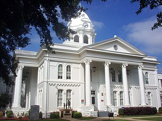
Colbert County is a county located in the northwestern part of the U.S. state of Alabama. As of the 2020 census the county's population was 57,227. The county seat is Tuscumbia. The largest city is Muscle Shoals.

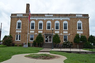
Lauderdale County is a county located in the northwestern corner of the U.S. state of Alabama. At the 2020 census the population was 93,564. Its county seat is Florence. Its name is in honor of Colonel James Lauderdale, of Tennessee. Lauderdale is part of the Florence-Muscle Shoals, AL Metropolitan Statistical Area, also known as "The Shoals".

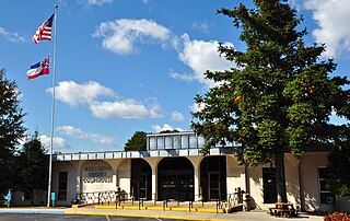
Hickman County is a county located in the U.S. state of Tennessee. As of the 2020 Census, the population was 24,925. Its county seat is Centerville. As of 2023, Hickman County is part of the Nashville–Davidson–Murfreesboro–Franklin, TN Metropolitan Statistical Area, although it was once removed in 2018.

The Chickasaw are an Indigenous people of the Southeastern Woodlands, United States. Their traditional territory was in northern Mississippi, northwestern and northern Alabama, western Tennessee and southwestern Kentucky. Their language is classified as a member of the Muskogean language family. In the present day, they are organized as the federally recognized Chickasaw Nation.

Tishomingo County is a county located in the northeastern corner of the U.S. state of Mississippi. As of the 2020 census, the population was 18,850. Its county seat is Iuka.

Cherokee is a town in west Colbert County, Alabama, United States. Located near the Tennessee River, it is part of the Florence–Muscle Shoals metropolitan area, known as "The Shoals". As of the 2010 census, the population of the town was 1,048.

Muscle Shoals is the largest city in Colbert County, Alabama, United States. It is located on the left bank of the Tennessee River in the northern part of the state and, as of the 2010 census, its population was 13,146. The estimated population in 2019 was 14,575.

The Natchez Trace, also known as the Old Natchez Trace, is a historic forest trail within the United States which extends roughly 440 miles (710 km) from Nashville, Tennessee, to Natchez, Mississippi, linking the Cumberland, Tennessee, and Mississippi rivers.

The Tennessee River is the largest tributary of the Ohio River. It is approximately 652 miles (1,049 km) long and is located in the southeastern United States in the Tennessee Valley. The river was once popularly known as the Cherokee River, among other names, as the Cherokee people had their homelands along its banks, especially in what are now East Tennessee and northern Alabama. Additionally, its tributary, the Little Tennessee River, flows into it from Western North Carolina and northeastern Georgia, where the river also was bordered by numerous Cherokee towns. Its current name is derived from the Cherokee town, Tanasi, which was located on the Tennessee side of the Appalachian Mountains.

The Natchez Trace Parkway is a national parkway in the Southeastern United States that commemorates the historic Natchez Trace and preserves sections of that original trail. Its central feature is a two-lane road that extends 444 miles (715 km) from Natchez, Mississippi, to Nashville, Tennessee. Access to the parkway is limited, with more than 50 access points in Mississippi, Alabama, and Tennessee. The southern end of the route is in Natchez at its intersection with Liberty Road, and the northern end is northeast of Fairview, Tennessee, in the suburban community of Pasquo, at an intersection with Tennessee State Route 100. In addition to Natchez and Nashville, larger cities along the route include Jackson and Tupelo, Mississippi, and Florence, Alabama.

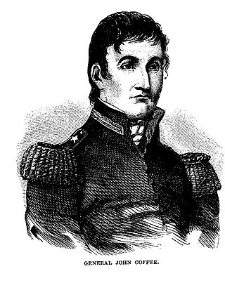
John R. Coffee was an American planter of English descent, and a state militia brigadier general in Tennessee. He commanded troops under General Andrew Jackson during the Creek Wars (1813–14) and during the Battle of New Orleans in the War of 1812.
Levi Colbert was an early 19th-century Chickasaw leader and the namesake of Itawamba County, Mississippi.

Barton Hall, also known as the Cunningham Plantation, is an antebellum plantation house near present-day Cherokee, Alabama. Built in 1840, it is a stylistically rare example of Greek Revival architecture in Alabama, with elements from the late Federal period. The house was designated a National Historic Landmark in 1973 for its architecture.

George Colbert was an early 19th-century Chickasaw leader. During the Creek War he commanded 350 Chickasaw auxiliary troops whom he had recruited, as a senior officer of militia, under Andrew Jackson. At the end of the War of 1812, he served a second time under Jackson.

Allsboro is a populated place in Colbert County, Alabama, United States. This unincorporated community is located in the far western area of the county, about 9 miles (14 km) southwest of the town of Cherokee, near the Mississippi state border.
Seven segments of the historic Natchez Trace are listed on the National Register of Historic Places (NRHP). Also there are additional NRHP-listed structures and other sites along the Natchez Trace, which served the travelers of the trace and survive from the era of its active use.
Buzzard Roost may refer to:

Pigeon Roost is a ghost town in Choctaw County, Mississippi.
John Gordon, was an American pioneer, Indian trader, planter, and militia captain in several Indian wars. Part of the post-Revolutionary War settlement of the trans-Appalachian frontier, Gordon was an early settler in the Nashville, Tennessee area. He gained notability and rank in the Tennessee Militia, fighting against the Creeks and Seminoles for Andrew Jackson, during the War of 1812. Jackson referred to him as his "Captain of the Spies."


