National Register of Historic Places listings in Colbert County, Alabama

Last updated

Location of Colbert County in Alabama Map of Alabama highlighting Colbert County.svg
Location of Colbert County in Alabama

This is a list of the National Register of Historic Places listings in Colbert County, Alabama.

Contents

This is intended to be a complete list of the properties and districts on the National Register of Historic Places in Colbert County, Alabama, United States. Latitude and longitude coordinates are provided for many National Register properties and districts; these locations may be seen together in an online map. [1]

There are 30 properties and districts listed on the National Register in the county, including 3 National Historic Landmarks.


    This National Park Service list is complete through NPS recent listings posted March 15, 2024. [2]

Current listings

[3] Name on the RegisterImageDate listed [4] Location City or townDescription
1 Barton Hall
Barton Hall Barton Hall Apr 2017 02.jpg
Barton Hall
November 7, 1973
(#73000337)
2.5 miles (4 km) west of Cherokee on U.S. Route 72
34°45′09″N88°00′12″W / 34.7525°N 88.003333°W / 34.7525; -88.003333 (Barton Hall)
Cherokee
2 Belle Mont
Belle Mont Belle Mont.jpg
Belle Mont
February 23, 1982
(#82002003)
Southeast of Tuscumbia
34°39′42″N87°40′01″W / 34.661667°N 87.666944°W / 34.661667; -87.666944 (Belle Mont)
Tuscumbia
3 Buzzard Roost
Buzzard Roost Buzzard Roost Spring.jpg
Buzzard Roost
November 7, 1976
(#76000157)
3 miles west of Cherokee on U.S. Route 72
34°45′37″N88°01′24″W / 34.760278°N 88.023333°W / 34.760278; -88.023333 (Buzzard Roost)
Cherokee
4 Clyde Carter House
Clyde Carter House Clyde Carter House Apr 2017 01.jpg
Clyde Carter House
June 2, 2004
(#04000559)
300 Lime Kiln Rd.
34°47′25″N87°31′41″W / 34.79016°N 87.52808°W / 34.79016; -87.52808 (Clyde Carter House)
Ford City
5 Chambers-Robinson House
Chambers-Robinson House Chambers-Robinson House 2012-09-29 17-19-50.jpg
Chambers-Robinson House
May 14, 1993
(#93000419)
910 Montgomery Ave.
34°46′04″N87°41′53″W / 34.767639°N 87.698056°W / 34.767639; -87.698056 (Chambers-Robinson House)
Sheffield
6 John and Archibald Christian House
John and Archibald Christian House FRONT VIEW. - Governor Robert Lindsay House, U.S. Highway 72, Tuscumbia, Colbert County, AL HABS ALA,17-TUSM,1-1.tif
John and Archibald Christian House
February 4, 1982
(#82002004)
Off U.S. Route 72
34°43′05″N87°42′14″W / 34.718056°N 87.703889°W / 34.718056; -87.703889 (John and Archibald Christian House)
Tuscumbia
7 Colbert County Courthouse Square Historic District
Colbert County Courthouse Square Historic District Colbert County Courthouse.JPG
Colbert County Courthouse Square Historic District
May 24, 1973
(#73000338)
Roughly bounded by E. and W. 2nd, N. and S. Cave, E. and W. 6th, and N. and S. Indian Sts.
34°44′02″N87°42′15″W / 34.733889°N 87.704167°W / 34.733889; -87.704167 (Colbert County Courthouse Square Historic District)
Tuscumbia
8 Easterwood House
Easterwood House Easterwood House.jpg
Easterwood House
January 31, 2019
(#100003107)
200 Easterwood St.
34°45′19″N87°57′52″W / 34.7554°N 87.9644°W / 34.7554; -87.9644 (Easterwood House)
Cherokee
9 Florence, Alabama Music Enterprises (FAME) Recording Studios
Florence, Alabama Music Enterprises (FAME) Recording Studios FAME Recording Studios Muscle Shoals.jpg
Florence, Alabama Music Enterprises (FAME) Recording Studios
November 29, 2016
(#16000397)
603 Avalon Ave.
34°44′42″N87°40′00″W / 34.74506°N 87.66667°W / 34.74506; -87.66667 (Florence, Alabama Music Enterprises (FAME) Recording Studios)
Muscle Shoals
10 Ivy Green
Ivy Green Ivy Green.jpg
Ivy Green
August 25, 1970
(#70000101)
300 W. North Common
34°44′21″N87°42′23″W / 34.739167°N 87.706389°W / 34.739167; -87.706389 (Ivy Green)
Tuscumbia
11 Johnson's Woods
Johnson's Woods FRONT (SOUTH) AND EAST SIDE - G. W. Carroll House, 801 East North Commons, Tuscumbia, Colbert County, AL HABS ALA,17-TUSM,8-2.tif
Johnson's Woods
May 4, 1988
(#88000511)
801 E. North Commons
34°44′26″N87°41′35″W / 34.740556°N 87.693056°W / 34.740556; -87.693056 (Johnson's Woods)
Tuscumbia
12 John Johnson House July 9, 1986
(#86001537)
Near the junction of Fosters Mill and River Rds.
34°46′04″N87°27′15″W / 34.767778°N 87.454167°W / 34.767778; -87.454167 (John Johnson House)
Leighton
13 La Grange Rock Shelter June 13, 1974
(#74000406)
Address Restricted
Leighton
14 Muscle Shoals Sound Studio
Muscle Shoals Sound Studio 3614 Jackson Highway September 2007.jpg
Muscle Shoals Sound Studio
June 2, 2006
(#06000437)
3614 Jackson Highway
34°46′05″N87°40′27″W / 34.767944°N 87.674167°W / 34.767944; -87.674167 (Muscle Shoals Sound Studio)
Sheffield
15 E.L. Newman Lustron House
E.L. Newman Lustron House E- L- Newman Lustron House 2012-09-29 17-12-07.jpg
E.L. Newman Lustron House
February 24, 2000
(#00000134)
1406 34th St.
34°46′14″N87°40′49″W / 34.770556°N 87.680278°W / 34.770556; -87.680278 (E.L. Newman Lustron House)
Sheffield
16 Nitrate Village No. 1 Historic District
Nitrate Village No. 1 Historic District 102 & 100 Pickwick St Sheffield Apr 2017.jpg
Nitrate Village No. 1 Historic District
August 30, 1984
(#84000603)
Roughly bounded by Wilson Dam Circle, Wheeler and Wilson Dam Aves., Fontana, and Pickwick Sts.
34°44′32″N87°43′14″W / 34.742222°N 87.720556°W / 34.742222; -87.720556 (Nitrate Village No. 1 Historic District)
Sheffield
17 Felix Grundy Norman House
Felix Grundy Norman House Felix Grundy Norman House.jpg
Felix Grundy Norman House
April 12, 1984
(#84000749)
401 N. Main St.
34°44′08″N87°42′14″W / 34.735556°N 87.703889°W / 34.735556; -87.703889 (Felix Grundy Norman House)
Tuscumbia
18 The Oaks
The Oaks The Oaks, Ricks Lane, Leighton (Colbert County, Alabama).jpg
The Oaks
November 7, 1976
(#76000319)
Southeast of Tuscumbia off State Route 157 on Ricks Lane
34°40′27″N87°35′36″W / 34.674167°N 87.593333°W / 34.674167; -87.593333 (The Oaks)
Tuscumbia
19 Old Brick Presbyterian Church
Old Brick Presbyterian Church Old Brick Presbyterian Church 2012-09-29 18-06-32.jpg
Old Brick Presbyterian Church
January 9, 1989
(#88003078)
Old Brick Rd., north of Leighton
34°46′14″N87°31′28″W / 34.770556°N 87.524444°W / 34.770556; -87.524444 (Old Brick Presbyterian Church)
Leighton
20 Preuit Oaks
Preuit Oaks Preuit Oaks Apr 2017.jpg
Preuit Oaks
May 8, 1986
(#86000997)
Cotton Town Rd.
34°40′26″N87°30′35″W / 34.67381°N 87.50974°W / 34.67381; -87.50974 (Preuit Oaks)
Leighton
21 John Daniel Rather House
John Daniel Rather House John Daniel Rather House, 209 South Cave Street, Tuscumbia (Colbert County, Alabama).jpg
John Daniel Rather House
December 16, 1982
(#82001603)
209 S. Cave St.
34°43′50″N87°41′56″W / 34.730556°N 87.698889°W / 34.730556; -87.698889 (John Daniel Rather House)
Tuscumbia
22 Rock Creek Archeological District (ACt44, ACt45) June 26, 1990
(#88003068)
Address Restricted
Maud
23 St. John's Episcopal Church
St. John's Episcopal Church Tuscumbia St. John's ECUSA, former.jpg
St. John's Episcopal Church
November 13, 2018
(#100001876)
300 N. Dickson St.
34°44′04″N87°42′07″W / 34.734583°N 87.701944°W / 34.734583; -87.701944 (St. John's Episcopal Church)
Tuscumbia
24 Seven Mile Island Archeological District April 16, 1979
(#79003352)
Address Restricted
Sheffield
25 Sheffield Downtown Commercial Historic District
Sheffield Downtown Commercial Historic District Sheffield Downtown Commercial Historic District 2012-09-30 12-35-17.jpg
Sheffield Downtown Commercial Historic District
May 24, 2010
(#10000271)
1st and 5th Sts. and Pittsburgh and Columbia Aves.
34°45′39″N87°41′59″W / 34.760875°N 87.699719°W / 34.760875; -87.699719 (Sheffield Downtown Commercial Historic District)
Sheffield
26 Sheffield Residential Historic District
Sheffield Residential Historic District Sheffield Residential Historic District 2012-09-29 17-20-31.jpg
Sheffield Residential Historic District
May 16, 2002
(#02000481)
Roughly bounded by Riverside Pike, River Bluff Dr., Wood, 3rd, and 2nd Sts., 15th Ave., 27th St., and 19th Ave.
34°45′56″N87°41′51″W / 34.765556°N 87.697500°W / 34.765556; -87.697500 (Sheffield Residential Historic District)
Sheffield
27 Tuscumbia Historic District
Tuscumbia Historic District First Baptist Church of Tuscumbia, former building.jpg
Tuscumbia Historic District
May 23, 1985
(#85001158)
Roughly bounded by N. and E. Commons, 8th St. and Spring Rd., Hooks, W. 5th and S. Milton, including Steel Bridge
34°43′59″N87°42′07″W / 34.733056°N 87.701944°W / 34.733056; -87.701944 (Tuscumbia Historic District)
Tuscumbia
28 Tuscumbia Landing Site
Tuscumbia Landing Site A foggy morning at Tuscumbia Landing Site near Sheffield, Alabama (6a61ab90-7897-4777-bb8f-193eb8c00b3f).JPG
Tuscumbia Landing Site
June 10, 1982
(#82002002)
West of Sheffield
34°44′56″N87°43′31″W / 34.748889°N 87.725278°W / 34.748889; -87.725278 (Tuscumbia Landing Site)
Sheffield
29 Wilson Dam
Wilson Dam USACE Wilson Lock and Dam.jpg
Wilson Dam
November 13, 1966
(#66000147)
On the Tennessee River along State Route 133
34°48′04″N87°37′38″W / 34.801111°N 87.627222°W / 34.801111; -87.627222 (Wilson Dam)
Florence Extends into Lauderdale County
30 William Winston House
William Winston House William Winston House, North Commons Street, Tuscumbia (Colbert County, Alabama).jpg
William Winston House
April 15, 1982
(#82002005)
N. Commons St.
34°44′18″N87°42′04″W / 34.738333°N 87.701111°W / 34.738333; -87.701111 (William Winston House)
Tuscumbia

See also

Related Research Articles

<span class="mw-page-title-main">National Register of Historic Places listings in Barbour County, Alabama</span>

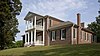
This is a list of the National Register of Historic Places listings in Barbour County, Alabama.

<span class="mw-page-title-main">National Register of Historic Places listings in Butler County, Alabama</span>

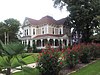
This is a list of the National Register of Historic Places listings in Butler County, Alabama.

<span class="mw-page-title-main">National Register of Historic Places listings in Calhoun County, Alabama</span>

This is a list of the National Register of Historic Places listings in Calhoun County, Alabama.

<span class="mw-page-title-main">National Register of Historic Places listings in Clarke County, Alabama</span>

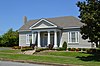
This is a list of the National Register of Historic Places listings in Clarke County, Alabama.

<span class="mw-page-title-main">National Register of Historic Places listings in Dallas County, Alabama</span>

This is a list of the National Register of Historic Places listings in Dallas County, Alabama.

<span class="mw-page-title-main">National Register of Historic Places listings in Elmore County, Alabama</span>

This is a list of the National Register of Historic Places listings in Elmore County, Alabama.

<span class="mw-page-title-main">National Register of Historic Places listings in Etowah County, Alabama</span>

This is a list of the National Register of Historic Places listings in Etowah County, Alabama.

<span class="mw-page-title-main">National Register of Historic Places listings in Hale County, Alabama</span>

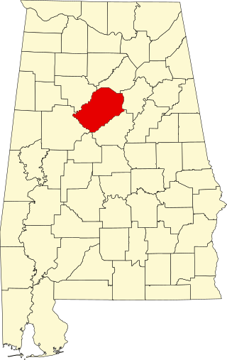
This is a list of the National Register of Historic Places listings in Hale County, Alabama.

<span class="mw-page-title-main">National Register of Historic Places listings in Jackson County, Alabama</span>

This is a list of the National Register of Historic Places listings in Jackson County, Alabama.

<span class="mw-page-title-main">National Register of Historic Places listings in Jefferson County, Alabama</span>

This is intended to be a complete list of the properties and districts on the National Register of Historic Places in Jefferson County, Alabama, United States. Latitude and longitude coordinates are provided for many National Register properties and districts; these locations may be seen together in an online map.

<span class="mw-page-title-main">National Register of Historic Places listings in Lee County, Alabama</span>

This is a list of the National Register of Historic Places listings in Lee County, Alabama.

<span class="mw-page-title-main">National Register of Historic Places listings in Macon County, Alabama</span>

This is a list of the National Register of Historic Places listings in Macon County, Alabama.

<span class="mw-page-title-main">National Register of Historic Places listings in Marengo County, Alabama</span>

This is a list of the National Register of Historic Places listings in Marengo County, Alabama.

<span class="mw-page-title-main">National Register of Historic Places listings in Marshall County, Alabama</span>

This is a list of the National Register of Historic Places listings in Marshall County, Alabama.

<span class="mw-page-title-main">National Register of Historic Places listings in Montgomery County, Alabama</span>

This is a list of the National Register of Historic Places listings in Montgomery County, Alabama.

<span class="mw-page-title-main">National Register of Historic Places listings in Perry County, Alabama</span>

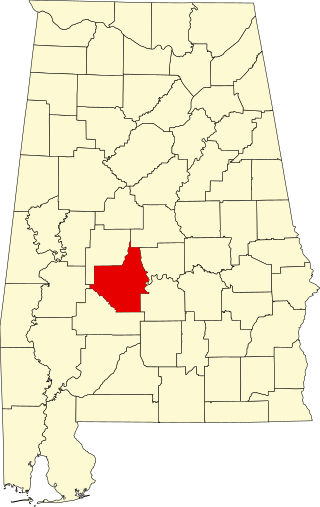
This is a list of the National Register of Historic Places listings in Perry County, Alabama.

<span class="mw-page-title-main">National Register of Historic Places listings in Russell County, Alabama</span>

This is a list of the National Register of Historic Places listings in Russell County, Alabama.

<span class="mw-page-title-main">National Register of Historic Places listings in St. Clair County, Alabama</span>

This is a list of the National Register of Historic Places listings in St. Clair County, Alabama.

<span class="mw-page-title-main">National Register of Historic Places listings in Sumter County, Alabama</span>

This is a list of the National Register of Historic Places listings in Sumter County, Alabama.

<span class="mw-page-title-main">National Register of Historic Places listings in Talladega County, Alabama</span>

This is a list of the National Register of Historic Places listings in Talladega County, Alabama.

References

  1. The latitude and longitude information provided in this table was derived originally from the National Register Information System, which has been found to be fairly accurate for about 99% of listings. Some locations in this table may have been corrected to current GPS standards.
  2. National Park Service, United States Department of the Interior, "National Register of Historic Places: Weekly List Actions", retrieved March 15, 2024.
  3. Numbers represent an alphabetical ordering by significant words. Various colorings, defined here, differentiate National Historic Landmarks and historic districts from other NRHP buildings, structures, sites or objects.
  4. The eight-digit number below each date is the number assigned to each location in the National Register Information System database, which can be viewed by clicking the number.