Byromville, Georgia

Last updated

Byromville, Georgia
Byromville city limit, GA90NB.JPG
Byromville city limit on GA90
Dooly County Georgia Incorporated and Unincorporated areas Byromville Highlighted.svg
Location in Dooly County and the state of Georgia
Coordinates: 32°12′5″N83°54′29″W / 32.20139°N 83.90806°W / 32.20139; -83.90806
Country United States
State Georgia
County Dooly
Area
[1]
  Total0.36 sq mi (0.94 km2)
  Land0.36 sq mi (0.94 km2)
  Water0.00 sq mi (0.00 km2)
Elevation
381 ft (116 m)
Population
 (2020)
  Total422
  Density1,165.75/sq mi (450.17/km2)
Time zone UTC-5 (Eastern (EST))
  Summer (DST) UTC-4 (EDT)
ZIP code
31007
Area code 478
FIPS code 13-12232 [2]
GNIS feature ID0354929 [3]

Byromville is a town in Dooly County, Georgia, United States. The population was 546 at the 2010 census, [4] up from 415 in 2000. In 2020, its population was 422.

Contents

History

The Georgia General Assembly incorporated the Town of Byromville in 1905. [5] The town was named in honor of early resident William H. Byrom. [6]

Geography

Byromville is located in northwestern Dooly County at 32°12′5″N83°54′29″W / 32.20139°N 83.90806°W / 32.20139; -83.90806 (32.201496, -83.908028). [7] Georgia State Route 90 passes through the center of town, leading southeast 11 miles (18 km) to Vienna, the county seat, and northwest 10 miles (16 km) to Montezuma. SR 230 leads northeast from Byromville 12 miles (19 km) to Unadilla and southwest 10 miles (16 km) to SR 27 at Drayton.

According to the United States Census Bureau, the town has a total area of 0.94 square kilometres (0.36 sq mi), all land. [4]

Demographics

Historical population
CensusPop.Note
1910 300
1920 41438.0%
1930 315−23.9%
1940 275−12.7%
1950 2884.7%
1960 34921.2%
1970 41920.1%
1980 56735.3%
1990 452−20.3%
2000 415−8.2%
2010 54631.6%
2020 422−22.7%
2023 (est.)335 [8] −20.6%
U.S. Decennial Census [9]
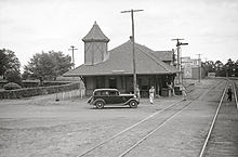
Byromville train station circa 1939 Station Byromville Georgia LOC fsa 8a03451.jpg
Byromville train station circa 1939
Byromville town, Georgia – Racial and Ethnic Composition
(NH = Non-Hispanic)
Note: the US Census treats Hispanic/Latino as an ethnic category. This table excludes Latinos from the racial categories and assigns them to a separate category. Hispanics/Latinos may be of any race.
Race / EthnicityPop 2010 [10] Pop 2020 [11] % 2010% 2020
White alone (NH)19917036.45%40.28%
Black or African American alone (NH)26920249.27%47.87%
Native American or Alaska Native alone (NH)000.00%0.00%
Asian alone (NH)120.18%0.47%
Pacific Islander alone (NH)000.00%0.00%
Some Other Race alone (NH)000.00%0.00%
Mixed Race/Multi-Racial (NH)180.18%1.90%
Hispanic or Latino (any race)764013.92%9.48%
Total546422100.00%100.00%

Arts and culture

Byromville is host to the annual Turkey Creek Festival. [12]

Related Research Articles

<span class="mw-page-title-main">Dooly County, Georgia</span> County in Georgia, United States

Dooly County is a county located in the central portion of the U.S. state of Georgia. As of the 2020 census, the population was 11,208. The county seat is Vienna. The county was created by an act of the Georgia General Assembly on May 15, 1821, and named for Colonel John Dooly, a Georgia American Revolutionary War fighter. It was one of the original landlot counties created from land ceded from the Creek Nation.
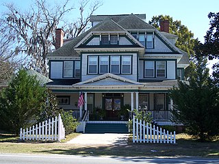
<span class="mw-page-title-main">Greenville, Florida</span> Town in the state of Florida, United States

Greenville is a town in Madison County, Florida, United States. The population was 746 at the 2020 census, down from 843 at the 2010 census.
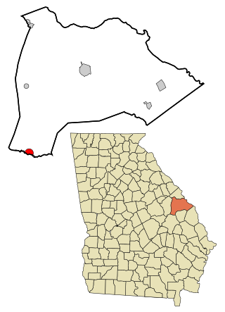
<span class="mw-page-title-main">Midville, Georgia</span> City in Georgia, United States

Midville is a city in Burke County, Georgia, United States. The population was 269 at the 2010 census, and 385 in 2020. It is part of the Augusta, Georgia metropolitan area.

<span class="mw-page-title-main">Edison, Georgia</span> City in Georgia, United States

Edison is a city in Calhoun County, Georgia, United States. Per the 2020 census, the population was 1,230. The Edison Commercial Historic District is listed on the National Register of Historic Places.

<span class="mw-page-title-main">Dooling, Georgia</span> Town in Georgia, United States

Dooling is a town in Dooly County, Georgia, United States. The population was 68 at the 2020 census.

<span class="mw-page-title-main">Siloam, Georgia</span> Town in Georgia, United States

Siloam is a town in Greene County, Georgia, United States. The population was 282 at the 2010 census, down from 331 in 2000.

<span class="mw-page-title-main">White Plains, Georgia</span> City in Georgia, United States

White Plains is a city in Greene County, Georgia, United States. The population was 284 at the 2010 census.

<span class="mw-page-title-main">Bartow, Georgia</span> Town in Georgia, United States

Bartow is a town in Jefferson County, Georgia, United States. As of the 2020 census, the city had a population of 186. Initially the town was known as "Spier's Turnout", but was changed to honor the first Confederate officer to die in battle, Colonel Francis S. Bartow of Savannah, Georgia, who was killed at the Battle of Manassas, Virginia on July 21, 1861.

<span class="mw-page-title-main">Wrightsville, Georgia</span> City in Georgia, United States

Wrightsville is a city in and the county seat of Johnson County, Georgia, United States. The population was 2,195 at the 2010 census, down from 2,223 at the 2000 census. By 2020, its population grew to 3,449. The city limits include Johnson State Prison on the northeast side of town. Wrightsville is part of the Dublin Micropolitan Statistical Area.

<span class="mw-page-title-main">Oglethorpe, Georgia</span> City in Georgia, United States

Oglethorpe is a city in Macon County, Georgia, United States. The population was 995 at the 2020 census, down from 1,328 in 2010. The city is the county seat of Macon County. It was named for Georgia's founder, James Oglethorpe.
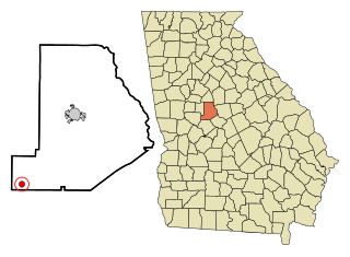
<span class="mw-page-title-main">Culloden, Georgia</span> City in Georgia, United States

Culloden is a city in Monroe County, Georgia, United States. The population was 200 in the 2020 census. It is part of the Macon metropolitan statistical area.

<span class="mw-page-title-main">Geneva, Georgia</span> Town in Georgia, United States

Geneva is a town in Talbot County, Georgia, United States. The population was 75 at the 2020 census.

<span class="mw-page-title-main">Junction City, Georgia</span> Town in Georgia, United States

Junction City is a town in Talbot County, Georgia, United States. The population was 138 at the 2020 census.

<span class="mw-page-title-main">Boston, Georgia</span> City in Georgia, United States

Boston is a city in Thomas County, Georgia, United States. As of the 2020 census, the city had a population of 1,207.

<span class="mw-page-title-main">Danville, Georgia</span> Town in Georgia, United States

Danville is a town in Twiggs and Wilkinson counties in the U.S. state of Georgia. The population was 238 at the 2010 census, down from 373 in 2000.

<span class="mw-page-title-main">Harrison, Georgia</span> Town in Georgia, United States

Harrison is a town in Washington County, Georgia, United States. The population was 339 in 2020.

<span class="mw-page-title-main">Pineview, Georgia</span> Town in Georgia, United States

Pineview is a town in Wilcox County, Georgia, United States. Per the 2020 census, the population was 454.

<span class="mw-page-title-main">McIntyre, Georgia</span> Town in Georgia, United States

McIntyre is a town in Wilkinson County, Georgia, United States. The population was 575 in 2020.

<span class="mw-page-title-main">Boykin, Georgia</span> Place in Georgia, United States

Boykin is an unincorporated community and census-designated place (CDP) in Miller County, Georgia, United States. The 2020 census listed a population of 151.

Smarr is an unincorporated community and census-designated place (CDP) in Monroe County, in the U.S. state of Georgia. The 2020 census listed a population of 218.

References

  1. "2020 U.S. Gazetteer Files". United States Census Bureau. Retrieved December 18, 2021.
  2. "U.S. Census website". United States Census Bureau . Retrieved January 31, 2008.
  3. "US Board on Geographic Names". United States Geological Survey. October 25, 2007. Retrieved January 31, 2008.
  4. 1 2 "Geographic Identifiers: 2010 Demographic Profile Data (G001): Byromville town, Georgia". U.S. Census Bureau, American Factfinder. Retrieved October 23, 2015.[ dead link ]
  5. Acts Passed by the General Assembly of Georgia. J. Johnston. 1905. p. 690.
  6. Krakow, Kenneth K. (1975). Georgia Place-Names: Their History and Origins (PDF). Macon, GA: Winship Press. p. 30. ISBN   0-915430-00-2.
  7. "US Gazetteer files: 2010, 2000, and 1990". United States Census Bureau. February 12, 2011. Retrieved April 23, 2011.
  8. "City and Town Population Totals: 2020-2023". United States Census Bureau. May 16, 2024. Retrieved May 16, 2024.
  9. "Census of Population and Housing". Census.gov. Retrieved June 4, 2015.
  10. "P2 HISPANIC OR LATINO, AND NOT HISPANIC OR LATINO BY RACE – 2010: DEC Redistricting Data (PL 94-171) – Byromville town, Georgia". United States Census Bureau .
  11. "P2 HISPANIC OR LATINO, AND NOT HISPANIC OR LATINO BY RACE - 2020: DEC Redistricting Data (PL 94-171) – Byromville town, Georgia". United States Census Bureau .
  12. "Byromville". GeorgiaGov. Retrieved April 4, 2018.