Cadbury Camp

Last updated

Cadbury Camp
Cadbury Camp Ramparts - geograph.org.uk - 697213.jpg
Tree growth on the ramparts at Cadbury Camp
Location Tickenham, Somerset, England
Coordinates 51°26′55″N2°47′13″W / 51.44861°N 2.78694°W / 51.44861; -2.78694 Coordinates: 51°26′55″N2°47′13″W / 51.44861°N 2.78694°W / 51.44861; -2.78694
OS grid reference ST 45406 72467
Built Iron Age
Official nameCadbury Camp
Designated17 October 1930 [1]
Reference no.1008295
Somerset UK location map.svg
Red pog.svg
Location of Cadbury Camp in Somerset

Cadbury Camp is an Iron Age hill fort in Somerset, England, near the village of Tickenham. It is a scheduled monument. [1] [2] Although primarily known as a fort during the Iron Age it is likely, from artefacts, including a bronze spear or axe head, discovered at the site, that it was first used in the Bronze Age and still occupied through the Roman era into the sub-Roman period when the area became part of a Celtic kingdom. The name may mean "Fort of Cador" - Cado(r) being possibly the regional king or warlord controlling Somerset, Bristol, and South Gloucestershire, in the middle to late 5th century. Cador has been associated with Arthurian England, though the only evidence for this is the reference in the Life of St. Carantoc to Arthur and Cador ruling from Dindraithou (perhaps the hillfort at Dundry [3] ) and having the power over western Somerset to grant Carantoc's plea to build a church at Carhampton. Geoffrey of Monmouth invented the title 'Duke of Cornwall' for Cador in his misleading History of the Kings of Britain.

Contents

The 7-acre (2.8 ha) hill fort is well preserved, and is managed by the National Trust through a Higher Level Stewardship agreement with Natural England which involves tree clearing, including non-native Turkey Oaks, and management of the scrub.

The name Cadbury is derived from "Cada's byrig"; byrig is the Anglo-Saxon word meaning "fort" or "town", which is frequently, but not exclusively, used to refer to hill-forts. [4] [5] [6] It is one of three sites in Somerset to include the Cadbury name, the others being Cadbury Castle, near South Cadbury and Cadbury Hill which is also known as Cadbury-Congresbury to distinguish it from the other sites.

Location

Cadbury Camp is situated on a natural ridge between the Gordano Valley and the North Somerset Levels, next to the Limebreach Wood ancient woodland and nature reserve. [7] [8]

History

The hill fort was constructed during the Iron Age, probably by the local Dobunni tribe, however the details are not fully known. The discovery of a bronze spear or axe head at the site indicates use before the Iron Age. [4] [1] The Bronze Age spearhead is in the Museum of Somerset in Taunton. [2] [9]

Hill forts developed in the Late Bronze and Early Iron Age, roughly the start of the first millennium BC. [10] The reason for their emergence in Britain, and their purpose, has been a subject of debate. It has been argued that they could have been military sites constructed in response to invasion from continental Europe, sites built by invaders, or a military reaction to social tensions caused by an increasing population and consequent pressure on agriculture. The dominant view since the 1960s has been that the increasing use of iron led to social changes in Britain. Deposits of iron ore were located in different places to the tin and copper ore necessary to make bronze, and as a result trading patterns shifted and the old elites lost their economic and social status. Power passed into the hands of a new group of people. [11] Archaeologist Barry Cunliffe believes that population increase still played a role and has stated "the forts provided defensive possibilities for the community at those times when the stress of an increasing population burst out into open warfare. But I would not see them as having been built because there was a state of war. They would be functional as defensive strongholds when there were tensions and undoubtedly some of them were attacked and destroyed, but this was not the only, or even the most significant, factor in their construction". [12]

Plan of earthworks at Cadbury Camp, Tickenham Tickenham Camp Somerset Map.jpg
Plan of earthworks at Cadbury Camp, Tickenham

The fort, which covers about 7 acres (2.8 ha), [2] consisted of ditches and earth banks topped with a wooden fence in an elevated position above the marshy land below. [4] The ramparts are 45 feet (14 m) apart. [13] It extends approximately 190 metres (620 ft) from north to south and 160 metres (520 ft) from east to west. The ditch is around 2 metres (6 ft 7 in) deep and the ramparts rise up around 1.5 metres (4 ft 11 in). [1]

After the Iron Age occupation may have continued into the Roman era indicated by the discovery of pottery fragments, a small stone statue of Mars possibly from a Roman temple and coins of Claudius Gothicus and Valentinian II. [4] [1] [14] The site may still have been occupied into the Anglo-Saxon period. [4] Several of the finds were uncovered during excavations by Harold St George Gray in 1922, although the coin dating from around 370 was discovered in 1945 and a Romano-British relief in the inner defensive ditch in 1974. [2] The relief was given to Weston Museum, [2] and loaned to Bristol City Museum and Art Gallery. [9]

During World War II the site was used for bomb disposal and as the location for a searchlight battery. [2]

Current management

The site was once part of the estate linked to Clevedon Court. [15] It is now managed via a Higher Level Stewardship agreement between the National Trust and Natural England. [16] This has involved removing trees whose roots are growing into the earthen banks of the site. In particular non-native Turkey Oaks, which provide a habitat for damaging Gall wasps, are being removed. Cattle are also being used to manage the scrub and encourage the growth of flowers such as orchids. [16]

Myths and legends

Local legends associate it with Arthurian England and Camelot, though these may be due to confusion with the better-known Cadbury Castle, near South Cadbury some 50 miles to the south. [17] [18]

CadburyCampUKpanorama.jpg
360° Panoramic view of Cadbury Camp. This photograph was taken from the edge of the camp, which caused a distorted perspective.

See also

Related Research Articles

<span class="mw-page-title-main">Hillfort</span> Type of earthworks used as a fortified refuge or defended settlement

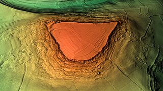
A hillfort is a type of earthwork used as a fortified refuge or defended settlement, located to exploit a rise in elevation for defensive advantage. They are typically European and of the Bronze Age or Iron Age. Some were used in the post-Roman period. The fortification usually follows the contours of a hill and consists of one or more lines of earthworks, with stockades or defensive walls, and external ditches. Hillforts developed in the Late Bronze and Early Iron Age, roughly the start of the first millennium BC, and were used in many Celtic areas of central and western Europe until the Roman conquest.

<span class="mw-page-title-main">Solsbury Hill</span> Iron Age hillfort in Somerset, England

Little Solsbury Hill is a small flat-topped hill and the site of an Iron Age hill fort, above the village of Batheaston in Somerset, England. The hill rises to 625 feet (191 m) above the River Avon, which is just over 1 mile (2 km) to the south, and gives views of the city of Bath and the surrounding area. It is within the Cotswolds Area of Outstanding Natural Beauty.

<span class="mw-page-title-main">Cadbury Castle, Somerset</span> Hillfort in Somerset, England

Cadbury Castle is a Bronze and Iron Age hillfort in the civil parish of South Cadbury in the English county of Somerset. It is a scheduled monument and has been associated with King Arthur's legendary court at Camelot.

Cadbury Hill is a small hill, mostly in the civil parish of Congresbury, overlooking the village of Yatton in North Somerset. On its summit stands an Iron Age hill fort, which is a Scheduled Ancient Monument.

<span class="mw-page-title-main">Worlebury Hill</span>

Worlebury Hill is the name given to an upland area lying between the flatlands of Weston-super-Mare and the Kewstoke area of North Somerset, England. Worlebury Hill's rises from sea level to its highest point of 109 metres (358 ft), and the western end of the hill forms a peninsula, jutting out into the Bristol Channel, between Weston Bay and Sand Bay. A toll road follows the coast around the hill from Sand Bay in the north to the now derelict Birnbeck Pier in the west, although tolls are not currently collected on the road. Worlebury Golf Club is situated on the Hill and the area is known for being one of the wealthiest areas in the county of Somerset.

<span class="mw-page-title-main">Burledge Hill</span> Iron Age hillfort in Somerset, England

Burledge Hill is on the southern edge of the village of Bishop Sutton, Somerset, England. It is the site of a Site of Special Scientific Interest and an univallate Iron Age hillfort.

<span class="mw-page-title-main">Dolebury Warren</span> Hillfort in North Somerset

Dolebury Warren is a 90.6 hectares biological Site of Special Scientific Interest (SSSI) and ancient monument near the villages of Churchill and Rowberrow in North Somerset, part of South West England. It is owned by the National Trust, who acquired the freehold in 1983, and managed by the Avon Wildlife Trust.

<span class="mw-page-title-main">Cleeve Toot</span> Iron Age hillfort in Somerset, England

Cleeve Toot is an Iron Age univallate hillfort above Goblin Combe, Cleeve, Somerset, England. It is a Scheduled Ancient Monument.

<span class="mw-page-title-main">Norton Camp</span> Bronze Age hillfort in Somerset, England

Norton Camp is a Bronze Age hill fort at Norton Fitzwarren near Taunton in Somerset, England.

<span class="mw-page-title-main">Clatworthy Camp</span> Iron Age hillfort in Somerset, England

Clatworthy Camp is an Iron Age hill fort 3 miles (4.8 km) North West of Wiveliscombe, Somerset, England. It has been scheduled as an Ancient Monument. Due to the vulnerability to scrub and tree growth it has been added to the Heritage at Risk Register.

Kingsdown Camp is an Iron Age hill fort at Buckland Dinham 4.5 kilometres (3 mi) South East of Radstock, Somerset, England. It is a Scheduled Ancient Monument.

<span class="mw-page-title-main">Sweetworthy</span> Site of two Iron Age hillforts in Somerset, England

Sweetworthy is the site of two Iron Age hill forts or enclosures at Luccombe, 4 kilometres (2 mi) south of Porlock, Somerset, England. They are on the north-facing slope of Dunkery Hill. One has a single rampart and external ditch, enclosing 0.25 hectares. The rampart is still visible and the ditch on the east side is used as a trackway. There was a defended settlement above the main site.

Mellor hill fort is a prehistoric site in North West England, that dates from the British Iron Age—about 800 BC to 100 AD. Situated on a hill in Mellor, Greater Manchester, on the western edge of the Peak District, the hill fort overlooks the Cheshire Plain. Although the settlement was founded during the Iron Age, evidence exists of activity on the site as far back as 8,000 BC; during the Bronze Age the hill may have been an area where funerary practices were performed. Artefacts such as a Bronze Age amber necklace indicate the site was high status and that its residents took part in long-distance trade. The settlement was occupied into the Roman period. After the site was abandoned, probably in the 4th century, it was forgotten until its rediscovery in the 1990s.

<span class="mw-page-title-main">Worlebury Camp</span> Iron Age hillfort in Somerset, England

Worlebury Camp is the site of an Iron Age hillfort on Worlebury Hill, north of Weston-super-Mare in Somerset, England. The fort was well defended with numerous walls, embankments and ditches around the site. Several large triangular platforms have been uncovered around the sides of the fort, lower down on the hillside. Nearly one hundred storage pits of various sizes were cut into the bedrock, and many of these had human remains, coins, and other artefacts in them. During the 19th and 20th centuries the fort suffered damage and was threatened with complete destruction on multiple occasions. Now, the site is a designated Scheduled monument. it falls within the Weston Woods Local Nature Reserve which was declared to Natural England by North Somerset Council in 2005.

<span class="mw-page-title-main">Brent Knoll Camp</span> Iron Age hillfort in Somerset, England

Brent Knoll Camp is an Iron Age hillfort at Brent Knoll, 3 kilometres (1.9 mi) from Burnham-on-Sea, Somerset, England. It has been designated as a Scheduled Monument, and is now in the care of the National Trust.

<span class="mw-page-title-main">Stokeleigh Camp</span> Iron Age promontory fort in Somerset, England

Stokeleigh Camp is an Iron Age promontory fort in Leigh Woods North Somerset near Bristol, England. The hill fort is one of three Iron Age fortifications overlooking the Avon Gorge, the others being Burgh Walls Camp south of the Nightingale Valley, of which almost no trace remains, and the other being Clifton Down Camp on the opposite side of the gorge, on Clifton Down near the Observatory. A prehistoric road is believed to have connected Stokeleigh Camp with Cadbury Camp near Tickenham in North Somerset.

<span class="mw-page-title-main">Sigwells</span>

Sigwells is a hamlet located in an area rich in archaeology remains, overlooking Cadbury Castle in Somerset, England.

References

  1. 1 2 3 4 5 Historic England. "Cadbury Camp, a small multivalate hillfort on Cadbury Hill (1008295)". National Heritage List for England . Retrieved 16 May 2015.
  2. 1 2 3 4 5 6 Historic England. "Cadbury Camp (195367)". Research records (formerly PastScape). Retrieved 4 May 2015.
  3. "St. Carantoc « kingarthursomerset". 4 March 2013. Archived from the original on 25 April 2019. Retrieved 29 April 2019.
  4. 1 2 3 4 5 "The Iron Age past of Cadbury Camp". National Trust. Archived from the original on 16 December 2013. Retrieved 21 December 2013.
  5. "Clambering over Cadbury Camp" (PDF). North Somerset Council. Archived from the original (PDF) on 3 March 2016. Retrieved 4 May 2015.
  6. Ekwall, Eilert (1960). The Concise Oxford Dictionary of English Place Names. Oxford University Press. p. 80. ISBN   978-0-19-869103-7.
  7. "Horse riding in North Somerset: 10 beautiful bridleways". North Somerset Times. Archived from the original on 19 August 2016. Retrieved 16 May 2015.
  8. "National Character Area profile: 118: Bristol, Avon Valleys and Ridges" (PDF). Natural England. Archived (PDF) from the original on 13 May 2015. Retrieved 16 May 2015.
  9. 1 2 "Cadbury Camp Tickenham". 466AD. Archived from the original on 16 May 2015. Retrieved 18 June 2015.
  10. Payne, Andrew; Corney, Mark; Cunliffe, Barry (2007). The Wessex Hillforts Project: Extensive Survey of Hillfort Interiors in Central Southern England. English Heritage. p. 1. ISBN   978-1-873592-85-4. Archived from the original on 4 March 2016. Retrieved 16 May 2015.
  11. Sharples, Niall M (1991). English Heritage Book of Maiden Castle. London: B. T. Batsford. pp. 71–72. ISBN   978-0713460834.
  12. "Time Team: Swords, skulls and strongholds". Channel 4. 19 May 2008. Archived from the original on 11 August 2011. Retrieved 16 September 2009.
  13. Seyer, Samuel (1821). Memoirs Historical and Topographical of Bristol and its Neighbourhood. Volume 1. Bristol: Samuel Seyer. p. 81. Archived from the original on 4 April 2016. Retrieved 29 April 2019.
  14. Burrow, Ian (1981). Hillfort and Hill-Top Settlement in Somerset in the First to Eighth Centuries A.D. British Archaeological Reports. pp. 291–293. ISBN   978-0860541370.
  15. "Cadbury Camp". National Trust. Archived from the original on 16 December 2013. Retrieved 21 December 2013.
  16. 1 2 "Cadbury Camp — our work". National Trust. Archived from the original on 16 December 2013. Retrieved 21 December 2013.
  17. Reno, Frank D. (2007). The Historic King Arthur: Authenticating the Celtic Hero of Post-Roman Britain. McFarland & Co Inc. p. 206. ISBN   978-0786430253.
  18. Sire, Paul (2014). King Arthur's European Realm: New Evidence from Monmouth's Primary Sources. McFarland. p. 65. ISBN   9780786478019.