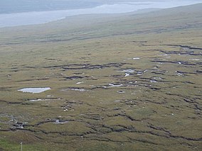
NatureScot, which was formerly known as Scottish Natural Heritage, is the public body responsible for Scotland's natural heritage, especially its natural, genetic and scenic diversity. It advises the Scottish Government and acts as a government agent in the delivery of conservation designations, i.e. national nature reserves, local nature reserves, national parks, Sites of Special Scientific Interest (SSSIs), Special Areas of Conservation, Special Protection Areas and the national scenic areas. The protected areas in Scotland account for 20% of the total area, SSSIs alone 13%. NatureScot receives annual funding from the Government in the form of Grant in Aid to deliver Government priorities for the natural heritage.

The national nature reserves (NNRs) of Scotland are areas of land or water designated under the Wildlife and Countryside Act 1981 as containing habitats and species of national importance. National nature reserves can be owned by public, private, community or voluntary organisations but must be managed to conserve their important habitats and species, as well as providing opportunities for the public to enjoy and engage with nature. There are currently 43 NNRs in Scotland, which cover 154,250 hectares (1,542.5 km2), or less than 1.5% of the land area of Scotland. They range in size from Corrieshalloch Gorge at 7 ha to Mar Lodge Estate, which covers 29,324 ha.

Caerlaverock is a national nature reserve (NNR) covering parts of the mudflats and shoreline of the Solway Firth about 10 km south of Dumfries, in Dumfries and Galloway, Scotland. It lies between the River Nith and the Lochar Water, and consists of a variety of wetland habitats including bare mud and sand, merse and marshes, and is fringed by neutral grassland on the landward side. A nature reserve was designated in 1957 at the instigation of the Duke of Norfolk. The NNR covers an area of 82 square kilometres (32 sq mi) and is an internationally important wintering site for waterfowl and wading birds.

Caithness is a historic county, registration county and lieutenancy area of Scotland.

The Dornoch Firth is a firth on the east coast of Highland, in northern Scotland. It forms part of the boundary between Ross and Cromarty, to the south, and Sutherland, to the north. The firth is designated as a national scenic area, one of 40 such areas in Scotland. The national scenic area covers 15,782 ha in total, of which 4,240 ha is the marine area of the firth below low tide. A review of the national scenic areas by Scottish Natural Heritage in 2010 commented:
By comparison with other east coast firths the Dornoch Firth is narrow and sinuous, yet it exhibits within its compass a surprising variety of landscapes. It is enclosed by abrupt rounded granitic hills clad in heather moor and scree, their Gaelic names of cnoc, meall and creag giving the clue to their character. Their lower slopes are frequently wooded, oakwoods being a noticeable feature of the area, but with other deciduous and coniferous species represented in plantations which vary from the policy plantings of Skibo Castle to the pines of the Struie Forest.

Loch Fleet is a sea loch on the east coast of Scotland, located between Golspie and Dornoch. It forms the estuary of the River Fleet, a small spate river that rises in the hills east of Lairg. The loch was designated a National Nature Reserve (NNR) in 1998, and is managed by a partnership between NatureScot, the Scottish Wildlife Trust (SWT) and Sutherland Estates. The NNR extends to 1058 hectares, including the Loch Fleet tidal basin, sand dunes, shingle ridges and the adjacent pine woods, including Balbair Wood and Ferry Wood. The tidal basin of the loch covers over 630 ha, and forms the largest habitat on the NNR.

Insh Marshes are an area of floodplain of the River Spey between Kingussie and Kincraig in Badenoch and Strathspey, Highland, Scotland. The marshes are said to be one of the most important wetlands in Europe. They lie at altitude of approximately 240 to 220 m above sea level, and form one of the largest areas of floodplain mire and fen vegetation in Scotland.
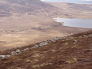
Forsinard is a hamlet in the county of Sutherland in the Highland area of Scotland. It is located on the A897 road in Strath Halladale. It is served by a railway station on the Far North Line. The local hotel closed several years ago, but there is now a b&b just across the level crossing.
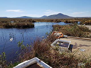
The Flow Country is a large, rolling expanse of peatland and wetland area of Caithness and Sutherland in the North of Scotland. It is the largest expanse of blanket bog in Europe, and covers about 4,000 km2 (1,500 sq mi). It is an area of deep peat, dotted with bog pools and a very important habitat for wildlife, as well as climate change mitigation. As peat is largely made up of the remains of plants, which are themselves made up of carbon, it locks up large stores of carbon for thousands of years. This carbon would otherwise be released to the atmosphere and contribute to global warming. The Flow Country is currently being considered as a potential World Heritage Site on account of its unparalleled blanket bog habitat. It could be part of the Global Peatlands Initiative.
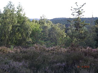
Muir of Dinnet is a national nature reserve (NNR) situated close to the village of Dinnet in Aberdeenshire, Scotland. The reserve extends 1166 hectares from the River Dee to Culbean hill, and encompasses a wide range of habitats including dry heath, raised bog, woodland, and two lochs: Loch Kinord and Loch Davan. Muir of Dinnet was first declared a NNR in 1977 due to its value as a habitat for flora and fauna, and its important geomorphological features, the most striking of which is the Burn O'Vat. Muir of Dinnet is owned by Dinnet Estate and managed by NatureScot, who provide a visitor centre and a range of other facilities including waymarked paths and a car park. As of 2012 it was estimated that approximately 40,000 people visited Muir of Dinnet each year.
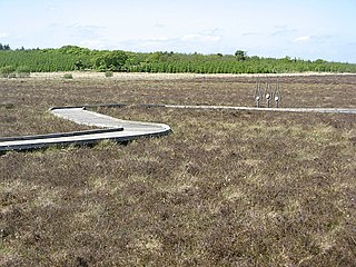
Blawhorn Moss is a raised bog located to the northwest of the village of Blackridge, about 6 kilometres (3.7 mi) west of Armadale in the council area of West Lothian in central Scotland. It is the largest and least disturbed raised bog in the Lothians, and has been a National Nature Reserve since 1980. It is owned and managed by NatureScot, the public body responsible for Scotland's natural heritage.

Forsinard Flows is a national nature reserve (NNR) covering much of the area surrounding Forsinard in the Highland council area of Scotland. It lies at the heart of the Flow Country, a large, rolling expanse of peatland and wetland area of Caithness and Sutherland that makes up almost 5% of the world's blanket bog. The reserve is managed by the Royal Society for the Protection of Birds (RSPB), and is designated a Category II protected area by the International Union for Conservation of Nature. Much of the NNR overlaps with the designated area of the Caithness and Sutherland Peatlands Special Protection Area and Special Area of Conservation.

Many parts of Scotland are protected in accordance with a number of national and international designations because of their environmental, historical or cultural value. Protected areas can be divided according to the type of resource which each seeks to protect. NatureScot has various roles in the delivery of many environmental designations in Scotland, i.e. those aimed at protecting flora and fauna, scenic qualities and geological features. Historic Environment Scotland is responsible for designations that protect sites of historic and cultural importance. Some international designations, such as World Heritage Sites, can cover both categories of site.

South Thames Estuary and Marshes is a 5,289-hectare (13,070-acre) biological Site of Special Scientific Interest which stretches between Gravesend and the mouth of the River Medway in Kent. Part of it is a Nature Conservation Review site, Grade I, and part is a Royal Society for the Protection of Birds nature reserve. It is part of the Thames Estuary and Marshes Ramsar internationally important wetland site and Special Protection Area under the European Union Directive on the Conservation of Wild Birds.

Caithness Lochs is a protected wetland area in the historic county of Caithness in the far north of Scotland. With a total area of 1,379 hectares, it covers six freshwater lochs and a complex area of fen and swamp, and has been protected as a Ramsar Site since 1998.
Fala Flow is an area of upland blanket bog on the edge of the Lammermuir Hills, in Midlothian, Scotland. Located north of the village of Fala, around 15km south east of Edinburgh, an area of 318 hectares has been designated as a Ramsar Site since 1990.
Lewis Peatlands is a large area of blanket bog covering more than one third of the Isle of Lewis, off the west coast of Scotland. With a total area of 58,984 hectares, it is one of the largest and most intact known areas of blanket bog in the world, and is the second largest Ramsar site in Scotland.

South Tayside Goose Roosts is a composite wetland site to the west of Perth in central Scotland, covering a total of 331 hectares, which has been protected as a Ramsar Site since 1993. Incorporating three disconnected sections, separated by several kilometres, the site contains seven freshwater lochs along with other wetland habitats, including one of the largest raised bogs in the region.

The name East Caithness Cliffs refers to weathered sandstone cliffs on the east coast of Caithness in Scotland. The cliffs, which rise to 150 m at Berriedale, provide ideal nesting conditions for breeding seabirds, and are protected by several overlapping conservation designations:
