Peat, also known as turf, is an accumulation of partially decayed vegetation or organic matter. It is unique to natural areas called peatlands, bogs, mires, moors, or muskegs. The peatland ecosystem covers 3.7 million square kilometres (1.4 million square miles) and is the most efficient carbon sink on the planet, because peatland plants capture carbon dioxide (CO2) naturally released from the peat, maintaining an equilibrium. In natural peatlands, the "annual rate of biomass production is greater than the rate of decomposition", but it takes "thousands of years for peatlands to develop the deposits of 1.5 to 2.3 m [4.9 to 7.5 ft], which is the average depth of the boreal [northern] peatlands", which store around 415 gigatonnes (Gt) of carbon (about 46 times 2019 global CO2 emissions). Globally, peat stores up to 550 Gt of carbon, 42% of all soil carbon, which exceeds the carbon stored in all other vegetation types, including the world's forests, although it covers just 3% of the land's surface. Sphagnum moss, also called peat moss, is one of the most common components in peat, although many other plants can contribute. The biological features of sphagnum mosses act to create a habitat aiding peat formation, a phenomenon termed 'habitat manipulation'. Soils consisting primarily of peat are known as histosols. Peat forms in wetland conditions, where flooding or stagnant water obstructs the flow of oxygen from the atmosphere, slowing the rate of decomposition. Peat properties such as organic matter content and saturated hydraulic conductivity can exhibit high spatial heterogeneity.

NatureScot, which was formerly known as Scottish Natural Heritage, is the public body responsible for Scotland's natural heritage, especially its natural, genetic and scenic diversity. It advises the Scottish Government and acts as a government agent in the delivery of conservation designations, i.e. national nature reserves, local nature reserves, national parks, Sites of Special Scientific Interest (SSSIs), Special Areas of Conservation, Special Protection Areas and the national scenic areas. The protected areas in Scotland account for 20% of the total area, SSSIs alone 13%. NatureScot receives annual funding from the Government in the form of Grant in Aid to deliver Government priorities for the natural heritage.

The national nature reserves (NNRs) of Scotland are areas of land or water designated under the Wildlife and Countryside Act 1981 as containing habitats and species of national importance. National nature reserves can be owned by public, private, community or voluntary organisations but must be managed to conserve their important habitats and species, as well as providing opportunities for the public to enjoy and engage with nature. There are currently 43 NNRs in Scotland, which cover 154,250 hectares (1,542.5 km2), or less than 1.5% of the land area of Scotland. They range in size from Corrieshalloch Gorge at 7 ha to Mar Lodge Estate, which covers 29,324 ha.

A bog or bogland is a wetland that accumulates peat as a deposit of dead plant materials – often mosses, typically sphagnum moss. It is one of the four main types of wetlands. Other names for bogs include mire, mosses, quagmire, and muskeg; alkaline mires are called fens. A baygall is another type of bog found in the forest of the Gulf Coast states in the United States. They are often covered in heath or heather shrubs rooted in the sphagnum moss and peat. The gradual accumulation of decayed plant material in a bog functions as a carbon sink.

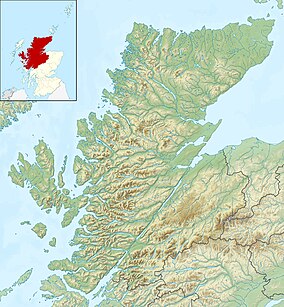
Caithness is a historic county, registration county and lieutenancy area of Scotland.

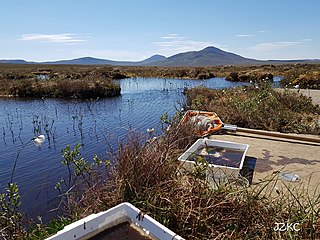
Insh Marshes are an area of floodplain of the River Spey between Kingussie and Kincraig in Badenoch and Strathspey, Highland, Scotland. The marshes are said to be one of the most important wetlands in Europe. They lie at altitude of approximately 240 to 220 m above sea level, and form one of the largest areas of floodplain mire and fen vegetation in Scotland.
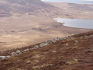
Forsinard is a hamlet in the county of Sutherland in the Highland area of Scotland. It is located on the A897 road in Strath Halladale. It is served by a railway station on the Far North Line. The local hotel closed several years ago, but there is now a b&b just across the level crossing.
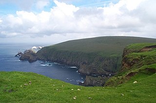
Hermaness is the northernmost headland of Unst, the most northerly inhabited island of Shetland, Scotland. It consists of huge sea cliffs and moorland, making it an ideal habitat for a variety of birds. Hermaness was designated a national nature reserve (NNR) in 1955. The NNR extends over 965 hectares, including the whole of the Hermaness peninsula and the outlying Muckle Flugga and Out Stack. The reserve has a path and boardwalk that extends out onto the moorland. The reserve is managed by NatureScot, though it remains in private ownership, with most being owned by the Buness Estate, although the stacks and skerries around Muckle Flugga are owned by the Northern Lighthouse Board.
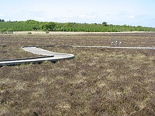
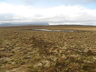
The Flow Country is a large, rolling expanse of peatland and wetland area of Caithness and Sutherland in the North of Scotland. It is the largest expanse of blanket bog in Europe, and covers about 4,000 km2 (1,500 sq mi). It is an area of deep peat, dotted with bog pools and a very important habitat for wildlife, as well as climate change mitigation. As peat is largely made up of the remains of plants, which are themselves made up of carbon, it locks up large stores of carbon for thousands of years. This carbon would otherwise be released to the atmosphere and contribute to global warming. The Flow Country is currently being considered as a potential World Heritage Site on account of its unparalleled blanket bog habitat. It could be part of the Global Peatlands Initiative.
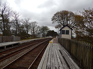
Forsinard railway station is a railway station serving the village of Forsinard in the Highland council area in the north of Scotland. It is located on the Far North Line, 125 miles 69 chains from Inverness, between Kinbrace and Altnabreac. The station is managed by ScotRail, who operate the services at the station.

Abernethy Forest is a remnant of the Caledonian Forest in Strathspey, in the Highland council area of Scotland. It lies within the Cairngorms National Park, close to the villages of Nethy Bridge, Boat of Garten, and Aviemore. The forest is an RSPB reserve, close to Loch Garten Osprey Centre, which is also owned by the RSPB. It is popular with walkers, as there are various trails throughout the reserve. The forest forms part of the wider Abernethy National Nature Reserve.

Ham Wall is an English wetland National Nature Reserve (NNR) 4 kilometres (2.5 mi) west of Glastonbury on the Somerset Levels. It is managed by the Royal Society for the Protection of Birds (RSPB). Since the last Ice Age, decomposing plants in the marshes of the Brue valley in Somerset have accumulated as deep layers of peat that were commercially exploited on a large scale in the twentieth century. Consumer demand eventually declined, and in 1994 the landowners, Fisons, gave their old workings to what is now Natural England, who passed the management of the 260 hectares Ham Wall section to the RSPB.
Blawhorn Moss is a raised bog located to the northwest of the village of Blackridge, about 6 kilometres (3.7 mi) west of Armadale in the council area of West Lothian in central Scotland. It is the largest and least disturbed raised bog in the Lothians, and has been a National Nature Reserve since 1980. It is owned and managed by NatureScot, the public body responsible for Scotland's natural heritage.

Loch Lomond National Nature Reserve (NNR) encompasses 430 hectares of land at the southeastern part of Loch Lomond in the council areas of Stirling and West Dunbartonshire, in Scotland. It covers the islands of Inchcailloch, Clairinsh, Torrinch, Creinch and Aber Isle, alongside areas of woodland and wetlands to either side of the mouth of the Endrick Water. NatureScot owns two parts of the reserve - the island of Inchcailloch and part of Gartfairn Wood - and the rest is privately owned. The reserve is managed by a partnership consisting of NatureScot, the RSPB Scotland and the Loch Lomond and The Trossachs National Park, along with the owners and tenants of the land under agreements. Within this framework NatureScot directly manage the islands of Clairinsh, Inchcailloch, Torrinch and Creinch, and land to the north of the Endrick Water. The RSPB manages the area to the south of the Endrick Water, and the national park manages visitor facilities on Inchcailloch.
A' Mhòine is a peninsula in the Highlands, Scotland. The peninsula is bounded to the west by Loch Eriboll, and to the east by the Kyle of Tongue. The A838 road crosses the peninsula on an east–west axis. Much of the peninsula is owned by Melness Estate on behalf of 59 crofters.

The Caithness and Sutherland Peatlands is a large area of blanket bog and peatland, covering a number of disconnected regions across the historic counties of Caithness and Sutherland in the far north of Scotland, across an area known as the Flow Country. With a total area of 143,503 hectares, it is one of the largest recognised conservation sites in the UK, and is the largest Ramsar Site in Scotland.
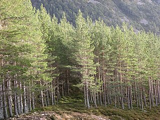
Invereshie and Inshriach is a national nature reserve on the western flank of the Cairngorms in the Highland council area of Scotland. The reserve covers habitats at a range of different altitudes, ranging from Caledonian Forest beside the River Feshie in the west, via bog and open moorland, to an arctic-alpine environment on the Cairngorm plateau. The Munro summit of Sgòr Gaoith (1118 m) lies on the eastern boundary of the reserve. The forested areas of the reserve form part of an expanse of Caledonian pinewood that stretches from Glen Feshie to Abernethy, and which as a whole forms the largest single area of this habitat remaining in Scotland. The reserve is owned and managed jointly by NatureScot and Forestry and Land Scotland (FLS): NatureScot own the Invereshie portion of the reserve and FLS the Inshriach area.

Moine Mhòr encompasses a large area of raised bog in the Kilmartin Glen area of Argyll and Bute, Scotland. As well as raised bog there are areas of saltmarsh, brackish grassland, alder carr, fen and woodland, and the variety of habitats at Moine Mhòr provide important habitats for a variety of animal and plant species. The area was declared a national nature reserve (NNR) in 1987, and is now owned and managed by NatureScot. According to NatureScot lowland raised bogs like Moine Mhòr are some of the rarest and most threatened natural wildlife habitats in Europe, due to removal of peat, afforestation and reclamation of farmland.

Whitelee Moor is nature reserve of the Northumberland Wildlife Trust, in Northumberland, England, near Carter Bar. A large part of the moor is blanket bog.