Forvie National Nature Reserve

Last updated

Forvie National Nature Reserve
Sands of Forvie looking south.jpg
Forvie in 2013
Aberdeenshire UK relief location map.jpg
Red pog.svg
Location Newburgh, Aberdeenshire, Scotland
Coordinates 57°18′43″N1°59′10″W / 57.31194°N 1.98611°W / 57.31194; -1.98611
Area973 ha (2,400 acres) [2]
Established1959 [1]
Governing body NatureScot
Forvie National Nature Reserve
Sands of Forvie. Sands of Forvie.jpg
Sands of Forvie.

The Forvie National Nature Reserve is a national nature reserve owned and managed by NatureScot. It is located north of Newburgh in Aberdeenshire, in the northeast of Scotland. The reserve includes the Sands of Forvie, which are the fifth largest sand dune system in Britain, and the least disturbed by human activity. [3] The dune system is an integral part of the Ythan Estuary, which also forms part of the reserve, and separates the sands from Balmedie beach.

Contents

The reserve contained at one point the largest breeding colony of breeding common eider in Britain and while they are still a protected feature of the reserve the eider colony suffered dramatic losses starting in 2006 and the subsequent years. The reserve also hosts an internationally important ternery [4] and a protected seal haul-out containing both common seals and grey seals, predominantly the latter. [5]

The area is designated as a both a Special Protection Area and a Special Area of Conservation under the Natura 2000 scheme, as well as being a Site of Special Scientific Interest. [6] [7] [8] The site is designated a Category II protected area by the International Union for Conservation of Nature. [1]

The sands were the site of the village of Forvie that was abandoned due to drifting sands. [9]

Sands of Forvie

The Sands of Forvie are one of the largest areas of blown sand in Scotland. The sand at Forvie is formed from the remains of sediment that was transported by rivers to the coast at the end of the last ice age. The sediment settled in the sea, but was gradually washed onshore by the action of waves and wind. [10]

The sand dunes at Forvie can be divided into three distinct parts. The southernmost point of the reserve consists of a sand spit at the point where the River Ythan enters the sea. To the north the sand rests on raised beaches terraces and glaciated rocks. North of this region is an area where the sand lies on top of a rock plateau, with glacial deposits of varying depths sandwiched between the rock and the sand. [10] The dunes are highly mobile, and can reach up to 20 metres (66 ft) in height. As there is relatively little plant life on these mobile dunes, they have been likened to the Sahara Desert. [11]

Flora and fauna

Roosting waders on the Sands of Forvie Roosting waders on the Sands of Forvie National Nature Reserve - geograph.org.uk - 618304.jpg
Roosting waders on the Sands of Forvie

The reserve contains large areas of sandy foreshore, mobile and fixed dunes, dune pasture and lowland heath and the successional development of vegetation. The sand dunes are of various stages of evolution and contain plethora of plant species including marram grass (Ammophila arenaria), red fescue, (Festuca rubra), crowberry, (Empetrum nigrum), the cross-leaved heath (Erica tetralix), common sedge, (Carex nigra), marsh pennywort (Hydrocotyle vulgaris) and the invasive creeping willow (Salix repens ssp. argentea). Vascular plants are an identified and protected feature of the reserve under the Sands of Forvie and Ythan Estuary SSSI. [8] 15 species are identified on reserve with 10 of which are red book listed species [12] ( Astragalus danicus , Carex maritima, Coeloglossum viride, Corollarhiza trifida, Gentianella campestris , Platanthera bifolia , Salsola kali, Mertensia maritima , Radiola linoides and Teesdalia nudicaulis) and five of which are classified as UK scarce species ( Equisetum variegatum , Festuca arenaria, Ophioglossum azoricum , Potamogeton filiformis, Puccinellia distans ).

Four species of tern breed at Forvie, building their nests among the dunes and on the beach. Little terns and arctic terns favour the foreshore and raised beaches, while the sandwich terns and common terns nest amongst the marram tussocks of the dune system. [13] The breeding success of the terns has fluctuated widely over the years, [14] and since 1995 NatureScot have undertaken selected culling of predating species, specifically crows, gulls and foxes. [14] In addition to culling, NatureScot have also trialled the use of decoy terns to attract little terns into the areas protected from foxes by fences, as well as providing artificial shelters for tern chicks to use to avoid crows and gulls. [15] [16] In recent years the colonies of sandwich tern and black headed gulls have had great success in breeding with some of the highest populations recorded to date in 2019. [17]

The mudflats of the estuary provide an important wintering ground for migratory birds such as wigeon, oystercatcher, golden plover, lapwing, dunlin, curlew and redshank, and around 15,000 geese may be seen on the estuary each spring. [14] The reserve hosts a population of protected breeding eider that spend the breeding season on reserve, with many heading to the Tay estuary for the winter, although there is also a smaller population that remains year-round. In 2005 the reserve held a population of over 5000 eiders but has since suffered losses and in 2019 recorded a spring peak of 1323 eiders. [18]

The cliffs in the northern part of the reserve host breeding colonies of many seabirds, including northern fulmar, shag, cormorant, kittiwake and razorbill. Raptor species such as short-eared owls, kestrel, sparrowhawk, osprey and buzzard are also regularly seen, and in total 255 species of bird have been recorded at Forvie. [19]

Forvie is a popular site for viewing grey and common seals, which haul out onto beaches and mudflats at the mouth of the Ythan estuary. [20] [21] The Protection of Seals (Designated Sea Haul-out Sites) (Scotland) Order 2014 introduced additional protection for seals at 194 designated haul-out sites and in 2017 the seal haul-out site at Forvie National Nature reserve was granted this designation and legal protection. [22] To avoid disturbance to the seals the advised viewpoint is established on the Newburgh beach. The population is growing rapidly with numbers anywhere between 1,000 and 3,000 seals present. [5]

Bottlenose dolphins visit the seas off Forvie, and there is a population of otter on the River Ythan. Other mammals found at Forvie and those typical of northeast Scotland such roe deer, red foxes, badgers and stoats. [20]

History

The coastline at Forvie has a long history of human occupation. The earliest evidence of human activity takes the form of flint working sites and shell middens, which date from around 8,000 years ago. Excavations have also revealed burial cairns from the Neolithic period (around 6,000 years ago), and kerb cairns (built to hold cremation remains) dating from the Bronze Age. [23] Other Bronze Age objects found at Forvie include pieces of a quern-stone and fragments of pottery. The remains of a small village of 31 huts dating from around 700 BC have also been identified. Finds from the village include jet beads, bracelets, querns and pottery. [24] [25]

The deserted village of Forvie lies within the sand dunes. Excavations of the village church, which is dedicated to Saint Adamnan, shown that it was constructed in the 12th-century, and the dating of burials within the church indicate that it had become a ruin by the 15th-century: local folk history tells of a nine-day storm that led to the village being engulfed by sand in August 1413. [24] The parish of Forvie was annexed by the neighbouring parish of Slains in 1573. [26]

In 1959 the Sands of Forvie was declared a national nature reserve (NNR) by agreement between the Nature Conservancy Council (predecessor body of NatureScot) and the landowners; the NNR was extended in 1979 to include the Ythan Estuary. In 2003 65 hectares (160 acres) were purchased from the landowners, with the remaining land being purchased in 2012. [27]

During the World Wars

Forvie was active in World Wars I and II, although very few details are recorded on the use of the area. It was incorrectly claimed [ by whom? ] there was a nine-hole golf course from 1900 to the outbreak of World War II. The course built for Lady Cathcart in 1900 was on the west coast island Uist.

The layout of Forvie and Newburgh could be mistaken for the mouth of the River Don in Aberdeen. With this in mind, defences were put in places around the mouth of the Ythan. These consisted of pillboxes, two gun batteries and anti-tank blocks built by the 143rd Pioneer Corps. From a review of vulnerable beaches from April–October 1941, Forvie appeared on this list and was identified as "blocked with mines". The minefield ran from East to West (WO ref 31/521474 to 538472). These were British Type C land mines weighing about 65 lbs each.

Following a clear-up of the area in July 1944, a number of landmines were unaccounted for due to the shifting sands of the area. Mine clearance altered the area slightly as the Bomb Disposal Unit from the Royal Engineers used a converted Bren gun carrier (known as a wasp) as a flamethrower to scorch vegetation on the mined area. Images of the clearance and the location of the minefield is recorded in a local book covering World War II in northeastern Scotland. [28] Records show on some days 222 mines being dealt with, the actual mine count is unknown but the area took several months to clear. On 27 July 1944, Sapper Harry Dean (28) of 11 coy, Royal Engineers was killed whilst clearing a mine at Forvie. Sapper Dean is buried in Yorkshire. [29]

Minefield start / end from Royal Engineers file in TNA - Kew Forvie minefield.jpg
Minefield start / end from Royal Engineers file in TNA - Kew

Forvie sands was used to train the Gordon Highlanders and Highland Light Infantry in desert warfare, in addition to this Forvie Moor was used to train soldiers in the use of grenade, anti-tank grenades and two-inch trench mortars. Since the war, mortar bombs have been found across the moor. Craters are still visible in the area. The soldiers training at Forvie were billeted at the Slains Lodge and buildings in Collieston.

On 3 November 1940, 30 High Explosive Bombs were dropped on Forvie Links by the Luftwaffe. This is listed in the Aberdeenshire Civil Defence register, the craters can be seen in 1941 and 1946 aerial photos.

Whilst soldiers were training there, the moor were off limits to locals. However, on Sundays, the locals could use the moor. During this time, locals collected birds eggs to use as food was rationed, and there was a plentiful supply of rabbits. On Sunday 30 November 1941, three local boys found an unexploded anti-tank grenade in a rabbit burrow that the army had been demonstrating to the home guard. One of the boys (Alex Ross), then threw it away where it exploded causing him to lose sight in one eye.

On 31 March 1941, the British steamer Melrose Abbey ran aground. On 2 April 1941 she was hit by a drifting sea mine blowing a large hole in her side, and settled on the Ythan river bed. During this time, a machine gun was posted at Forvie Sands to offer some protection for the vessel whilst plans were made to move her as she was a target for passing aircraft. The ship was refloated on 26 July 1941 and towed to Aberdeen for repairs. She was later sunk by U-356 on 27 December 1942 north-east of the Azores. Several websites confirm this sinking, but this disagrees with the information in the reference below, which states that "As for Melrose Abbey, she was released from the Royal Navy in May 1945 and returned to her former owners, the Associated Humber Lines." The second reference may help to resolve this mix-up of ship names.

Beside the pill box of Forvie, two mobile naval four-inch guns were places and controlled by 942nd Defence battery.

On 26 January 1942, the SS Lesrix, which was carrying machinery, ran aground off Hackley head during a blizzard. Locals in the community aided in the rescue of some of the crew, although ten crew members were lost. A bronze medal for gallantry was given by the King to one local for his part.

During patrols on the beach and cliffs of Forvie, a dinghy was found and this sparked a search for a spy that had been landed by submarine. This spy was caught in the moray area. It was rumoured that Tillery house near Udny had fascist sympathizers, where spies and airmen were told this was a "safe house" during the war. Since there were also Norwegian army personnel in the area who patrolled the beaches, the coast guard and home guard were issued with passes to identify themselves to the Norwegian soldiers.

In 1948, the Forvie area was earmarked to be a bombing and artillery range for the Royal Air Force and Army, as a site further north than the existing area at Lunan Bay near Arbroath. Forvie was to be used for air to ground and dive bombing practice. This involved a gunnery range out at sea and a rifle range on the moor. This proposal was cancelled in 1950; records exist in the National Archives on the proposal.

Visitors

The Forvie National Nature Reserve is visited by around 35,000 people each year. [30] Stevenson Forvie Centre near Collieston at the northern end of the reserve provides information to visitors. [31] The centre first opened in the 1980s, and was substantially upgraded in 1998 with funding from Shell and a bequest from a local resident, Margaret Stevenson, after whom the centre is now named. [30]

Two waymarked trails to allow visitors to access the reserve. The 5.5 km (3.4 mi) Dune Trail is a circular route around the southern part of the reserve, through the dunes landscape and out to the beach, passing the site of the abandoned village and the ruins of the kirk. The 3.4 km (2.1 mi) Heath Trail is a circular route starting and finishing at the visitor centre, passing through the heathland of the northern part of the reserve. The two paths can be linked by a path running along the seafront. [32]

Related Research Articles

<span class="mw-page-title-main">Holkham National Nature Reserve</span> Nature reserve in the United Kingdom

Holkham National Nature Reserve is England's largest national nature reserve (NNR). It is on the Norfolk coast between Burnham Overy Staithe and Blakeney, and is managed by Natural England with the cooperation of the Holkham Estate. Its 3,900 hectares comprise a wide range of habitats, including grazing marsh, woodland, salt marsh, sand dunes and foreshore. The reserve is part of the North Norfolk Coast Site of Special Scientific Interest, and the larger area is additionally protected through Natura 2000, Special Protection Area (SPA) and Ramsar listings, and is part of both an Area of Outstanding Natural Beauty (AONB) and a World Biosphere Reserve. Holkham NNR is important for its wintering wildfowl, especially pink-footed geese, Eurasian wigeon and brant geese, but it also has breeding waders, and attracts many migrating birds in autumn. Many scarce invertebrates and plants can be found in the dunes, and the reserve is one of the only two sites in the UK to have an antlion colony.

<span class="mw-page-title-main">Caerlaverock National Nature Reserve</span>

Caerlaverock is a national nature reserve (NNR) covering parts of the mudflats and shoreline of the Solway Firth about 10 km south of Dumfries, in Dumfries and Galloway, Scotland. It lies between the River Nith and the Lochar Water, and consists of a variety of wetland habitats including bare mud and sand, merse and marshes, and is fringed by neutral grassland on the landward side. A nature reserve was designated in 1957 at the instigation of the Duke of Norfolk. The NNR covers an area of 82 square kilometres (32 sq mi) and is an internationally important wintering site for waterfowl and wading birds.

<span class="mw-page-title-main">Loch Fleet</span>

Loch Fleet is a sea loch on the east coast of Scotland, located between Golspie and Dornoch. It forms the estuary of the River Fleet, a small spate river that rises in the hills east of Lairg. The loch was designated a National Nature Reserve (NNR) in 1998, and is managed by a partnership between NatureScot, the Scottish Wildlife Trust (SWT) and Sutherland Estates. The NNR extends to 1058 hectares, including the Loch Fleet tidal basin, sand dunes, shingle ridges and the adjacent pine woods, including Balbair Wood and Ferry Wood. The tidal basin of the loch covers over 630 ha, and forms the largest habitat on the NNR.

<span class="mw-page-title-main">River Ythan</span> River in Scotland

The Ythan is a river in the north-east of Scotland rising at Wells of Ythan near the village of Ythanwells and flowing south-eastwards through the towns of Fyvie, Methlick and Ellon before flowing into the North Sea near Newburgh, in Formartine.

<span class="mw-page-title-main">Meikle Loch</span>

Meikle Loch is an inland loch some miles north of Collieston, Aberdeenshire, Scotland. It is designated as part of the Ythan Estuary complex, along with the Sands of Forvie, as a Special Protection Area for wildlife conservation purposes. Meikle is a Scots word for large/big, which the loch is when compared to the adjacent Little Loch.

<span class="mw-page-title-main">Newburgh, Aberdeenshire</span> Human settlement in Scotland

Newburgh is a coastal village in Aberdeenshire, Scotland. The village dates to 1261 AD, when Lord Sinclair wanted to establish a chapel in the area. Originally built as a school, somewhat later the chapel of Holy Rood was established.

<span class="mw-page-title-main">Duddon Estuary</span> Estuary and SSSI in the South Lakeland district of Cumbria, England

The Duddon Estuary is the sandy, gritty estuary of the River Duddon that lies between Morecambe Bay and the North Lonsdale coast.

The Isle of May is located in the north of the outer Firth of Forth, approximately 8 km (5.0 mi) off the coast of mainland Scotland. It is about 1.5 kilometres long and 0.5 kilometres wide. The island is owned and managed by NatureScot as a national nature reserve. There are now no permanent residents, but the island was the site of St Adrian's Priory during the Middle Ages.
<span class="mw-page-title-main">Hermaness</span>

Hermaness is the northernmost headland of Unst, the most northerly inhabited island of Shetland, Scotland. It consists of huge sea cliffs and moorland, making it an ideal habitat for a variety of birds. Hermaness was designated a national nature reserve (NNR) in 1955. The NNR extends over 965 hectares, including the whole of the Hermaness peninsula and the outlying Muckle Flugga and Out Stack. The reserve has a path and boardwalk that extends out onto the moorland. The reserve is managed by NatureScot, though it remains in private ownership, with most being owned by the Buness Estate, although the stacks and skerries around Muckle Flugga are owned by the Northern Lighthouse Board.

<span class="mw-page-title-main">Ythan Estuary</span>

The Ythan Estuary is the tidal component of the Ythan River, emptying into the North Sea 19 kilometres (12 mi) north of Aberdeen, Scotland. The estuary’s tidal action extends a 7 kilometres (4.3 mi) inland and has characteristic widths of between 250 metres (820 ft) and 780 metres (2,560 ft). Besides the tidal channel there are interfaces to the upland dunes including mudflats, sand beaches and shingle flats. Reaches of salt marsh occur, but they are primarily near the Waterside Bridge and the mouth of the Tarty Burn, a small tributary river. Based upon the habitat of the moorland bordering the east of the Ythan River near the mouth, this estuary is the most significant coastal moorland in the northern United Kingdom.

<span class="mw-page-title-main">Balmedie</span> Human settlement in Scotland

Balmedie is a large village in Aberdeenshire in Scotland. It lies north of the city of Aberdeen, in the civil parish of Belhelvie. The long and wide beach is bordered by an extensive dune system that stretches 14 miles (23 km) from Aberdeen to just north of the Ythan Estuary at Newburgh. The dynamic dunes has marram grass as the principal vegetation. They support a large array of wildlife. Two watercourses make their way to the sea within the area creating ribbons of wetland vegetation along their course. The village is near the Sands of Forvie Site of Special Scientific Interest, the fifth largest sand dune system in Britain; this is an integral part of the Ythan Estuary, which separates the sands from Balmedie Beach.

<span class="mw-page-title-main">Hodbarrow RSPB reserve</span> Nature reserve in Cumbria, England

Hodbarrow RSPB Reserve is a nature reserve run by the Royal Society for the Protection of Birds on the edge of the Lake District National Park in Cumbria, England. It is on the Duddon Estuary near the town of Millom.
<span class="mw-page-title-main">Blakeney Point</span> National nature reserve on the north coast of Norfolk, England

Blakeney Point is a national nature reserve situated near to the villages of Blakeney, Morston and Cley next the Sea on the north coast of Norfolk, England. Its main feature is a 6.4 km (4.0 mi) spit of shingle and sand dunes, but the reserve also includes salt marshes, tidal mudflats and reclaimed farmland. It has been managed by the National Trust since 1912, and lies within the North Norfolk Coast Site of Special Scientific Interest, which is additionally protected through Natura 2000, Special Protection Area (SPA), International Union for Conservation of Nature (IUCN) and Ramsar listings. The reserve is part of both an Area of Outstanding Natural Beauty (AONB), and a World Biosphere Reserve. The Point has been studied for more than a century, following pioneering ecological studies by botanist Francis Wall Oliver and a bird ringing programme initiated by ornithologist Emma Turner.
<span class="mw-page-title-main">Flora and fauna of the Outer Hebrides</span> UNESCO World Heritage Site in Scotland

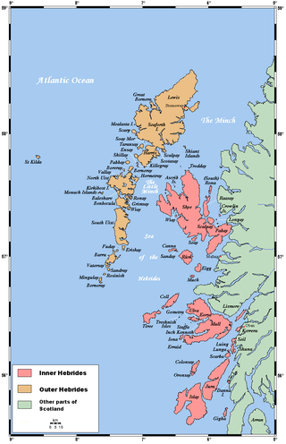
The flora and fauna of the Outer Hebrides in north west Scotland comprises a unique and diverse ecosystem. A long archipelago, set on the eastern shores of the Atlantic Ocean, it attracts a wide variety of seabirds, and thanks to the Gulf Stream a climate more mild than might be expected at this latitude. Because it is on the Gulf Stream, it also occasionally gets exotic visitors.

Culbin Sands, Forest and Findhorn Bay is a huge area of coast and countryside and an SSSI in Moray, Scotland, stretching from just east of the town of Nairn eastwards to the village of Findhorn and its bay. All of the areas are very important for wildlife in general and are strongly protected by law. The Culbin Sands are known in Gaelic as Bar Inbhir Èireann.

<span class="mw-page-title-main">Lower Saxon Wadden Sea National Park</span> National Park in Lower Saxony, Germany

The Lower Saxon Wadden Sea National Park was established in 1986 and embraces the East Frisian Islands, mudflats and salt marshes between the Bay of Dollart on the border with the Netherlands in the west and Cuxhaven as far as the Outer Elbe shipping channel in the east. The national park has an area of about 345,800 hectares (1,335 sq mi). The National Park organisation is located in Wilhelmshaven. In June 2009, the National Park became a UNESCO World Heritage Site along with the Schleswig-Holstein Wadden Sea and the Dutch Wadden Sea, highlighting its unique intertidal ecosystem and high biodiversity.
<span class="mw-page-title-main">Tentsmuir National Nature Reserve</span>

Tentsmuir National Nature Reserve (NNR) is located southeast of Tayport in Fife, Scotland. The reserve is made up of three parts, encompassing Morton Lochs, Tentsmuir Point and Tayport Heath, and is managed by NatureScot. The different sections of Tentsmuir NNR were originally designated as separate national nature reserves at different times: the Morton Lochs section was designated in 1952; Tentsmuir Point in 1954; and Tayport Heath in 1988. While these discrete sections are distant from one another, they form part of the extensive dune system at Tentsmuir, and in 2003 SNH combined the three sites to form Tentsmuir National Nature Reserve. The adjoining Tentsmuir Forest is managed by Forestry and Land Scotland and covers most of the land between the three portions of the NNR.

<span class="mw-page-title-main">St Cyrus National Nature Reserve</span> Scottish nature reserve

St Cyrus National Nature Reserve (NNR) is situated between the village of St Cyrus and the North Sea in the far south of the council area of Aberdeenshire in Scotland. The reserve comprises a narrow strip of land that is 3.5 km long and less than 500 m across at its widest point: the total area is 92 hectares, most of which is only a few metres above sea level and bounded by cliffs to the west. It forms the northern third of Montrose Bay, with the River North Esk marking its southern boundary. The reserve was declared in 1962, and is managed by NatureScot. The cliffs and dunes provide a nationally important habitat for flowering plants and insects, many of which are at their northern limit in Britain. The reserve is one of the most important botanical sites on the north-east coast of Scotland, supporting over 300 plant species.

<span class="mw-page-title-main">Foveran Links</span>

Foveran Links is a Site of Special Scientific Interest (SSSI) in the parish of Foveran, in Aberdeenshire, Scotland. It consists of a mobile dune system located along the coast south of the Ythan Estuary, which separates it from the sand dunes of the Forvie National Nature Reserve. The southern parts of the site were partially destroyed by the construction of the Trump International Golf Links resort, which has led to the start of a consultation for the removal of its SSSI status.

References

Citations

  1. 1 2 3 "Forvie". Protected Planet. Retrieved 14 February 2021.
  2. "Forvie National Nature Reserve". NatureScot. Retrieved 15 September 2020.
  3. "Special Area of Conservation designation" . Retrieved 6 May 2007.
  4. SNH. "Sands of Forvie and Ythan Estuary SSSI Citation" . Retrieved 4 February 2019.
  5. 1 2 "Community pulls together to safeguard seals". NatureScot. 18 September 2019. Retrieved 15 September 2020.
  6. "Ythan Estuary, Sands of Forvie and Meikle Loch SPA". NatureScot. Retrieved 15 September 2020.
  7. "Sands of Forvie SAC". NatureScot. Retrieved 15 September 2020.
  8. 1 2 "Sands of Forvie and Ythan Estuary SSSI". NatureScot. Retrieved 15 September 2020.
  9. Stephen Fisk. "Abandoned Communities ... Shifting Sands" . Retrieved 2 February 2019.
  10. 1 2 The Story of Forvie National Nature Reserve. p. 9.
  11. The Story of Forvie National Nature Reserve. p. 10.
  12. "Conservation designations for UK taxa – updates | JNCC - Adviser to Government on Nature Conservation". jncc.gov.uk. Retrieved 9 April 2020.
  13. The Story of Forvie National Nature Reserve. p. 13.
  14. 1 2 3 The Story of Forvie National Nature Reserve. p. 14.
  15. The Story of Forvie National Nature Reserve. p. 25.
  16. The Story of Forvie National Nature Reserve. p. 26.
  17. Heritage, Scottish Natural (6 August 2019). "The Terns of Forvie". Scotland's Nature. Retrieved 9 April 2020.
  18. patrickantonakis (19 November 2019). "Forvie eiders season". Forvie National Nature Reserve. Retrieved 9 April 2020.
  19. The Story of Forvie National Nature Reserve. p. 15.
  20. 1 2 The Story of Forvie National Nature Reserve. p. 16.
  21. The Story of Forvie National Nature Reserve. p. 2.
  22. "Seal haul-out sites | Marine Scotland Information". marine.gov.scot. Retrieved 9 April 2020.
  23. The Story of Forvie National Nature Reserve. p. 18.
  24. 1 2 The Story of Forvie National Nature Reserve. p. 19.
  25. Historic Environment Scotland. "Sands of Forvie (20850)". Canmore .
  26. Historic Environment Scotland. "Forvie Church (20839)". Canmore .
  27. The Story of Forvie National Nature Reserve. p. 22.
  28. "Buchan at war book published". Buchan Observer. 25 April 2018. Retrieved 31 January 2019.
  29. "Sapper Harry Dean". The Royal Engineers Association. 2020. Retrieved 1 June 2021.
  30. 1 2 The Story of Forvie National Nature Reserve. p. 27.
  31. Scottish Natural Heritage. "Forvie Nature Reserve" . Retrieved 6 May 2007.
  32. "Visit Forvie National Nature Reserve" (PDF). Scottish Natural Heritage. 2015. Retrieved 4 February 2019.

Bibliography