California State Route 3

Last updated

California 3.svg

State Route 3

California State Route 3.svg
SR 3 highlighted in red
Route information
Maintained by Caltrans
Length146.369 mi [1]  (235.558 km)
SR 3 is broken into pieces, and the length does not reflect the SR 299 overlap that would be required to make the route continuous.
Existed 1964 renumbering [2] –present
Tourist
routes
National Forest Scenic Byway.svg Trinity Heritage Scenic Byway
Major junctions
South endCalifornia 36.svg SR 36 near Peanut
Major intersections
North endBall Mountain Little Shasta Road in Montague
Location
Country United States
State California
Counties Trinity, Siskiyou
Highway system
California 2.svg SR 2 California 4.svg SR 4

State Route 3 (SR 3) is a state highway in the U.S. state of California that serves Trinity and Siskiyou counties. It runs from SR 36 north along the shore of Trinity Lake, Fort Jones and Etna. The route then approaches Yreka, intersecting with Interstate 5 (I-5), and turns east to Montague. The road was numbered SR 3 in 1964, and most of it has been part of the state highway system since 1933.

Contents

Route description

SR 3 begins at the junction with SR 36 south of the town of Peanut in Trinity County. SR 3 is also known as Bramlot Road from its southern terminus to Hayfork. This stretch of road through the Shasta-Trinity National Forest parallels the Hayfork River. Once SR 3 reaches the town of Hayfork, it travels along Hyampom Road east and snakes through the mountains to Douglas City and the junction with SR 299. From there, SR 3 runs concurrently with SR 299 north to the town of Weaverville. [3] [4] SR 3 then separates from SR 299, providing access to the Whiskeytown-Shasta-Trinity National Recreation Area and Trinity Dam along Lewiston Lake.

Trinity Dam in Trinity Lake north of Lewiston Trinity dam us bor.jpg
Trinity Dam in Trinity Lake north of Lewiston

SR 3 passes through the towns of Covington Mill, Trinity Center, and Wyntoon before paralleling the Trinity River and Trinity Mountains as Weaverville-Scott Mountain Road and crossing the Scott Mountains and the Pacific Crest Trailinto Siskiyou County. [3] [4]

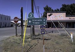
In Siskiyou County, SR 3 passes through Callahan, Etna, Greenview, and Fort Jones as it turns northeast to intersect with Interstate 5 in Yreka. At this point, SR 263 continues in the northerly direction towards SR 96; SR 3 turns east to its northern terminus in the incorporated city of Montague. [3] [4]

SR 3 is part of the California Freeway and Expressway System, [5] and a portion near the northern terminus is part of the National Highway System, [6] a network of highways that are considered essential to the country's economy, defense, and mobility by the Federal Highway Administration. [7] SR 3 is eligible to be included in the State Scenic Highway System, [8] and is officially designated as a scenic highway by the California Department of Transportation for its entire length, [9] meaning that it is a substantial section of highway passing through a "memorable landscape" with no "visual intrusions", where the potential designation has gained popular favor with the community. [10]

The segment of SR 3 from Weaverville to Gazelle Callahan Road forms part of the Trinity Heritage Scenic Byway, a National Forest Scenic Byway. [11]

In 2014, SR 3 had an annual average daily traffic (AADT) of 135 at U.S. Forest Service Road, and 10,000 at Moonlit Oaks Avenue, the latter of which was the highest AADT for the highway. [12]

Junction of SR 3 and CR A28 in Montague Montague A28nCA3.jpg
Junction of SR 3 and CR A28 in Montague

History

The short piece from SR 36 north to Peanut was added to the state highway system in 1907 as part of the Peanut Road, [13] which became Route 35 in 1917. [14] Route 35 was extended north from Peanut to Route 20 (SR 299) near Douglas City in 1933, and simultaneously a new Route 82 was created, running from Route 3 (I-5) in the Yreka area southwest to Etna and east to Montague. [15] [16] The gap between Douglas City and Etna was filled in 1959 with an extension of Route 82 south to Route 20 near Weaverville; at the same time, the portion between Weaverville and Yreka was added to the California Freeway and Expressway System, which identifies the main routes of transportation in the state of California. [17] The State Route 3 designation was applied to the Peanut-Montague roadway in the 1964 renumbering. [18] The overlap with temporary I-5 (along the portion where SR 3 runs concurrently with Interstate 5 today) near Yreka was removed when the new I-5 bypass was built; the legislative definition was updated to reflect this in 1974, soon after the building of the bypass. [19]

Major intersections

Except where prefixed with a letter, postmiles were measured on the road as it was in 1964, based on the alignment that existed at the time, and do not necessarily reflect current mileage. R reflects a realignment in the route since then, M indicates a second realignment, L refers to an overlap due to a correction or change, and T indicates postmiles classified as temporary (for a full list of prefixes, see California postmile § Official postmile definitions ). [1] Segments that remain unconstructed or have been relinquished to local control may be omitted. The numbers reset at county lines; the start and end postmiles in each county are given in the county column.

CountyLocationPostmile
[1] [20] [21]
DestinationsNotes
Trinity
TRI L0.00-85.07
L0.00California 36.svg SR 36  Red Bluff, Forest Glen South end of SR 3
Hayfork Hyampom Road – Hyampom
L30.89
R58.11 [N 1]
East plate green.svg
California 299.svg
SR 299 east Redding
South end of SR 299 overlap
56.80 [N 1] Moon Lim Lee Rest Area
Weaverville 51.57 [N 1]
30.86
West plate green.svg
California 299.svg
SR 299 west (Main Street) Eureka
North end of SR 299 overlap
Siskiyou
SIS 0.41-54.19
6.95Gazelle Callahan Road – Gazelle
Fort Jones 32.20Scott River Road – Scott Bar
Yreka L47.26To plate blue.svg
I-5 (1961).svg
Moonlit Oaks Avenue (I-5 Bus. south) to I-5  Redding, Portland
South end of I-5 Bus. overlap
L49.21To plate blue.svg
I-5 (1961).svg
Center Street to I-5
L49.87North plate green.svg
California 263.svg
SR 263 north (North Main Street) / Tebbe Street
R47.38I-5 (1961).svg I-5  Portland, Redding I-5 exit 776; north end of I-5 Bus. overlap
Montague 53.22South plate county.svg
CR A28 jct.svg
CR A28 south (Montague Grenada Road) Grenada
South end of CR A28 overlap
North plate county.svg
CR A28 jct.svg
CR A28 north (11th Street)
North end of CR A28 overlap
54.19Ball Mountain Little Shasta Road – Ball Mountain Continuation beyond the Montague east city limit; north end of SR 3
1.000 mi = 1.609 km; 1.000 km = 0.621 mi
  1. 1 2 3 Indicates that the postmile represents the distance along SR 299 rather than SR 3.

See also

Related Research Articles

<span class="mw-page-title-main">California State Route 111</span> Highway in California

State Route 111 is a state highway in the U.S. state of California. It is the main north-south route and retail corridor through the Coachella Valley, a part of the Colorado Desert in the southeastern corner of the state and a famous resort destination. It also runs through the Imperial Valley, and along the eastern shore of the Salton Sea. Its southern terminus is in Calexico near the Calexico West Port of Entry on the U.S.-Mexico border, and its northern terminus is at Interstate 10 at the northwestern corner of the Palm Springs city limits, near the unincorporated community of Whitewater.

<span class="mw-page-title-main">California State Route 160</span> Highway in California

State Route 160 is a state highway in the U.S. state of California consisting of two sections. The longer, southern, section is a scenic highway through the alluvial plain of the Sacramento River, linking SR 4 in Antioch with Sacramento via the Antioch Bridge. The northern section, separated from the southern by Sacramento city streets, is the North Sacramento Freeway, running from the 16th Street Bridge over the American River to Interstate 80 Business towards Roseville.

<span class="mw-page-title-main">California State Route 38</span> Highway in California

State Route 38 is a mostly rural and scenic state highway in the U.S. state of California, connecting Interstate 10 in Redlands with State Route 18 in the Big Bear Lake area. It is one of the primary routes into the San Bernardino Mountains. Despite the orientation of its alignment, SR 38 is assigned in a west–east direction.

<span class="mw-page-title-main">California State Route 9</span> Highway in California

State Route 9 is a rural and mountainous state highway in the U.S. state of California that travels 35 miles (56 km) from SR 1 in Santa Cruz to SR 17 in Los Gatos, passing through the San Lorenzo Valley and the Saratoga Gap in the Santa Cruz Mountains.

<span class="mw-page-title-main">California State Route 299</span> State highway in California, United States

State Route 299 is an east–west state highway in the state of California that runs across the northern part of the state. At 305.777 miles (492.100 km), it is the third longest California state highway. Route 299 begins at US 101 at the northern edge of Arcata and continues in an easterly direction through to the Nevada state line. Between Arcata and Redding, Route 299 intersects with State Route 96, and is briefly co-signed with State Route 3. In Redding, it intersects with State Route 273, State Route 44, and Interstate 5. East of Redding, it intersects with State Route 89, and a section is co-signed with State Route 139 before reaching Alturas. It is then co-signed with U.S. Route 395 northeast of Alturas, and then runs east toward the border with Nevada. A ghost town, Vya, Nevada, can be reached via this route, which after the border becomes a dirt road, which was formerly Nevada State Route 8A. The segment of SR 299 between Arcata and Redding is the Trinity Scenic Byway, a National Forest Scenic Byway.

<span class="mw-page-title-main">California State Route 247</span> Highway in California

State Route 247 is a state highway in the U.S. state of California. The road passes through the Mojave Desert in San Bernardino County, connecting SR 62 in Yucca Valley to Interstate 15 (I-15) in Barstow. SR 247 was designated by the California State Legislature in 1969; the county roads along that route were given to the state in 1972.

<span class="mw-page-title-main">California State Route 16</span> State highway in California, United States

State Route 16 is a state highway in the northern region of the U.S. state of California that runs from Route 20 in Colusa County to Route 49 just outside Plymouth in Amador County, primarily crossing the Sacramento Valley. Much of the route through the Sacramento area is unsigned as it runs on a concurrency with the I-5 and US 50 freeways.

<span class="mw-page-title-main">California State Route 154</span> Highway in California

State Route 154 is a state highway in the U.S. state of California that runs from Los Olivos to Santa Barbara, crossing the San Marcos Pass in the Santa Ynez Mountains. Before U.S. Route 101 was built through the Gaviota Pass, SR 154 was the main throughway to Santa Barbara and the tri city area including use as a stagecoach route in early years. After being replaced by US 101 as the primary route between the Santa Ynez Valley and Santa Barbara, SR 154 now serves as a scenic bypass.

<span class="mw-page-title-main">California State Route 142</span> Highway in California

State Route 142, also known as Carbon Canyon Road for most of its length, is a state highway in the U.S. state of California that connects Brea in Orange County with Chino Hills in San Bernardino County. The eastern portion of the route is known as Chino Hills Parkway.

<span class="mw-page-title-main">California State Route 232</span> Highway in California

State Route 232 is a state highway in the U.S. state of California that runs along Vineyard Avenue in Ventura County, serving as a connector between US 101 in Oxnard and SR 118 near Saticoy.

<span class="mw-page-title-main">California State Route 96</span> Highway in California

State Route 96 is a state highway in the U.S. state of California that follows the Trinity and Klamath Rivers between State Route 299 in Willow Creek and Interstate 5 near Yreka in Northern California. For most of the route it goes through the Karuk Tribal Reservation, the Yurok Tribal Reservation, and the Hoopa Tribal Reservation. Over half of the length is the Bigfoot Scenic Byway, passing through "the region boasting the most sightings of Bigfoot of anywhere in the country" according to the National Forest Scenic Byway Program.

<span class="mw-page-title-main">Topanga Canyon Boulevard</span> Highway in California

State Route 27, commonly known by its street name Topanga Canyon Boulevard, is a state highway in the U.S. state of California that runs from the Pacific Coast Highway at Topanga State Beach near Pacific Palisades, through the Topanga Canyon in Topanga, and continuing through Woodland Hills, Canoga Park, West Hills, and Chatsworth to the Ronald Reagan Freeway.

<span class="mw-page-title-main">California State Route 224</span> Former state highway in California

State Route 224 was a state highway in the U.S. state of California that served as a spur route in Santa Barbara County from U.S. Route 101 in Carpinteria to Carpinteria State Beach.

<span class="mw-page-title-main">California State Route 62</span> Highway in California

State Route 62 is a state highway in the U.S. state of California that cuts across the Little San Bernardino Mountains in Riverside and San Bernardino counties. It runs from Interstate 10 near White Water to the Arizona state line, passing through the city of Twentynine Palms and along the northern boundary of the Joshua Tree National Park.

<span class="mw-page-title-main">California State Route 115</span> Highway in California

State Route 115 is a state highway in the U.S. state of California. It runs in Imperial County from Interstate 8 (I-8) southeast of Holtville to SR 111 in Calipatria. The routing was added to the state highway system in 1933, and was constructed by 1934; SR 115 was officially designated in the 1964 state highway renumbering.

<span class="mw-page-title-main">California State Route 127</span> Highway in California

State Route 127 is a state highway in the U.S. state of California that connects Interstate 15 in Baker to Nevada State Route 373 at the Nevada state line, passing near the eastern boundary of Death Valley National Park. The entire length of the highway closely follows the central portion of the former Tonopah and Tidewater Railroad and loosely follows the Amargosa River.

<span class="mw-page-title-main">California State Route 266</span> Highway in California

State Route 266 is a state highway in the U.S. state of California. The route traverses Fish Lake Valley, which is part in California and part in Nevada. The route connects two Nevada state routes that traverse the Nevada portion of the valley, NV 264 and NV 266. The only connection from SR 266 to the rest of California's road network is via SR 168 in the community of Oasis. Prior to 1986 the southern and northern halves of modern SR 266 had separate numerical designations. The southern portion of the highway, along with modern SR 168, dates to the auto trail era, forming part of the Midland Trail.

<span class="mw-page-title-main">California State Route 139</span> Highway in California

State Route 139 is a state highway in the U.S. state of California. Running from SR 36 in Susanville north to Oregon Route 39 at the Oregon state line, it forms part of the shortest route between Reno, Nevada, and Klamath Falls, Oregon. SR 139 cuts through much Modoc National Forest and passes near Antelope Mountain and Tule Lake. North of SR 299 near Canby, the SR 139 was built by the federal government and turned over to the state in about 1940; the remainder was built by a joint highway district of Lassen and Modoc Counties, completed in 1956, and given to the state in 1959.

<span class="mw-page-title-main">California State Route 174</span> Highway in California

State Route 174 is a state highway in the U.S. state of California. The two-lane 13-mile (21 km) highway in the western Sierra Nevada, added to the state highway system in 1933, connects Interstate 80 in Colfax with SR 20/SR 49 in Grass Valley, crossing the Bear River next to a 1924 concrete arch bridge. The majority of the route is eligible for the State Scenic Highway System, but local residents have blocked its designation due to property right concerns.

<span class="mw-page-title-main">U.S. Route 95 in California</span> Highway in California

U.S. Route 95 (US 95) is a United States Numbered Highway, stretching from the Mexican border in San Luis, Arizona to the Canadian border near Eastport, Idaho. The California portion of US 95 traverses through the far eastern edges of both Riverside and San Bernardino counties. US 95 serves Blythe and Needles and junctions with SR 62 at Vidal Junction.

References

  1. 1 2 3 California Department of Transportation. "State Truck Route List". Sacramento: California Department of Transportation. Archived from the original (XLS file) on June 30, 2015. Retrieved June 30, 2015.
  2. California State Assembly. "An act to add Section 253 and Article 3 (commencing with Section 300) to Chapter 2 of Division 1 of, and to repeal Section 253 and Article 3 (commencing with Section 300) of Chapter 2 of Division 1 of, the..." 1963 Session of the Legislature. Statutes of California. State of California. Ch. 385 p. 1182.
  3. 1 2 3 The Road Atlas (Map). Rand McNally. 2008. p. 12. § NB3-NE4.
  4. 1 2 3 California Road Atlas and Driver's Guide (Map). Thomas Brothers. 2000. p. 3,4,11,12,17.
  5. "Article 2 of Chapter 2 of Division 1". California Streets and Highways Code. Sacramento: California Office of Legislative Counsel. Retrieved February 6, 2019.
  6. Federal Highway Administration (March 25, 2015). National Highway System: California (North) (PDF) (Map). Scale not given. Washington, DC: Federal Highway Administration. Retrieved October 21, 2017.
  7. Natzke, Stefan; Neathery, Mike & Adderly, Kevin (June 20, 2012). "What is the National Highway System?". National Highway System. Washington, DC: Federal Highway Administration. Retrieved July 1, 2012.
  8. "Article 2.5 of Chapter 2 of Division 1". California Streets & Highways Code. Sacramento: California Office of Legislative Counsel. Retrieved February 6, 2019.
  9. California Department of Transportation (August 2019). "Officially Designated State Scenic Highways and Historic Parkways" (XLSX). Sacramento: California Department of Transportation.
  10. California Department of Transportation (2012). Scenic Highway Guidelines (PDF). Sacramento: California Department of Transportation. p. 5. Retrieved June 8, 2017.
  11. Federal Highway Administration (n.d.). "Trinity Heritage Scenic Byway". America's Byways. Federal Highway Administration. Archived from the original on October 11, 2011. Retrieved October 23, 2011.
  12. California Department of Transportation (2014). "All Traffic Volumes on CSHS". Sacramento: California Department of Transportation. Retrieved July 29, 2016.
  13. California State Assembly. "An act to provide for...a state highway connecting the present county road systems of any one or all of the counties of Trinity, Tehama and Shasta with the road system of Humboldt county..." Thirty-seventh Session of the Legislature. Statutes of California. State of California. Ch. 117 p. 139.
  14. Ben Blow, California Highways: A Descriptive Record of Road Development by the State and by Such Counties as Have Paved Highways, 1920 (Archive.org or Internet Archive), p. 112
  15. California State Assembly. "An act to amend sections 2, 3 and 5 and to add two sections to be numbered 6 and 7 to an act entitled 'An act to provide for the acquisition of rights of way for and the construction, maintenance..." Fiftieth Session of the Legislature. Statutes of California. State of California. Ch. 767 p. 2034.: "Etna Mills to Montague." "State Highway Route 35 near Peanut to State Highway Route 20 near Douglas City."
  16. California State Assembly. "An act to establish a Streets and Highways Code, thereby consolidating and revising the law relating to public ways and all appurtenances thereto, and to repeal certain acts and parts of acts specified herein". Fifty-first Session of the Legislature. Statutes of California. State of California. Ch. 29 p. 277, 281.: "Route 35 is from Route 1 near Alton to Route 20 near Douglas City, passing near Kuntz and Peanut." "Route 82 is from Etna Mills to Montague."
  17. California State Assembly. "An act to amend Sections 306, 320, 332, 351, 362, 365, 369, 374, 382, 388, 397, 407, 408, 409, 410, 415, 422, 435, 440, 446, 453, 456, 460, 467, 470, 476, 487, 492, 493, 494, 506, 521, 528, and 529..." 1959 Session of the Legislature. Statutes of California. State of California. Ch. 1062 p. 3113, 3116.
  18. California State Assembly. "An act to add Section 253 and Article 3 (commencing with Section 300) to Chapter 2 of Division 1 of, and to repeal Section 253 and Article 3 (commencing with Section 300) of Chapter 2 of Division 1 of, the..." 1963 Session of the Legislature. Statutes of California. State of California. Ch. 385 p. 1171.
  19. California State Assembly. "An act to amend Section 303 of the Streets and Highway Code, relating to state highways". 1973–1974 Session of the Legislature. Statutes of California. State of California. Ch. 123 p. 247.: "Route 3 is from: ...(b) Route 299 near Weaverville to Montague via Main Street in Yreka."
  20. California Department of Transportation (July 2007). "Log of Bridges on State Highways". Sacramento: California Department of Transportation.
  21. California Department of Transportation, All Traffic Volumes on CSHS, 2005 and 2006

Route map:

Template:Attached KML/California State Route 3
KML is from Wikidata