Esholt is a village between Shipley and Guiseley, in the metropolitan district of the City of Bradford, West Yorkshire, England. It is situated 4 miles (6.4 km) east of Shipley, 4 miles (6.4 km) south-west of Guiseley, 5 miles (8.0 km) north of Bradford, and 12 miles (19 km) north-west of Leeds.
Pudsey is a market town in West Yorkshire, England. Once independent, it was incorporated into the City of Leeds metropolitan borough in 1974. It is located midway between Bradford city centre and Leeds city centre. Historically in the West Riding of Yorkshire, it has a population of 22,408. It also lends its name and sits in the local Leeds City Council ward of Pudsey and Pudsey parliamentary constituency.

Horsforth is a suburb and civil parish within the City of Leeds metropolitan borough, in West Yorkshire, England, lying about five miles north-west of Leeds city centre. Historically within the West Riding of Yorkshire, it has a population of 18,895 according to the 2011 Census. Horsforth was considered to have the largest population of any village in the United Kingdom during the latter part of the 19th century. It became part of the City of Leeds metropolitan borough in 1974. In 1999 the community created a civil parish to cover the area, which voted to rename itself a town council. The area sits within the Horsforth ward of Leeds City Council, which also includes the southern part of Rawdon.
The Leeds–Bradford lines are two railway lines connecting the cities of Leeds and Bradford in West Yorkshire, both meeting in Leeds railway station and are included in the West Yorkshire Metro area system of lines.
The Airedale line is one of the rail services in the West Yorkshire Metro area centred on West Yorkshire in northern England. The service is operated by Northern, on the route connecting Leeds and Bradford with Skipton. Some services along the line continue to Morecambe or Carlisle. The route covered by the service was historically part of the Midland Railway.

Ilkley railway station is a railway station in Ilkley, in the City of Bradford, West Yorkshire, England. On the Wharfedale Line, it is served by Class 333 electric trains run by Northern Trains, which also manages the station.

Selby railway station is a Grade II listed station which serves the town of Selby in North Yorkshire, England. The original terminus station was opened in 1834 for the Leeds and Selby Railway. The Hull and Selby Railway extended the line in 1840, and a new station was built, with the old station becoming a goods shed. The station was rebuilt in 1873 and 1891, the 1891 rebuilding being required due to the replacement of the swing bridge over the Ouse at the same time.

Marsden railway station serves the village of Marsden near Huddersfield in West Yorkshire, England. The station is on the Huddersfield Line, operated by Northern and is about 7 miles (11 km) west of Huddersfield station. It was opened in 1849 by the London & North Western Railway and is the last station before the West Yorkshire boundary with Greater Manchester.
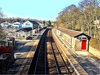
Horsforth railway station is a railway station in West Yorkshire, England. It is on the Harrogate Line 5.75 miles (9 km) north west of Leeds station and the final stop in the West Yorkshire Metro regulated area towards Harrogate.

Bingley railway station is a grade II listed railway station that serves the town of Bingley in West Yorkshire, England, and is 13.5 miles (21.7 km) away from Leeds and 5.5 miles (8.9 km) away from Bradford Forster Square on the Airedale line operated by Northern Trains.
The Leeds and Bradford Railway (L&BR) was formed in 1843 to bring the railway to Bradford: the line opened on 1 July 1846. The company was always closely allied with the Midland Railway, and within ten years the L&BR had been absorbed into the Midland, and disappeared.

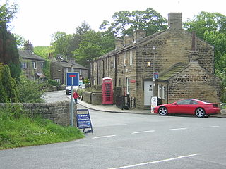
Calverley is a village in the City of Leeds metropolitan borough in West Yorkshire, England, on the A657 road, about ten miles (16 km) from Leeds city centre and four miles (7 km) from Bradford. The population of Calverley in 2011 was 4,328. It is part of the City of Leeds ward Calverley and Farsley, with a population of 22,594 at the 2011 Census.

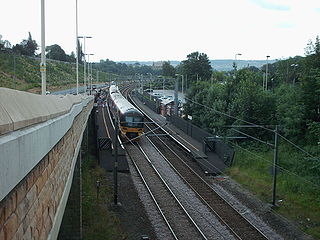
Apperley Bridge station is situated in Bradford on the line between Leeds and Shipley, West Yorkshire, England. It serves the district of Apperley Bridge in the north-east of the city.

Rodley is a suburb in the City of Leeds metropolitan borough, West Yorkshire, England. The village is situated within the Bramley and Stanningley ward of Leeds Metropolitan Council, just inside the Leeds Outer Ring Road, 5 miles (8.0 km) north-west from Leeds city centre and 4 miles (6.4 km) north-east from Bradford. The hamlet of Bagley borders Rodley.

Barnoldswick railway station was the only railway station on the Midland Railway's 1-mile-64-chain (2.9 km) long Barnoldswick Branch in the West Riding of Yorkshire in England. The line left the Leeds and Bradford Extension Railway at Barnoldswick Junction 55 chains from Earby railway station. The line through the junction was on a 20-chain radius after which it converged to a single track and ran in a straight but undulating line to Barnoldswick. The passenger train that ran back and forth between Barnoldswick and Earby was known locally as the 'Barlick Spud' or 'Spudroaster'. The real reason for the name is lost in time, but the two versions that were commonly recited are that the original branch locomotive was so small it looked like a portable potato roaster used by a local vendor or that the journey time was the same as that taken to roast a potato in the locomotive's firebox.

Kildwick and Crosshills [sic] was a railway station off Station Road in Cross Hills, North Yorkshire, England. It served the villages of Cross Hills, Cowling, Glusburn, Kildwick and Sutton-in-Craven.
Horsforth Woodside was a proposed railway station that was to be built on the site of Woodside Quarry near Horsforth in West Yorkshire, England. It would have been located on the Harrogate Line near the extant Horsforth station which would also stay open. Horsforth Woodside was also the name of a very early station on the Leeds-Northallerton railway, but was closed completely in 1864. The fact that both this old closed station and the proposed new station shared the same name is a matter known to cause confusion when railway historical matters in this area are being discussed. The proposed station would have served a proposed housing development at the former Woodside Quarry as well as providing a park and ride service in to Leeds city centre.
Great Horton railway station was a railway station on the Queensbury-Bradford section of the Queensbury Lines which ran between Bradford, Keighley and Halifax via Queensbury. The station opened for passengers in 1878 and closed on 23 May 1955 but remained open to goods with full staff until 28 June 1965 before it was closed, then demolished and the branch line tracks ripped up.

Stanningley railway station, also called Stanningley for Farsley, is a closed railway station in Stanningley, Pudsey, West Yorkshire, England, located about 5 mi (8 km) west of Leeds station. It also served Farsley and Pudsey, the latter namely until the Pudsey Loop was built.

Newlay and Horsforth railway station, until 1889 and from 1961 called Newlay station, was a station on the route of the former Leeds and Bradford Railway, located on the right bank of the River Aire and on the left bank of the Leeds and Liverpool canal between Horsforth in the north and Bramley in the south. It was accessed from Pollard Lane, which still crosses the railway on a bridge there, and served mainly the southern parts of Horsforth in West Yorkshire, England.


/Calverley.jpg)
/020%20Calverley.jpg)