Kelliher is a city in Beltrami County, Minnesota, United States. The population was 258 at the 2020 census. Minnesota State Highway 72 is the primary route through Kelliher.

Chickamaw Beach is a city in Cass County, Minnesota, United States. The population was 128 at the 2020 census. It is part of the Brainerd Micropolitan Statistical Area.

Lake Shore is a city in Cass County, Minnesota, United States. The population was 1,056 at the 2020 census. It is part of the Brainerd Micropolitan Statistical Area.
Pillager is a city in Cass County, Minnesota, United States. Its population was 507 at the 2020 census. It is part of the Brainerd Micropolitan Statistical Area.

Trommald is a city in Crow Wing County, Minnesota, United States. The population was 99 at the 2020 census. It is part of the Brainerd Micropolitan Statistical Area.

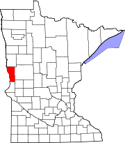
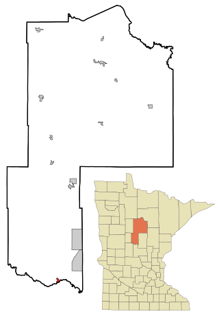
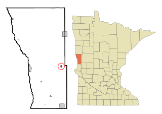
Evansville is a city in Douglas County, Minnesota, United States. The population was 603 at the 2020 census.

Calumet is a city in Itasca County, Minnesota, United States. The population was 334 at the 2020 census.

Warba is a city in Itasca County, Minnesota, United States. The population was 168 at the 2020 census.

Lancaster is a city in Kittson County, Minnesota, United States. As of the 2020 census, the city population was 364.

Russell is a city in Lyon County, Minnesota, United States. The population was 348 at the 2020 census.

Erhard is a city in Otter Tail County, Minnesota, United States. The population was 132 at the 2020 census.

Urbank is a city in Otter Tail County, Minnesota, United States. The population was 52 at the 2020 census.

Nielsville is a city in Polk County, Minnesota, United States. It is part of the Grand Forks, ND-MN Metropolitan Statistical Area. The population was 78 at the 2020 census.

McKinley is a city in Saint Louis County, Minnesota, United States; located within the Iron Range region of Minnesota. The population was 103 at the 2020 census.

Winton is a city in Saint Louis County, Minnesota, United States. The population was 169 at the 2020 census. The city is home to a small hydroelectric dam on the edge of Garden Lake, one of 11 stations owned by Minnesota Power.
Foxhome is a city in Wilkin County, Minnesota, United States. The population was 126 at the 2020 census. It is part of the Wahpeton, ND—MN Micropolitan Statistical Area.

Dakota is a city in Winona County, Minnesota, United States. The population was 295 at the 2020 census.

Minnesota City is a city in Winona County, Minnesota, United States. The population was 202 at the 2020 census.

Rollingstone is a city in Winona County, Minnesota, United States. The population was 678 at the 2020 census.

Brownsville is a city in Houston County, Minnesota, United States. The population was 566 at the 2020 census.