Agglethorpe is a hamlet in the Richmondshire district of North Yorkshire, England, it lies in northern Coverdale, approximately 4 miles (6.4 km) south west of Leyburn.

Azerley is a hamlet and civil parish in the Harrogate district of North Yorkshire, England. It is about 4 miles (6 km) north-west of Ripon.

Caldwell is a village and civil parish in the Richmondshire district of North Yorkshire, England, close to the border with County Durham and approximately 10 miles west of Darlington. According to the 2011 UK census the parish had a population of 138, increasing from 115 at the 2001 census.
Carlton Highdale is a civil parish in Coverdale, North Yorkshire, England. According to the 2001 census it had a population of 95.

West Layton is a village and civil parish in the Richmondshire district of North Yorkshire, England, close to the border with County Durham and a few miles west of Darlington.
East Witton is a village and civil parish in Wensleydale in North Yorkshire, England. It lies south of Leyburn, in the Richmondshire district. Richard Whiteley is buried there; he and his partner, Kathryn Apanowicz, lived in the village.
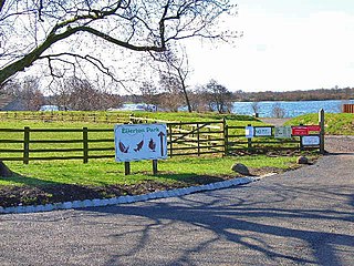
Ellerton-on-Swale or Ellerton is a small village and civil parish about a mile east of Catterick in the Richmondshire district of North Yorkshire, England. In 2015, North Yorkshire County Council estimated the population of the parish at 110.

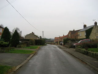
Wensley is a small village and civil parish in North Yorkshire, England. It consists of a few homes and holiday cottage, an inn, a pub and a historic church. It is on the A684 road 1 mile (1.6 km) south-west of the market town of Leyburn. The River Ure passes through the village.

Worton is a hamlet in Wensleydale in the Yorkshire Dales in the Richmondshire district of North Yorkshire, England. It lies 1-mile (1.6 km) east of Bainbridge on the A684 road, 4 miles (6.4 km) west of Aysgarth and 1-mile (1.6 km) south east of Askrigg. The hamlet is just south of the River Ure, the biggest river in Wensleydale. The hamlet is named in the Domesday Book and its name derives from the Old English wyrt-tūn and means the garden.

Hornby is a village and civil parish in the Hambleton district of North Yorkshire, England. It lies on a minor road between Great Smeaton and Appleton Wiske.

Melmerby is a village and civil parish in North Yorkshire, England. It lies in Coverdale in the Yorkshire Dales about 3 miles (4.8 km) south-west of Leyburn. Its neighbours are the villages of Carlton and Agglethorpe. The population of the civil parish was estimated at 40 in 2015.

Horsehouse is a village in Coverdale in the Yorkshire Dales, North Yorkshire, England. It is listed as a hamlet in many texts, but the presence of the church makes it a village. The River Cover runs near the village, and it lies some 6 miles (9.7 km) and 8.5 miles (13.7 km) south-west of Middleham and Leyburn respectively, at an elevation of 820 feet (250 m).

Woodale is a hamlet in Coverdale in the Yorkshire Dales in England. It lies in the civil parish of Carlton Highdale in the Richmondshire district of North Yorkshire. The River Cover flows nearby.

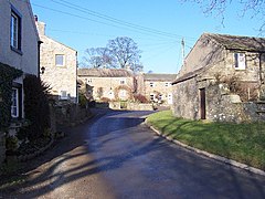
Braidley is a hamlet in Coverdale in the Yorkshire Dales, England. It lies in the civil parish of Carlton Highdale in the Richmondshire district of North Yorkshire. The River Cover flows nearby, and the peak of Little Whernside is visible from the hamlet.

Hornby is a small village and civil parish located about 4 miles (6.4 km) north-west of Bedale. It is part of the non-metropolitan district of Richmondshire in the shire county of North Yorkshire, England.

Hunton is a village and civil parish about 3 miles (4.8 km) south of Catterick Garrison and 6 miles (10 km) north west of Bedale, in North Yorkshire, England. It is part of the Richmondshire district of North Yorkshire, and at the 2001 census had a population of 420, decreasing to 414 at the 2011 census. The name of the village derives from Old English and means the town of the huntsmen, or where the hunts hounds were kept.

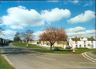
Castle Bolton is a village in North Yorkshire, England. It is in Wensleydale, one of the Yorkshire Dales. The village takes its name from Bolton Castle, which overlooks the west end of the village green. The population of the civil parish was less than 100 at the 2011 census, so details are maintained in the parish of Redmire. In 2015, North Yorkshire County Council estimated the population to be 60.

Thornton in Lonsdale is a village and civil parish in the Craven District and ceremonial county of North Yorkshire in England. It is very close to the border with Cumbria and Lancashire and is 1 mile (1.6 km) north of Ingleton and 5 miles (8.0 km) south-east of Kirkby Lonsdale, and has a population of 308, falling to 288 at the 2011 Census. Its main claims to fame are the Marton Arms pub and St Oswald's Church, Sir Arthur Conan Doyle married his first wife at this church in 1885 and held his reception at The Marton Arms before setting off to Ireland on honeymoon. Doyle's mother resided at nearby Masongill from 1882 to 1917.
Ferrensby is a village and civil parish in the Harrogate district of North Yorkshire, England. The population of the civil parish at the 2011 census was 187. It is about 3 miles (4.8 km) north-east of Knaresborough and near the A1(M) motorway. Nearby attractions include a balloon centre and a maze.
Exelby is a village in the Hambleton district of North Yorkshire, England. It is 2 miles (3.2 km) south-east of Bedale and 0.5 miles (0.8 km) west of the A1(M) motorway and is part of the civil parish of Exelby, Leeming and Londonderry. The civil parish had a total of 2,788 residents at the time of the 2011 census, though Exelby had only 80 homes. The name of the village derives from Old Danish or Old Norse and means Eskil's farm or Eskil's settlement.