
Bramhope is a village and civil parish in the City of Leeds metropolitan borough, West Yorkshire, England, north of Holt Park and north east of Cookridge.

Sempringham is a hamlet in the South Kesteven district of Lincolnshire, England. It is situated 2 miles (3.2 km) south from the A52 road, 12 miles (19 km) east from Grantham and 8 miles (13 km) north from Bourne. The hamlet is in the civil parish of Pointon and Sempringham, and on the western edge of the Lincolnshire Fens, the closest village being Billingborough, 0.5 miles (0.80 km) to the north on the B1177 road. Sempringham is noted as the home of Gilbert of Sempringham, the son of the lord of the manor. Gilbert is the only English Saint to have founded a monastic order, the Gilbertines.

Carlton Colville is a civil parish and suburb of Lowestoft in the English county of Suffolk. It is 3 miles (5 km) south-west of the centre of the town, in the East Suffolk district. The area lies along the A146 Lowestoft to Beccles road.

West Bagborough is a village and civil parish in Somerset, England, about 5 miles (8.0 km) north of Taunton in the Somerset West and Taunton district. In 2011 the village had a population of 358.

Blythburgh is a village and civil parish in the East Suffolk district of the English county of Suffolk. It is 4 miles (6.4 km) west of Southwold and 5 miles (8.0 km) south-east of Halesworth and lies on the River Blyth. The A12 road runs through the village which is split either side of the road. At the 2011 census the population of the parish was 297. The parish includes the hamlets of Bulcamp and Hinton.

Alstonefield is a village and civil parish in the Peak District National Park and the Staffordshire Moorlands district of Staffordshire, England about 7 miles (11 km) north of Ashbourne, 10 miles (16 km) east of Leek and 16 miles (26 km) south of Buxton. The parish had a population of 274 according to the 2001 census, increasing to 304 at the 2011 census.

Bassingham is a village and civil parish in the North Kesteven district of Lincolnshire, England. The population of the civil parish at the 2011 census was 1,425. The village is situated approximately 8 miles (13 km) south-west of Lincoln.

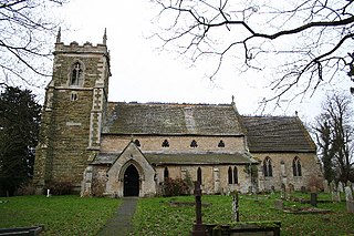
Partney is a small village and civil parish in the East Lindsey district of Lincolnshire, England. It is situated 3 miles (4.8 km) north of Spilsby, and in the Lincolnshire Wolds. The village was the birthplace of Henry Stubbe, the noted 17th-century Intellectual.

Brendon is a village and former civil parish, now in the parish of Brendon and Countisbury, in the North Devon district, in the county of Devon, England. It is close to the border with Somerset within the Exmoor National Park, the village is 1.5 miles (2.4 km) southeast of Lynton and 15 miles (24 km) west of Minehead in the East Lyn Valley. It is located just off the A39 and is on two long distance footpaths, the Coleridge Way and the Samaritans Way South West. The Church of St Brendon is 2 mi (3 km) from the village and was built in 1738, possibly with building material brought from another site. In 2001 the parish had a population of 159.

Burton Lazars is a village and former civil parish, now in the parish of Burton and Dalby, in the Melton district, in the county of Leicestershire, England. It is two miles (3 km) south-east of Melton Mowbray, having a population of c.450 in 2015. It is the site of the remains of the English headquarters of the military and hospitaller Order of Saint Lazarus.

Little Snoring is a village and a civil parish in Norfolk, England.

Foston is a small village and civil parish in the Ryedale district of North Yorkshire, England. The population of the civil parish as of the 2011 census was 263. Details are included in the civil parish of Whitwell-on-the-Hill. It is situated close to the A64 road and is approximately 9 miles (14 km) north-east from York.

East Carlton is a village and civil parish in the county of Northamptonshire, on the southern ridge overlooking the Welland valley to the north and covers 1,645 acres (666 ha) on a long strip of land. It is 2 miles (3.2 km) west of the town of Corby and is administered as part of North Northamptonshire but was previously in the Corby borough until 2021. At the time of the 2001 census, the parish's population was 270, reducing to 259 at the 2011 census. East Carlton is one of the Thankful Villages that suffered no fatalities during World War I. Although in Northamptonshire, the village is in the Leicestershire LE16 postcode area.

Stixwould is a small village in the civil parish of Stixwould and Woodhall, in the East Lindsey district of Lincolnshire, England.
Great Carlton is a village and civil parish in the East Lindsey district of Lincolnshire, England. The population of the civil parish at the 2011 census was 136. It is situated 5 miles (8.0 km) southeast from the market town of Louth, Lincolnshire.

Gayton le Wold is a village and civil parish in the East Lindsey district of Lincolnshire, England. It lies 6 miles (10 km) west from Louth, 3 miles (5 km) north from Donington on Bain, and to the south of the A157. The parish includes Biscathorpe 1 mile (1.6 km) to the south-west.

Greetwell is a village and civil parish in the West Lindsey district of Lincolnshire, England. The population of the civil parish at the 2011 census was 823. It is situated 2 miles (3 km) east from the city and county town of Lincoln.

Stainton le Vale is a village in the civil parish of Thoresway in the West Lindsey district of Lincolnshire, England. It is situated about 6 miles (9.7 km) north-east from the town of Market Rasen and about 6 miles south-east from the town of Caistor. It is a former civil parish and lies in the Lincolnshire Wolds, a designated Area of Outstanding Natural Beauty.

Waithe is a hamlet and civil parish in the East Lindsey district of Lincolnshire, England. It is on the A16, 1 mile (1.6 km) south from Holton-le-Clay and 1 mile (1.6 km) north from North Thoresby.

Welton le Wold is a village and civil parish in the East Lindsey district of Lincolnshire, England. It is situated approximately 4 miles (6 km) west of the town of Louth.

