Carpenter, California

Last updated

Coordinates: 37°36′48″N122°02′40″W / 37.61333°N 122.04444°W / 37.61333; -122.04444 Carpenter is an unincorporated community in Alameda County, California, adjacent to Hayward. It lies at an elevation of 36 feet (11 m) and is located at 37°36′48″N122°02′40″W / 37.61333°N 122.04444°W / 37.61333; -122.04444 . Its zip code is 94544.

Geographic coordinate system Coordinate system

A geographic coordinate system is a coordinate system that enables every location on Earth to be specified by a set of numbers, letters or symbols. The coordinates are often chosen such that one of the numbers represents a vertical position and two or three of the numbers represent a horizontal position; alternatively, a geographic position may be expressed in a combined three-dimensional Cartesian vector. A common choice of coordinates is latitude, longitude and elevation. To specify a location on a plane requires a map projection.

Unincorporated area Region of land not governed by own local government

In law, an unincorporated area is a region of land that is not governed by a local municipal corporation; similarly an unincorporated community is a settlement that is not governed by its own local municipal corporation, but rather is administered as part of larger administrative divisions, such as a township, parish, borough, county, city, canton, state, province or country. Occasionally, municipalities dissolve or disincorporate, which may happen if they become fiscally insolvent, and services become the responsibility of a higher administration. Widespread unincorporated communities and areas are a distinguishing feature of the United States and Canada. In most other countries of the world, there are either no unincorporated areas at all, or these are very rare; typically remote, outlying, sparsely populated or uninhabited areas.

Alameda County, California County in California

Alameda County is a county in the state of California in the United States. As of the 2010 census, the population was 1,510,271, making it the 7th-most populous county in the state. The county seat is Oakland. Alameda County is included in the San Francisco Bay Area, occupying much of the East Bay region.
Related Research Articles

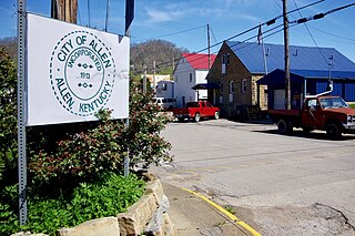
Allen, Kentucky City in Kentucky, United States

Allen is a home rule-class city in Floyd County, Kentucky, in the United States. The population was 193 at the 2010 census, up from 150 at the 2000 census.

Pleasantville, Bedford County, Pennsylvania Borough in Pennsylvania, United States

Pleasantville, also known as Alum Bank, is a borough in Bedford County, Pennsylvania, United States. The population was 198 at the 2010 census.

The Narrows strait in New York City

The Narrows is the tidal strait separating the boroughs of Staten Island and Brooklyn in New York City. It connects the Upper New York Bay and Lower New York Bay and forms the principal channel by which the Hudson River empties into the Atlantic Ocean. It has long been considered to be the maritime "gateway" to New York City and historically has been one of the most important entrances into the harbors of the Port of New York and New Jersey.

Vanderbilt Avenue Wikimedia disambiguation page

Vanderbilt Avenue is the name of three streets in New York City, all of which were named after Cornelius Vanderbilt, the builder of Grand Central Terminal.

Wren, Mississippi human settlement in United States of America

Wren is an unincorporated community in Monroe County, Mississippi.

Capitol Theater (Olympia) movie theater in Olympia, Washington, United States

The Capitol Theater, at 206 East Fifth Avenue in downtown Olympia, Washington, was built in 1924. It was designed by architect Joseph Wohleb and has a capacity of 1500. Since 1986, the Olympia Film Society operates the theater.

Modra nad Cirochou municipality of Slovakia

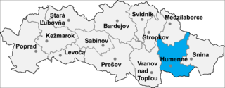
Modra nad Cirochou is a village and municipality in Humenné District in the Prešov Region of north-east Slovakia.

The Seattle School of Theology & Psychology is a progressive, multi-denominational graduate school located in the Belltown, Seattle, Washington.

Money Creek Township, McLean County, Illinois Township in Illinois, United States

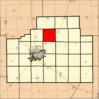
Money Creek Township is located in McLean County, Illinois. As of the 2010 census, its population was 1,085 and it contained 511 housing units.

Bald Mountain (California) name given to over fifty summits in California

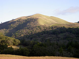
Bald Mountain is a name given to over fifty summits in California.

Valdez, California Unincorporated community in California, United States

Valdez is an unincorporated community in Yolo County, California. It is located on the Sacramento Northern Railroad 8 miles (13 km) south-southwest of Clarksburg, at an elevation of 10 feet (3.0 m).

Sandybottom is an unincorporated community in Charles City County, Virginia, United States.

Glenridge Park, California Unincorporated community in California, United States

Glenridge Park is an unincorporated community in El Dorado County, California. It lies at an elevation of 6352 feet.

Golfland chain of amusement centers

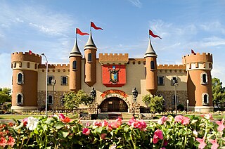
Golfland Entertainment Centers are a chain of family amusement centers, miniature golf courses, and water parks located in California and Arizona. The company was founded in 1953.

Mount Olivet is an unincorporated community in Pulaski County, in the U.S. state of Virginia.

AN/FPS-24 Radar

The AN/FPS-24 Radar was a Long Range Search Radar used by the United States Air Force Air Defense Command.

Long Creek (New York)

Long Creek is a salt-water channel running roughly north from South Oyster Bay toward Freeport, New York. It is spanned by the Long Creek Bridge.

Busby is an unincorporated community in Elk County, Kansas, in the United States.

Hyde Creek is a stream in Webster and Wright counties of southern Missouri. The stream headwaters are in western Wright County northwest of Hartville and south of Grovespring. The stream flows northwest to its confluence with Cantrell Creek in Webster County due west of Grovespring and east of Niangua.

References