Central Point, Oregon

Last updated

Central Point, Oregon
Nickname: 
The Fair City
Jackson County Oregon Incorporated and Unincorporated areas Central Point Highlighted.svg
Location in Oregon
Coordinates: 42°22′N122°55′W / 42.367°N 122.917°W / 42.367; -122.917
CountryUnited States
State Oregon
County Jackson
Incorporated 1889
Government
   Mayor Hank Williams
Area
[1]
  Total3.94 sq mi (10.21 km2)
  Land3.94 sq mi (10.21 km2)
  Water0.00 sq mi (0.00 km2)
Elevation
1,272 ft (388 m)
Population
 (2020) [2]
  Total18,997
  Density4,820.35/sq mi (1,861.30/km2)
Time zone UTC−8 (Pacific)
  Summer (DST) UTC−7 (Pacific)
ZIP code
97502
Area code Area code 541/458
FIPS code 41-12400 [3]
GNIS feature ID1118785 [4]
Website www.centralpointoregon.gov

Central Point is a city in Jackson County, Oregon, United States. The population was 17,169 as of 2010. [5] The city shares its southern border with Medford and is a part of the Medford metropolitan area. Central Point is home of the Jackson County Fair that occurs in July.

Contents

History

Isaac Constant, a pioneer who settled here in 1852, named the location Central Point because of its location at a crossroads in the middle of the Rogue Valley. At this point, the main north–south road from the Willamette Valley met the road between Jacksonville and settlements along the Rogue River. In about 1870, Magruder Brothers opened a store at the crossroads. In 1872, a post office was established here under the name Central Point. [6]

Geography

According to the United States Census Bureau, the city has a total area of 3.90 square miles (10.10 km2), all of it land. [7]

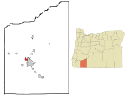
The city lies at an elevation of about 1,272 feet (388 m) along Oregon Highway 99 and Interstate 5 northwest of Medford. Jacksonville is to the south and Gold Hill to the northwest. [8] The Central Oregon and Pacific Railroad passes through Central Point. [6]

Griffin Creek, a tributary of Bear Creek, joins the larger stream at Central Point. [8] The Bear Creek Greenway, a biking and hiking trail connecting Ashland, Talent, Phoenix and Medford along Bear Creek, also passes through Central Point. [9]

Climate

This region experiences warm (but not hot) and dry summers, with no average monthly temperatures above 71.6 °F (22.0 °C). According to the Köppen Climate Classification system, Central Point has a warm-summer Mediterranean climate, abbreviated "Csb" on climate maps. [10]

Climate data for Central Point, Oregon
MonthJanFebMarAprMayJunJulAugSepOctNovDecYear
Record high °F (°C)71
(22)
80
(27)
86
(30)
96
(36)
103
(39)
115
(46)
115
(46)
114
(46)
110
(43)
100
(38)
82
(28)
72
(22)
115
(46)
Mean daily maximum °F (°C)48
(9)
54
(12)
59
(15)
65
(18)
73
(23)
82
(28)
92
(33)
91
(33)
84
(29)
70
(21)
53
(12)
46
(8)
68
(20)
Mean daily minimum °F (°C)32
(0)
34
(1)
36
(2)
40
(4)
45
(7)
51
(11)
57
(14)
56
(13)
49
(9)
42
(6)
36
(2)
30
(−1)
42
(6)
Record low °F (°C)−3
(−19)
6
(−14)
16
(−9)
21
(−6)
28
(−2)
31
(−1)
38
(3)
39
(4)
29
(−2)
18
(−8)
10
(−12)
−10
(−23)
−10
(−23)
Average precipitation inches (mm)2.42
(61)
2.01
(51)
1.71
(43)
1.38
(35)
1.30
(33)
0.62
(16)
0.28
(7.1)
0.40
(10)
0.57
(14)
1.13
(29)
3.01
(76)
3.49
(89)
18.32
(464.1)
Average snowfall inches (cm)1.3
(3.3)
0.6
(1.5)
0.4
(1.0)
0
(0)
0
(0)
0
(0)
0
(0)
0
(0)
0
(0)
0
(0)
0.2
(0.51)
1.1
(2.8)
3.6
(9.1)
Source: Medford Weather Forecast Office [11]

Demographics

Historical population
CensusPop.Note
1890 534
1900 322−39.7%
1910 761136.3%
1920 582−23.5%
1930 82141.1%
1940 90610.4%
1950 1,66784.0%
1960 2,28937.3%
1970 4,00474.9%
1980 6,35758.8%
1990 7,50918.1%
2000 12,49366.4%
2010 17,16937.4%
2020 18,99710.6%
Sources: [3] [12] [13] [14] [15] [16] [2]

Five of the eight public schools of the Central Point School District are located in the city: Central Point Elementary School, Mae Richardson Elementary School, Jewett Elementary School, Scenic Middle School, and Crater High School.

2010 census

As of the census [17] of 2010, there were 17,169 people, 6,542 households, and 4,670 families living in the city. The population density was 4,402.3 inhabitants per square mile (1,699.7/km2). There were 6,975 housing units at an average density of 1,788.5 per square mile (690.5/km2). The racial makeup of the city was 90.8% White, 0.4% African American, 1.0% Native American, 1.0% Asian, 0.4% Pacific Islander, 3.1% from other races, and 3.2% from two or more races. Hispanic or Latino of any race were 9.0% of the population.

There were 6,542 households, of which 37.2% had children under the age of 18 living with them, 53.8% were married couples living together, 12.5% had a female householder with no husband present, 5.1% had a male householder with no wife present, and 28.6% were non-families. 22.5% of all households were made up of individuals, and 11.4% had someone living alone who was 65 years of age or older. The average household size was 2.61 and the average family size was 3.03.

The median age in the city was 36.5 years. 26.5% of residents were under the age of 18; 8.1% were between the ages of 18 and 24; 26.8% were from 25 to 44; 23.7% were from 45 to 64; and 14.8% were 65 years of age or older. The gender makeup of the city was 48.1% male and 51.9% female.

2000 census

As of the census [3] of 2000, there were 12,493 people, 4,613 households, and 3,450 families living in the city. The population density was 4,073.6 inhabitants per square mile (1,572.8/km2). There were 4,760 housing units at an average density of 1,552.1 per square mile (599.3/km2). The racial makeup of the city was 94.00% White, 0.25% African American, 0.88% Native American, 0.73% Asian, 0.19% Pacific Islander, 1.26% from other races, and 2.69% from two or more races. Hispanic or Latino of any race were 4.22% of the population.

There were 4,613 households, out of which 37.5% had children under the age of 18 living with them, 59.2% were married couples living together, 11.5% had a female householder with no husband present, and 25.2% were non-families. 20.0% of all households were made up of individuals, and 9.6% had someone living alone who was 65 years of age or older. The average household size was 2.69 and the average family size was 3.06.

In the city, the population was spread out, with 28.6% under the age of 18, 7.8% from 18 to 24, 29.2% from 25 to 44, 20.2% from 45 to 64, and 14.2% who were 65 years of age or older. The median age was 34 years. For every 100 females, there were 91.9 males. For every 100 females age 18 and over, there were 89.2 males.

The median income for a household in the city was $40,622, and the median income for a family was $44,849. Males had a median income of $32,778 versus $23,851 for females. The per capita income for the city was $17,003. About 5.9% of families and 6.6% of the population were below the poverty line, including 10.2% of those under age 18 and 3.1% of those age 65 or over.

Economy

Talk Radio Network, Erickson Air Crane, and Crater Rock Museum are located in Central Point. Rogue Creamery in Central Point makes some of the world's best cheeses, according to judges at the World Cheese Awards and American Cheese Society Awards.[ citation needed ] Agriculture is dominated by the pear, wine, and recently industrial hemp.[ citation needed ]

Top employers

According to the city's 2020 Comprehensive Annual Financial Report, [18] the top employers in the city are:

#Employer# of Employees
1 School District 6 673
2 Costco 384
3Knife River Materials142
4 Pilot Travel Center 110
5 USF Reddaway 110
6So. Ore. Veterinary110
7 Albertsons 100
8City of Central Point75
9 McDonald's 48

Notable people

Related Research Articles

<span class="mw-page-title-main">Jackson County, Oregon</span> County in Oregon, United States

Jackson County is one of the 36 counties in the U.S. state of Oregon. As of the 2020 census, the population was 223,259. The county seat is Medford. The county is named for Andrew Jackson, the seventh president of the United States.

<span class="mw-page-title-main">Bear Creek Township, Michigan</span> Civil township in Michigan, United States

Bear Creek Township is a civil township of Emmet County in the U.S. state of Michigan. As of the 2020 census, the township population was 6,542, making it the most populous municipality in Emmet County.

<span class="mw-page-title-main">Medford, Minnesota</span> City in Minnesota, United States

Medford is a city in Steele County, Minnesota, United States. The population was 1,239 at the 2010 census.

<span class="mw-page-title-main">Gold Beach, Oregon</span> City in Oregon, United States

Gold Beach is a city in and the county seat of Curry County, Oregon, United States, on the Oregon Coast. The population was 2,241 at the 2020 census.

<span class="mw-page-title-main">Myrtle Creek, Oregon</span> City in Oregon, United States

Myrtle Creek is a city in Douglas County, Oregon, United States. The population was 3,439 at the 2010 census.

<span class="mw-page-title-main">Riddle, Oregon</span> City in Oregon, United States

Riddle is a city in Douglas County, Oregon, United States. The population was 1,185 at the 2010 census.

<span class="mw-page-title-main">Winston, Oregon</span> City in Oregon, United States

Winston is a city in Douglas County, Oregon, United States, located 7 miles southwest of Roseburg. The population was 5,379 according to the 2010 United States Census. Winston is probably best-known as the home of Wildlife Safari.

<span class="mw-page-title-main">Long Creek, Oregon</span> City in Oregon, United States

Long Creek is a city in Grant County, Oregon, United States. The population was 173 at the 2020 census. The city is named after John Long, a prominent miner who came to Grant County in 1862 during the Canyon City rush of that same year. Located in a high valley of the Blue Mountains, ranching has been the principal enterprise for the area. Log harvesting was slowly curtailed in the nearby Malheur National Forest until the local mill was closed in 1998.

<span class="mw-page-title-main">Butte Falls, Oregon</span> City in Oregon, United States

Butte Falls is a city in Jackson County, Oregon, United States. The population was 423 at the 2010 census. As of July 1, 2018, the city's population was estimated to be 450.

<span class="mw-page-title-main">Eagle Point, Oregon</span> City in Oregon, United States

Eagle Point is a city in Jackson County, Oregon, United States. The population was 8,469 at the 2010 census, up from 4,798 at the 2000 census. As of 2018, the estimated population was 9,408.

<span class="mw-page-title-main">Gold Hill, Oregon</span> City in Jackson County, Oregon, United States

Gold Hill is a city in Jackson County, Oregon, in the United States. As of the 2010 census the population was 1,335. It is along a bend of the Rogue River.

<span class="mw-page-title-main">Jacksonville, Oregon</span> City in Oregon, United States

Jacksonville is a city in Jackson County, Oregon, United States, approximately 5 miles (8 km) west of Medford. It was named for Jackson Creek, which flows through the community and was the site of one of the first placer gold claims in the area. It includes Jacksonville Historic District, which was designated a U.S. National Historic Landmark in 1966. As of the 2010 census, the city population was 2,785, up from 2,235 at the 2000 census.

<span class="mw-page-title-main">Phoenix, Oregon</span> City in Oregon, United States

Phoenix is a city in Jackson County, Oregon, United States. The population was 4,538 at the 2010 census. Phoenix is a part of the Medford Metropolitan Statistical Area, in the Rogue Valley, and is 3 miles (5 km) southeast of Medford on Interstate 5.

<span class="mw-page-title-main">Rogue River, Oregon</span> City in Oregon, United States

Rogue River is a city in Jackson County, Oregon, United States. As of the 2020 census the population was 2,407.

<span class="mw-page-title-main">Talent, Oregon</span> City in Oregon, United States

Talent is a city in Jackson County, Oregon, United States. The population was 6,282 at the 2020 census.

<span class="mw-page-title-main">White City, Oregon</span> Unincorporated community in the state of Oregon, United States

White City is an unincorporated community and census-designated place (CDP) in Jackson County, Oregon, United States. The population was 7,975 at the 2010 census, up from 5,466 at the 2000 census. White City is about 9 miles (14 km) north of the center of Medford and 4 miles (6 km) south of Eagle Point.

<span class="mw-page-title-main">Lowell, Oregon</span> City in Oregon, United States

Lowell is a city in Lane County, in the U.S. state of Oregon. As of the 2010 census, the city population was 1,045. The city is on the north shore of Dexter Reservoir on the Middle Fork Willamette River. The most used route to Lowell is along Lowell Bridge, a covered bridge that crosses the reservoir from Oregon Route 58.

<span class="mw-page-title-main">Scio, Oregon</span> City in Oregon, United States

Scio is a city in Linn County, Oregon, United States. The population was 838 at the 2010 census.

<span class="mw-page-title-main">Independence, Oregon</span> City in Oregon, United States

Independence is a city in Polk County, Oregon, United States, on the west bank of the Willamette River along Oregon Route 51, and east of nearby Monmouth. It is part of the Salem Metropolitan Statistical Area. Thirty square blocks of the oldest part of Independence form the National Register of Historic Places-listed Independence Historic District.

<span class="mw-page-title-main">Shady Cove, Oregon</span> City in Oregon, United States

Shady Cove is a city in Jackson County, Oregon, United States. The population was 2,904 at the 2010 census.

References

  1. "ArcGIS REST Services Directory". United States Census Bureau. Retrieved October 12, 2022.
  2. 1 2 "Census Population API". United States Census Bureau. Retrieved October 12, 2022.
  3. 1 2 3 "U.S. Census website". United States Census Bureau . Retrieved January 31, 2008.
  4. "US Board on Geographic Names". United States Geological Survey. October 25, 2007. Retrieved January 31, 2008.
  5. "2011 Certified Population Estimates". Portland State University. Archived from the original on November 13, 2011. Retrieved December 29, 2011.
  6. 1 2 McArthur, Lewis A.; Lewis L. McArthur (2003) [1928]. Oregon Geographic Names (7th ed.). Portland, Oregon: Oregon Historical Society Press. p. 185. ISBN   0-87595-277-1.
  7. "US Gazetteer files 2010". United States Census Bureau. Archived from the original on January 25, 2012. Retrieved December 21, 2012.
  8. 1 2 Oregon Road & Recreation Atlas (5th ed.). Santa Barbara, California: Benchmark Maps. 2012. p. 96. ISBN   978-0-929591-62-9.
  9. "Map". Bear Creek Greenway Foundation. Retrieved October 9, 2015.
  10. "Central Point, Oregon". Weatherbase. CantyMedia. Retrieved October 5, 2015.
  11. "Medford, OR". National Weather Forecast Office.
  12. "Population-Oregon" (PDF). U.S. Census 1910. U.S. Census Bureau. Retrieved November 22, 2013.
  13. "Population-Oregon" (PDF). 15th Census of the United States. U.S. Census Bureau. Retrieved November 27, 2013.
  14. "Number of Inhabitants: Oregon" (PDF). 18th Census of the United States. U.S. Census Bureau. Retrieved November 22, 2013.
  15. "Pennsylvania: Population and Housing Unit Counts" (PDF). U.S. Census Bureau. Retrieved November 22, 2013.
  16. "Incorporated Places and Minor Civil Divisions Datasets: Subcounty Population Estimates: April 1, 2010 to July 1, 2012". U.S. Census Bureau. Archived from the original on June 11, 2013. Retrieved November 25, 2013.
  17. "U.S. Census website". United States Census Bureau . Retrieved December 21, 2012.
  18. "City of Central Point CAFR" (PDF).