Charley is a civil parish located in the North West Leicestershire district of Leicestershire, England. According to the 2001 census, it had a population of 203, increasing to 236 at the 2011 census. [1] It is set within the Charnwood Forest.

In England, a civil parish is a type of administrative parish used for local government, they are a territorial designation which is the lowest tier of local government below districts and counties, or their combined form, the unitary authority. Civil parishes can trace their origin to the ancient system of ecclesiastical parishes which historically played a role in both civil and ecclesiastical administration; civil and religious parishes were formally split into two types in the 19th century and are now entirely separate. The unit was devised and rolled out across England in the 1860s.

North West Leicestershire is a local government district in Leicestershire, England. The population of the Local Authority at the 2011 census was 93,348. Its main towns are Ashby-de-la-Zouch and Coalville.

Leicestershire is a landlocked county in the English Midlands. The county borders Nottinghamshire to the north, Lincolnshire to the north-east, Rutland to the east, Northamptonshire to the south-east, Warwickshire to the south-west, Staffordshire to the west, and Derbyshire to the north-west. The border with most of Warwickshire is Watling Street.

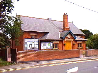
photographed June 2006
A quarry within the parish was the source of Charley Forest whetstones. [2]
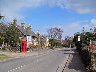
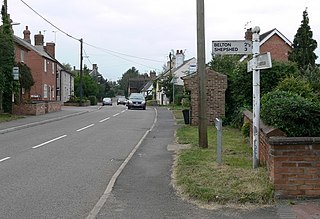
Charley is near to Shepshed, Copt Oak and Whitwick.

Shepshed, often known until 1888 as Sheepshed, is a town in Leicestershire, England with a population of around 14,000 people, measured at 13,505 at the 2011 census. It sits within the borough of Charnwood local authority, where Shepshed is the second biggest settlement after the town of Loughborough.

Copt Oak is a place in Leicestershire in England. It is in the North West Leicestershire district, near Bawdon Lodge, Charley and Ulverscroft.

Whitwick is a large village in Leicestershire, England, close to the town of Coalville in the northwest of the county. It lies in an ancient parish which formerly included the equally historic villages of Thringstone and Swannington. It was an important manor in the Middle Ages, which once included Bardon and Markfield, parts of Hugglescote, Donington le Heath, Ratby, Bocheston, Newtown Unthank and Whittington. As early as 1293, Whitwick had a weekly market and a four-day fair. The population of Whitwick, according to the 2001 census was 10,815 persons. 8,092 of these fell into the 16-74 working age range, although only 4,689 were employed. The population of the village at the 2011 census had fallen to 8,612.
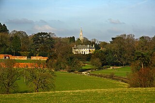
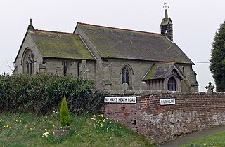
The parish of Charley contains Mount Saint Bernard Abbey and the hamlet of Oaks in Charnwood. The parish church of St James the Greater, Oaks in Charnwood was consecrated on 18 June 1815, the same day as the Battle of Waterloo and a selection of French lances captured from the battle can be seen inside the church, mounted on the north wall.

Oaks in Charnwood is a hamlet of scattered houses in the English county of Leicestershire within the Charnwood Forest. Oaks in Charnwood is located in and is part of the Civil Parish of Charley in North West Leicestershire. The ecclesiastical Parish of Oaks in Charnwood extends to the north of the Charley civil parish boundary, into the Shepshed civil parish.
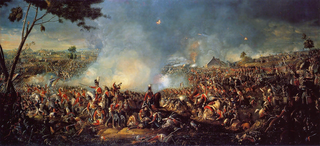
The Battle of Waterloo was fought on Sunday, 18 June 1815 near Waterloo in Belgium, part of the United Kingdom of the Netherlands at the time. A French army under the command of Napoleon Bonaparte was defeated by two of the armies of the Seventh Coalition: a British-led allied army under the command of the Duke of Wellington, and a Prussian army under the command of Field Marshal Blücher. The battle marked the end of the Napoleonic Wars.