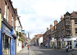
Bunbury is a village in Cheshire, England, south of Tarporley and north west of Nantwich on the Shropshire Union Canal. At the 2011 Census, it had a population of 1,195.

North West Leicestershire is a local government district in Leicestershire, England. The council is based in Coalville, the area's largest town. The district also contains the towns of Ashby-de-la-Zouch, Ashby Woulds and Ibstock, along with numerous villages and surrounding rural areas.

Buckminster is a village and civil parish within the Melton district of Leicestershire, England, which includes the two villages of Buckminster and Sewstern. The total population of the civil parish was 335 at the 2021 census. It is on the B676 road, 10 miles east of Melton Mowbray and 4 miles west of the A1 at Colsterworth.

Great Glen is a village and civil parish in the Harborough district, in Leicestershire, 2 miles south of Oadby. The population of the civil parish at the 2011 census was 3,662. Leicester city centre is about seven miles north west. Its name comes from the original Iron Age settlers who used the Celtic word glennos meaning valley, and comes from the fact that Great Glen lies in part of the valley of the River Sence. The 'great' part is to distinguish the village from Glen Parva.

Melbourne is a market town and civil parish in South Derbyshire, England. It was home to Thomas Cook, and has a street named after him. It is 8 miles (13 km) south of Derby and 2 miles (3 km) from the River Trent. The population of the civil parish at the 2021 Census was 5,264.

Abbotskerswell is a village and civil parish in the English county of Devon. The village is in the north part of the parish and is located two miles (3 km) south of the town of Newton Abbot, 7 miles (11 km) from the seaside resort of Torquay and 32 miles (51 km) from the city of Plymouth. The A381 road between Newton Abbot and Totnes runs down the western side of the parish and the main railway line between these two towns forms part of its eastern boundary.

Dethick, Lea and Holloway is a civil parish, in the Amber Valley borough of the English county of Derbyshire. The population of the civil parish taken at the 2011 census was 1,027.

Kingston on Soar is a village and civil parish in the Rushcliffe borough of Nottinghamshire, England.
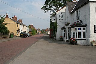
Kilby is a village and civil parish in the Blaby district of Leicestershire, England. Kilby is the easternmost village in the district, and is 6.1 miles (9.8 km) south east of Leicester. Kilby civil parish includes the former parish of Foston and it's deserted medieval village. Nearby places are Countesthorpe 2.21 miles (3.56 km), Fleckney 2.12 miles (3.41 km), Arnesby 1.96 miles (3.15 km), Wistow 1.4 miles (2.3 km) and Kilby Bridge 1.18 miles (1.90 km).

Wymondham is a village in the Borough of Melton in Leicestershire, England. It is part of a civil parish which also covers the nearby hamlet of Edmondthorpe. The parish has a population of 623, increasing to 632 at the 2011 census. It is close to the county boundaries with Lincolnshire and Rutland, nearby places being Garthorpe, Teigh and South Witham.
Snarestone is a small rural village in North West Leicestershire, England.
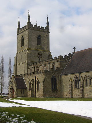
Swepstone is a village in the civil parish of Swepstone and Newton Burgoland, in the North West Leicestershire district of Leicestershire, England, about five miles south of Ashby de la Zouch. The population of the civil parish at the 2011 census 656. The parish includes the villages of Swepstone and Newton Burgoland. On 1 March 2023 the parish was renamed from "Swepstone" to "Swepstone and Newton Burgoland".

Colden Common is a civil parish in the Winchester District of Hampshire, England, approximately 5 miles south of the city of Winchester, covering an area of 690.74 hectares (2.6670 sq mi) with a resident population of approximately 4,000 people. It includes the village of Colden Common and the hamlets of Hensting, Fisher's Pond, Nob's Crook, Highbridge and Brambridge. Part of the parish lies within the South Downs National Park.

Higham on the Hill is a village and civil parish in the Hinckley and Bosworth district of Leicestershire, England. The population at the 2011 census was 840.

Tibshelf is a village and civil parish in the Bolsover District in Derbyshire, England. Located between the towns of Clay Cross, Shirebrook, Mansfield and Chesterfield. It had a population at the 2001 UK census of 3,548, increasing to 3,787 at the 2011 Census, and increasing to 4,348 at the 2021 Census Tibshelf shares its boundaries with the villages of Morton, Pilsley, Newton, Teversal and Hardstoft.

Worthington is a village and civil parish in North West Leicestershire, England, about 4 miles (6.4 km) north of the town of Coalville and a similar distance north-east of the market town of Ashby-de-la-Zouch. The population of the civil parish at the 2011 census was 1,461. The village is about 5 miles (8 km) from East Midlands Airport and junction 23a of the M1 motorway where it meets the A42 road. The parish also includes the hamlet of Newbold.
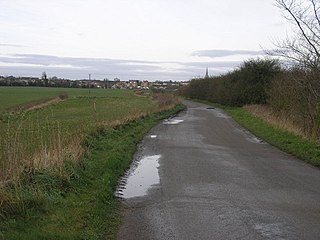
Laughton en le Morthen is a village and civil parish in the Metropolitan Borough of Rotherham lying to the south of Rotherham, South Yorkshire, England, and its main attraction is the All Saints Church with its tower and spire of 185 feet. The village had a population of 1,241 at the 2011 Census. The parish also includes the hamlets of Carr, Slade Hooton and Brookhouse.
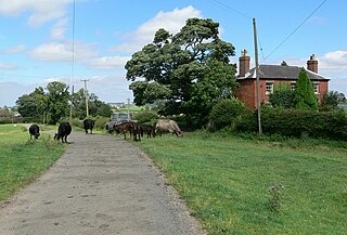
Cold Newton is a small hamlet and civil parish in the Harborough district of Leicestershire, England. It is situated about two miles from Tilton on the Hill and two miles north of Billesdon. Some 700 feet (210 m) above sea level, it overlooks the Wreake valley. Any population remaining is listed in the civil parish of Lowesby.


