
North West Leicestershire is a local government district in Leicestershire, England. The population of the Local Authority at the 2011 census was 93,348. Its main towns are Ashby-de-la-Zouch, Castle Donington, Coalville and Ibstock.
The Leicester and Swannington Railway (L&SR) was one of England's first railways, built to bring coal from West Leicestershire collieries to Leicester, where there was great industrial demand for coal. The line opened in 1832, and included a tunnel over a mile in length, and two rope-worked inclined planes; elsewhere it was locomotive-operated, and it carried passengers.

Whitwick is a large village in Leicestershire, England, close to the town of Coalville in the northwest of the county. It lies in an ancient parish which formerly included the equally historic villages of Thringstone and Swannington. It was an important manor in the Middle Ages, which once included Bardon and Markfield, parts of Hugglescote, Donington le Heath, Ratby, Bocheston, Newtown Unthank and Whittington. As early as 1293, Whitwick had a weekly market and a four-day fair. The population of Whitwick, according to the 2001 census was 10,815 persons. 8,092 of these fell into the 16-74 working age range, although only 4,689 were employed. The population of the village at the 2011 census had fallen to 8,612.
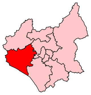
Bosworth is a constituency represented in the House of Commons of the UK Parliament since 2019 by Luke Evans, a Conservative.

Beaumont Leys is a suburb and electoral ward in north-western Leicester, in the Leicester district, in the ceremonial county of Leicestershire, England. The population of the ward at the 2011 census was 16,480. Locally, Beaumont Leys is usually used in reference to the large housing estate, built within the administrative division, centred on Strasbourg Drive.

Ibstock is a former coal mining village and civil parish about 3 miles (5 km) south of Coalville in North West Leicestershire, England. The population of the civil parish was 5,760 at the 2001 census increasing to 6,201 at the 2011 census.

Stoughton is a village and civil parish in the Harborough district of Leicestershire. The population at the 2011 census was 351.

Bardon is a civil parish and former village in North West Leicestershire about 1.5 miles (2.4 km) southeast of the centre of Coalville. The parish includes Bardon Hill, which at 912 feet (278 m) above sea level is the highest point in Leicestershire. With the population remaining less than 100, information from the 2011 census was included in the civil parish of Ellistown and Battleflat.

Osgathorpe is a small village which lies in a fold of the hills in North West Leicestershire, England, and is about a quarter of a mile from the A512 Coalville to Loughborough Road. The civil parish population at the 2011 census was 411.

Snibston is an area and former civil parish east of Ravenstone, now in the parish of Ravenstone with Snibstone, in the North West Leicestershire district, in the county of Leicestershire, England. Originally rural, part of Snibston was transformed into a coal mining village by the opening of coal mines by the Snibston Colliery Company in the early 1830s. This industrial part of Snibston was subsequently subsumed into the developing town of Coalville, though small rural areas of Snibston survive within the civil parishes of Ravenstone with Snibston and Hugglescote and Donington le Heath. In the part of Snibston within the latter civil parish stands the 13th-century church of St Mary, noted as the smallest church still in use for regular worship in England. The main Snibston Colliery was sunk in 1831, and after its closure the Snibston Country Park with the Snibston Discovery Museum was built on part of the colliery site. Part of the park is Snibston Grange Local Nature Reserve.

Thringstone is a village and unparished area in the North West Leicestershire district, in Leicestershire, England about 3 miles (4.8 km) north of Coalville. It lies within the area of the English National Forest.
The Charnwood Forest Railway was a branch line in Leicestershire constructed by the Charnwood Forest Company between 1881 and 1883. The branch line ran from Coalville to the town of Loughborough.

Coleorton is a village and civil parish in North West Leicestershire, England. It is situated on the A512 road approximately 2 miles (3.2 km) east of Ashby de la Zouch. Nearby villages include Newbold, to the north, Thringstone to the east, and Swannington to the south-east.

Hugglescote is a village on the River Sence in North West Leicestershire, England. The village is about 1 mile (1.6 km) south of the centre of Coalville, and its built-up area is now contiguous with the town.
Peggs Green is a hamlet within the parish of Coleorton, Leicestershire. For many years it had formed part of the civil parish of Thringstone, until this was dissolved in 1936.

William Stenson (1770–1861) was a mining engineer born in Coleorton, Leicestershire.

Newbold otherwise Newbold Coleorton is a large hamlet in the parish of Worthington, Leicestershire, England. It is situated in the North West Leicestershire district, approximately midway between the town of Ashby-de-la-Zouch and the village of Whitwick, just to the north of the B5324 route.

Hough windmill, Swannington, Leicestershire is a tower windmill built in the late 18th century on the boundary between Swannington, Leicestershire and Thringstone. The mill served a coal mining community, the structure is surrounded by the remains of ancient shallow coal mines and local maps show many footpaths, -tracks made by the miners who walked between them. The mill and surrounding area is owned by the Swannington Heritage Trust.


