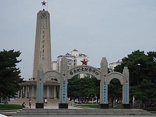
The China National Highways (CNH/Guodao) is a network of trunk roads across mainland China. Apart from the expressways of China that are planned and constructed later, most of the CNH are not controlled-access highways.

The expressway network of China, with the national-level expressway system officially known as the National Trunk Highway System, is an integrated system of national and provincial-level expressways in China.

China National Highway 201 (G201) runs from Hegang, Heilongjiang Province to Lushunkou, Liaoning Province. It is 1,964 kilometres in length and runs southeast from Hegang towards the border with Russia before turning southwest, going via Mudanjiang, Heilongjiang Province and Dandong, Liaoning Province.

Siping, formerly Sipingjie, is a prefecture-level city in the west of Jilin province, People's Republic of China. It has a total population of 1,814,733 inhabitants, as of the 2020 census. Siping covers an area of 14,323 km2 (5,530 sq mi) and is located in the middle of the Songliao Plain, near the border with Liaoning and Inner Mongolia provinces.

Honghe Hani and Yi Autonomous Prefecture is an autonomous prefecture in Southeast-Central Yunnan Province, China, bordering Vietnam's Lào Cai and Lai Châu provinces to the south. Its name is derived from the Hong (Red) River and the two major ethnic minority groups who live there: the Yi and the Hani. Honghe has an area of 32,929 square kilometres (12,714 sq mi) and its seat is Mengzi. The total population is 4.8 million, of which 61.3% belong to ethnic minorities.

Gaocheng is one of eight districts of the prefecture-level city of Shijiazhuang, the capital of Hebei Province, North China, on the upper reaches of the Hutuo River (滹沱河). The city has a total area of 836 square kilometres (323 sq mi) and in 2010 had a population of 743,000.

National Route 1, also known as National Route 1A, is the trans-Vietnam highway. The route begins at km 0 at Hữu Nghị Quan Border Gate near the China-Vietnam border, runs the length of the country connecting major cities including Hanoi, Da Nang and Ho Chi Minh City, and ends at km 2301.34 at Năm Căn township in Cà Mau Province.

Laiyuan County is a county in western Hebei province, China, bordering Shanxi province to the west. It is under the jurisdiction of the prefecture-level city of Baoding, and, as of 2006, it had a population of 270,000 residing in an area of 2,430 km2 (940 sq mi).

China National Highway 209 (G209) runs from Sonid Left Banner, Inner Mongolia to Beihai, Guangxi province. It is 3,435 kilometres in length and runs south from Huhhot towards Shanxi province, Henan province, Hubei province, Hunan province, and ends in Guangxi province.

China National Highway 207 (G207) runs from Ulanhot, Inner Mongolia to Hai'an, Guangdong. It is 3,738 km (2,323 mi) in length and runs south from Xilinhot through Inner Mongolia, Hebei, Shanxi, Henan, Hubei, Guangxi, and ends in Guangdong.

China National Highway 205 (G205) runs from Shanhaiguan, Hebei Province to Shenzhen, Guangdong. It is 3,160 kilometres in length and runs south from Shanhaiguan towards Tianjin, Hebei, Shandong, Jiangsu, Anhui, Zhejiang, Fujian, and ends in Guangdong Province.

China National Highway 206 (G206) runs from Weihai, Shandong Province to Shantou, Guangdong Province. It is 2,375 kilometres in length and runs south from Yantai, going via Shandong, Jiangsu, Anhui, Jiangxi Province, and ends in Guangdong Province.

China National Highway 307 (G307) runs west from Qikou, Hebei towards Shanxi Province, Shaanxi Province, and ends in Yinchuan, Ningxia. It is 1,351 kilometres in length.

Constructed in 1954, the Qinghai-Xinjiang Highway, also known as the China National Highway 315 (G315) runs west from Xining, Qinghai towards Kashgar, Xinjiang. It is 3,063 kilometres (1,903 mi) in length. In 1994 the departments of communication and transportation in Qinghai and Xinjiang began the process of updating the highway. In the west it follows the desert Qaidam Basin south of the traditional Silk Road, crosses the Altyn-Tagh into Xinjiang, and then follows the south side of the Tarim Basin to Kashgar.

China National Highway 319 (G319) runs northwest from Xiamen, Fujian towards Jiangxi Province, Hunan Province, Chongqing, and ends in Chengdu, Sichuan. It is 2984 kilometres in length.

China National Highway 321 (G321) runs northwest from Guangzhou, Guangdong towards Guangxi Province, Guizhou Province, and ends in Chengdu, Sichuan Province. It is 2,220 kilometres in length.

China National Highway 324 (G324) runs west from Fuzhou, Fujian towards Guangdong Province, Guangxi Province, Guizhou Province, and ends in Kunming, Yunnan Province. It is 2,712 kilometres in length.

The Longnan–Heyuan Expressway, commonly referred to as the Longhe Expressway, is a 127.87-kilometre-long Chinese expressway (79.45 mi) that connects Longnan County, a county under the administration of the city of Ganzhou in the province of Jiangxi, and Dongyuan County, a county under the administration of the city of Heyuan, in the province of Guangdong. The expressway is a spur of the G45 Daqing–Guangzhou Expressway.

National Highway 228 was a hypothetical highway encircling the island of Taiwan as part of the National Highway System of the People's Republic of China. It never came into existence due to the political status of Taiwan. The People's Republic of China claims control over Taiwan while it is currently administered and controlled by the Republic of China. Taiwan has its own highway system and does not recognize the designation by the People's Republic of China.


